The Modern Antiquarian. Stone Circles, Ancient Sites, Neolithic Monuments, Ancient Monuments, Prehistoric Sites, Megalithic MysteriesThe Modern Antiquarian


Burgh On Bain Long Barrow

Long Barrow

<b>Burgh On Bain Long Barrow</b>Posted by Chris CollyerImage © Chris Collyer
Nearest Town:Market Rasen (11km W)
OS Ref (GB):   TF213850 / Sheet: 122
Latitude:53° 20' 50.42" N
Longitude:   0° 10' 39.93" W

Added by Chris Collyer


Discussion Topics0 discussions
Start a topic


Show  |  Hide
Web searches for Burgh On Bain Long Barrow
Show map   (inline Google Map)

Images (click to view fullsize)

Add an image Add an image
<b>Burgh On Bain Long Barrow</b>Posted by Chris Collyer <b>Burgh On Bain Long Barrow</b>Posted by Chris Collyer

Fieldnotes

Add fieldnotes Add fieldnotes
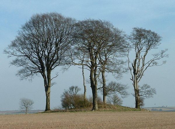
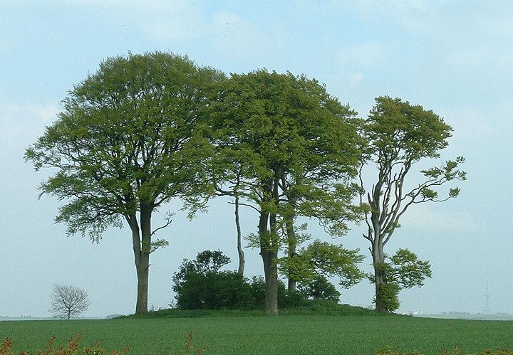
One of the smaller long barrows in Lincolnshire, this oval mound is only 27 metres long and 14 metres at its widest point. It stands around 2 metres tall (underneath the grass and bushes) and is ringed by 5 largish trees that have probably protected it from agricultural damage for a good few years.
Aligned wsw-ene it is situated on a ridge that slopes down to the valley of the River Bain about a mile away to the west, and is less than 100 metres from the ancient trackway of High Street. This trackway, that runs along the spine of the Wolds, is rich in round barrows and 3 stand within a few hundred metres to the south.
Note: This long barrow is marked on the OS Map as 'tumulus'
Chris Collyer Posted by Chris Collyer
22nd July 2006ce