The Modern Antiquarian
Log in
|
Register
Home
Latest Posts
Forums
Maps
Help
Browse Sites
News
Blog
Contributors
The Books
Select
-
Belgium
Denmark
Eire
France
Germany
Greece
Italy
The Netherlands
Norway
Portugal
Republic of Malta
Spain
Sweden
Switzerland
United Kingdom
England
Northern England
Northumberland
Heddon Moor
Ancient Village / Settlement / Misc. Earthwork
Heddon Moor (Ancient Village / Settlement / Misc. Earthwork) on The Modern Antiquarian, the UK & Ireland's most popular megalithic community website. 10 images, plus information on many more ancient sites nearby and across the UK & Ireland.
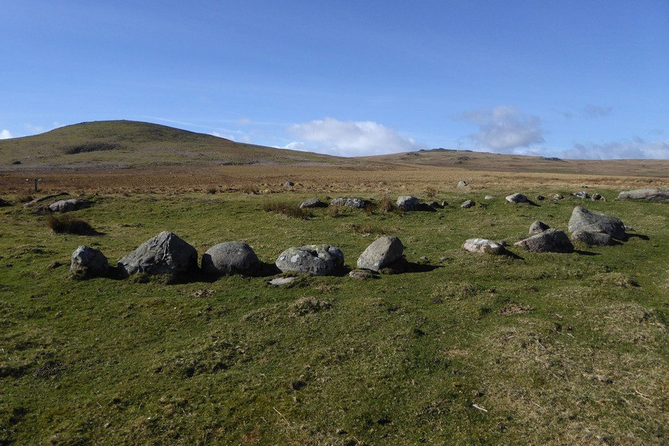
Image © A. Brookes (11.3.2019)
Nearest Town:
Alnwick (20km ESE)
OS Ref (GB):
NT99592118 /
Sheet: 75
Latitude:
55° 29' 3.67" N
Longitude:
2° 0' 23.36" W
Added by
thesweetcheat
Images (10)
0 discussions
Start a topic
Show |
Hide
Web searches for Heddon Moor
Flickr
Google
Google Images
MAGIC
The Megalithic Portal
Bing
Stone Pages
Streetmap.co.uk
Wikipedia
Show map
(inline Google Map)
- Sites within 20 km -
-
Dod Hill East (0.4km S) (8 posts)
Heddon Moor cairn (0.51km N) (4 posts)
Heddon Hill (0.61km N) (4 posts)
Middleton Dean (0.76km NNE) (8 posts)
Dod Hill (1.15km WSW) (2 posts)
Middleton Dean cairn (1.33km NW) (4 posts)
South Middleton Moor (1.44km NW) (2 posts)
Threestone Burn (2.19km WSW) (20 posts)
Heddon Hill (5.17km ESE) (3 posts)
Hedgehope (5.46km WSW) (6 posts)
Percy's Leap (5.5km E) (1 post)
Hurl Stone (5.55km NE) (13 posts)
Hart Heugh (5.6km NW) (2 posts)
Hart Heugh (5.64km WNW) (2 posts)
Newtown Mill (5.66km ENE) (16 posts)
Way to Wooler (5.86km NNE) (0 posts)
Fowberry Moor Farm Stone (5.91km NE) (3 posts)
Fowberry Enclosure 3 (5.91km NE) (6 posts)
Pin Well / King's Chair (5.97km NNW) (7 posts)
Fowberry Enclosure 1&2 (5.97km NE) (11 posts)
The Kettles (6.22km NNW) (5 posts)
Green Castle (6.75km NNW) (6 posts)
West Horton 6 c (6.93km NNW) (3 posts)
Coldmartin Loughs 1-2 (6.95km N) (31 posts)
Whitsunbank 1 (6.97km NNE) (8 posts)
Whitsunbank 3 (7.02km NNE) (7 posts)
Whitsunbank 2 (7.04km NNE) (17 posts)
Fowberry Cairn (7.04km NNE) (22 posts)
Fowberry Moor Stone-3 (7.06km NNE) (1 post)
North Plantation (7.1km NNE) (11 posts)
Fowberry Mains (7.25km NNE) (23 posts)
Weetwood North (7.3km NNE) (3 posts)
Highburn House (7.33km NNW) (7 posts)
Powburn (7.47km E) (9 posts)
Weetwood Moor (7.48km NNE) (86 posts)
Old Bewick Cairn (7.49km ENE) (8 posts)
Humbleton Hill (7.57km NW) (9 posts)
Old Bewick Hillfort (7.79km ENE) (29 posts)
Weetwood 8 (8.1km NNE) (5 posts)
Old Bewick (8.19km ENE) (98 posts)
Monday Cleugh (8.31km NW) (9 posts)
Berthele's Stone (8.37km ENE) (3 posts)
Clavering (8.41km NNE) (2 posts)
Hepburn Crags Camp (8.54km ENE) (11 posts)
Blawearie Cairn (8.55km ENE) (54 posts)
Harehope Hill (8.56km NW) (3 posts)
Hepburn Moor (8.68km ENE) (5 posts)
Tick Law (8.68km ENE) (9 posts)
Battlestone (Humbleton) (8.72km NW) (9 posts)
The Cheviot (8.79km WSW) (5 posts)
Glead's Cleugh (9.18km WNW) (8 posts)
Harehope Hill (9.2km E) (3 posts)
Ros Castle (9.25km ENE) (26 posts)
Gled Law (9.5km N) (31 posts)
Amerside Law (9.61km ENE) (17 posts)
Cuddy's Cave (Doddington) (9.82km N) (11 posts)
Amerside Law north (9.97km NE) (6 posts)
Buttony (10.02km N) (43 posts)
Gled Law North (10.08km N) (15 posts)
Beanley Plantation Settlement (10.15km E) (8 posts)
West Akeld Stead (10.3km NW) (1 post)
Ox Eye (10.41km ENE) (4 posts)
Dod Law Hillfort rock art (10.54km N) (22 posts)
Dod Law Main (10.54km N) (31 posts)
Yeavering Bell (10.54km WNW) (38 posts)
Dod Law (10.55km N) (11 posts)
Doddington Enclosure (10.57km N) (8 posts)
West Horton (10.62km NNE) (10 posts)
Doddington Stone Circle (10.64km N) (29 posts)
Ringses Camp, Beanley Moor (10.64km E) (21 posts)
Millstone Hill (10.69km ENE) (5 posts)
Doddington Moor Quarry Site (10.86km N) (18 posts)
Doddington North (11.11km N) (11 posts)
Doddington Dubious Stone (11.16km N) (3 posts)
Chatton (11.18km NE) (117 posts)
Chatton Camp (11.18km NE) (16 posts)
Ewart Park Henge (11.19km NW) (1 post)
Battle Stone (Yeavering) (11.3km WNW) (9 posts)
Scrainwood (11.32km SSE) (5 posts)
Kettley Stone (11.39km NE) (14 posts)
Cateran Hill (11.5km ENE) (12 posts)
Whinny Hill (11.55km ENE) (16 posts)
Gefrin (11.56km WNW) (6 posts)
Kettley Crag (11.6km NE) (64 posts)
Old Yeavering (11.62km WNW) (2 posts)
Kettley Crag - lower outcrop (11.68km NE) (1 post)
Titlington Mount (11.69km E) (13 posts)
The Ringses Hillfort (11.83km N) (2 posts)
The Ringses (11.87km N) (40 posts)
Whitehill Head (11.95km ENE) (3 posts)
The Bell (12.06km WNW) (1 post)
Hethpool cairn (12.28km W) (3 posts)
Hethpool (12.28km W) (22 posts)
High Chesters (12.3km N) (9 posts)
East Marleyknowe (12.33km NW) (1 post)
Hare Law Crags (12.41km N) (16 posts)
Hunterheugh 6 (12.52km E) (8 posts)
Hazelrigg (12.53km NNE) (2 posts)
Great Hetha Camp (12.67km W) (6 posts)
Hunterheugh 8 and 9 (12.78km E) (10 posts)
Hunterheugh 2 and 3 (12.84km E) (13 posts)
Hunterheugh 1 (12.87km E) (42 posts)
Little Hetha (12.91km W) (9 posts)
Castle Hill (Callaly) (12.99km SE) (2 posts)
Lyham Moor (13.02km NE) (3 posts)
Hunterheugh 4 and 5 (13.03km E) (6 posts)
Hunterheugh North East (13.09km E) (7 posts)
Coupland Henge (13.13km NW) (2 posts)
Lucker Moor (13.3km ENE) (3 posts)
Hunterheugh East (13.4km E) (4 posts)
The Bowden Doors (13.52km NE) (11 posts)
Maelmin Henge Reconstruction (13.68km NW) (16 posts)
Hard Nab (13.94km SE) (2 posts)
Midstead (13.97km E) (24 posts)
Doddington North Moor (14.41km N) (4 posts)
Wandylaw (14.59km ENE) (7 posts)
Milfield North (15.02km NW) (1 post)
Isabella's Mount (15.05km ENE) (1 post)
Camp Knowe (15.07km SSW) (1 post)
Uplaw Knowe (15.1km SW) (0 posts)
Russell's Cairn (15.26km WSW) (8 posts)
St Cuthbert's Cave (Cockenheugh) (15.34km NNE) (12 posts)
Alwinton-Clennel Cottages (15.42km SSW) (6 posts)
Stob Stones (15.53km W) (3 posts)
Roughting Linn (15.54km NNW) (96 posts)
West Brizlee (15.6km E) (2 posts)
Roughting Linn Camp (15.61km NNW) (11 posts)
Flodden Camp (15.64km NW) (2 posts)
Crag Hill (15.81km E) (9 posts)
Goatscrag (15.91km NNW) (16 posts)
Castle Hills (15.95km SSW) (0 posts)
Broomridge (15.98km NNW) (37 posts)
West Brizlee (South) (16.02km E) (2 posts)
Rough Castles / Roughley Wood (16.2km ESE) (9 posts)
Cartington (16.38km SE) (5 posts)
Charlton Burn (16.58km ENE) (1 post)
Broomwood Camp (16.6km E) (3 posts)
Bunkerhill Plantation (16.64km E) (7 posts)
White House Folly Hill (16.7km E) (24 posts)
Shillhope Law (16.79km SW) (3 posts)
Lemmington Wood (16.84km ESE) (16 posts)
Ford Henge (16.86km NW) (1 post)
Blackchester (17.03km NNW) (7 posts)
Cartington Hill (17.05km SE) (3 posts)
Honey Hill (17.09km E) (6 posts)
Barrowburn Wood (17.19km SSW) (0 posts)
Corby's Bridge Enclosure (17.26km ESE) (2 posts)
Lamp Hill (17.38km E) (10 posts)
East Linkhall (17.47km ENE) (1 post)
Corby's Crags Rock Shelter (17.53km ESE) (23 posts)
Cartington Carriageway (b) (17.71km SE) (2 posts)
Chester Cottage Settlement (18.1km E) (2 posts)
Crocky's Heugh (18.18km SE) (4 posts)
Drake Stone (18.35km SSW) (10 posts)
Kyloe Camp (18.42km NNE) (1 post)
Caller Crag (18.48km ESE) (15 posts)
Kippy Heugh (18.62km NE) (1 post)
Heifer Law (18.63km E) (9 posts)
Ellsnook (18.63km E) (7 posts)
Blackbog Dean (18.65km E) (9 posts)
Dunstan Hill (18.7km ENE) (5 posts)
Lady's Well (Coquetdale) (18.76km S) (3 posts)
Football Cairn (e) (18.77km SE) (7 posts)
Football Cairn (18.84km SE) (23 posts)
Chirnells Moor, Thropton (18.93km SE) (4 posts)
Wellhope (18.96km ESE) (7 posts)
Addeyheugh (19.22km SE) (9 posts)
Campville (19.26km SSW) (2 posts)
West Hills, Thropton (19.54km SSE) (7 posts)
Cross dyke, Campville (19.56km SSW) (0 posts)
Cartington Carriageway (a) (19.61km SE) (2 posts)
The Five Barrows (19.63km S) (0 posts)
Rothbury (19.74km SE) (6 posts)
Old Rothbury (19.8km SE) (4 posts)
- Facilities within 20 km -
-
Chillingham Castle (Holiday Cottage: 7.6 km NE)
Percy Arms Hotel (Hotel: 9.3 km NNE)
- Add -
-
Add news
Add an image
Add fieldnotes
Add folklore
Add miscellaneous
Add a link
Add a nearby facility
Add an alternative name/spelling
Images
(click to view fullsize)
Add an image
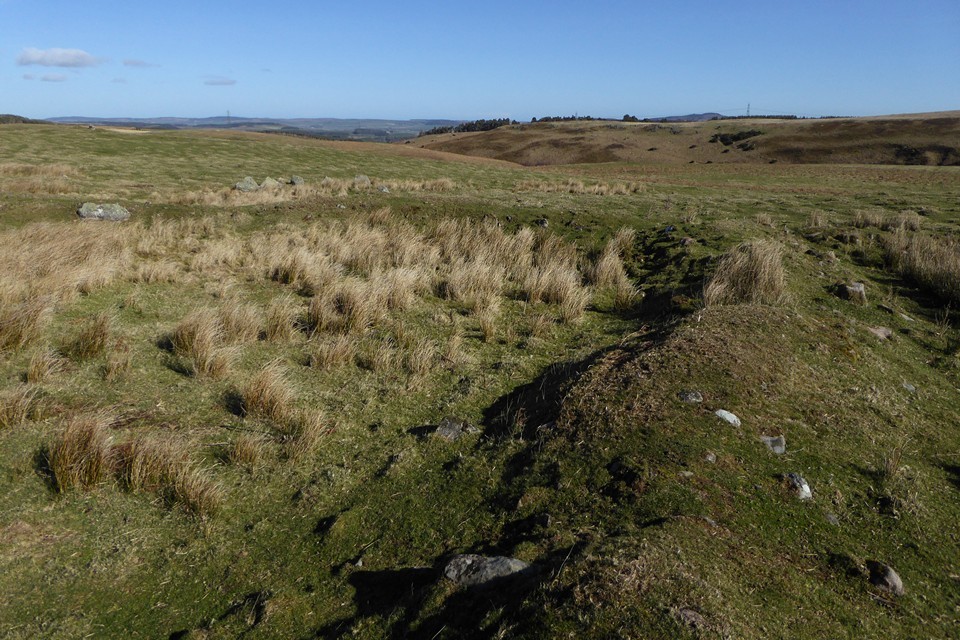
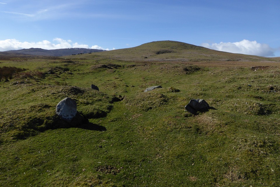
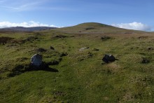 Image © A. Brookes (11.3.2019)
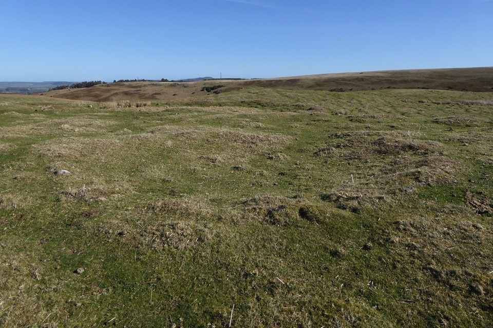