The Modern Antiquarian
Log in
|
Register
Home
Latest Posts
Forums
Maps
Help
Browse Sites
News
Blog
Contributors
The Books
Select
-
Belgium
Denmark
Eire
France
Germany
Greece
Italy
The Netherlands
Norway
Portugal
Republic of Malta
Spain
Sweden
Switzerland
United Kingdom
England
Northern England
Cleveland
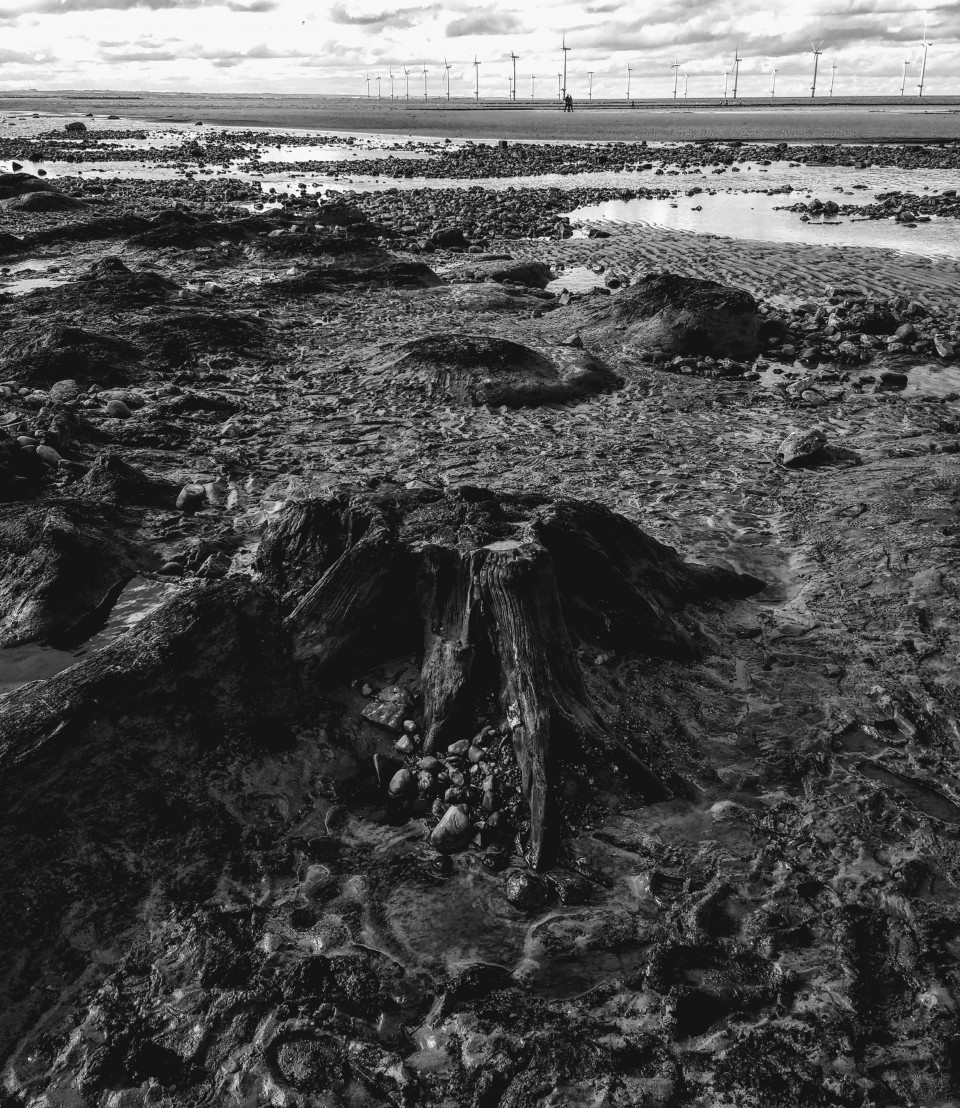
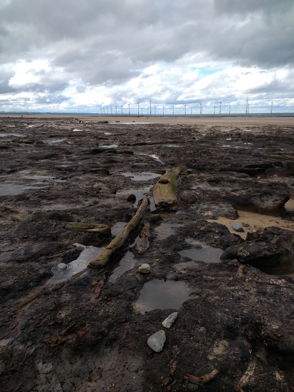
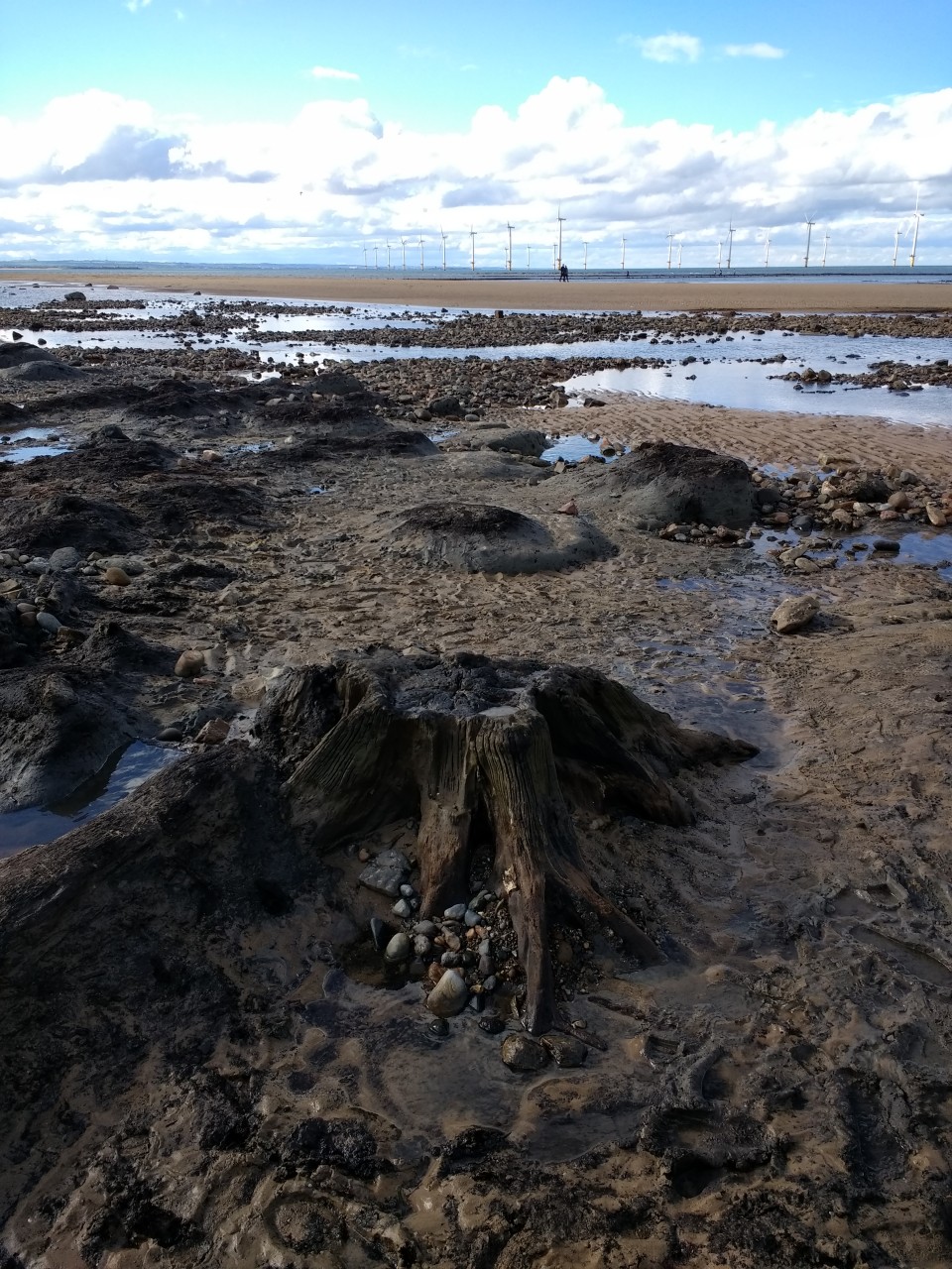
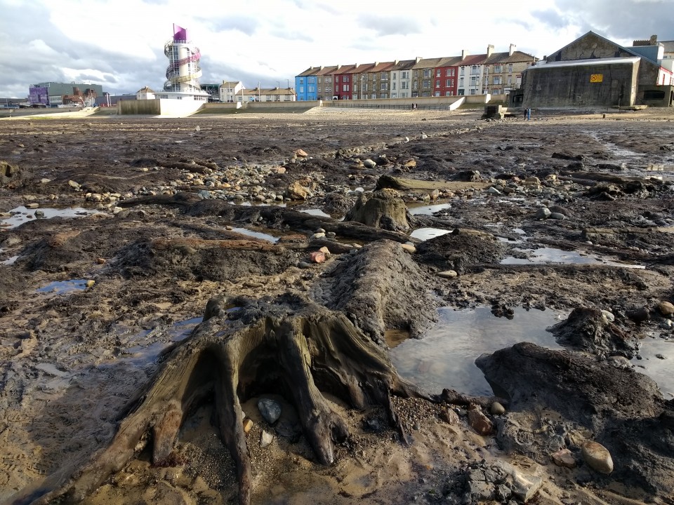
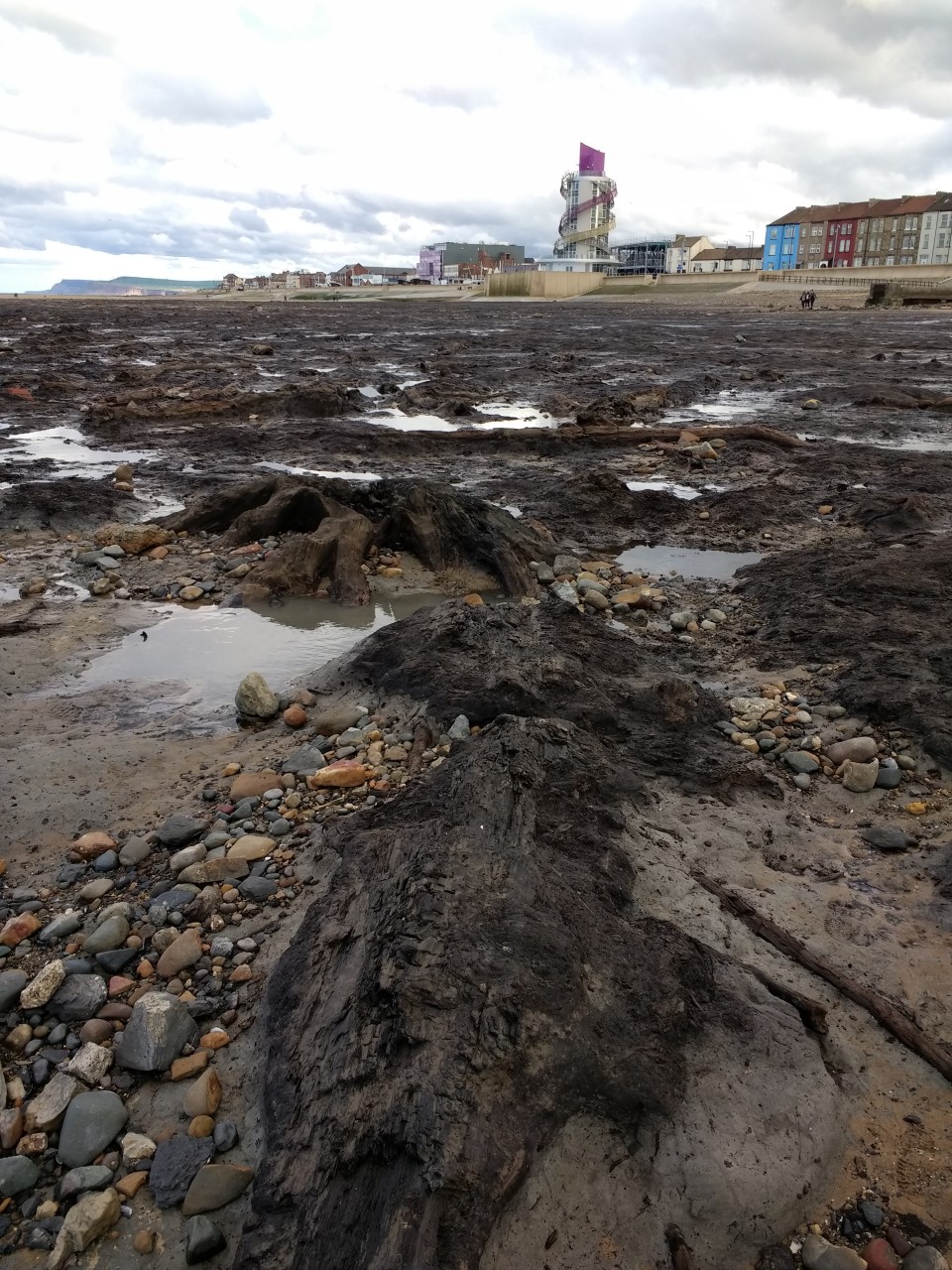
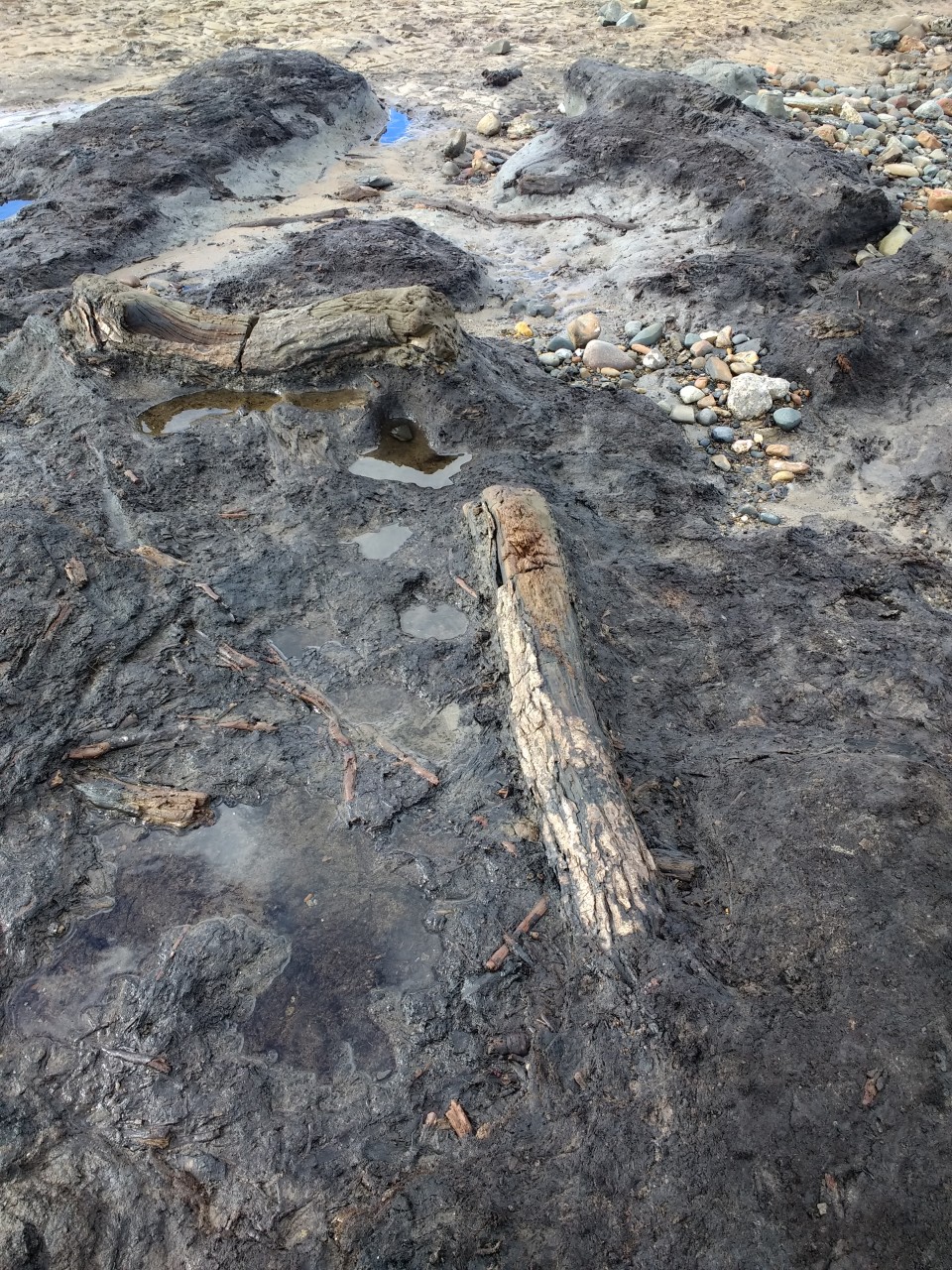
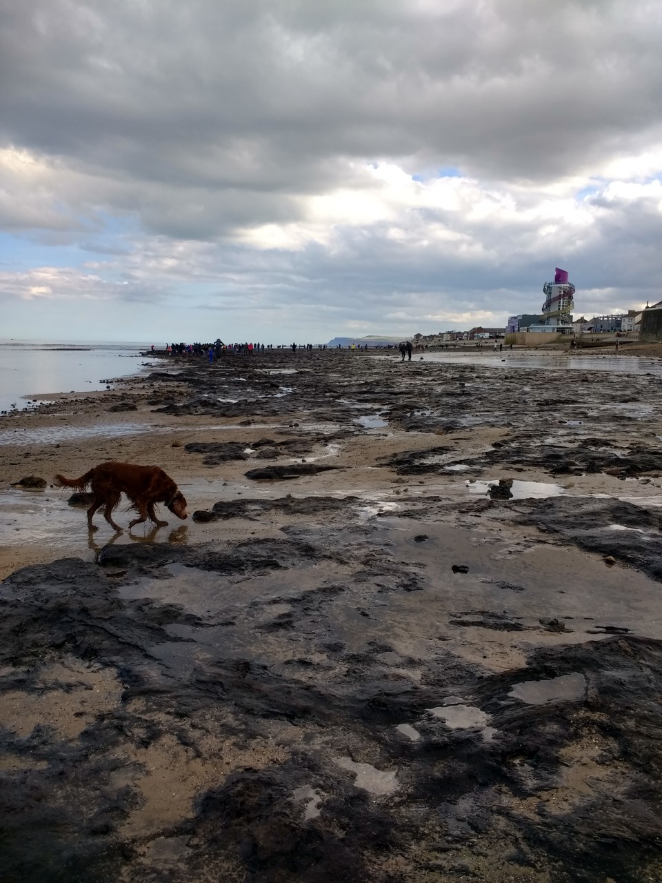
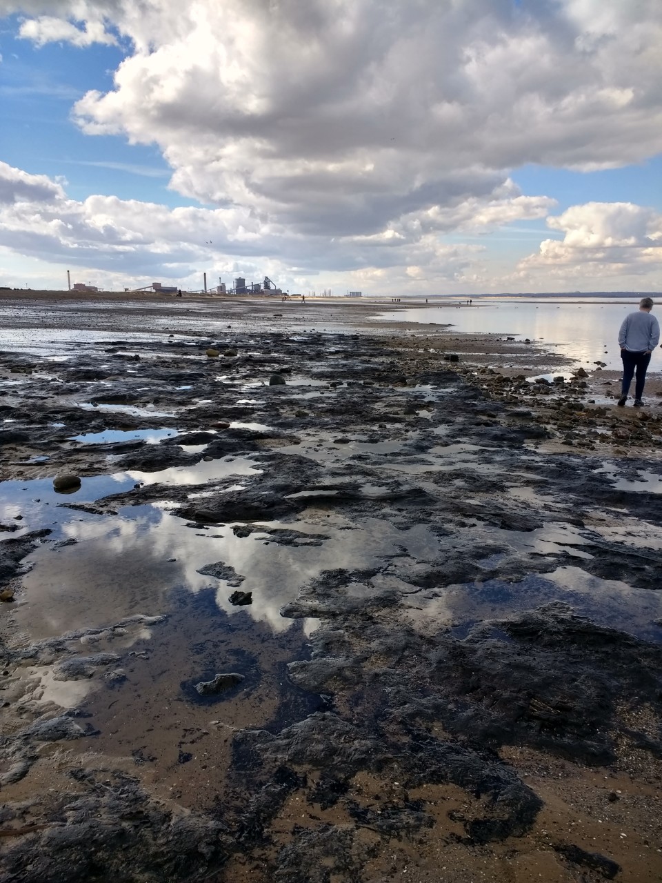
Redcar Beach Submerged Forest
Mesolithic site
Redcar Beach Submerged Forest (Mesolithic site) on The Modern Antiquarian, the UK & Ireland's most popular megalithic community website. 9 images, plus information on many more ancient sites nearby and across the UK & Ireland.
Image © spencer
Nearest Town:
Redcar (2km SE)
OS Ref (GB):
NZ599257 /
Sheet: 93
Latitude:
54° 37' 21.77" N
Longitude:
1° 4' 19.86" W
Added by
spencer
Images (9)
0 discussions
Start a topic
Show |
Hide
Web searches for Redcar Beach Submerged Forest
Flickr
Google
Google Images
MAGIC
The Megalithic Portal
Bing
Stone Pages
Streetmap.co.uk
Wikipedia
Show map
(inline Google Map)
- Sites within 20 km -
-
Upleatham (5.96km SE) (7 posts)
Patterson's Bank (6.04km SE) (21 posts)
Sandy Lane (6.13km SE) (1 post)
Soapwell Wood (6.38km SE) (0 posts)
Sandy Lane Standing Stone (6.61km SE) (4 posts)
Upleatham (6.64km ESE) (1 post)
Court Green Howe (7.58km SSW) (0 posts)
Cat Nab (8.14km E) (5 posts)
Eston Nab (8.45km SSW) (31 posts)
Eston Moor Carved Stone (9.16km SSW) (8 posts)
Airy Hill Farm (10.05km SE) (4 posts)
Mount Pleasant (10.06km SSW) (3 posts)
Warsett Hill (10.19km E) (7 posts)
Hartlepool Mesolithic/Neolithic Forest (10.23km WNW) (6 posts)
Howe Hill (11.31km ESE) (0 posts)
Brotton Howe (11.85km ESE) (1 post)
Highcliff Nab (11.94km SSE) (7 posts)
Hanging Stone (12.21km S) (4 posts)
Three Howes (Guisborough Moor) (12.76km SSE) (1 post)
Newton Under Roseberry Stone (12.92km SSW) (4 posts)
Cod Hill, Sleddale (13.17km SSE) (1 post)
Roseberry Topping (13.23km S) (43 posts)
Lockwood Beck Farm (13.55km ESE) (2 posts)
Gisborough Moor (13.81km SE) (1 post)
Hob on the Hill (14km SE) (7 posts)
Percy Rigg (14.23km SSE) (5 posts)
Great Ayton Moor Enclosure (14.29km S) (9 posts)
Great Ayton Moor Chambered Cairn (14.3km S) (13 posts)
The Bridestones (14.34km SE) (8 posts)
Percy Rigg Standing Stone (14.49km SSE) (3 posts)
Black Howes (14.74km SE) (5 posts)
Street House (14.95km E) (7 posts)
Commondale Moor (15.02km SE) (2 posts)
Commondale (15.36km SSE) (23 posts)
Old Castle Hill (15.37km SE) (10 posts)
Freebrough Hill (15.8km ESE) (17 posts)
Stony Ruck (16.06km ESE) (0 posts)
Moorsholm Spring (16.06km ESE) (0 posts)
Kildale Un-named stone (16.19km SE) (4 posts)
Moorsholm Rigg (16.32km ESE) (0 posts)
Sand Hill (16.44km SE) (2 posts)
Howe Hill, Newby (16.92km SW) (7 posts)
Kildale (17.23km SSE) (1 post)
Haw Rigg Barrows (17.38km ESE) (1 post)
Three Howes Rigg (Commondale) (17.38km SE) (6 posts)
Herd Howe (17.44km ESE) (7 posts)
Gerrick Moor (17.45km ESE) (6 posts)
Kildale Moor (17.69km SSE) (2 posts)
Gerrick Moor 1 (17.7km ESE) (3 posts)
Gerrick Moor Dyke (17.73km ESE) (1 post)
Roxby (17.95km E) (10 posts)
Box Hall/Castleton Moor (17.95km SE) (2 posts)
Robin Hood's Butts (Gerrick) (18.24km ESE) (4 posts)
Baysdale (18.42km SSE) (6 posts)
Elm Lodge, Danby Low Moor (18.77km ESE) (3 posts)
Battersby Moor Cross-Ridge Boundary (19.1km SSE) (7 posts)
Staithes (19.44km E) (2 posts)
Crown End, Westerdale (19.53km SE) (2 posts)
Westerdale Moor (19.55km SE) (8 posts)
Little Hograh Moor (19.65km SE) (3 posts)
- Facilities within 20 km -
-
Margrove Park Heritage... (Museum: 11.5 km SE)
Dorman Museum (Museum: 12.7 km SW)
The Captain Cook Inn (Pub: 19.6 km E)
- Add -
-
Add news
Add an image
Add fieldnotes
Add folklore
Add miscellaneous
Add a link
-
Add a site
Add a nearby facility
Add an alternative name/spelling
Images
(click to view fullsize)
Add an image
Photographs:
Artistic / Interpretive:
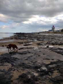 Image © spencer


 Artistic / Interpretive: