|
|

|
|
Allt SgiathaigChambered Cairn
|
||||||||||||||||||||||||
|
|
|
Images (click to view fullsize) |
|
Photographs: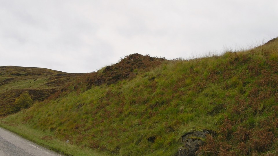

 Artistic / Interpretive:
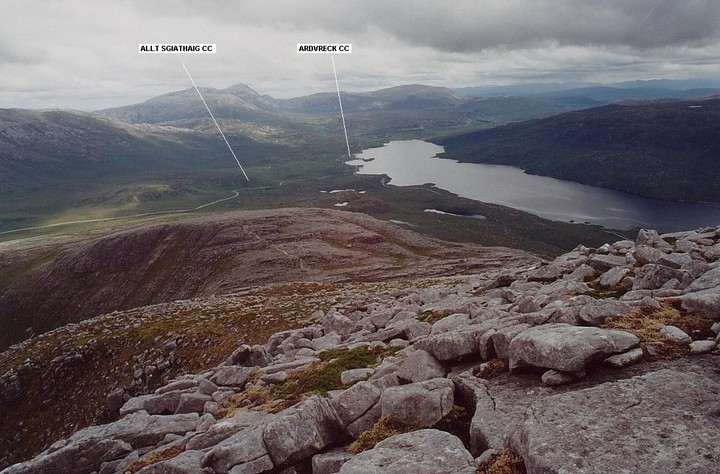
|
Fieldnotes |
|
|
We parked at the north entrance to Achmore Fram, which we would visit later, to climb the hill and approach Allt Sgiathaig from the east. As Mr G and Carl suggest, the cairn has seen a fair amount of damage and it is a minor miracle that it still sits precariously perched above the A894. We made our way down to the road and back to our car. However it can be spotted from the road from north and south, hopefully not by the driver but by the passenger. Good wee site. Visited 15/10/2020 |
26th December 2020ce |
|
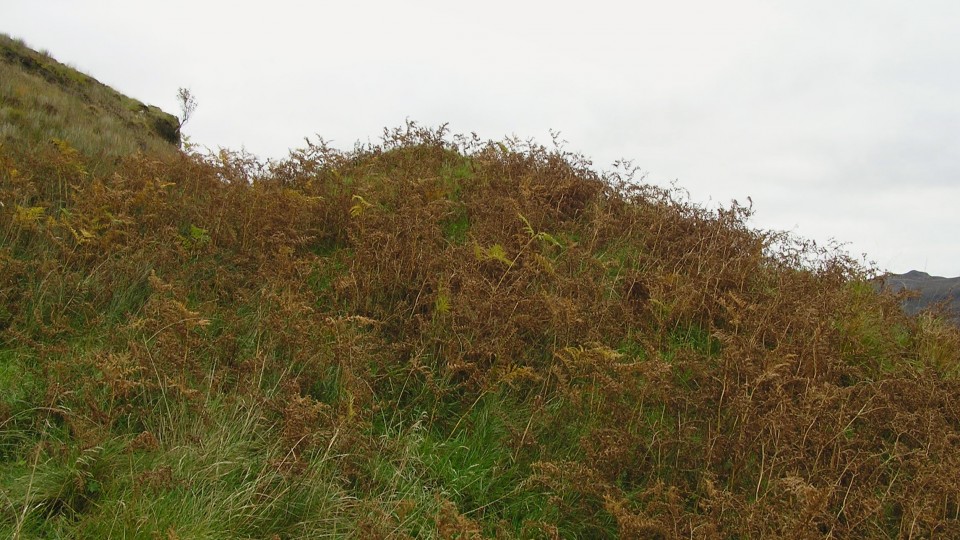
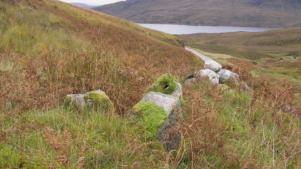
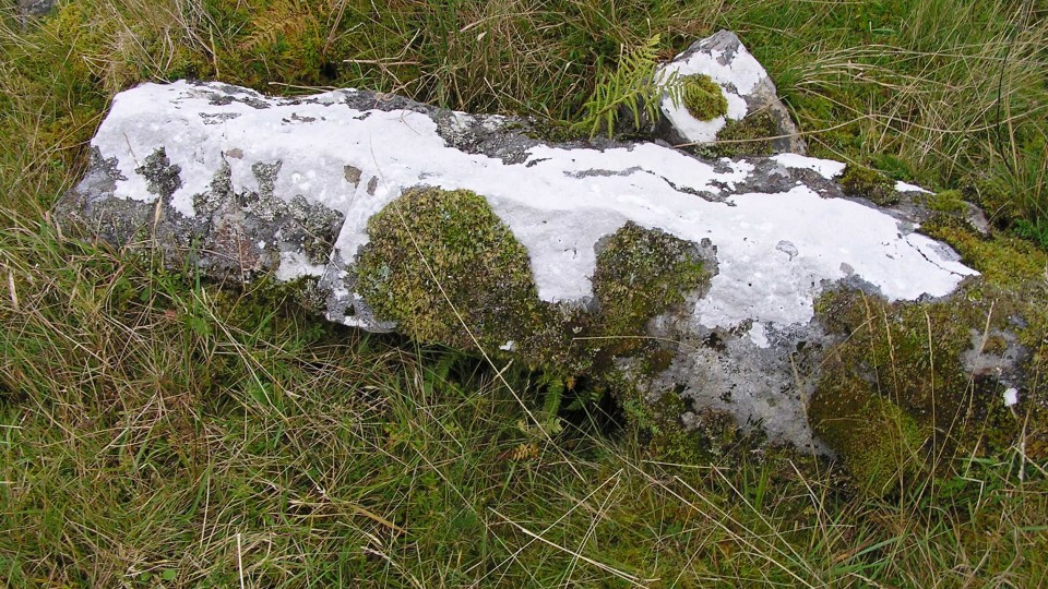
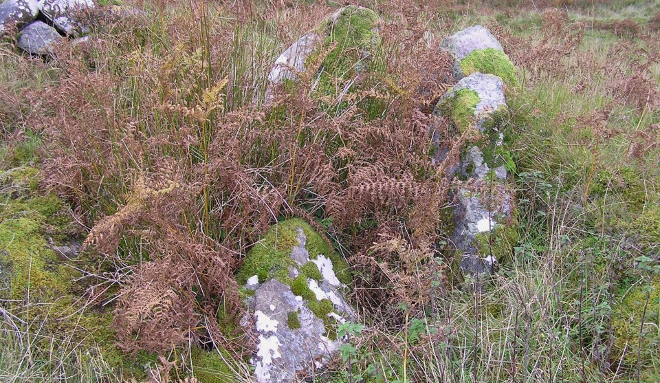
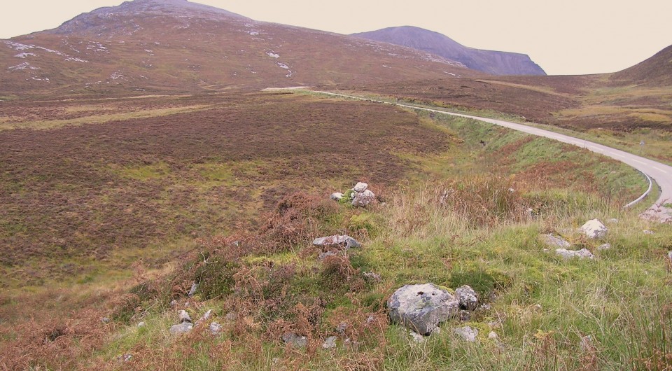
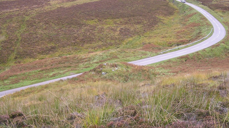
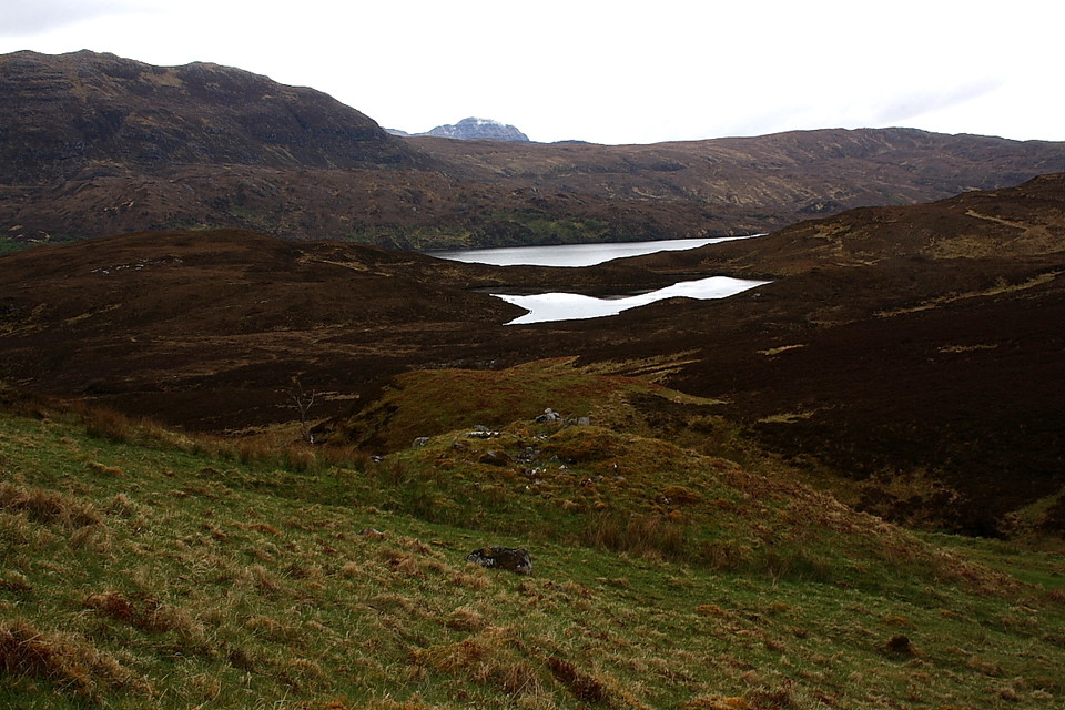
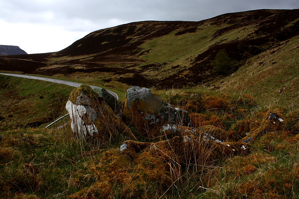
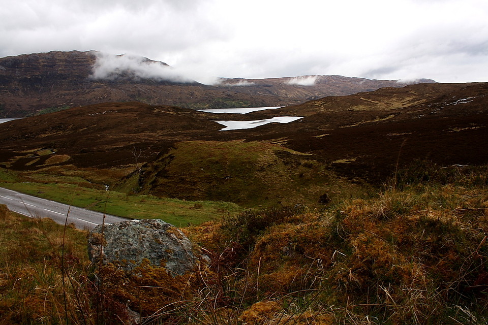
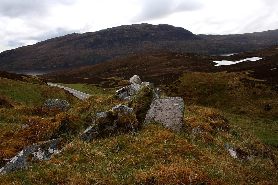
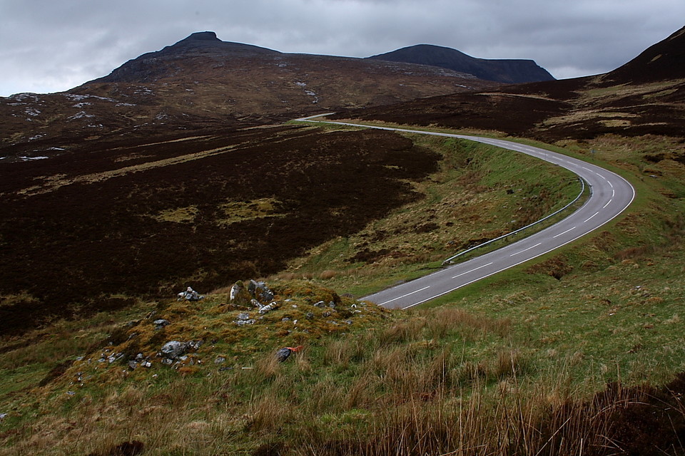
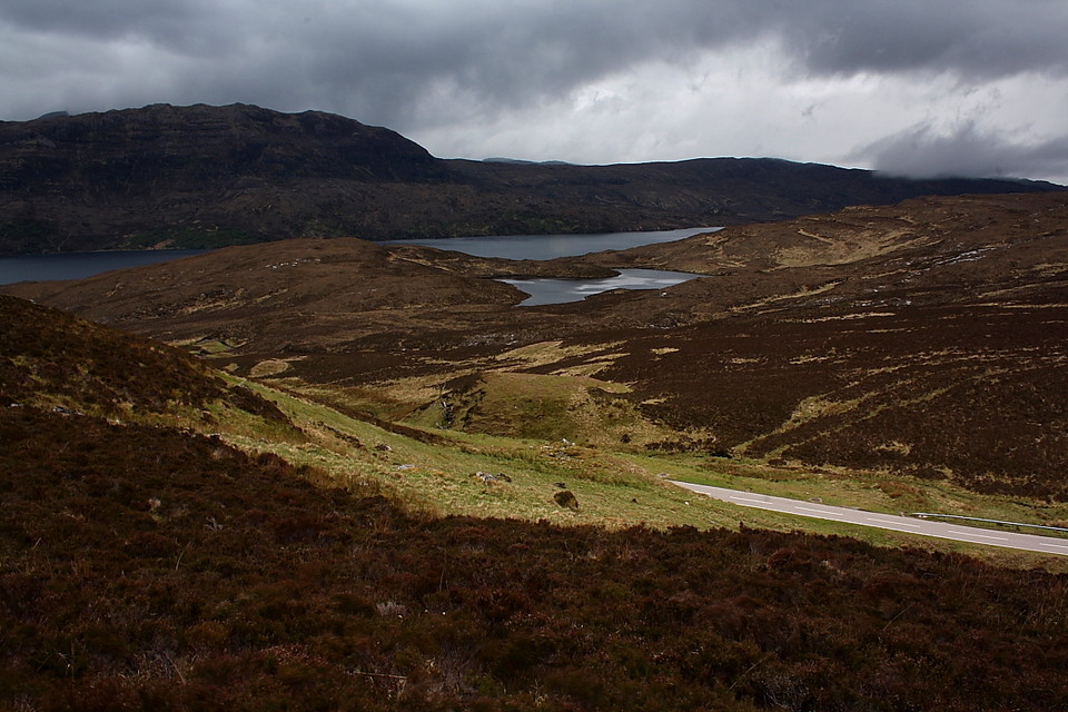
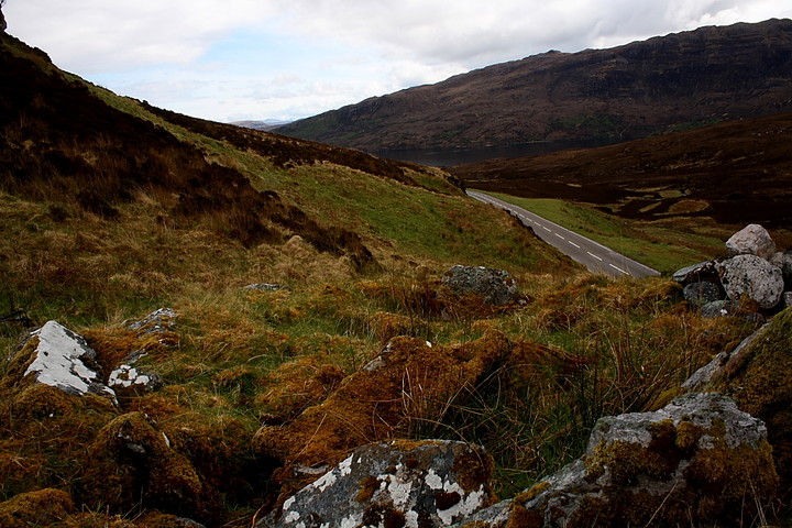
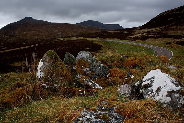
How good is this? Although close by the busy A894 - and apparently damaged by its construction - the shattered remains of this chambered cairn literally rise above such an appalling indignity, according the visitor a wondrous perspective of what surely must have been an ancient route across the gloriously brutal, mountainous landscape of The Quinag. Perhaps not so 'glorious' to the sodden Neolithic traveller, perhaps, but full of inherent meaning nevertheless? The situation is dramatic, to say the least, the towering mountain mass, rising beyond the Allt Sgiathaig, sculptured by the greatest forces of all to form the enigmatic, strikingly elegant summit of Spidean Coinich. Not the highest of The Quinag, but suffice to say it catches the eye. According to Assynt's Hidden Lives Project [2009] the monument is: "An uneven, sub-triangular grass covered cairn.... the W side has been completely truncated by the road. The cairn sits on a slope....3.5m high at the W and 1m high on the E.....Large stones are present on the top which are perhaps displaced lintels or capstones". Yeah, I'd concur with that. I also agree with Carl. The chambered cairn can not be seen from the road. Having said that, I approached from the steep hillside above, the monument presenting an iconic foreground image to such a desolately beautiful, watery landscape. Unfortunately the lack of internal detail within the cairn did not allow me to come to any firm conclusion regarding any correlation between alignment and the aforementioned Spidean Coinich... as I would suggest is reasonably obvious at the Ardvreck cairn down the road. But hey, despite the arrival of a pretty hostile rain front, I enjoyed myself here gazing down upon the camper vans heading for Kylesku, the mind drifting back to a much more serious 'working over' upon Spidean Coinich a decade ago. It's good to return and gain a different perspective, to close the loop. Ascending the A894 from Loch Assynt there are numerous parking spaces to be had before passing the track to Achmore Farm... should you be arriving by car, of course. As mentioned I climbed the hillside to the right and worked my way along. However if you'd rather stick to the tarmac - and why not? - look out for a solitary tree to your left... I think there was only the one. If located, the cairn lies, unseen, upon the steep rise to your right. P.S - if your onward route happens to take you to Kylesku it is worth considering a boat trip along Loch Glencoul to see Eas-Coul-Aulin, Britain's highest waterfall. As the local who took me said of his craft... "one careful owner... can't speak for the other dozen, though!" Nice. |
 Posted by GLADMAN
1st October 2013ce Edited 2nd October 2013ce |
|
Visited 2.6.12 Directions: Approx 2 miles north of Ardvreck castle on the right hand side of the A894. The cairn sits on top of a steep rise and cannot be seen from the road. We parked on the grass verge and I clambered up the short but very steep slope to the cairn. There are 9 large stones forming a rough circle – 5 of the stones are in a group. The cairn has clearly been dug into at some point in the past and is approx 2 metres high x 5 metres across. It has been cut in half by the road. There is lots of green lichen on the stones. The cairn occupies a good spot and affords lovely views.It was really pretty when I visited with bluebells, fern and heather in abundance. It is well worth stopping off for a look at the cairn but it does require a steep climb. |
Posted by CARL 5th July 2012ce |