|
        
|
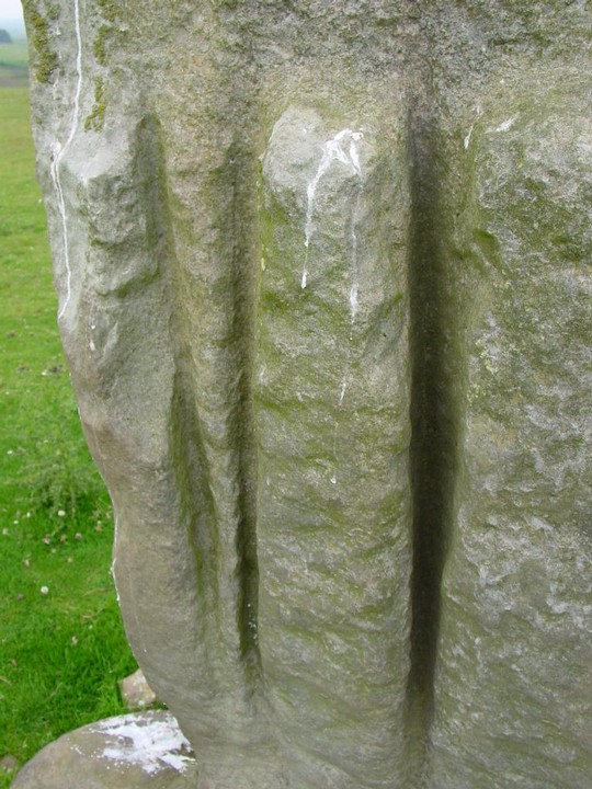
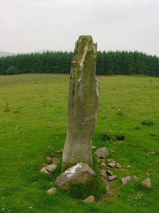
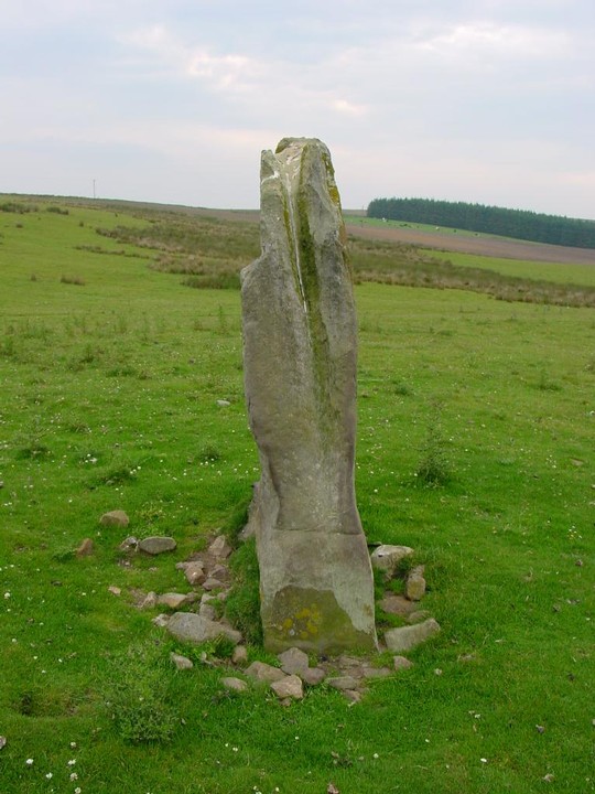
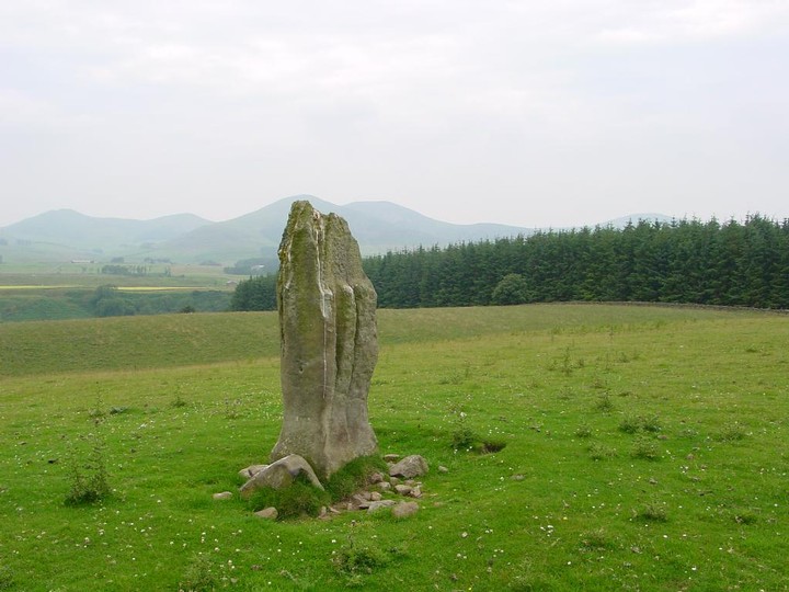
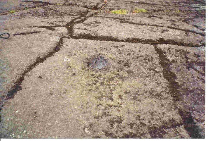
From the RCAHMS CANMORE detailing the Latin carving;
The top portion of its E face, above two weathered vertical grooves, has been chiselled off to a depth of 3 1/2", and here, on a panel with a horizontal beading above and below is a fragmentary inscription in well-cut Roman capitals, which may not be ancient, and of which only a few letters are now legible. They are in three lines, ......RK....; TI....DUM...; and ..X...BOUNTI
|
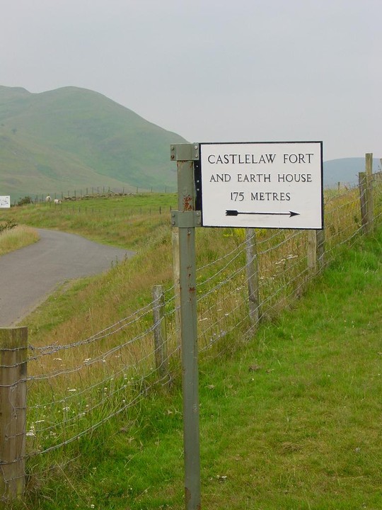
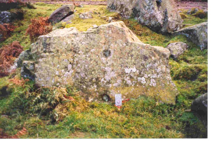
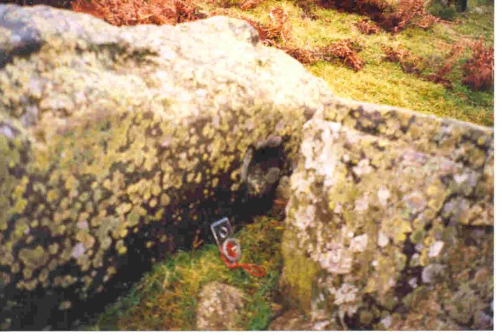
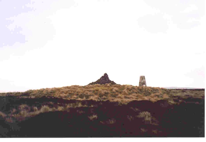
Monday 2/8/04
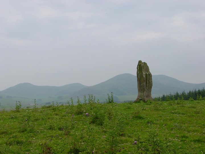
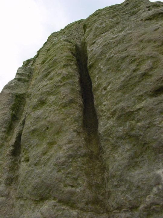
I drive down to Auchencorth Farm to ask permission to visit this stone and am greeted by a friendly old farmer on his quad bike with his sheep dog on the back ‘aye, you can jist aboot see it fae here’. I drive back up to the main road and wander across the empty moorland in the direction of the ridge of the Pentland Hills dodging the flying ants. The stone stands about 1.8 metres high and is rectangular at the base though tapers up to a point towards the SSE. It’s aligned SSE/NNW. There are three massive grooves on the east side about 1 metre long and up to 10 cm deep. Above the grooves a panel has been chiselled off and apparently there is the fragmentary remains of well-cut Roman capitals on it, but I can only just about make out one or two letters.
|
  
|
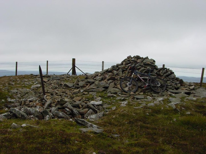
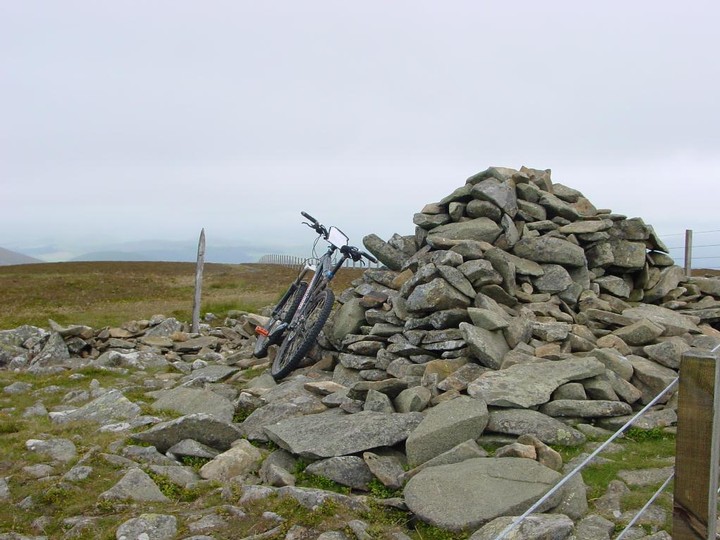
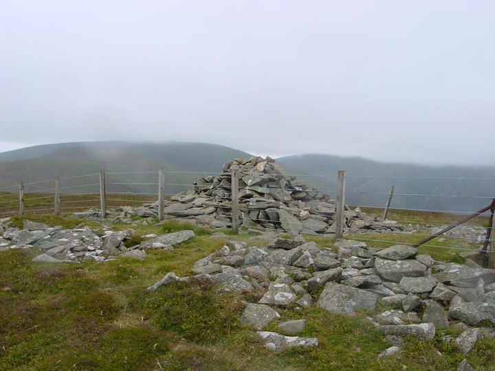
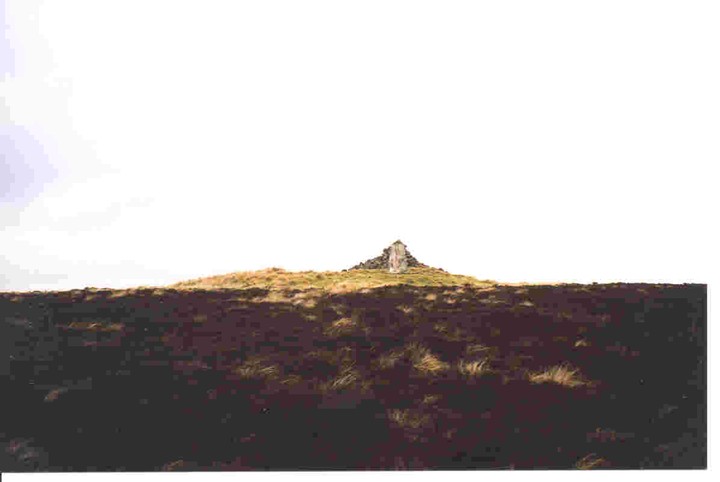
Saturday 24/7/04
I’d already biked about 25 to 30 K across some very desolate and remote country before arriving at the summit of Birkscairn Hill. As I near the summit the hills to the west open out into a giant bowl all dark and brooding. The wind up here is so strong I am struggling to remain upright and it doesn’t help that there is horizontal rain. The cairn itself has been much remodelled over the years and a modern summit cairn has been built from some of the stones- it offers a welcome shelter from the unrelenting onslaught of the wind and rain. The cairn still covers an area of around 10 metres in diameter with some large kerb stones amongst the remains.
|
 
|
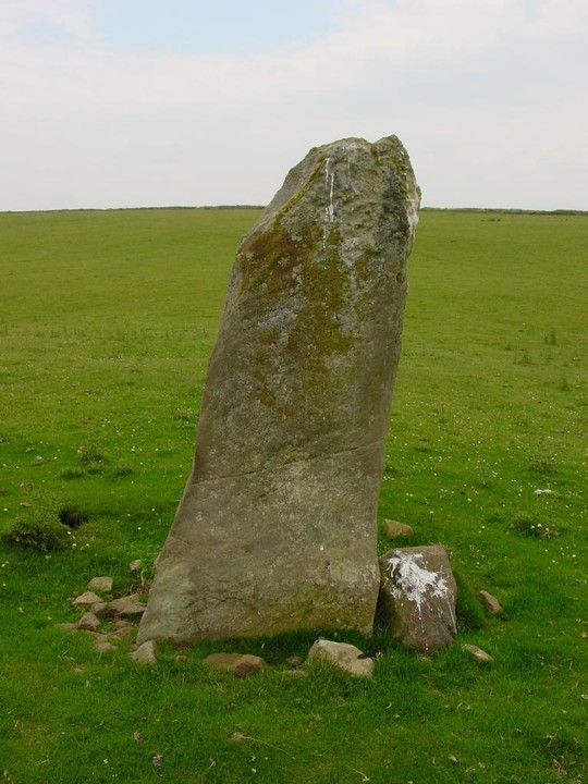
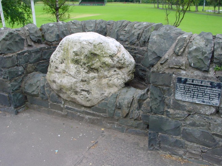
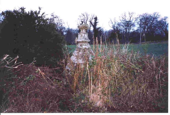
The old metal sign next to the stone reads;
‘The White Stone. So called because it is a quartz rock believed to have been carried to this location during the ice age. The White Stone is frequently referred to in the records of the burgh of Peebles. It became the spot where visitors were welcomed by the Magistrates on their entry to the town and where parting guests drank from the stirrup cup.’
|
Friday 23/7/04
On the right hand side of the road leading out of Peebles to Innerleithen there is a recess built into the wall to accommodate this massive quartz stone. The sign next to its says that it was an erratic deposited in the ice age and the first written record of the stone was in 1462 when it was used a s a boundary marker for the town. Such an unusual and large quartz stone (about 1m by 70 cm by about 2.5m) would not have gone unnoticed in megalithic times and it’s continuing use as a boundary marker in later times reaffirms this.
|
 
|
From the RCAHMS CANMORE database;
This fort lies within a small clearing in the Glentress Forest and a forestry road passes immediately to the W of it.
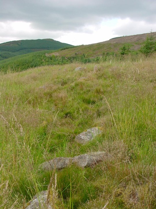
The defences have consisted of two stone walls which enclose an area measuring 155' by 135'. They have been heavily damaged by stone-robbing and tree-felling, and much of what remains is now obscured by a thick covering of rough grass. Little survives of the outer wall round the W half of the fort, but on the E its debris appears as a stony bank accompanied by an outer ditch. Where best preserved, the bank stands 3' above the bottom of the ditch and 3'6" above the interior. Five outer facing-stones are still visible, the largest of them measuring 4' in length and one foot in height above ground. The inner wall, however, can still be traced for almost its entire circuit as a stony bank standing up to 2' in height. A number of its outer facing-stones remain, including an unbroken stretch of the wall face, 31' in length, on the ENE. These stones, like those in the outer wall, are large blocks, standing up to 1'6" in height. No inner facing-stones can be seen in either wall, but the dimensions of the core suggest that the walls had an original thickness of 8'-10'. The entrance is on the S and appears to have led obliquely through the defences. A modern track has enlarged the original passage and there is now a wide gap in the inner wall at this point. From the W end of this gap a stony bank runs obliquely across between the two walls, and within the gap itself there are two shallow semicircular depressions; in the absence of excavation it is impossible to determine the true nature of these features, but it seems likely that they are simply a by-product of the subsequent mutilation of the site. Within the interior on the SE a low scarp extends inside the inner wall for a distance of 80' uniting with it at either end. In this scarp there are a number of large boulders which do not appear to be in situ, and which are probably disloged facing-stones originally belonging to the inner wall. The remainder of the interior which rises 18' from W to E is featureless.
|
Friday 23/7/04
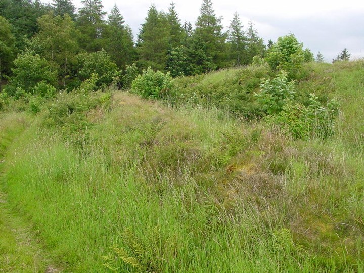
The forest opens out to a clearing to the east of the firetrack (again there are Forestry Commission ‘S’ posts around the site where they have cleared the trees from it). I climb up from the drainage channel at the side of the fire road and can see one of the ramparts due to the presence of many outer facing stones still in place. This settlement sits in a hollow with the hillside it is built on actually higher that it- so not a defensive position. The interior is irregular and there are no discernable features to be seen.
|

|
Description for the RCAHMS CANMORE database;
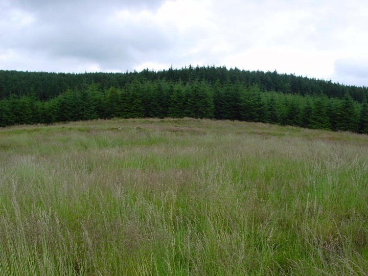
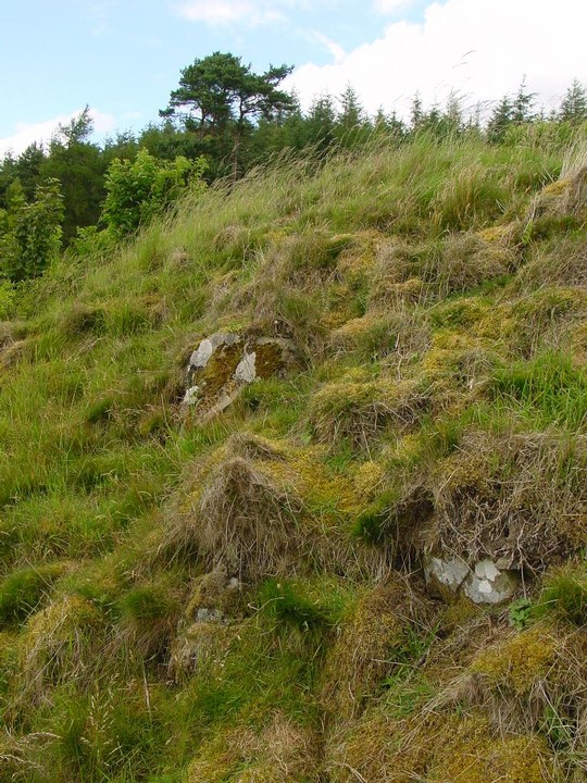
The fragmentary remains of a fort occupy the summit of Cardie Hill which is thickly covered with trees forming part of the Glentress Forest. Stone-robbing and cultivation, followed by tree-planting and felling, have caused severe damage, and at the time of visit the site was masked by a thick covering of tussocky grass and brushwood. The fort appears to have had at least two, and possibly three, lines of defence, which enclose a circular area measuring about 105' in diameter. The considerable quantity of stones, both large and small, that marks their course, indicates that they were probably walls. The debris stands to a maximum height 3' and is spread to a thickness of up to 20'. It is impossible to tell which, if any, of the numerous gaps through the defences are original. The interior contains no recognisable structures.
|
Friday 23/7/04
A very mutilated site caused by stone robbing, cultivation, planting and felling. There are many pits and tussocks in the interior, but nothing to interpret. Sections of ramparts still exist, but only to a height of less than a metre, the best of which (an it ain’t that great) is found on the NW side before the forestry plantation begins again.
|
Good site description from the RCAHMS CANMORE database;
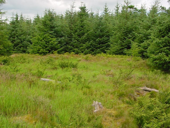
This fort is situated in a plantation on the S end of the ridge of high ground that forms the steep E side of the valley of the Soonhope Burn. The main defences consist of double ramparts and ditches which enclosure an area measuring 250' x 195'. On the N and E, where they are best preserved, the inner rampart stands to a maximum height of 3' above the interior and 10' above the bottom of the inner ditch, while the outer rampart measures up to 4' in height internally and 1'6" externally. The outer ditch, which can only be seen intermittently, is accompanied for a length of 85' on the NNW by a slight external upcast-bank. On the SE, S and SW, however, the ramparts have disappeared in some places, and elsewhere they are either greatly diminished or reduced to mere scarps, the ditches being completely filled up. Two boulders, visible on the outside of the inner rampart on the WNW, suggest that this rampart at least may have been kerbed or revetted with stone. The entrance is probably represented by the gap on the W. The interior, which slopes down from the NNE to SSW, is featureless. On the ENE extra protection has been afforded by the addition of an outer work set some 35' beyond the main defences, and consisting of a bank, now not more than 1'6" high and 7' thick, accompanied by a slight external quarry-ditch. It runs across the ridge for a distance of 170', and its slight construction may imply that it was never completed
|
   
|
Friday 23/7/04
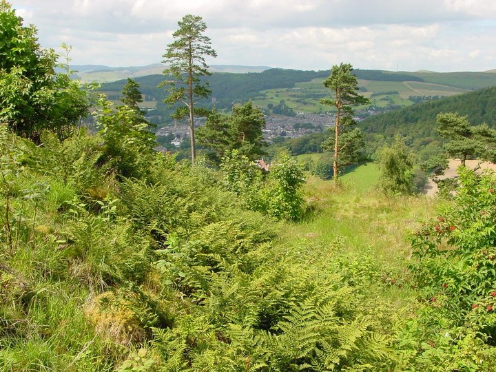
A sort and steep climb up from Peebles Hydro Hotel and into Glentress Forest brings you here. The fort covers and area of around 250 by 195 feet and was once forested, but was cleared of trees in 87/88 to offer a grand view over Peebles and the Tweed Valley. The inner site has many ditches and bumps, but none discernable as hut circles.
|
From the RCAHMS CANMORE database (1967 entry);
This settlement is situated among trees and occupies the summit of a low knoll which stands out from the general slope of the hill-side. It has been defended by triple ramparts which enclose a roughly oval area measuring 220' x 170'. For a length of 240' round the N and E sides the inner rampart still stands to a height of about one foot internally and up to 4'6" externally. Elsewhere, however, all three ramparts are now reduced, where still visible, to mere scarps varying in height from 6' on the NE to 2' on the SSW. Any ditches which may have existed are now completely filled up. The entrance is in the WNW and appears to have led obliquely through the defences. The interior, the level of which falls 32' from NE to SW, is broken up into a number of natural irregular-shaped terraces on which some slight crescentic scoops, too indefinite to plan, may mark the sites of timber houses.
|

From the RCAHMS CANMORE database (1967 entry);
This fort is situated among trees and occupies the summit of a low knoll which stands out from the general slope of the hill-side. It has been defended by triple ramparts which enclose a roughly oval area measuring 220' x 170'. For a length of 240' round the N and E sides the inner rampart still stands to a height of about one foot internally and up to 4'6" externally. Elsewhere, however, all three ramparts are now reduced, where still visible, to mere scarps varying in height from 6' on the NE to 2' on the SSW. Any ditches which may have existed are now completely filled up. The entrance is in the WNW and appears to have led obliquely through the defences. The interior, the level of which falls 32' from NE to SW, is broken up into a number of natural irregular-shaped terraces on which some slight crescentic scoops, too indefinite to plan, may mark the sites of timber houses.
|

|
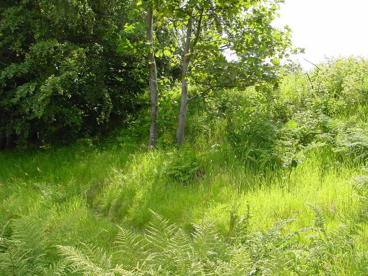
Friday 23/7/04
Not a lot left of this settlement and even more difficult in summer due to chest high grasses, ferns and assorted vegetation. This site (along with the nearby fort) was cleared of trees in 87/88 and not much remains in the interior. The only real visible remains of the ramparts are to be found on the north and east of the site where the external ramparts still stand to a height of about 2.5 metres and the internal to about 1 metre.
|
 
|
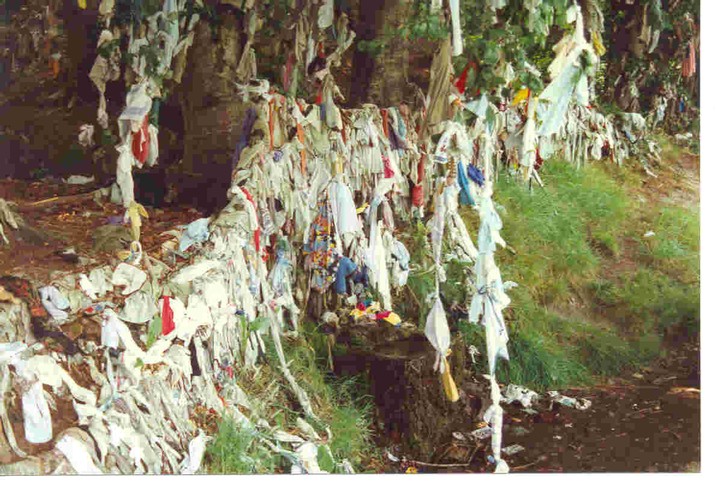
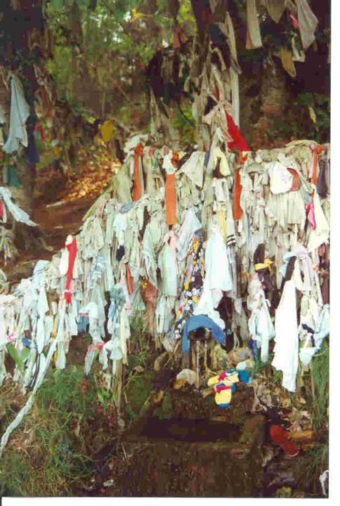
August 97
Kat and I stopped off at this famous clootie (or rag) well on the Black Isle on our way to the fantastic Groam House Pictish Museum. It’s, er, quite a sight! The well is now a trough beside the road into which a natural spring flows. Then around about this in all the trees are thousands of cloots. From the usual hankies to old socks and even the odd tartan insole. The whole site is kinda disgusting, though it’s heartening to see the ancient ways and traditions still very much in use.
|
|