Bladnoch Standing Stone
markj99
Acharra Standing Stone

Slope up to Eastman’s Cairn from Billy Marshall’s Cave
Image credit: Mark Johnstone

Close-up of rusted iron pin indicating Billy Marshall’s Cave
Image credit: Mark Johnstone

The entrance to Billy Marshall’s Cave
Image credit: Mark Johnstone

The interior of Billy Marshall’s Cave
Image credit: Mark Johnstone

The dead end of Billy Marshall’s Cave
Image credit: Mark Johnstone

Skylight from Billy Marshall’s Cave
Image credit: Mark Johnstone

Looking N from Billy Marshall’s Cave
Image credit: Mark Johnstone
Billy Marshall’s Cave is situated at NX494679, approximately 900 metres north west of the summit. Again this cave is worth a visit, but difficult to find. Fortunately a rock above the cave has an iron bar protruding from it – thus helping to identify its location.”
The above quote is from Newton Stewart WalkFest.
It is more of a rock recess than a cave, lying 2 metres below the slope of Cairnsmore of Fleet and extending for around 10 metres. There is not enough room for Billy Marshall’s Band of Gypsies (go to Cairnsmore of Fleet Folklore), maybe 5 people max.
The easiest way to find Billy Marshall’s Cave is from the summit of Cairnsmore of Fleet. Skirting round Cairnsmore is pathless and longer. Approaching from the N via forest tracks and boggy moorland is unappealing.
From the trig point head NW towards Eastman’s cairn (a pile of stones) at NX 495 675. Follow down the slope to the N towards NX 4948 6798. This will require scrambling down into the valley but it is moderate. Look out for a flat rock with a rusted iron bar protruding vertically. Billy Marshall’s Cave is situated within several yards, a narrow vertical entrance into the cave.
Loch Head Cairn
Carlin Stone
Whirlpool Recumbent Stone
White Cairn, Boreland
Beinn Ghott Cairn on Isle of Tiree
White Cairn, Culroy
Cauldside Burn Stone Setting
Cauldside Burn Cairn North
White Cairn, Chapelton
Culroy Farm Cairn
Cradle Stone, an erratic split in two.
Drummore Castle Fort
Terally Standing Stone
The Taxing Stone
Long Tom (Cairnryan) Standing Stone
Tor of Craigoch Fort.
Despite it’s relative isolation in the modern world the complex of sites at Mid Gleniron indicates it must have been a hub of social activity. The well preserved Round Cairn overlooks three chambered cairns and numerous scattered clearance cairns. Excavation in the sixties revealed occupation of Mid Gleniron from the Neolithic Period. The chambered cairns were constructed in multiple stages implying a continuous population at Mid Gleniron.
Mid Gleniron Round Cairn.
Mid Gleniron III Cairn. Canmore gives details of an excavation running from 1963 to 1966.
Mid Gleniron II Cairn. Canmore gives details of an excavation running from 1963 to 1966.
Mid Gleniron I Cairn. Canmore gives details of an excavation running from 1963 to 1966.

Outer Rampart, Kemp’s Graves
Image credit: Mark Johnstone

Outer Ditch, Kemp’s Graves
Image credit: Mark Johnstone

Middle Rampart, Kemp’s Graves
Image credit: Mark Johnstone

Inner Ditch, Kemp’s Graves
Image credit: Mark Johnstone

Inner Rampart, Kemp’s Graves
Image credit: Mark Johnstone
Kemp’s Graves consists of three parallel ramparts protecting an enclosure at the top of Aldouran Glen. The S & W approaches are protected by the steep glenside. Trees and bracken have invaded the space making interpretation of the fort difficult.
Canmore ID 60845 (go to Links) gives a detailed interpretation of the fort.
To get to the fort head to Leswalt from Stranraer, travel straight through Leswalt , take the 1st L turn after the uphill Z bends, signed for Path Aldouran Woodland Circle. Around 300 yards along this rough road there is a large parking space to the L. A Woodland path starts here. Keep straight on this path for around a third of a mile until you reach a clearing with a wooden bench and earthworks.
There is no signage indicating Kemp’s Graves.
Kemp’s Grave / Glenhead of Aldouran Promontory Fort
Doon Castle Broch is my favourite local site to visit. The name may be confusing to some people because there is a Doon Castle in Ayrshire on Loch Doon. Doon Castle Broch is on Ardwell Point in Dumfries and Galloway.
A site of this quality deserves more visitors however the isolated location discourages people. There is the problem of the rocky road after West Ardwell Farm however it just requires careful driving on a short stretch to reach the Ardwell Bay car park. There is a sandy beach for non-antiquarians to amuse themselves while TMAers visit Doon Castle.
Directions: From Stranraer head towards Sandhead on the A716. Drive past Sandhead and take the 1st R signposted for Kirkmadrine. (Incidentally, Kirkmadrine is a short signposted detour and well worth a visit). Keep straight on this road for 1.5 miles until you reach a crossroads. Continue straight onto a dead-end road for Ardwell Bay. Follow this single track for 1 mile until you reach a sharp bend at West Ardwell Farm. Continue straight on the rough farm road for around 0.5 miles until you reach Ardwell Bay car park. Walk round the rough road until it stops. Take the Public Path over a style. Follow this path round the coast for around 500 yards to find Doon Castle.
Doon Castle / Ardwell Point Broch
Sig More Cairn, South Uist.
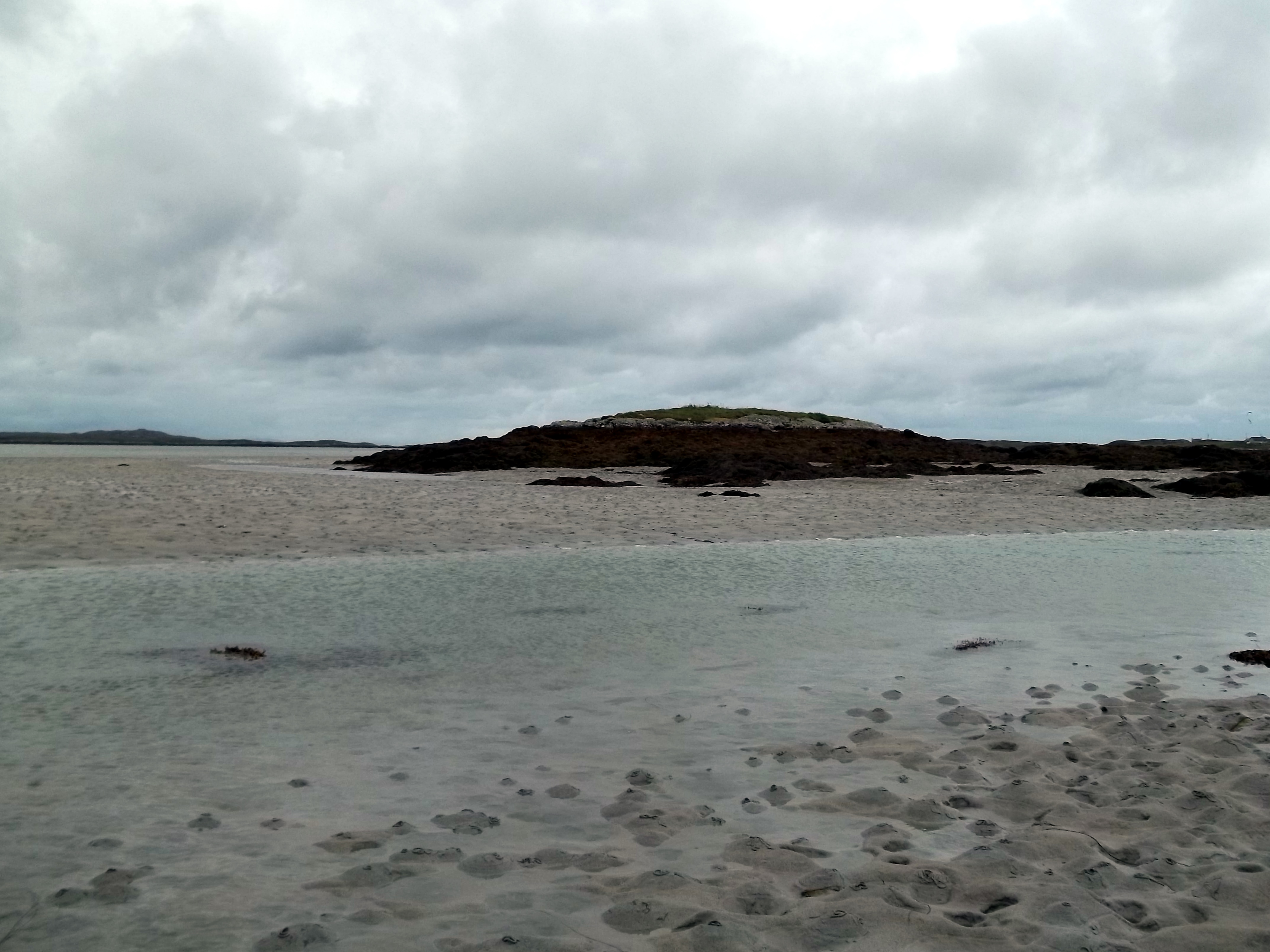
Sig More cairn with Sig More tidal inlet in the foreground.
Image credit: Mark Johnstone

I attempted to reach Sig More cairn from the beach however the cairn was surrounded by a carpet of seaweed which deterred me from investigating further. The profile of the mound is a classic cairn with large kerb stones visible.
Directions: The cairn is located on the N coast of South Uist. Half a mile before the South Uist Benbecula Causeway turn R to Aird Mhor/Ardmore just after passing a roadside shrine. Follow the single track road to park at a dead end at Rhughasinish (NF81394517). Walk back along the track for c. 300 yards to reach a house. Head NW across rough ground for c. 500 yards to reach the coast. The cairn is accessible from the coast depending on the tide level.

Approaching Hendraburnick Quoit
Image credit: Mark Johnstone


Apron Full of Stones Cairn viewed from NNE.
Image credit: Mark Johnstone


The Galloway Stone OS Bench Mark Bolt
Image credit: Mark Johnstone
