
A R Cane


Small cairn about 50m NW from the cairn circle.
Image credit: A R Cane

I guess this may have been the entrance. Beyond is the Eastern cairn.
Image credit: A R Cane


Old photo from 1894 showing fallen stones.
dartmoortrust.org/archive/view/3460
Image credit: Dartmoor Trust Archive

It took a little longer than anticipated to find this beauty, but thanks to some local rangers we sorted out where we were and eventually stumbled on it. And we were not disappointed.
Image credit: A R Cane

Panorama from East to West. There seems to be an obvious gap, or missing stone, at this end. I know that the largest stones were re-erected earlier in the 20th Century. I wonder if one had gone missing over the centuries?
Image credit: A R Cane

Looking back along the row westwards to the cairn circle.
Image credit: A R Cane
Evidence of a prehistoric “farming collective” has been discovered after aerial laser scanning was carried out in the South Downs National Park.

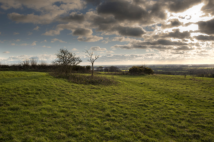
Nice days cycle over the Downs. Wolstonbury Hill is, I think, directly behind the barrow.
Image credit: A R Cane

I found this site slightly confusing. Is this ‘The Giant’s Grave’ within this copse or is it the barrow slightly further up the track that looks, from a distance, like a long barrow. Either way, lovely spot.
Image credit: A R Cane

The barrow further up the track from the copse. Long barrow or a round barrow slightly truncated by the track? Who knows?
Image credit: A R Cane

This one’s all but disappeared and is situated just outside the copse.
Image credit: A R Cane

Captured by my son with his drone last week while working near Dorchester.
Image credit: Felix Speller

I came here about 8 months ago and it was all completely dry , including the trickle from Silbury Hill which I walked back along. Look at it now though, you can’t even get across it via the large sarsens laid down there! Interesting that a lot of these rivers are winterbournes, but this one thrives in the spring/summer.....hmmm.
Image credit: A R Cane


Large sarsen built into someones back garden steps overlooking the Tye about 100m from the church.
Image credit: A R Cane

Large sarsen built into a garden wall approximately 400m from the church. It looks like two stones from a distance but it’s just a natural fissure viewed close-up.
Image credit: A R Cane

The banded quartz stone on the South side of the circle.
Image credit: A R Cane


The public swimming pool recently opened within the circle.
Image credit: A R Cane


Sunburst over Chichester and Selsey viewed from the South Western entrance to The Trundle.
Image credit: A R Cane

Panorama showing almost all of the stones remaining in an arc. The others are gathered together further back in the wood.
Image credit: A R Cane

Feels like a half finished job here, a bit like the circle itself. It might have been nicer to completely clear the imposing trees or, better still, have left the circle alone as it seems to have lost some of it’s mystery.
Image credit: A R Cane

The approach to Halnaker Hill from Stane Street. The hill gets it’s name from the nearby Halnaker village and the name is derived from ‘half naked’ apparently. Curious.
Image credit: A R Cane

Looking East across the 19th Century dew pond. Note the WWII structure in the background, one of three, which was either for a search light or RDF equipment.
Image credit: A R Cane
The bank on the left is probably not ancient and maybe contemporary with the post mill of 1740.
Image credit: A R Cane

The edge of the enclosure is defined by the fence and bank on the right.
Image credit: A R Cane

The Southern entrance is just beyond the dew pond on the left hand side.
Image credit: A R Cane
Like nearby Court Hill there’s not a great deal to see here in terms of the Causewayed Enclosure which once dominated this hill top, but there has been a great deal of activity since then and you certainly get your money’s worth. The most noticeable thing is the windmill (visible from the A27 between Arundel and Chichester) which has been here since 1740, though the original mill was built in 1540 for the nearby Goodwood Estate. The 1740 mill was destroyed by fire in 1913 and then vandals came back in the summer of 2015 to try and torch it again which is why it currently has no sails and you can no longer go inside. The enclosure is largely defined by a bank surrounding about 2 hectares, with the main entrance in the Southern part, where the modern gate stands today. The outer ditch has largely disappeared through centuries of ploughing. There are also three WWII structures, one inside, one in the bank and another just outside to the west of the entrance. These were either searchlight emplacements or Radio Directional Finding towers (nobody seems to agree which!) that would have served Goodwood and Tangmere airfields. It’s clearly always been a strategic and prominent point as Bronze Age and Roman artefacts have been found here as well and the Roman Stane Street runs about 200m to the South past the bottom of the hill. The views from here are also quite stunning with the rolling South Downs to the North and Chichester and the Channel to the South.

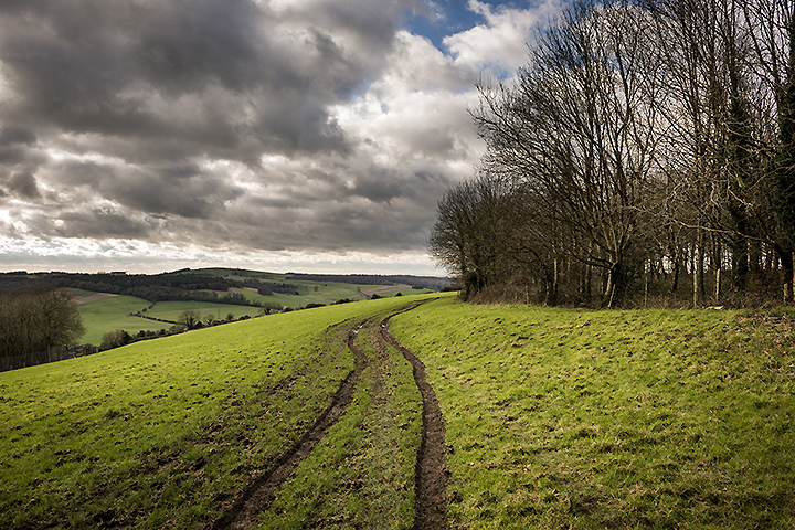
While making our way up the track to Court Hill we passed these ancient droving tracks descending from the South Downs to the village of East Dean.
Image credit: A R Cane

The raised bank disappearing through the fence into the copse.
Image credit: A R Cane
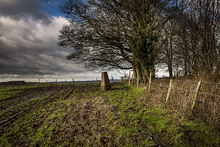
The Trig point which stands on the South Western edge of the enclosure.
Image credit: A R Cane

Looking out South West you can see Goodwood Race Course and The Trundle.
Image credit: A R Cane

Peering into the copse you can just about make out the raised bank of the enclosure.
Image credit: A R Cane
Maybe there should have been a notice placed near the top of Court Hill saying ‘Move along now, nothing to see here’, but that wouldn’t be strictly true. Having conveniently parked at the little church at East Dean village we made our way up the track, past the ancient droving tracks descending from the Downs, and onwards to a copse which covers most of the hill top. The only evidence of the enclosure is a slight bank which comes around the South Eastern edge of the hill before disappearing through the fence into the copse. You can’t get into the copse because of a barbed wire fence and there seems to be a lot of stuff connected with the pheasant slaughtering industry in there, but you can definitely see evidence of the bank running through the trees (this is more evident if you look at a satellite image). Also from the top you get wonderful views along the valley towards Charlton, Goodwood Race Course and The Trundle (which has a Neolithic Causewayed Enclosure inside it’s Iron Age fortifications) and you’re also only about 3 miles from Halnaker Hill, another NCE.

The dip in the railings of the Race Course run-off track indicate the faint remains of the 3rd ring of the Causewayed Enclosure.
Image credit: A R Cane

One of the areas dug in August 2014 on Whitehawk Hill, sadly yielding very little.
Image credit: A R Cane
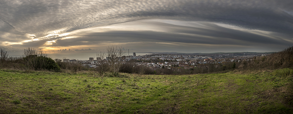
The view over Brighton & Hove from Whitehawk Hill. This is the same section that was dug in August 2014 in the previous photo.
Image credit: A R Cane