
Open Source Environment agency LIDAR
Image credit: © Environment Agency copyright and/or database right 2015.
Open Source Environment agency LIDAR

The approach to Halnaker Hill from Stane Street. The hill gets it’s name from the nearby Halnaker village and the name is derived from ‘half naked’ apparently. Curious.

Looking East across the 19th Century dew pond. Note the WWII structure in the background, one of three, which was either for a search light or RDF equipment.
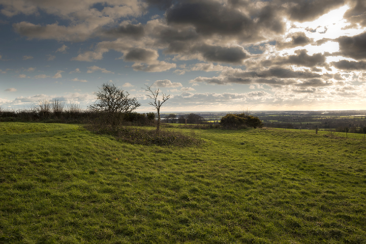
The bank on the left is probably not ancient and maybe contemporary with the post mill of 1740.

The edge of the enclosure is defined by the fence and bank on the right.

The Southern entrance is just beyond the dew pond on the left hand side.
Like nearby Court Hill there’s not a great deal to see here in terms of the Causewayed Enclosure which once dominated this hill top, but there has been a great deal of activity since then and you certainly get your money’s worth. The most noticeable thing is the windmill (visible from the A27 between Arundel and Chichester) which has been here since 1740, though the original mill was built in 1540 for the nearby Goodwood Estate. The 1740 mill was destroyed by fire in 1913 and then vandals came back in the summer of 2015 to try and torch it again which is why it currently has no sails and you can no longer go inside. The enclosure is largely defined by a bank surrounding about 2 hectares, with the main entrance in the Southern part, where the modern gate stands today. The outer ditch has largely disappeared through centuries of ploughing. There are also three WWII structures, one inside, one in the bank and another just outside to the west of the entrance. These were either searchlight emplacements or Radio Directional Finding towers (nobody seems to agree which!) that would have served Goodwood and Tangmere airfields. It’s clearly always been a strategic and prominent point as Bronze Age and Roman artefacts have been found here as well and the Roman Stane Street runs about 200m to the South past the bottom of the hill. The views from here are also quite stunning with the rolling South Downs to the North and Chichester and the Channel to the South.


