


The entrance to Seven Barrows Nature Reserve – impassable with wellies.
Today, with an interlude of winter sun for about an hour.
A circular (triangular) walk from Upper Lambourn using OS map 170. Set off late morning along a surprisingly unmuddy byway as far as Postdown’s Farm from where we had to do some road walking. Clear signs of recent flooding, the adjacent fields were lake-like in places – we passed a couple of large round barrows on our left as we walked towards Seven Barrows Nature Reserve. The road was badly flooded by the entrance to the nature reserve and the entrance impassable on foot without wellies, fast flowing water running off into a nearby field (must be springs around here to cause to the water to flow such). We managed to jump across a water filled ditch and scramble under some blackthorn hedging to get a better look at the seven (possibly eight) barrows.
The landscape is astonishing – apparently 26 barrows in all dating back to 2200BC. We didn’t actually count the ones we saw besides the seven in the nature reserve but there were several. The sense of walking through an important Bronze Age cemetery was tangible.
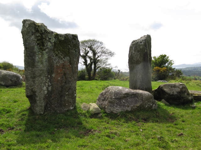
We continued on foot along the road past Seven Barrows House and took the track towards Uffington to look for the long barrow shown on the OS map. Not much left and it would be easy to walk past if you didn’t know it was there as absorbed into a beech plantation – two fine stones remain though.
Picked up another muddy byway back to Upper Lambourn and happily came across the Hangman’s Stone just before the track back down to the village. A small standing stone approximately a metre high – probably a boundary stone.
These stones are mentioned by Sara Maitland in her book “Gossip From The Forest – The Tangled Roots of Our Forests and Fairytales” in her chapter on Purgatory Wood. She relates their dark history as a a non-native spruce plantation and associations with Pugatory Burn which marked the western boundary of a nearby leper colony.
“The track I took into the Purgatory Wood meets the Southern Upland Way as it climbs up from New Luce, and a single path crossed the Purgatory Burn and runs eastward to Laggangairn ... and then beyond it to the Laggangairn standing stones – the last vestiges of a Bronze Age stone circle, carved with eighth century christian graffiti left by the pilgrims to St Ninians shrine at Whithorn”
Interesting article in December’s edition of Antiquity “The Giants of Wessex: the chronology of the three largest mounds in Wiltshire, UK” – by Jim Leary and Peter Marshall
Some useful information and folklore about Hangman’s Stones.
Out walking yesterday – one of those November days that feels like a gift. Sunday, the rain lashed down. Monday, the sun came back and warmed the sodden earth. Had arranged to walk with my Gloucestershire walking friend who picked out a route that stuck to green paths where possible. We set off at from the little village of Yanworth (near Chedworth Roman villa) and walked to the village of Hampnett. Hangman’s Stone is marked on the OS map about halfway between the two villages, just off the Salt Way and on the Macmillan Way. The stone itself lies on its side and is well camouflaged by the Cotswold stone wall behind it. Now in two parts with a hole through what looks like the top half. (Just read tsc’s post which indicates the stone has always been two stones – to me it looked like one standing stone that had split naturally through weathering)
Curious this one – came upon it by chance and it doesn’t really want to be seen.

I omitted to add this when I wrote up my fieldnotes on Gower. This atmospheric cairn is about 30 metres from Maen Ceti and the two sites seem connected. I don’t know if there is any archaeological data concerning this cairn – it just seems to be in the right place. Stopped here for bit to enjoy the estuary view towards Llanelli. Anyone visiting Maen Ceti would feel naturally drawn to walk over to it.


Sunday 21st October 2012
The day started overcast but quickly turned into an amazing day full of blue sky and sea. Rhossili soon became very busy because of the lovely weather (surfers out in droves). Fortunately we had made an early start so avoided the crowds until later in the day. The plan was to walk to Hillend from Rhossili along the top of Rhossili Down and return along the beach (which I believe is the largest in the UK). Sweyne Howes burial chambers came into view at about the half way point of the walk – one is ruined with the stones scattered. The larger and more intact chamber is reminiscent of some of the wedge tombs I saw in Ireland. Unlike the wedge tombs, however, these two are hidden from the sea view being well below the high ridge of the Down.
Saturday 20th October 2012
Starting from Penmaen, three miles along the Gower Way – the walk along the top of Cefn Bryn made the visit to this astonishing site all the more memorable. It was a beautiful mid October morning – the sea visible on both sides. So much to see and enjoy, not least the free range Welsh ponies which galloped across the brown bracken.
Maen Ceti is astonishing – a massive capstone standing on several small stone ‘legs’ with a scatter of smaller stones around. The legs stand in water and the surrounding ground is boggy in places – I believe there are a few springs nearby. Close by too, is a large stone cairn (which felt related).


Cat Hole Cave is just a short walk from Parc Le Breos (about 200 yards north) uphill into a wooded area. Access is no longer possible as the cave has now been closed to the public with bars in situ. A local person said this was because the bats were being disturbed by people going into the cave looking for the ‘reindeer rock art’.
In 1968 excavations recovered flint blades of the ‘Creswellian’ type which indicated this cave was the home to hunting parties towards the end of the Ice Age some 14,000 years ago.

Visited Friday 19th October 2012 – first port of call of weekend on the lovely Gower Peninsular. About half a mile up the hill from the Park Mill Heritage Centre, this chambered stone long barrow is hard to miss. This was my first encounter with a ‘cairn’ type long barrow. Now open to the elements in the same way that Nympsfield in the Cotswolds is – the chambers are impressive.
The Cat Hole cave is a short walk away up into a wooded area.

Many thanks to thesweetcheat for this link – am adding as a link because I don’t want to lose sight of it (I think my laptop is on the blink).
This article appeared in last Saturday’s edition of The Times under the heading “Discovery of Mesolithic camp sheds light on the origins of Stonehenge”. It relates to the exhibition held at Amesbury earlier in the year on the finds and work around Blick Mead.
sis-group.org.uk/news/stonehenge-mesolithic.htm
(Source: “Current Archaeology” No 271:28-33)
Apparently the native people of St Kilda had developed a genetically inherited elongated big toe that let the men cling more easily to the cracks in the rocks. On one side of the island is the Mistress Stone where marriageable men had to balance on one leg – on the edge of a 300 ft drop – to prove their agility on the rocks and their ability to support a family.
Source: “West Coast” by Kate Muir

24/8/2012
In the grounds of an early 17th century hunting lodge now owned by the National Trust. There is public access to the barrow field though today there was a large herd of young frisky pedigree cattle also in the field. They didn’t notice us until we were making our way back (a little too frisky for my taste).
This long barrow is now protected by an electric fence – I imagine to keep cattle, rather than people, off. Easy enough to step over if you want to. The barrow looked in good condition and no signs of the past damage recently reported by Evergreen Dazed. Three of the stones from the chamber still remain (reminded me of a small wedge tomb).

A three strand electric fence protects the barrow from the large herd of cattle in the NT meadow.

Second visit to this spectacular hill fort today. Incorporated it with a stop off in Andover to visit the superb Museum of the Iron Age based on the excavations at Danebury but which also attempts to give a general impression of life in the Iron Age. Well worth a visit – lots to see, lots to learn.
It was a hot afternoon but the walk up to Danebury somehow felt breezy and just the right place to be. Wonderful views across the now golden grain fields of Hampshire. We had gone back specifically to see the wild flowers which seem to grow in such profusion at other hill forts like Barbury. The predominate wild flowers today were great stands of yellow ragwort – a wild flower I have reservations about as believe it is poisonous to horses and cattle. Lots of delicate harebells growing too.
Butterflies galore ... which was a bit of a joy as its been a bad year for butterflies up till now. Saw my first red admiral of the summer, along with chalk blues, marbled whites and many more.
Danebury had a little surprise for us – we found a small wooded area to take shade and stop for a drink. Three brown ponies (possibly Exmoors) appeared and calmly walked past unperturbed by our presence. I was particularly surprised to see them as there was so much ragwort around. I guess they just know not to eat it.
Visited this museum in Andover on a return visit to Danebury. Excellent and atmospheric museum, constructed as a round house inside (though in a conventional building). A great place for a family outing with lots to learn. One display focuses on the animals and plantlife that were around at the time. I learnt that the cockeral, goose and hare were held as sacred and never eaten. The raven was a symbol of darkness and death though also associated with foretelling the future.
Also – something I’ve never seen before, a hologram of the Lindow Man. Very realistic.
We’ve all been to an ancient site and left with a sinking heart because of litter or the vandalism of past excavations. Today I almost wept – had to go to Stroud in Gloucestershire, the sun came out so thought to make a day of it and walk up to Painswick Beacon. A place I’ve visited once before three years and, although then the whole of Painswick Hill seems to be a golf course, it seemed peaceful and the views across the Severn Valley are pretty amazing.
Today I discovered part of the hillside is missing – a great yawning chunk of hillside gone. The noise from the diggers moving great lumps of Cotswold stone around destroyed any peace. Cotswold stone has always been quarried but I’ve never seen it done on such a destructive and industrial scale.
i296.photobucket.com/albums/mm200/TJJackson66/012-19.jpg
Painswick hillfort and beacon are still intact, the views still terrific, a kestrel still hovered but what a travesty.


Taken from Aubrey Burl’s book “John Aubrey & Stone Circles”.
(As a 12 year old John Aubrey spent time playing around Stanton Drew)
The chaos told the young Aubrey nothing.
Village gossip offered explanations. Some slabs were so ponderous that no man could have raised them. They were the work of giants. The name of one of them was known, Hackwell. He had been so strong that he had thrown an immensely heavy stone from a distant hill and it landed over a mile away on that ridge on the skyline just above the circles. There were rumours claiming Hackwell was so famous that he was buried in the nearby church at Chew Magna.
Others added a warning. The boy should never try to count the stones. It was impossible anyway because of the jumble but if anyone did reach the right number that person would suffer great misfortune, maybe even death for interfering in what was best left alone.
Another superstition relates how, on the sixth day of the full moon, at midnight, the stones walk down to the river to take a drink. But the best known whimsy, probably celebrated from Puritan pulpits as justifiable punishment for profaning the Sabbath, was that the stones were the petrified remains of a wedding party that had sinned.
A fiddler and his accompanists had played merry jigs for the dancers until Saturday midnight when, of course, the merry-making had to stop before Sunday began. Defiantly, the young bride refused to abandon her pleasure. She, her husband and all their guests would dance on. Midnight came.
The fiddler vanished. The Devil flashed, flared into the night. Everyone, bride, groom, parson, dancers, musicians, all of them instantly became stones wherever they were. And there they remain.
Superstitiously apprehensive locals told Aubrey that the sinners were still to be seen. Three stones by the church were the solidified bride, groom and parson. In the fields the rings were the rigid remnants of the dancers. The avenues were the tumbled lines of musicians.
The tale-tellers said that the fate of those wicked merry makers had been observed that dreadful night by horrified bystanders and had been remembered ever since in this neighbourhood.
“That a Bride goeing to be married, she and the rest of the company were metamorphos’d into these stones: but whether it were true or not they told me they could not tell.”
Reminiscing years later John Aubrey mused:
“I know that some will nauseate these old fables; but I do professe to regard to regard them as the most considerable pieces of [‘observable’ inserted] of Antiquity’ …. After all, was not Lot’s wife turned turned into a pillar of salt”
It would be almost another thirty years before he was experienced enough to see the devilish stones with a more sceptical archaeological eye. He was living in a superstitious world.


Visited on Friday 18th May , the one really wet day of the week. I have to say unfairly perhaps, that after the remote, mysterious circles, wedge tombs and standing stones situated on mountain sides, often in peat bogs almost always facing towards the sea – this stone circle was an anti-climax. Near the centre of the town of Kenmare (Ceann Mara – the head of the sea) it is the largest and most well preserved circle in the south-west measuring about 17 metres in diameter with 15 uprights and a large boulder dolmen at the centre. Boulder dolmens are rarely found outside south-western Ireland and are thought to be ‘memorials set above burials rather than formal chambers intended as receptacles for burial deposits’ (quote:* Sean O’Nuallain). The local information leaflet says that this bears some relationship to Stonehenge.
When Julian Cope visited in 2002 he describes it thus “ in their current state these stones remind the traveller of a fussy, ersatz and over-presented garden centre feature … “
Nicknamed the Shrubberies by the locals and ten years on – fast growing conifers have been planted completely enclosing it. And yet, and yet ... as the disappointment settles over you, you know the Caha Mountains are there though cannot been seen because of the plantings; you can hear, though cannot see, a rushing river nearby. Give this stone circle back to Nature and the ‘sense of place’ recently discussed on the forum would be there in abundance.
*from: “Stone Circles, Stone Rows, Boulder-Burials and Standing Stones”
The Jan Brouwer Trail
A great way to commemorate Jan Brouwer and all the work he did for rockartuk.


Visited 19th May 2012:
Needless to Drombeg (Droumbeag) was very high on my list of stone circles to visit in Cork. However, as it was on the south coast my companion (and driver) sensibly suggested we visit on our return journey to Wexford. So it was with something of a heavy heart that we drove away from beautiful, wild, West Cork towards the more lushly green pastures of the south. I’m not sure if this coloured my visit – Drombeg is in a wonderful setting but I didn’t experience quite the same thrill as on the Beara Peninsula – coming across Cashelkeelty by chance on our first full day, followed by Ardgroom. Once again I refer back to Jack Robert’s marvellous little book – full of inspired drawings and a comprehensive guide to all the many ancient sites in West Cork. I can’t recommend it too highly (can be obtained from bookshops in Bantry and Kenmare).
Taken from “Exploring West Cork” by Jack Roberts
Droumbeag, stone circle, Fulach Fiann and Fort
Named after the townland in which it stands- drum beag (the small ridge) this is perhaps the most well known prehistoric monument in West Cork and easily found as it is liberally signposted from Rosscarbery or Leap. The circle and its attendant Fulach Fian were excavated in 1958 and the findings from this circle constitute a large proportion of our present knowledge of the use and age of these monuments.
The circle has survived in an almost perfect state of preservation, only one of the stones on the eastern side have fallen, and it probably appears now much as it did to those who came here in pre-Christian times. The circle consists of thirteen stones around an area that was cleared and paved with small flat stones. The excavations have revealed a number of burial pits, one of which contained cremated human remains. Unfortunately none of the findings has established a date for the structure but it is thought it may have still been in use towards the beginning of the Christian era.
The name ‘Recumbent Stone Circle’ is thought to have originated from this circle in which the features of this type of monument are particularly pronounced. The recumbent is a large flat-topped block that is loosely set on the ground, not embedded like all the other stones, and bears three deeply carved cup and ring marks. On the opposite side of the circle are the ‘Portal and Pillar stones’, and it is thought that the circle is set in alignment running through the pillars and across the recumbent. This alignment at Droumbeg is towards the winter sun-set which sets in a cleft of the hill to the south-west.
To the west of the circle are the foundations of what are called ‘hut sites’ one of which is set around a hollow in which there is a stone basin fed with water from a nearby spring. This type of monument is also called a Fulach Fian – cooking place of the hunters – and it is thought that the basin was used as a cooking pot. All around this area are the remains of fires and burnt stone and it thought that the pot was heated by dropping hot stones into the water. However there is some thought that says the use of such sites was actually more ritualistic in nature, a steam bath or early sauna?.
Visited 14/5/2012
After visiting Kealkil we walked down the lane, then turning left walked back uphill to find Breeny More. Views even more spectacular than Kealkil. Breeny More is not signposted and, as we were unable to open the gate, we climbed over.
Again I quote from Jack Robert’s “Exploring West Cork”:
“This was once the largest stone circle in West Cork and its quadrant of cromlechs at the centre formed probably one of prehistoric mans’ most important structures. Unfortunately the destruction of this monument has left few of its original stones intact and the destruction continues into the present day. Even the sign erected at the site which establishes it as one of the few protected monuments of the area has been torn from the ground and is heaped up with some stones that originally formed part of the circle.
At present only three of the circle of stones are in their original positions. These may have been the ‘portal’ stones if it was in fact a ‘recumbent stone circle’. Fortunately the enclosure and its cromlechs have yet to be invaded and these, the most curious aspect of the site, are set in an offset square formation and are facing the south west. A complex site of this nature could possibly have been valuable in the search for clues to the original purpose and use of these types of monuments, had it been handed down to us in good order. In its present condition it is possible that its original meaning has been totally destroyed and so we might never know what our ancestors were trying to achieve by building this puzzling structure.”
“Exploring West Cork” was first published in in 1986, the revised and edited edition was republished by Bandia Publishing in 2009.
