
A pair of round barrows on Friar Waddon hill.
Image credit: Mike Rowland 08/02/10
A pair of round barrows on Friar Waddon hill.

Three barrows on Friar Waddon hill from nearby Corton.

A single round barrow, one of a pair, the western most of the group.
Finally got around to taking some photos of the site, had to wait until winter as it’s obscured by undergrowth in summer. It is a slight hillfort and is best seen from the valley below, I have walked up it but didn’t today as it was far too muddy.

A close up of the eastern end of the bank.
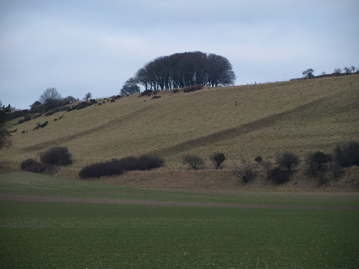
Field boundaries sloping down from the main settlement. The clump of trees is where one of the barrows is.

What looks like an outer bank, from the Sydling valley below.

Most of the hill, from the valley below, looking east.


The most substantial part of the banking which can be see from the road below it.

This is a destroyed site which once had four barrows on it. These were so slight in the 19th century as they weren’t robbed out like the rest of the local barrows. In addition to the barrows there is one of the most extensive urn fields in the country. The flat burial site site is comparable with the also destroyed Rimbury site near Weymouth, and is of the same middle bronze age date and cultural type.
The site was excavated prior to gravel extraction and building work in 1967 – 69 and yielded about 300 urns containing 180+ cremations.This is the largest urn field in the country yet to be excavated. A great deal of worked flint and a large amount of bronze age pottery were found during the dig.

The bell – disc barrow from the west.

A small barrow on the other side of the Weymouth road.

A bowl barrow with the hybrid behind it.

The middle of three ploughed barrows.
The curve of the outer bank.

The north of the barrow, note the length of the outer bank.

The large bell / disc hybrid from Ridge hill.
Magic / O.S. show six barrows in this group, this is the only one visible from this point, which is at the top of Goulds hill looking south. Waddon hill is south of the main Ridgeway and is between Upwey and Portisham.
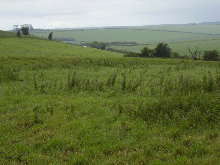
I have now returned a few days later, on the road south of Friar Waddon hill. Four more of the barrows are visible from the valley below. They are not easy to photograph as they are high up, I don’t think there is easy access to these barrows as although I can see a footpath up to them, parking is very difficult on the narrow lanes.


The whole of the group from the east, near sunset.

The second barrow from the top of the first.

The central barrow of the triple, the most damaged in the group.

The central barrows in the group.

The fourth of the group from the top of the third.

The large western barrow, showing the large chunk dug out of it.

The Triple barrow from the east, the centre barrow has been extensively dug out in the past.


The large western barrow of the Bincombe Bumps group.
“Some mounds on the Thorncombe Beacon and Langdon Hill are called the Devil’s Jumps”. It is said that the mounds were made where the devil bounced when the abbott of Forde Abbey kicked him out to sea.
“There are some burial mounds in a field by the road between Bere Regis and Wimborne. It is said that treasure is buried in these mounds.” The legend may have been caused by the barrow digging of Shipp and Durden here in 1854. (Palmer 1973 p149)
In 1881 an Iron Age smith’s hoard was found within the earthworks of this fort, and Edward Cunnington investigated the discovery. He found the old woman and the conversation went much as in Rhiannon’s post, however he went to the sons house and found the animal nailed above the front door. The “little dog” was in fact a bull, one of two now to be found in Dorset County Museum.
“Conig or Kings Castle, as its name implies, is said to have been the headquarters of King Egbert when he fought his brave, but losing battle against the Danes at Charmouth beach in 833” (Turner 1947). The same romantic etymology has occured to other authors, with similar developements: in fact the name means what it says, rabbits’ castle.

I fully intended to walk this site today, but as you can see from the photo taken at midday it was not a good day to be out and about. There are 10 bowl barrows spread across an upland heath area now surrounded by houses. On the next day it isn’t peeing down with rain I will visit these barrows and take some proper photos.
One of the barrows from a nearby carpark.
I have decided to update the field notes for this site as the last one I put up was inaccurate. There are in fact 8 barrows in this group. The road from Wareham to Bere Regis splits the cemetery in half. It is two groups of four and they are aligned from east to west in a line.
M.A.G.I.C says they were excavated by Shipp and Durden in 1844, the signs left by these amateur diggers are plain to see now.
These are all medium sized bowl barrows in reasonable condition. They overlook Poole harbour and the Purbeck hills to the south.

This is one of the western group, just adjacent to the road.

One of the eastern group, this is the most complete and least damaged.

The westernmost pair in the cemetery.

The second most easterly of the group.

This is next to the road on the east side of the group.

The most easterly of the group.

An aerial photo of Poundbury from the 1930’s, north is to the right of the picture.

This is a northern outlier, near to Blagdon barn, it’s not really part of the Blackdown group but would be too confusing as there is another site called Blagdon in the east of the county.
An article on the recent huge hoard of bronze axes found in Dorset.


