The Trendle is an iron age enclosure with two sets of banks and ditches. It measures 37m by 30m and is sub rectangular in shape. It is small in size compared to other similar sites, one on Pilsdon Pen is about four times the size of this one. It is similar in form to another one near to Blackdown, just to the south of the long barrow on Sheepdown.
formicaant

The Trendle can be seen as a raised bank, just above the Giant.
Image credit: Mike Rowland 18/10/09

Fabulous gold torcs and a hoard of bronze axe heads in Dorset County Museum.
Image credit: Mike Rowland 17/10/09

This is a giant kink in the ramparts on the south side, overlooking the village of Winterbourne Monkton.
Image credit: Mike Rowland 17/10/09

One of the scruffier barrows on this site.
Image credit: Mike Rowland 17/10/09

The long barrow from the Ridgeway, looking south.
Image credit: Mike Rowland 17/10/09
This was visited in 1827 by one J.F.Pennie who thought this was a small stone circle of druidic origin. He painted a fanciful picture of rituals and solemn ceremonies, involving naked women and sacrifices. Pennie was not unusual in his assumption of a druidic origin to what he erroneously thought a stone circle instead of the remains of a barrow. The original barrow would have pre-dated the druids by about two thousand years.
This was to be the site of Christchurch priory. It was said that everytime stones were laid on the site, by morning they had moved from the hill to where the priory now sits, over 2 miles away.
A similar tales exists in the parish of Fordington in Dorchester, which involved the siting of the parish church. The twist is that an ancient stone returned to the site after having been removed.
Both these stories appear in Peter Knight’s “Ancient Stones of Dorset”
This is speculative at best, that the original stone circles existed is not really in doubt. Documentary evidence survives from several contemporary sources, two of whom wrote books in the 19th century. Both books were written by local women, Clara King-Warry and Elizabeth Pearce. Pearce wrote her memoir in 1805, before much of the major quarrying took place on this part of the island, she names one of the circles as being called The Frolic . King Warry wrote several books about a century later and sites the circles as having stood either side of Easton Lane ( now Easton road ), she says they were removed and due to the unwillingness of the local workmen were not destroyed but built into the walls along the lane. The sawmills name comes from the name of a now destroyed inn.
This brings us to the stones in the photos I took, they are in the right place and are much larger than any other stones I have seen built into old walls on the island. I have not seen all of the dry stone walling on Portland, there are miles of it, but these are unusual inclusions. Portland stone is and was expensive stuff and large pieces of it are not usually used in this way. Portlanders are a superstitious people, the word rabbit is still taboo, and I would not at all be surprised at the reluctance of workmen to destroy ancient stones .
The only other place where such stones exist is in another wall close to a site described by a visiting antiquarian called Fido Lunettes. Lunettes describes a place near the Portland young offenders institute, which was the original convict prison on the island. He visited the site in 1824, before the prison was built, he descibes an ancient British eartwork called Arun’s Green. He further describes some standing stones with a large flat stone on top which he calls a cromlech.
There can be little doubt that standing stones, circles, barrows etc did exist on this ancient island, but due to the quarrying and military activities in the 19th century much of it has been destroyed or moved or reused.

Part of a possible stone circle built into a wall behind the Portland Heights hotel.
Image credit: Mike Rowland 30/09/09

More possible ex standing stones.
Image credit: Mike Rowland 30/09/09


More of the alledged standing stones built into a wall on Easton road.
Image credit: Mike Rowland 30/09/09

Stones built into a wall on Easton road.
Image credit: Mike Rowland 30/09/09
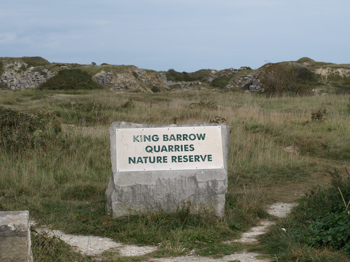
This is the site of a now destroyed round barrow, it is believed to been in existence prior to its removal by quarrying in the late 19th century. The site is now a nature reserve.
I have finally got round to visiting this site on foot. I have deleted my previous photos and comment as they weren’t much cop anyway.
As can be seen there isn’t much to see, the actual excavation being under the shelter of the small, low wooden building. Having said that this is a very important site, nationally as well as locally. Apart from the recently excavated Doghouse hill, this is one of the oldest settlement sites in Dorset.
Several hundred feet west of the site can be seen the well after which the site takes its name. The well is edged with high quality local stone and is held to have been in use since time out of mind. A narrow gully takes its outflow to the cliff where it flows in to the sea as a waterfall.

This is the actual Culverwell after which the site is named.
Image credit: Mike Rowland 30/09/09

This building covers the site of the mesolithic encampment.
Image credit: Mike Rowland 30/09/09

The sign which gives details of the site.
Image credit: Mike Rowland 30/09/09
This is a promontory hillfort in the village of Milborne Wick in south Somerset. It sits on the south western end of Barrow Hill. The village surrounds the fort on three sides. In places the rampart stands up to 6 metres in height. It encloses an area of just over 19 acres.
Magic states that the main ramparts cross the hill at its northern neck and run down the eastern side. The western side and southern end are mostly natural hillslope, with some additional height added artificially. While no excavation has provided dating evidence, the form, shape and placing of this site are consisitent with an Iron Age date.
This not the most accesible hillfort around as it is bounded by housing and private farm land, there does not appear to be a footpath on or near it. Also it is not easy to photograph through various trees and bushes, I must see if there is a nearby hill from which it can be viewed with a long lens.


The western rampart / hillside, with garage to show some scale.
Image credit: Mike Rowland 21/09/09

The south west corner where the bank dips down.
Image credit: Mike Rowland 21/09/09


One of the barrows from the main road to Swanage, I took this photo oppposite the school in the valley below the barrows.
Image credit: Mike Rowland 21/09/09


Ridge Hill barrows from the A35 roman road as it exits Dorchester, these are the central ones.
Image credit: Mike Rowland 19/09/09

Clandon Barrow from the north east.
Image credit: Mike Rowland 19/09/09
This group of three bowl barrows lay on a north facing hillslope to the south of the village of Winterbourne St Martin or Martinstown. The barrows are close to the buildings which are a dairy. The other barrows in the photo are further away on Ridge hill.

Three barrows on Grove Hill from the A35 near Dorchester.
Image credit: Mike Rowland 19/09/09
This is a very prominent hill, almost iconic in this part of Dorset. It can be seen from many places and the addition of the trees, during the first world war, makes it all the more visible.
Although the modern name is 19th century, after the reverend John Colmer the land owner. The original name was Sigismund’s Berg, which gives the name to the adjacent village of Symondsbury.
Cope thinks it the centre piece of a sacred river valley, the rivers Brit, Simene and Asker converge nearby.

Looking down from Eype Down to the south.
Image credit: Mike Rowland 17/09/09

Looking up from the A35 road to the south east.
Image credit: Mike Rowland 17/09/09
This is an area of upland heath about a half mile from the Dorset coast, it is a single bowl barrow on a small hill. It overlooks Colmer’s hill to the north and lines up with the Thorncombe Beacon barrows to the south. From it can be seen Golden Cap and the barrow cemetery on Hardown Hill to the north west.
Whilst there is not much to see on the hill itself apart from a linear feature near the cliff edge, never the less it is at a point on the coast which is between other sites. Adjacent to it are the barrows on Thorncombe beacon, to the east and the settlement and barrows on Golden Cap to the west.

A linear feature on the flat part of the hill.
Image credit: Mike Rowland 17/09/09
Four barrows on a hilltop on the west Dorset coast. They are in a row from north to south and appear to point towards Colmer’s hill. A fifth barrow is also in line with them on Eype Down about half a mile to the north.
The first of the barrows is the mound on which the beacon itself sits. The second is the largest at about 12 feet in height and 30 odd yards in diameter. The next two are less distinct, possibly plough damage has lowered the height and they are now less easy to see as barrows.
This is a very prominent point on the coast from which you can see a long stretch of the Dorset and Devon coasts. It also has the advantage of far views inland. Very close by are other ancient sites such as Golden Cap, Colmer’s Hill and the recently excavated Doghouse Hill – probably the oldest site of human habitation in Dorset.

The second biggest of the barrows, this between the largest and smallest.
Image credit: Mike Rowland 17/09/09

This is shot from the top of a round barrow near Thorncombe Beacon to the east.
Image credit: Mike Rowland 17/09/09

Hardown Hill from Eype Down.
Image credit: Mike Rowland 17/09/09

The rear of Doghouse Hill from Eype Down, looking south.
Image credit: Mike Rowland 17/09/09

Doghouse Hill from Thorncombe Beacon.
Image credit: Mike Rowland 17/09/09

The smaller barrow looking south, the summit of the big one can just be seen.
Image credit: Mike Rowland 17/09/09

The smaller barrow, from the top of the biggest looking north.
Image credit: Mike Rowland 17/09/09

The biggest barrow from the top of the beacon, also in line is the smallest, Eype down barrow and Colmer’s Hill.
Image credit: Mike Rowland 17/09/09

The largest of the barrows, set back from the edge of the cliff, Thorncombe Beacon itself is on the cliff edge.
Image credit: Mike Rowland 17/09/09

The barrow is in the middle distance, with Colmer’s hill in the background, the largest of the Thorncombe Beacon barrows is in the foreground.
Image credit: Mike Rowland 17/09/09
