
Old Knowle and its smaller partner from Whitcombe Hill.
Image credit: Mike Rowland 27/01/2008.

Old Knowle and its smaller partner from Whitcombe Hill.

The two eastern most barrows.

The western middle barrow.

The smallest of the barrows, the eastern middle.

The eastern barrow with Woodman’s Cross in the background.

The western most barrow with the trig point.
This barrow could possibly be the shortest known bank barrow. In David Field’s excellent book Earthen Long Barrows he refers to a Bradford Peverell bank barrow of 64 metres in length. Another candidate could possibly be the long barrow called Red Barn, which is equally close to Bradford Peverell. However he provides no grid reference for it, I will probably have to write him a letter to find out.
Grinsell says this is 150 feet long, 60 – 90 feet wide and 4 feet in height.

The west side of the hillfort, the low bank in the fore ground is the area of the original neolithic enclosure.
A collection of three round barrows north of the tiny hamlet of Holworth. The biggest is the most easily accessible as it is next to the road. It’s very scruffy, covered in hawthorn and has a tin box on it for some reason. West of it in the middle of a field is a small scrub covered round barrow. South of this is a low round barrow in the corner of the same field.
These appear to be part of a chain, with the Lord’s barrow and the Five Marys to the east and Moigns down/Poxwell to the west. I will revisit these soon as I was pushed for time and the footpath was a waterlogged mess.

This small clump of trees hides a small round barrow.

Another round barrow in the corner of a field.
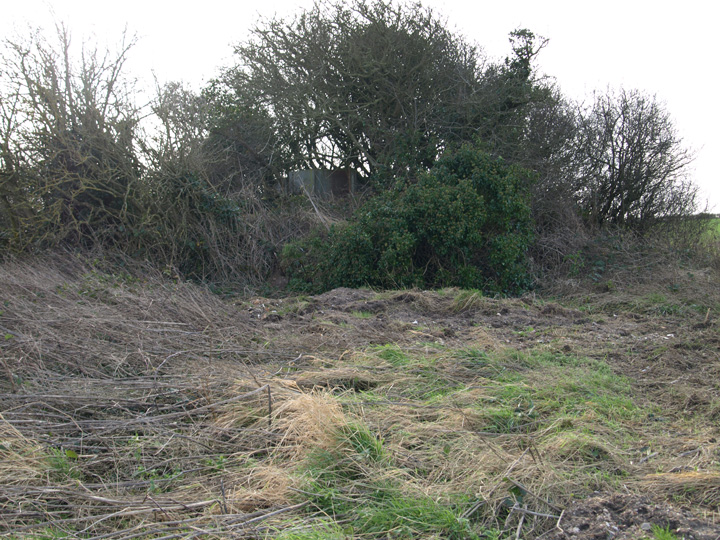
A very scruffy medium bowl barrow.
This is a single large bowl type round barrow south of Whitfield farm long barrow. It is tree covered and looks like a clump of foliage in the summer.

A single large round barrow on the ridge of the hill.

Wood Hill from Poundbury, it is the pale hill in the centre of the photo.
These barrows are fairly easy to get to from a national trust car park at South Down. Public footpaths lead across Chaldon Down, but it was particularly wet and filthy when I went there. The easiest three barrows to see here consist of three and a single round barrow further to the east.
The three barrows are a medium and a small bowl type and a very small low type. Both have large clefts in their tops from old diggings.
The eastern barrow is on the crest of a hill and has an O.S. concrete trig point on it and overlooks Durdle Door and West Lulworth. A stone is marked on some maps, it is a memorial stone to Llewellyn Powys a local writer.

The pair of round barrows from the east, looking down.

A single round barrow with a trig point on it.

A deep scar of excavation in the top of the larger of a pair of barrows.
I had noticed a large round barrow in Came Wood while driving past. This is not visible during the summer months, the foliage is too dense. The barrow turned out to be a large bell type up close, this is very similar to Culliford Tree barrow which is only about 100 yards away to the east. If anything this barrow is in better condition as it lacks the large excavation cleft in its crown.
An added bonus while in the wood was a large ring or disc barrow about 50 yards east of the bell. It is about 15 yards across and has a bank about 3 feet high. It has an outer ditch about 3 feet deep and about 3 yards across. This has no visible burial mound inside the bank and could be a ring barrow or a possible pond type like the one adjacent to Culliford tree.

The outer bank of the ring/disc barrow.

A large ring/disc barrow in Came Wood.

A large bell barrow within Came Wood.
This barrow was opened by the rev J.Skinner in 1815. He employed two colliers from 22nd until 30th September. They tunnelled into the centre but “the interment was gone; there was no cist, only a hole in the soil”. There was a burnt layer on the original turf-line which revealed a structure of stones with a revetment wall on the north side, and a quarry on the south side from which some of the material from the barrow was derived. This opening revealed a human thighbone and a broken whetstone. Skinner thought the barrow had previously been opened in the 18th.c. and robbed of its contents.
An adjacent barrow also yielded an antler pick, ox bones and two flint scrapers.
from Somerset barrows by L.V.Grinsell.
From Somerset Brrows by L.V.Grinsell.
This is said to contain the remains of a saxon chief killed in battle, or of soldiers killed in a battle. An oak or elm, which grew on this barrow until 1937, is said to have bled when cut with a knife.
Wedlake, W.J. (1958) and Tongue, R.L. (1965).
The dyke as it stands in its current form is a Romano-Britsh defensive earthwork. However H.C. Bowen in the excellent book “The Archaeology of Bokerley Dyke” gives a good argument for a much earlier origin. He argues that in the Bronze age the dyke was a cultural boundary which can be shown by the differences between types of round barrow which only occur either side of the ditch.
The bronze age date has also been partially confirmed by excavated finds, the similarity of Neolithic long barrows on both sides of the dyke show no significant difference in typology / culture at that time. There are problems with finds because of the confused stratigraphy caused by the different stages in the developement of the dyke. It was greatly deepened and heightened at a later stage of its history.

At this point the cursus is visible as the dark green line below the trees.

Penbury knoll from Wyke down barrow cemetery.
One of a group of four barrows on the ridge of hills to the east of the south Dorset Ridgeway. It is to the east of Poxwell ring cairn and north of South down barrow cemetery.
This group of four round barrows lie to the south of the Dorset Ridgeway. It is to the north of the coastal village of Ringstead. The barrows are medium sized bowl types in reasonable condition. The best way to approach them is to park in the free national trust car park and walk the 100 yards or so along the road to the barrows.
These barrows are split by the road that leads to a National Trust car park, two are south of the road and two north of it.


A central barrow on the south side of the road.

This barrow is on the north side of the road.

The second barrow on the north side of the road.

Round barrow seen fom the ridge of Southdown hill to the south.
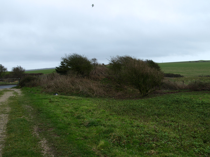
This small bowl barrow is just across the road from the main group. It’s only really visible at this time of the year.
Sadly there is not much to see here. There is a barrow but it has been brought so low by ploughing, it had been recently ploughed when I visited it, that it was impossible to photograph. I will see if a growth of crops makes it easier to see in a month or so. It’s a great shame that so much damage has been done as this is a wonderful site with 360 degree views of the local hills and valleys. There is another barrow shown on maps to the south east, this is now completely missing, assuming I was in the right place.
This group of barrows bridges the gap between Gould’s hill and the Came / Bincombe groups. It consists of about 7 – 10 round barrows, some of which are very badly damaged by ploughing. This set completes the south Dorset Ridgeway line of monuments which runs from Martin’s Down to White Horse hill. I have included the two most easily photographable barrows, there are another three that I know of still visible in the landscape.

This is the most westerly of the group.
The O.S. map shows nine barrows on this site, although four are marked with crosses. On the ground I could only see three, and one of these was a very low feature. The largest and most complete was next to the track, just past a barn. It forms part of the field margin and has plough damage where it is in the field. The next most visible is also part of a hedge row to the south, on a ridge below a small wood.
This must once have been a substantial cemetetary but centuries of agriculture have reduced or removed most of the barrows.

This round barrow, although damaged by ploughing is the most complete on this site.

This very heavily damaged barrow shows itself as a low mound in the field.

This small round barrow has been saved by being in the middle of a hedge row.
Another visit to this substantial long barrow, I had hoped autumn would make it easier to see. The under growth is less now but a fallen tree still obscures much of it. Its a real fight through thick hawthorn and brambles to take some not very clear photos, however the barrow itself is worth a look as it is very big. Shorn of the brush and trees this would be an impressive monument in an area thick with barrows of all kinds and conditions.

Looking north along the top of the long barrow, note the heavy undergrowth.

The bank of the long barrow from the east.

The round barrow from the south.
These three barrows are in the middle of Knowle hill, there is a fourth further east which I didn’t get to as the weather closed in. The biggest and most southerly is covered in gorse and has traces of a ditch around most of its circumference, the footpath is where it fades out. To the north west of it is a low bowl type also with a ditch and traces of an excavation on its crown.
The western barrow is also a low bowl shape on the ridge of the hill and has a cross dyke running next to it. The cross dyke cuts through the ditch of the barrow so must be later. These boundary ditches cross many hills like this locally, indeed the same hill has another set to the west, dating these ditches is difficult as not many have been properly investigated.

The middle barrow from the north west.

The largest and most easterly of the three barrows.