


As the stone was thrown down, it seems that an attempt was made to smash it and to bury it. The N81 is visible in the background.

The letters are recent and are deeply carved into the stone, ready to last for thousands of years.

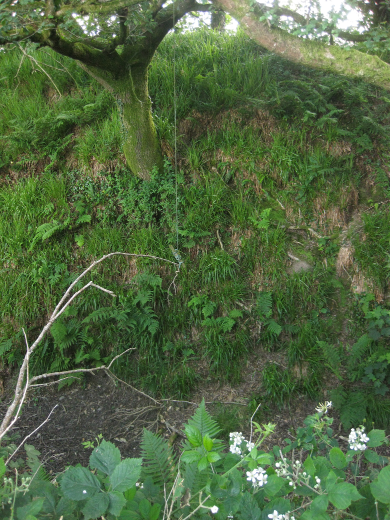
Remains of a former standing stone at the edge of Tallaght.


The note says no visible trace on the ground but the barrow is very much there.


Urban barrow, behind Aldi in Blessington.

This face of the stone is encrusted in quartz – Sorrel Hill is covered in cloud in the distance.

Poulaphuca reservoir and Kilbeg standing stone – the field over the point of the stone contains the wonderful Kilbeg bullaun stone.

Along the long axis NNW-SSE, Lugnagun passage grave is in the trees at the tip of the stone.
From aracheology.ie:
Description: On a N-Facing slope of Black Hill. A granite standing stone (max dims. Wth 1.45m; H 1.6m; T 0.7m), with a long axis of NNW-SSE, tapers to form a point at the top (T 0.28m).
Compiled by: Matt Kelleher
Date of upload: 17 December 2012
From archaeology.ie:
Description: On gently undulating terrain in the landscaped demesne of Damshire House. Circular mound with external annular ditch (max. ext. diam. c. 14m). No visible surface remains. Visible on aerial photograph (G.S.I. O 73/N 332/333 (1973)).
Compiled by: Matt Kelleher
Date of upload: 04 December 2012
References:
Molloy, B. 2004 Blessington Demesne. In I. Bennett (Ed.) Excavations 2002: summary accounts of archaeological excavations in Ireland, 532 (No. 1958). Bray. Wordwell.
Date of last visit: 23 May 1989
From archaeology.ie:
Description: On a slight rise in gently undulating terrain with higher ground to the NW. Circular mound (diam. 11.1m; H. 1m) with an external annular ditch (Wth 1.5m; D. 0.45m).
Compiled by: Matt Kelleher
Date of upload: 04 December 2012
Date of last visit: 16 May 1989
From archaeology.ie:
Description: Prominently located (OD c. 296m) at the NE end of a narrow-topped, moderately steep-sided NE-SW ridge, overlooking Glen Ding valley to the NE and with panoramic views in all directions except SW. A sub-circular area (diam. 14.4m E-W; 13.4m N-S) is defined by a shallow fosse (D 0.2-0.4m: base Wth 0.8m at N – 3.5m at E) and by a low, heavily poached outer earthen bank (int. H 0.2-0.6m; Wth 2.5m at S – 4.1m at W; ext. H 0.3-0.5m) which has a spine of dense stony material, and possible small inner revetting stones at S (ext. diam. 29m E-W; 27.5m N-S). An entrance gap (Wth 3.3m) at ESE is flanked on its S side by a single revetting stone on the inner face of the bank.
Compiled by: Gearóid Conroy
Date of upload: 23 July 2012
Date of last visit: 02 November 2000
I had a couple of hours break from an event in Ballincollig and headed into the rolling hills north-west of Cork city near Model Village above the Shournagh river. There’s a concentration of standing stones marked on the OS map just off a very straight north-west/south-east road that leaves the village. Alas, most of these are gone, with the simple single word ‘Removed’ on the SMR database (I should have checked before I left). I think I found one the ‘removed’ stones in the neighbouring Kileen (Muskerry East By.) townland, knocked over, smashed and dumped in a ditch. Most of the others in the locality probably met a similar fate. However, this is a survivor.
It’s about 1.5 metres tall but leaning to the east. The longer axis is NNE-SSW according to the SMR (I had no compass with me). It was a small triumph for me to find this after the earlier disappointment, though it’s not that difficult to locate, about 150 metres into a pasture field down a side road off the aforementioned very straight road. I don’t know what type the stone is, but it’s very slate-like and an almost dark lavender in colour.
A mound, or possible rath, on the road from the N3 down to the Brú na Bóinne visitor centre. Anything in this vicinity could also be a passage grave. It is in a wheat field, wildly overgrown now, but is oval, the longer axis about 25 metres north/south, and 10 metres wide.
A small and charming barrow on a slight east/west ridge above a stream. It’s roughly round, about 10 metres in diameter with evidence of a ditch/fosse and rising to a little over a metre. There’s a lump of very smooth brownstone dumped on top, a handy little stool for LM to rest on as I explained to her about the princess buried beneath. There’s other cairn-like rubble on the northern arc of the barrow. A nice little diversion if you’re in the vicinity which has other mounds and habitation sites.
We were camping on a farm just outside Slane and had to head into Drogheda for supplies. There is no way that I could be this close to Dowth and not pay it a visit. I’ve been here many times, probably more than at any other site. Dowth offers the antiquarian explorer many delights, and not a few frustrations. There is a peace here, something that pulls you that’s beyond thought. But don’t be eager to get into its passages – you won’t be able, Joe Public’s not trusted to mind his own heritage (and with good reason).
The mound itself is getting more eroded where the gouge is, where worhshippers, visitors, hippies, whatever, have built concentric rings from the rubble of the tomb. Their play is not going to effect either of the passages or chambers, but the cairn has been exposed in a couple of places and, like sore teeth, will only get worse unless remedial work is carried out.
The height of Dowth is always impressive, especially when viewed from on top of its eastern arc, or from down where the sundial stone is, easily 15 metres from the base of the kerbstones to the rim of the crater, and would have been higher as both Beranger’s and Wakeman’s old drawings show a round-topped mound.
The tomb is in a pasture field, colonised by loud, hungry sheep. Summer vegetation is covering most of the carved kerbstones – neglect being the lot of Dowth, the poor relative of Brú na Bóinne. But sure what do you want? Another Newgrange or Knowth? Hardly, but a bit of respect wouldn’t go amiss. Dowth, Dubhach, the dark place, best left alone (not really).
A large, almost flat roadside stone in the isolated townland of Toor. The bullaun, or very large cupmark, is on the northern edge of the stone, about 10 cms across and 4 cms deep. There is some folklore attached to the stone here: megalithomania.com/show/site/731/the_dailteen_stone_bullaun_stone.htm
The stone is at the beginning of a gated track that leads up into the area of Toor that has the stones circles and other antiquarian curiosities.
From archaeology.ie:
Description: The following description is derived from the published ‘Archaeological Inventory of County Meath’ (Dublin: Stationery Office, 1987). In certain instances the entries have been revised and updated in the light of recent research.
Date of upload/revision: 10 July 2007
Fairly flat-topped mound (diam. of base 37m, H 3m). No kerb or fosse visible.
Date of last visit: 28 May 1969

Long zoom towards the south-south-west – looks impressive from here.


Looking north across the gouge with modern concentric rings.


Lost and alone at the edge of a football pitch, missing its companion.

Aligned NW/SE, this is from the north-west.


From archaeology.ie:
Description: On flat patch of ground, in rolling pasture, on N side of Shournagh River basin. One stone remains, long axis NE-SW; it is 2.2m L, 0.65m T and 3m H; second stone, standing in 1934, stood c. 2.6m to SW (O Nualláin 1988, 245, no. 99). According to local information, second stone fell during storm on Christmas Eve 1966. Twelve stones found in ‘immediate locality’ of stone pair, ‘some much larger, lying on the ground partly buried in the boggy soil of the place’ (Caulfield 1866, 293). Local tradition that there were at least 7 stones in this field.
The above description is derived from the published ‘Archaeological Inventory of County Cork. Volume 3: Mid Cork’ (Dublin: Stationery Office, 1997). In certain instances the entries have been revised and updated in the light of recent research.
Date of upload/revision: 14 January 2009
Date of last visit: 28 September 1982
From archaeology.ie:
Description: In pasture, on SW-facing slope. Circular area (91.4m N-S; 90.4m E-W) enclosed by substantial earthen bank (int. H 3.4m) with external fosse (D 2.65m). Low earthen field boundary (H 0.4m) at outer edge of fosse, stone faced externally. Gap (Wth 3m) in bank to SSW. Second gap (Wth 4.8m) to E with causeway across fosse; sides of gap cut back by machinery, giving vertical sections through bank. Fosse waterlogged to E; according to Hartnett (1939, 288), spring in fosse to S of entrance (causewayed gap). Possible souterrain (CO062-135002-) in interior; interior ploughed c. 1984.
The above description is derived from the published ‘Archaeological Inventory of County Cork. Volume 3: Mid Cork’ (Dublin: Stationery Office, 1997). In certain instances the entries have been revised and updated in the light of recent research.
Date of upload/revision: 14 January 2009
Date of last visit: 18 November 1993

Impossible to convey the size of this site in one photograph, this is from the bottom of the ditch with inner defensive ring on the left – you’re viewing about maybe one fiftieth of the total circumference.
From the bottom of the ditch to the top of the embankment is about 6 metres, a handy space for your swing.


The sign estimates about 10 tons for the largest roofstone – I’d say at least three times that.


