
Late evening looking north-west over the NW-SE aligned tomb.
Image credit: ryaner

Late evening looking north-west over the NW-SE aligned tomb.

The pencil is held up in the bowl of a cup-mark. There are three cup-marks on the west side of the stone, all above head height, eroded and about 3 centimetres deep.


This took me ages to find. It stands exactly where it is on Sheet 68, but with 8 foot high bracken all around it’s really hard to orient oneself. A frontal assault, over the gate at the bend in the track and straight ahead may not be your best bet in the summer. Winter or late Autumn may be different, but I went into the field to the west and followed the wall until I could see a gap in the vegetation and approached the tomb from the south.
The cemented sign about this monument being in state care that sits beside this tomb is a sick joke. As usual, nobody cares. Reading Fourwinds comments on megalithomania when I got back home, my suspicions were confirmed – I couldn’t work out what type this tomb is. My instinct said a wedge tomb, but I noticed the evidence of a court too. The tomb is aligned north-west/south-east and I guess that it’s pointing exactly on Mt. Leinster, though with all the vegetation that’s a hard one to call.
North of the tomb, about 15 metres away, is a large area of flat stones with a huge gorsedd-type outcrop. Some of the half-buried stones are very slab-like and may have come from the tomb itself. I cleared some of the moss off these, hoping to encounter some elusive rock-art, but no such luck.

Two portals and a door stone are all that’s left standing, holding the elegant capstone up. In fact, the capstone rests on the door stone and the portal furthest away.

I love this shot. The tomb appears dignified, contrary to the atrocious state I found it in.

Tilted shot, making the slipped capstone appear unslipped.

What can I say here? You’d have to be barking to bother just about sums it up.

Yes. The bump. Just left of centre. One of the Dranagh cairns sleeps quietly under all that.
This is a robbed out cairn, oval-shaped and quite large – possibly 25 metres on the longer diameter – and about 3 metres high, though it’s hard to tell with all the vegetation. The only real reason to come up here is for the spectacular views. On the day I was there, 27/7/06, an intermittently cloudy and brilliantly sunshone scrocher, I could see as far as Cork to the south-west, the sea off Waterford to the south and God knows how far directly west and north-west. The view across the Barrow valley to Brandon hill was worth the trek up here alone.
It is possible to drive up to this ridge to the mass rock at Ballycrinnigan rock, but you may miss the huge quartz boulders beside the forest track.

The top of the cairn, with Blackstairs mountain in the distance and Mt. Leinster behind it further back.

This is not marked on the OS Sheet 68. I was told about this by local man Pat Kavanagh and brought here by blow-in Dessie Kavanagh. It’s down a country lane at the southern end of the Blackstairs mountains and is a bit of a beaut.
(Slight edit. this is mentioned in the Archaeological inventory of county Carlow).

Estimated 1.8 metres high, this is worth the 5 minute trek down the country lane.

Blackstairs mountain to the left of the top of the stone.

They curved the wall around this one.


You could clomp through the gorse, bracken and brambles to get to this… or you could just look at the pictures.
There is a well-looked-after old slate quarry south-east of here at Inchanaglogh (S416308). The cliffs over the Lingaun river, with vegetation clinging precariously, are amazing. There are various modern ‘megalithic’ sculptures around the site. Well worth a visit if you have the time before or after the passage grave.
20/7/07
What at first seems like a chaotic, rubble-strewn disaster, soon reveals itself to be an intriguing jigsaw puzzle of the remains of a passage grave mound. At the end of a farm track and fenced in by barbed wire, access is easy over the farm gate here. I met the former owner of the site (before it was taken over by the board of works) who told me that I had just missed Muiris O’Súillebháin, head of the school of Archaeology at UCD, who is still excavating the mound. In fact the farmer at first thought I was part of O’Súillebháin’s entourage – how flattering, but I suppose it goes to show how little visited this place is.
I don’t know too much about this place except what I’ve read on Megalithomania ( megalithomania.com/show/site/149 ), but I can say that’s its passage grave art is a thrill to behold. Spirals, concentric circles and cup marks are found in abundance in the western passage. One of the southern kerbstones is clearly carved with what Eogan calls serpentiform and Brennan calls wavy lines. The kerbstones are all fairly large and most have collapsed, some back into the mound.
The quartz strewn forecourts are a bit of a puzzle as there is one on the southern side that doesn’t denote the entrance to a passage but could have been a ceremonial area in itself. I’ve tried to find a plan of the site but have failed so far.
Knockroe – Cnoc Rua – Red (sandstone?) Hill


This stone could be re-erected with little effort.

Sad and all that this is, I’m glad I visited it, if only to honour those that took the time to unearth these beauties: in the baking heat of July 06, defiance in the face of indifference. The various quartz encrustations and seams stiil give this wrecked tomb the power to move.


Three large, beautiful slabs prop each other up over a small ‘chamber’.

The pool above the well has had its bottom lined with clochanna an ghrian (quartz)

I called at the farmhouse beside where this rock art is marked on sheet 68. The very kind lady told me that I was welcome to look for the stone, but as far as she knows it had been removed to the National Museum. She told me about two women that had spent half a day here looking for the art only to find nowt.

Looking south. The lower part of this side of the stone once had a quartz veneer, most of which is now gone.

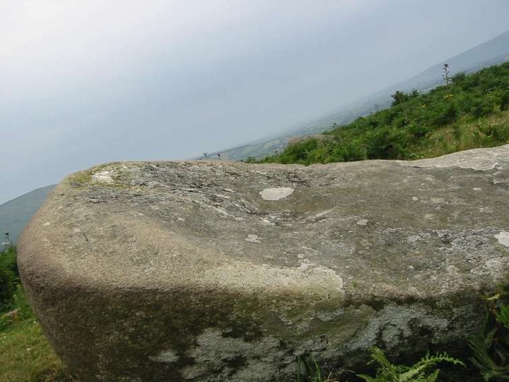

On a raised mound, tilting up from the north-west to the south-east.

That’s Blackstairs Mountain on the left, with Caher Roe’s Den on the ridge south-west of it.


No great light, no great camera, but a bit of determination got me here.

Aligned roughly north-south, this tomb forms part of an old wall at the back of an abandoned farmhouse. At the back of the tomb is this, a slightly-corballed or packed area. It’s hard to tell if this is part of the original or stems from the much newer wall. I guess the former.

After a brief tidy up, the front of the tomb is revealed. The roofstone rests here on 2 orthostats, the western one collapsing.


Looking down the western passage which is aligned with the winter solstice sunset


The exposed east (left) and west passages, with some kerbing in the foreground.

Looking east with the Wicklow mountains on the horizon. This reminded me of the Lia Fáil in Tara, not for its shape, but its position.

There’s a quartz outcrop right beside the standing stone. Symbolism?


