


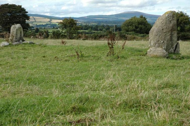

Very difficult to photograph in the dappled sunshine.
I approached this tomb from the farm-track on the north-east side of the hill (Kilmacoliver). You can park at S434293 and head up from there.
It was a very windy day and lots of low cloud obscured the fantastic views that have been described on megalithomania. That said, it’s great to see another passage tomb around here. I could see across to the quarry near Knockroe but couldn’t get a bearing on the tomb itself.
Approaching the site it looks like a stone circle; the kerbing on the south-east side looking more like standing stones than kerbstones.
The circular marking on one of the entrance stones is a bonus. One wonders how much more art there had been here once upon a time. The remains of the chamber say that it was of the cruciform type but there’s only vague hints of a passage left.
Blown away by the wind, I was slightly underwhelmed by the ruins here.
Parked in the large entranceway on the road above the village of Owning (Onainn, as gaeilge). There is an old mill/workhouse at the end of the track here. Walk to the right around the back of the adjoining house and the ruined tomb is in the 2nd field on your left.
It’s quite a sad sight, with the slipped capstone resting on the collapsing uprights. The day I was there (19/08/06) I noticed that some chemical weedkiller had been used on the brambles etc. but the resultant burnt foliage hadn’t been cleared and new growth was in evidence. There’s work going on around the tomb and maybe when the ‘important’ stuff is done, they’ll finish clearing up the tomb.

Would love to have a better look at this site. Maybe the landowners will clear it up.

Weedkiller had been used on the brambles and plants, but that was months ago and they’re fighting back now

Standing stone, with portal tomb in the corner of the field


The entrance, with rock outcrop on the summit in the distance


19/08/06
Impressive stone, nearly twice my height, 5’10”


A tangle of plants and rocks. The stone in the foreground is a collapsed upright. Direct centre is the capstone.

The tree dominates the site. To its right is the capstone.
A ruined portal tomb beside a farm track in this small Kilkenny townland. I parked on the road and walked down the track.
There are 2 uprights remaining standing. I couldn’t tell if these were portals or otherwise as there is so much ivy and growth around. The massive collapsed capstone, about 3 metres square and half a metre thick, lies over the chamber which is inaccessible. The capstone is of an aggregate similar to that at Howth demesne, or of the stones at Bawnfree Hill passage grave nearby. It really is a giant.
A large tree has now grown around one of the supporting orthostats. There is so much additional rubble here that it’s hard to distinguish the original stones from recent additions.
With some time and a little effort, this site could be restored, or at least cleaned up. Cutting down the tree would be a start.

Lovely lichen creeps up this stone like anenomes


The six stones at the south-west of the circle which make the longest continuous arc here.

We are all African:
news.independent.co.uk/world/science_technology/article1218427.ece

The gorse tends to spoil the view of this beautiful tomb a bit.

Looking north-east across the court at Aghowle Upper (right) and, I guess, Aghowle lower.


Don’t know about the stones, but I heard the views from up here are great.

If you squint really, really hard, patterns with emerge on the backs of your eyelids.


There’s a faint track marked on sheet 62 at the north end of Moylisha hill. To get to it you need to enter the white gate at the edge of the farm buildings and walk up to the fifth gate on your left. The farmer was more than happy to allow me up the track and offered directions.
Over the aforesaid 5th gate, walk through 2 fields in a south-east and upward direction and you will spot the site in the corner of the 2nd field by the pine plantation.
This is one of the best sites I’ve visited in Wicklow. It’s a pity that it’s not better looked after. The OPW sign was in bits on the ground. The tomb itself is now overgrown with bracken and gorse. Those negatives aside, the stones here are very well preserved and the layout very easy to see. It’s a pity that the roofstones are cast aside and left on the ground. A small bit of restoration here would not go amiss.

Moylisha wedge tomb, looking north-west from half way up a pine tree.
2/8/06
Re-visited here at the height of the bracken season. After beating back some of the brambles and bracken, the enormity of the capstone is revealed. Somebody had been here about 2 months ago and kindly cut down the tree at the northern end of the tomb. This allows much better views of the stones.
Access was once again along the west side of the DCPCA grounds for about 60 metres, over the barbed wire and across the small field here, and then in through the slightly overgrown gap. The tomb is still hidden until you go through this gap and turn left.

The bag on the capstone shows the scale of this beast

Eroded red quartz face on rock at Rathgeran summit (enclosure).

Alignment, including the curious slab, on Rathgeran summit (enclosure).

According to the Archaelogical Inventory of County Carlow, item no. 317 at Rathgeran:
Enclosure (possible) Grass-covered bank of earth and stones, including some large slabs, several standing upright, curving W–N (C 52m; est. Diam of circle if complete c. 80m; enclosing summit of hill). 1-9-1987
Archaelogical Inventory of County Carlow.
The Government of Ireland (copyright)
ISBN 0 7076 0324 2
This site really needs to be properly surveyed and studied.


Just a short note to say thank you to the farmer that I met at this monument. The man was almost apologetic for having disturbed me as I took photographs.
Very easy to find in July 06 as the field is now being used as pasture.
