


6pm, July shadow cast by the capstone. Yes, I climbed it barefoot.

Browne’s Hill portal with 5 feet high ladder for scale
This is a magical place. From the track, across the desolation of the felled part of the plantation, up to the circle in the baking heat, with massive Keadeen Mountain brooding off to the east, and then the first glimpse of the entrance stones.
When was the last time human feet trod here? One month? Two? There were crowns of dead leaves on two of the stones, left behind by those that are into that kind of thing. Bracken hid all the stones but four. Not for long! Nature was taking back the circle and it was with a tinge of guilt that I uncovered the stones.
Eleven remain. Were there 18? 19? 20? I brought up a fist-sized piece of gleaming quartz from the track and left it in the centre of the circle. Why? No reason.
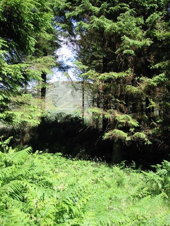
Keadeen, glimpsed through the trees on the east edge of the circle.


West stone, looking towards the road and the east stone


It’s very quiet in Larch Hill for July. I love this ruin.

Ogham script? The doodles of a bored teenager? They’re quite worn and old.


The two mounds, south-east of the ‘barrow’, that could be part of the remains of a far larger ring that surround this site.

The quarry, with the ‘barrow’ visible on the high background.

From the top of the trig point, south-south-west over the ‘barrow’ towards Croghan mountain.
On the road between Crone More and Kilqueeny, on the peak of a nameless hill with clear views to all points of the compass, is marked a barrow on the OS map – a dubious categorisation. What is here is a low henge, 50 to 80 cms high and 30 metres in diameter, with evidence of a ditch on the inside.
There is further evidence on the east arc of a larger, surrounding earthwork about 15 metres out from the very clear henge. South-east, in a clockwise direction are 2 mounds that seem to be the remains of an entrance to this larger ring. Following this imaginary ring in the same direction there is nothing.
South-south-west, the views across to Croghan mountain are gorgeous. 100 metres in the same direction is a quarry, modern but maybe with ancient origins. South-east, down the vale of Avoca, the sea around Arklow glimmers in the sun.


My mug is in this one to show some scale. Another impressive Dublin capstone!


The large granite boulder, about 2 metres long and a metre high, resting place for a crab apple tree.


The phallic stone. Stone behind it on the left just stares back at you.

Possible pick marks on this stone, with the phallic stone up in the background.
There are five little red dots, all within a kilometre of each other, marked on OS Sheet 62 in the Springfarm/Ballycapple/Ballykean area, 2 kilometres north of Redcross. They are, from north to south – T251863, T246860, T247857, T250855 and T251853.
T251863, T250855 and T251853 I didn’t get to see, the latter two being on land belonging to a stud farm with high walls, and the former being the last I tried to find, giving up after a not very comprehensive search.
T246860, T247857 are in the same field, the former dug in at the edge of the bank surrounding the field, the latter in one of three mounds slung up in a field clearance. T246860 is the most promising but I’ll deal with T247857 first.
The three mounds that are clearly visible from the road contain many interesting stones but none that I could say definitely had rock art. There was one in particular that had what looked like pick marks, but no discernible pattern. Also here was a phallic stone with glans, that may have once stood but is now flat on its back. The suspicion that I had here was that there had once been some sort of tomb or complex in this field, now wrecked, destroyed by the hunger for land. I don’t know this for a fact, but gut instinct said that all was not as it seemed.
Proceeding on up to T246860 this instinct was reinforced. Strung along about 80 metres of the bank were again many interesting stones. Three in particular caught my eye – a larger granite boulder with a facing of the type so familiar from other sites but again, no definite art work; a stone, 1 metre long, with signs of wear by human hands that could be a basin stone or a sharpening stone; and the most definite worked stone and the clearest piece of rock art that I could find. This last was next to the large granite boulder and had a half metre serpent-like line carved in its top.
At last, some rock art… but hold on. Along this bank were many other stones, some quite flat and slab-like and embedded into the ground. And then there was the gaping hole where somebody had recently dug up one of these slabs. Did this contain the elusive rock art of Springfarm and somebody had legged it with it? Judging by the condition of this whole area, I wouldn’t be surprised if that were the case.
I don’t believe that anybody has been here since Fourwind’s visit in 2004. The bracken was over 2 and a half metres tall and it took about 15 minutes before I could find the tomb. It is exactly where it says it is on the OS map, but I needed some time to orient myself.
I actually bled for this place, cutting my hand during a frenzied attack on said bracken. What was revealed was a lovely little wedge tomb with quite a bit of remaining structure.
There are many other megalithic-like boulders around the tomb and I ventured up to the farm with the rock-art that’s marked on the OS map 200 metres away. The owner, a very nice lady, told me that there was one stone with one cup-mark and she offered to turn off the electric fence to allow me to see it. I declined her kind offer, satisfied with the wedge tomb.
Worth the effort, if only for the quartz capstone. The remains are fenced in by barbed wire in the corner of a field. After a bit of judicious bramble clearance the tomb was revealed. There are some stones at the back of the gallery but I didn’t venture back there as the roofstone rests extremely precariously on the right-hand upright. A pretty little site all the same and worth the bumpy drive up from the main road.
Variously described as a cist, cromlech (OS map) or dolmen, this is one of the easier sites to get to. The track down to the tomb has a locked gate that is easily surmounted and the tomb itself is easily spotted. Just a metre high, the central remains are surrounded by quite a few boulders that could be kerbing. Traces of a mound and a sillstone further complicate any simple description.


Once again over the capstone, this time to the north-east with Carrickgollogan mountain prominent.

Over the capstone is the great Sugar Loaf mountain.

Shot taken over the wedge tomb, showing the possible extent of the original structure. It’s hard to judge front from back and I still have doubts as to which is which.


After my frenzied attack on the bracken, I left this little choked foxglove standing.

Looking east-south-east over the wedge tomb. It’s a bit of a mess!


In a little stream right beside the road is a well marked on the OS map. Searching the area I came across this place. All the boulders in the shot are quartz and probably delineated a small well dug into the bank of the stream. It is now neglected and overgrown, though there are modern steps leading down to it from the road.


After a small bit of bramble and ivy clearance, the tomb remains are revealed. The roofstone is quartz and is balanced precariously on the right-hand upright.


Front-side of the entrance stone of the northern passage at Dowth. Behind the trees is the passage entrance.

Another distorted view of Dowth henge, looking across at the south-west opening.

A tantalising view of this passage grave. The barbed-wire fences around this field make it clear that visitors are not welcome. Eogan refers to this excavated site as Gormanstown (Knockingen) passage tomb.
I parked mid-way down the long track that leads to the seashore and walked the rest of the way.
Three of the smaller remaining mounds are quite distinguishable but maybe not for too much longer. A remaining piece of the kerbing on the far south-east mound has been damaged by a harvesting machine.
The obvious main mound has a distinguishable passage aligned north-west. The mound immediately to the west of it has merged with it in the undergrowth.
I could see the Cooleys and the Mournes away to the north from here today. Beautiful. The shoreline is covered with the shells of many types of seafood and this abundance could have accounted for a large proportion of the food from any ancient inhabitants.

A large stone from the in the centre of the mound. It could be a capstone or a passage roof stone.
Asked permission to park in his driveway from the farmer in the house opposite this site. He had no problem.
A word of caution though – the speed limit on the road here is 100 KPH and the cars use every bit of it. Be extremely careful crossing both to, and especially from, the site.