
Tha last two standing stones of the lower circle.
Image credit: Peter Castle ©
Tha last two standing stones of the lower circle.

The lower ring which has only two stones standing.


The circle looking from the south with the small new addition in the front right side.

The circle, looking north west , showing the small stone added by someone just recently. See Mr Hamhead’s news post

The new stone added to the circle can be seen in the foreground. See Mr Hamhead’s new post

The cairn at SX652626 . This cairn is to the north west of the large central cairn.

The large central cairn at Three Barrows looking from the south. SX653625

This is one of the many shelters that have been built into the large central cairn. It is yet to be surveyed and repaired. Sharp Tor is in the background, centre right.

The largest of the three cairns. This one is 43 metres in diameter and 3.5 metres high. Four members of the survey team show some scale.

The cairn at SX653588 taken after the reconstruction.

The cairn at SX653588 taken during the survey.

The cairn at SX654585 after reconstruction.

A photo of the cairn at SX654585 taken during the survey.

A photo of the cairn at SX656585 looking from the east.

This a photo of the summit cairn, SX655586, taken during the reconstruction.
This is the summit cairn at SX655586 taken during the survey.

This is the most northerly of the two summit cairns. It is at SX655587. This photo was taken after the reconstruction work had been carried out.

Looking to the south from the hillside at the brook showing one of the houses.

Five of the roundhouses in the settlement on the north bank of the brook.

The stones of the retaining circle are very clear on the southerly side although the northerly side has been damaged be a later field wall. The cairn is at SX544644.

The kist in the cairn with the capstone to the left.

The summit cairn looking from the south east.

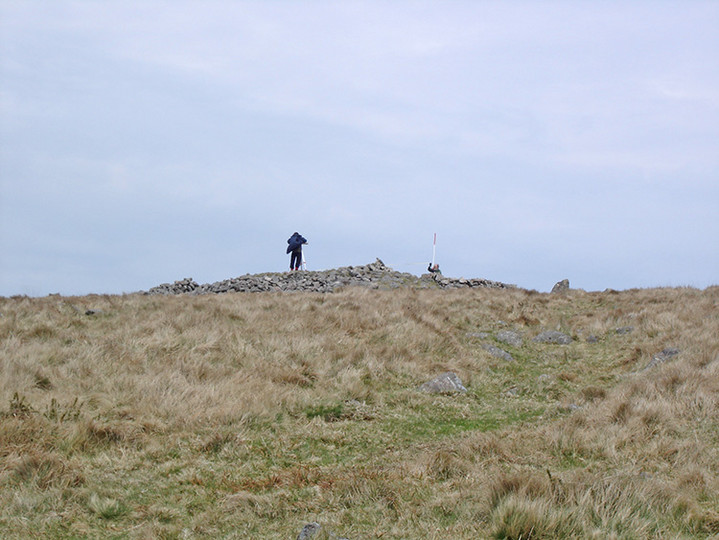
The summit cairn looking from the north east. The stone to the left of the cairn is an O.S. trig point.

The northerly of the cairns looking from the south.This cairn is at SX655587.

The northerly of the cairns on the summit.SX655587

Two of the cairns on Weatherdon Hill taken from Butterdon Hill.


Looking from the south with most of the bracken now gone.


The chambered tomb now the bracken has nearly gone.

The cairn at SX544644, the capstone of the kist can be seen in the centre of the cairn.

Part of the wall, possibly an entrance, of the hill fort on the Dewerstone.

Part of the wall of the enclosure/settlement on the Dewerstone. This is inside the wall of the hill fort.

Part of the wall of the enclosure on the Dewerstone.

A photo of the “Longstone” on the southern slopes of Butterdon Hill. This stone is part of a row of boundary stones another can be seen on the top of the hill.

A photo of the stone marked on the O.S. map as the Longstone.

The stone marked on the O.S. map as the Longstone at SX655583. This is marked as a boundary stone and is in the line of stones put up between 1800 and 1803 to mark the boundary of Ugborough and Harford, but looks a lot older than the other stones in the row.

One of the large cairns on Butterdon Hill

The cairn and kist at SX558706. 26th November 2005.

The kist and cairn at SX558706. 26th November 2005.

The double stone row at SX556706. 26th November 2005.

One of the roundhouses at Kraps Ring. 26th November 2005.


Part of the wall of the enclosure. 26th November 2005.

The stone row at SX643776. 26th November 2005.

