
Floor and rear wall of rock shelter. Basin in floor starts a shallow groove which runs along the vein of rock down to a lower level where a burial was found covered by a triangular rock slab.
Image credit: Rockandy
Floor and rear wall of rock shelter. Basin in floor starts a shallow groove which runs along the vein of rock down to a lower level where a burial was found covered by a triangular rock slab.

View of Cheviot (with small rim of snow) from the rock shelter.

An almost aerial view of Edlingham from the roof of the rock shelter. A Neolithic polished stone axe was discovered here in the 1970s and is now held by the Museum of Antiquities, Newcastle.

6c(ii). View NE towards Wellhope.

6c(ii). Surface above ‘the steps’ showing the basin on the outcrop edge to the left, and eroded cup and ring motifs. View to the N.

“The Sacrificial Steps” of 6c(ii) leading to the ‘ritual basin’ and cup & ring motifs on the horizontal outcrop. View E towards Snook Bank.


View of the marked outcrop. A difficult place for photography under trees and rhododendron bushes.

Two cups connected by a straight groove. One with a single ring and the other with a double ring or penannular.


View N from the top of Caller Crag as the weak November sun sinks behind the hills.


The recorded rock art is not so convincing though.


E part of rock: deep cup and groove with enclosing penannular cut in a circular depression.

Subtle cup and ring motifs on E part of rock surface.

E part of rock surface. Motfis cut into a flat rounded basin.

Cup and partial ring on exposed W part of rock surface.

Had the chance of a later visit, better weather and a closer look at the stone surface. Close up of cups and grooves on quarried W edge of outcrop.

The cup-marked millstone (Beckensall’s 6j); view NW towards the Cheviot Hills.

Beckensall’s 6g; cups carved onto a natural rock boss.

Beckensall’s 5d; a deeply cut panel, partly turf covered.

Beckensall’s 4a; part of the main carved panel, now highly eroded and subject to water flow


?Romano-British round-house, W of Snook Bank farmhouse, view N towards the carved rock outcrops.

Beckensall 3b; position in the landscape – view to SW.

Beckensall’s 3b; a small boulder decorated with cup and rings and plain cups.


Beckensall’s 4bi; a large sloping outrop 7m SW of 4a with highly eroded cup and ring motifs and a long curved groove barely visible except in ideal light.


Beckensall’s 7d; an outcrop with multiple cup and ring motifs although much obscured by lichen.

Beckensall’s rocks 1a, 1b & 1c just NW of Snook Bank
I added this site for consistency with the Beckensall Archive although, as Stan states, it is really just an extension NE of the North Lordenshaw area of cup and ring marked rocks, close to the B6342 road S of Rothbury.
The Archive describes 6 panels, but in the way of these things, several have just a few isolated cup marks and don’t make interesting photos. The best panel is Whitton Burn 2a, located just SE (uphill) of the fence and shown as a cup and ring marked rock on the 1:10,000 OS sheet. The outcrop has two cups with rings (the one illustrated is deep and roughly cut, the other faint) and 12 prominent single cups arranged in arcs.

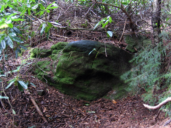
Whitton Burn 1a; a moss-covered cup-marked boulder in dark, thick forest by a stream. Easy to find, but not so easy to get to.


Whitton Burn 2a; close-up of cup and ring


Tod Crag 2; view East towards Tod Crag across acres of tussocky moorland.

Tod Crag 2; close-up of large oval basin.

Tod Crag 2; boulder situated on mostly featureless moorland 500m W of Tod Crag. There is a large deep oval basin and a cup (with possible ring) partially obscured by lichen.


Close-up of cup and rings at lower view-point shot directly into the oblique evening sun.

View NE towards Harwood Forest and distant Simonside Hills.

Tod Crag 1a; evening sun after rain. Probably one of the best carved rock panel in Northumberland.