
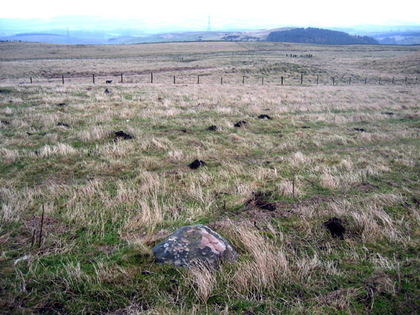
View from the top of the cairn SW towards the Ox Eye boundary stone. George looking for the cup-marked outcrops that are said to be somewhere between.
Image credit: Rockandy
View from the top of the cairn SW towards the Ox Eye boundary stone. George looking for the cup-marked outcrops that are said to be somewhere between.

The Ox Eye natural boundary stone viewed from the forest towards the cairn.

It was a horrible day with rain (sleet on the hills) and mist. However, the trusty hound wanted to go out and see some rock art, so I gave in and we went up to Ros Castle.
Millstone Hill is just over 1km NE of Ros Castle through deep wet heather and along the overgrown ?path on the E side of the substantial wall that makes the boundary of the Chillingham Castle estate and keeps you away from the wild white cattle. Fallen trees with wet branches, bog and heather made this a memorable experience.
We were heading for one of the more obscure panels of rock art in the Beckensall archive. This had not been revisited (probably never since 1990) and the grid reference given (actually very accurate) was based on the OS map, not a GPS. Just like the old days!
I give two pictures but apologise for the quality. Someone will just have to go back there, won’t they?
The rock is a gently sloping outcrop surrounded by deep heather which has been carved with cups linked by grooves; as Stan Beckensall says “like strings of beads”. This motif, although rare, is found elsewhere in Northumberland and further afield.
There are many cairns in the area – some probably from field clearance, but also a few kerbed cairns used for cremation burials. George Jobey excavated some on Millstone Hill in 1980 before afforestation but I don’t know how their position relates to that of the cup marked outcrop which wasn’t recorded at the time. Mr Berthele subsequently discovered a large triangular cup marked slab in a plough furrow when the forest was planted close to the excavated cairns. This portable stone is illustrated by Beckensall (1983 p.43) and is now at Chillingham Castle.
I took the way back through Ros Hill Wood to the E down the much easier system of forest rides. Don’t attempt this without a GPS. This lets you visit the Ox Eye long cairn on the way back.

Millstone Hill cup marked outcrop in deep heather just W of the boundary wall on ridge NE of Ros Castle.

Close up of S end of outcrop which (just) shows a string of linked cups. Hands were cold, it was snowing and misty (that’s my excuse).


2h; artificial light at night from W side.

5a; detail of complex motifs on SE side of panel (night flash).

4a; view from panel to NW towards Cheviot. The other side of the boundary (heather moor) is the site of marked rocks in groups 5 and 6.

4a; cup with large faint double ring and groove in SW part of panel.

4a; view of panel from NE end. Square-cut basin is a latter addition to the panel and may have been for a cross-base.

4a; detail of cup with faint ring from near centre part of panel.

Gled Law 4; view over panel to E. Single tree on prominent mound.

Gled Law 4; view NW over panel towards Shepherd’s House on Dod Law. Similar view to that of 2003 Pebblethief.

Gled Law 4; clearest remaining motif, close-up.


Gled Law 3; view E into the Till valley.


Gled Law 3; view SE to Hedgehope & Cheviot.


Gled Law 1; view E towards Buttony plantation (top left).


Buttony 4. Close-up of E’most motif (smaller cup with 7 concentric rings and 2 radial grooves).

Buttony 4. Close-up of W’most motif (cup with 8 concentric rings and 3 radial grooves).

View SW down Buttony outcrop from panel 6 through plantation.

Buttony 1c; 4 elements on a near vertical surface joined below by a long groove.

Buttony 1a; cup with 6 concentric rings.

View SW towards Wooler and Cheviot from just outside Buttony plantation.
There’s a photo here of Stan and friends at the rock and the rubbing that was produced.
Of the two cup and ring marked rocks recorded in Ilderton parish in the Beckensall archive this site gave me two problems. Firstly, it lies a good 1km NW of Heddon Hill close to the promontory Iron Age hill fort just SE of Middleton Dene. Secondly, I wasn’t completely convinced it showed anything other than natural erosion cups and grooves although the Archive record describes a minimum of 27 cups.
The weather wasn’t good as you could barely stand up in the cold wind blowing off Cheviot and perhaps on a better day I might have been more amenable. Clearly the experts believe it (at least partly) artificial. The nearby site at South Middleton Moor is undoubdetly a carved cup and ring and the area is rich in ancient settlement, clearance and burial cairns.
The two sites are well to the west of the main cup and ring areas of Northumberland and the rock type here is mainly volcanic. The land here was clearly well settled and cultivated for a long time period although at above 200m now given over to sheep grazing.


Small sandstone boulder sits in the middle of a small rectangular sheep enclosure. Good views E towards Chillingham and Ross Castle.

Cup and ring marked boulder.


Rock shelter from SE, view towards Cheviot.

Motif carved on top of the dome of rock above the shelter. A large basin surrounded by a shallow groove has a long groove running south down the sloping rock surface.

Interior of rock shelter from open end. Groove pecked on floor starts at the shallow basin near to the marker.

Shallow basin and groove that follows a vein in the rock and runs down the floor of the shelter to part where Stan Beckensall excavated a cremation burial in a food vessel of c.2000 BC. Stan describes the groove as having been pecked with a hard stone tool. The basin has been roughened possibly to hold a wooden upright (other metal-cut post holes are present) and the gutter may have been originally cut as a drainage channel.

Standing stone below rock shelter; view NW towards Cheviot.

Enhanced basin surrounded by groove with a long groove running down the rock above rock shelter; view W to Edlingham old railway viaduct, village and Thrunton Wood.

Above the shelter; artificially-enhanced basin and groove.