

September 2015.Finally went into the field. The worked stones in a pile in the corner have come from the uphill mound/s. My guess is they formed a kerb around ine or both mounds – I feel some of the mounds only appear seperate because of later activity. There are two stones still in situ, the most exposed one a rather large cuboid IIRC about 6” square in cross section


RH interior with entrance seen from top of hill looking in


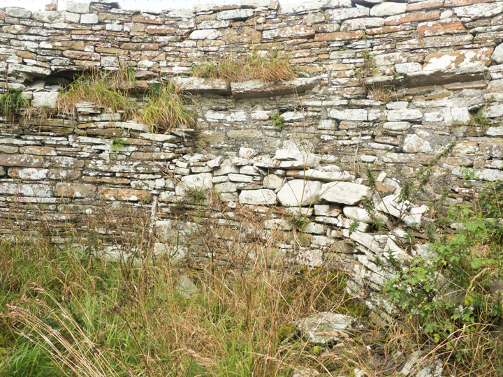
staircase and projections for upper floor viewed from inside


Up from the Harray Community Centre take the Netherbrough Road, go way down past Maesquoy and The Castle is on your right before the Ballarat House turn-off abutting the road. Because of the conflicting measurements I suspect some belong to the mound and others to the slight eminence it sits on. But most definitely well above head height from the road ! I didn’t have time to go on the mound, so I don’t know if the outcropping stones are still visible – perhaps they have been used for the modern cairn, thought to be broch material.
I went as far as the turn for Ballarat House, and in the field opposite Gullow is what looked like a banked feature which looks equally Iron Age but must be modern as it is not noted anywhere.
NMRS record no, HY31NW 1. In 1946 the rectilinear mound is 40-45 yards square and 12 foot high but in 1960 it is described as ~45m N/W by 36m and 1.5m high which does not compute. I suspect some belong to the mound and others to the slight eminence it sits on. Most definitely well above head height from the road ! An irregular outcrop of stones from the turf is thought to hint at a substantial structure beneath.

I think that is the berm visible at the right

North of Harray Community Hall is the Netherbrough Road. Just past Yeldavale the knowe stands out boldly in the far corner of a field, at this time swamped by bright vegetation vegetation. If only I hadn’t already been walking for miles I would have paid a visit despite the blooming plants. It sits on marshy ground thought to have been a lochan. Less than a kilometre further down is another broch, the Knowe of Gullow.From there I went as far as the turn for Ballarat House, where in the field opposite Gullow is what looked like a banked feature which looks equally Iron Age but must be modern as it is not noted anywhere. Burrian’s underground structure brings to my mind two Orcadian sites, one where a broch was built over a tomb and another where the supposed broch was purely ceremonial/ritual
The Knowe of Burrian , NMRS record no. HY31NW 2, was once 60’ in diameter and 17 high. A berm seperates south and west sides of broch remains 1.2m high on the flattened top of a steep natural hillock. On the east side are three courses of outer wall face and possible traces of the inner wall face, from which it is estimated that its external diameter is ~18.3m and internal 8.5m.
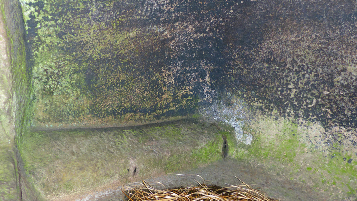
After several failed digs by other folk Robert Flett of Garth made a go of excavating it in 1936, when a trench found distinct layers of ‘hearth-materials’ – charcoal, pot-boilers, animal bones, etc – before almost at the other side a slight turn revealed an interior chamber floor. As well as the Pictish Symbol Stone he found some burnt wood, stone tools and ashes. Then came one of those myserious ‘wells’ . Of two excavations in the centre of the mound the more westerly is the now covered location of an underground chamber. From a vertical entrance approx. 2’6” square eleven steps led steeply down 12’ to a 10’x5’ flat-roofed figure-of-8 corbelled structure compared to the Gurness well then being dug, though the site was called an earth-house rather than a broch at the time.

the track to the Dwarfie Stane ends with duckboards, other duckboard sections along the way can be quite slippy


basically two compartments inside Dwarfie Stane


view from open-top T11 double decker bus
CLOSED September 26th indefinitely owing to traffic concerns
Entering the enclosure the second thing I noticed after the cairn itself was a shallow trench all around the ege of the mound, and outside that a lot of stones of decent size. Canmore says “bounded by a wall-face of horizontally laid stones. Surrounding the cairn is a spread of loose flat stones forming a sort of platform. An alley, clear of stones, led through it up to the W edge of the cairn”. Alley past tense. Before tackling the mound I investigated the other piece of the puzzle. This now has an angled metal door that swings out. This is where a fold-out screen comes in useful, sitting down on the horizontal stone and sticking the camera inside on wide angle. Then up to the main prize. I was very careful with the ladder in the cairn, starting face forward at the start, and the space between the rungs is over-large so that it would be all too easy for the whole leg to slip between them – I would have preferred to have someone with me just in case !


