
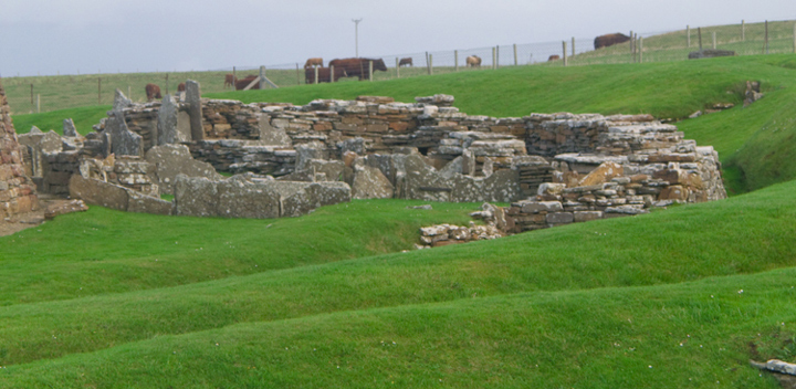
wideford


Watch Stone to Stones of Stenness viwed from Ireland Road
Image credit: wideford

exactly as it says in the link orkney...archaeology
When Stromness was planked in 1765 Innertoun was divided from Outertoun by “a line from the March Stone at the goe of Stinnigar and upwards to the March Stone at the west corner of Pressquoy, and from that in a crook eastward to the top of the Green Hillock, and from thence upwards through the middle of the Green Gate leading up to John Stout’s house called Gentle June [Gentlejohnshouse a.k.a. Castle (near Hillcrest) croft now abandoned HY236101].” At first I though the Green Hillock must be Brockan chambered mound, but that is westward. Another possibility is a mound S of Wester Leafea. But this is a “natural sandy knoll” rather (site of the Innertown cist HY20NW 3. Which leaves the Leafea standing stone pair as the only candidate for Green Hillock, the march stones those I saw coming up.
Orkney’s Hurtiso Hood dates back to at least Iron Age and is the oldest complete garment found in the UK (near Groatster/Grotsetter in St Andrew’s, though first report in 1863 stated “in the Holm district... in the moss off Hurtiso”).
orkneyjar.com/history/orkneyhood.htm
Orkney Herald :
May 23rd 1863 “One day last week... in the Holm district... in the moss off Hurtiso... exposed unexpectedly an ancient article of dress... This article was a short woolen cloak, finely adorned with fringes {?19} inches in length, and having a hood of the same material... This curious relic was found embedded in the moss at a depth of six feet, and under five solid layers of peat.” Hurtiso Farm HY506105 is in East Holm, which presumably makes the moss the extensive Muir of Meil.
December 5th 1877 “in Mr Petrie’s collection was a knitted woolen hood which was found in a moss in the parish of Kirkwall... which resembles in shape the old “trot cosy” of the last century... It had been done in bands, each with a seperate pattern, and round the edge is a fringe about twenty inches in depth.”
May 18th 1881 “Skeleton found... while engaged in peat cutting in the hills between Birsay and Evie... The remains... that of a female of about twenty years of age. Some pieces of cloth, apparently used for wrapping the body, or part of the deceased’s clothing... The strongest of the three pieces of cloth is of a peculiar woolen fabric... a close resemblance in texture and style to the hood found in a moss in the parish of St.Andrews upwards of 20 years ago..”


Appears on tonight’s “Digging For Britain”, BBC2 9 p.m. It is open to the public until Halloween and there is also a feed from the featured cell. It sits to the side of the Skerries Bistro.
In 1990 Andrew Appleby reported that recently much had been removed by someone cutting across the seaward side.
Covering the site for next year was well in hand on Thursday, with the building in the far corner already fully blanketed in black plastic. So I had a bit of a race against time. Actually as far as making sense of the site is concerned it is much easier to make out the structures, especially the walls, with the plastic sheet laid on the floors ! After photographing all you would need to to do is ‘photoshop’ the black for a less obtrusive contrast in colour. Today another big deep hearth stood out. Very close to it are two large slabs on edge making a likely corner. The hearth seems a little close to be connected or respecting it (though it could mirror the hearth’s far left corner). One side is a thick rectangular slab and the other is thinner and has one angled end. On the other hand the latter also looks to line up with an edge of a thick tall-ish ortostat. Both have narrow horizontal slabs by them at ground level (that at the orthostat resembling part of a standing stone socket) and another in the space between them. From the orthostat another much lower orthostat runs to the wall of a structure, and by its RH side a small paved area [?entrance] ends at another wall. In the photograph I can see a slighly angled orthostat built into the ? far wall of the structure. Of course even looking from other directions perspective might be misleading me. But a diagram to help you see would fall foul of ORCA’s no image policy. There are at least two fallen rectangular stone near all of this, one of which might well have formed a wall with the rectangular and another abutting the angle of the corner to its left. I had a look at the drain exposed below the paved circular passage near the viewing platform. It is not much wider than a small soil pipe and bounded by a mostly thin coursed wall, though there is one stone on its long edge I can see. All over the site there are the tops of walls and fallen slabs, the latter as likely isolated as not. Unlike the north end (I can even make out the N/S baulk in one image) the view from the west end spoil heap is really a mish-mash at this stage in the cover-up. Along the south end the tapes were gone. So I finally had a chance fror a peak from this direction, treading carefully like the seasoned digger I had been. I am particularly struck by a horizontal lang stane, virtually by itself, closely parallel to what was/is the E/W baulk about half-way along the east ‘arm’. What is visible is mid-brown, five to six feet long and about the thickness of a brick wall course. The long edge facing me seemed to have a square cut running along the top but I see it is simply that this is a roughly flat edge [??natural]. From here I can see that my corner is less so – there is a gap before the angled slab, which is thin, and the other two stones are the true corner. But all of it is on the same ‘grid’, with at least another three walls on the same alignment [NW/SE if the baulks do run cardinally] between the walls/structure directly ahint the corner and the site’s east end by the north end of the platform. Nick Card has noticed where I am and calls me out as this part of the site is still sacrosanct. I try to see the lang stane from the viewing platform ramp but cannot, though a digger near to it is working close to it and in front of her may be another one [?? or the same], for I can see a big long block with a horizontal split hard against the baulk. Leaving I take a gander at the finds ‘trays’ outside being packed. I see that large potsherd with deep ribs and two of the smooth stone balls, one an oblate spheroid and the other an almost complete ovoid with a linear crack running around it (and a piece from elsewhere detached on it, sandy coloured inside).


Reached the Ness of Brodgar around dinner-time, in between the guided tours, so decided not to ask to look at the finds. Re Brodgar Boy what in one view did look idol-like (despite that lop-sided third ‘eye’) in another was distinctly a broken-off top with a short ‘stem’ at the bottom. Now that the rest has been found the object is two-and-a-half times as long and looks like a mini-staff (a symbol of authority and/or for ceremonies, or a representation of one ?). Including the ‘neck’ and that stem there are three circumferential grooves that might have been for rope – you can easily imagine it with tassels ! In digging the midden of Structure Eight they have found a stone incised with an earth sign [Pars Fortuna]. . Structure One has so far produced several dozen incised stones, the last what what they take for a representation of a comet (but a circle with three trailing lines has other meanings). But the most common symbol is what they are calling a double-triangle and associating with a bee, though these also been ‘read’ elsewhere as butterflies (over at Banks Chambered Tomb there are vees/chevrons, which are seen as birds). Pre C14 dating one at Stonehenge was wrongly identified with the Cretan labrys (double-axe). Much has been made of Stenness infuence on the Avebury area, so is this another indicator ? Finally on site the Neolithic roof tiles were removed, only for more to be revealed at the same place after further digging – the imp of the perverse wonders if this is a dump rather than collapse in sensu strictu.
Despite the very strong wind the first thing that I did was go up the viewing platform. The lighting being distinctly flat all structures tended to merge – in these conditions what is needed for photographing features is a little light rain I recall. First new item to ‘pop out’ the monumental hearth in Structure Ten. ImmediatelyI thought of the one in the Stones of Stenness circle, though I think comparisons will instead be made with Barnhouse ‘village’. Next I saw a long slab with ends framed by angle topped orthostats. This must be the probable Structure Ten entrance they have found – having been caught out before by dodgy contexts they are holding back judgement until they can be certain it does not belong to another period or structure (I saw what could be another rectangular feature [or part of a passage/’street’] directly in front of it). Coming down again it did not surprise me that nothing further has happened to the NE corner that took my fancy when I came here with Orkney Blide Trust the previous week (not realising we would stay for the whole 90 minute tour I’d had to come back for The Work photography) as it is at the very edge of the dig. The day I came seemed to be dedicated to cleaning and recording several parts of the site so I tried to avoid getting in their way. Nothing major looks to have appeared in the sides overlooked by the spoil heaps – I would dearly love to find out where that drain goes to in the piece by the western edge. Filling the appended SW corner Structure Twelve still sits in splendid isolation from the rest of the buildings as far as I can tell. Either that will change in future seasons or it is telling us something. Going round the final side and that massive squat standing stone still has pride of place in the SE corner. Does it extend much below what we see now or will it prove as shallow rooted as the red orthostat they have recently removed ?
Last year they lterally got to the bottom of the Lesser Wall of Brodgar, only to find that it stood on paving and possibly earlier structures. This year geophysics has confirmed that it bridges the ness and it is back to being part of a wall circuit encompassing the site they are investigating (could the paving be an extended base ??). The Kockna-Cumming chambered mound still lies outside the whole and the Brodgar Standing Stone Pair straddle the wall. Are the stones from a prior age or were they put there later than the wall, either much later to show where it was or immediately after to mark it out ? Don’t be misled by its narrowness in comparison to the Great Wall as only a ditch seperated the 4m thick Great Wall from one ouside of it ‘only’ 2m thick. Still thicker though – might there be a presently unlocated other Great Wall in parts still virgin to excavation ?? If the remains below the Lesser Wall are from an earlier period then might we re-interpret the putatative structures and likely hearth found in testing outside the Great Wall as coming from that time too instead of post-dating the wall as originally theorised? Certainly the public perception of the wall’s primacy needs revising. Indeed it is my opinion the that the Great Wall (and possibly the circuit) comes yet later in the scheme of things than first thought.
From the main road about one field west of the Stenness Kirk junction you can see that the profile of the Ness of Brodgar follows that of the Black Hill of Warbister in view behind it, or rather the sub-hill which the Bookan Tomb presides over.
An engineered road thought to have connected the Wrekin and Old Oswestry hillforts pre-dates R*man construction by several hundred years according to a summation of excavation newspaper reports (regarding Bayston Hill quarry) in the new Fortean Times, FT279
now resembling a segmented rolling-pin orkneyjar.com/archaeology/nessofbrodgar/wp-content/uploads/2011/08/0808114.jpg
rather small image showing topographical survey of centre of ring
David Lynn has now been here. On the one hand the broch expert has dropped it down a level from “probable” owing to insufficiency ofsurviving circularity. On the other hand I somehow missed a lot of associated large stones and blocks, so Dave agrees there is definitely something very big under the mound on which the church sits.
A long and lovely ride up hill and down dale into the South Parish. Before getting to the branch road there is the one that passes the post office where you need to go for the key to the church (along the road to Burwick) that now holds the Ladykirk Stone (a.k.a. St Magnus Boat) once in another now gone. This stone has two foot hollows. A sandstone block bearing the ‘impression’ of a right foot alone was found in St Andrew’s in the area where you find Mine Howe [Stoney Howe], Round Howe and Long Howe so is likely to have been similarly in (St Ninian’s) Chapel.
Going by road it is not difficult to miss the turn-off for the Tomb of The Eagles despite the direction marker. Should have one opposite the junction as well. Once on the right road you then need to make sure to take the correct piece for the Banks Bistro rather than that for Liddel/Liddle and the Isbister tomb. To the right of the final stretch I see a large conical mound, too large to have been missed before now and too clean-cut to be prehistoric (unlike CANMAP on the newer Canmore Mapping they do mark the Banks tomb). On leaving the bus the horizon presented several panoramas; long lines of cliff and Muckle Skerry with its lighthouse. Nearer to my left I saw a section of cliff lit up on the far side of a narrow inlet. At its far end the earth dips down and there is what I take for a mound though my photo only resembles two horns of stripped turf. Further away and near the horizon there is a wall of weather coming in across the waters to my right. The ‘Tomb of The Otters’ is slap bang by the customer car park. Only now do I find out none of my companions had realised about the tomb being here, they’ve come for the culinary experience after their walk. My gaffe. The weather arrives light summer rain. Decide it would be a good idea to check whether I can publish photos to the Net. A young lady passes me on to the finder, Hamish Mowatt, who guesses that I am Wideford but has no firm opinion in response to my question.
The mound is said to be low. It actually stands a couple of feet proud of the surrounding land, which is nae bad really. We decide that I shall concentrate on the recently restored chamber that first brought attention to the cairn – you can still see a circle above the top of the rock-cut rear wall where he frst peered in. Last year he found a long heavy slab buried alongside the damaged chamber. All that had been above ground had been a few inches of litch covered corner. On the edge facing into the ground Hamish found a host of markings made in antiquity. An attempt was made to downplay its relationship to the tomb itself – ah, that sacred phrase “in situ” is being applied way too restrictively here, because not only had the stone been buried alongside the disturbed chamber but it also slots into place to complete the capping in the chamber’s restoration, not merely somewhere in the vicinity as “not in situ” implies. In April the owner and a Rousay mason affectionately known as Colin ‘Bin Laden’ followed Orcadian tradition and sensitively restored the damaged chamber. The stones added to complete the passage were keyed into the existing stones at two key points. To roof the chamber they put back the slab hit by the digger and placed the buried stone over the front of the chamber, where the way that it slotted in confirmed the original fit. In between was filled in by a new slab taken from the shore below. Altogether, even using the digger, it took two days to finish the job – from seven in the morning to seven in the evening of the first day and until four in the afternoon of the second day. The final result justifies the decision to ignore the archaeological authorities leave the capstone over the eastern chamber in place, giving the public a proper idea of how the tomb looked – the purpose of a capstone is to stop the whole falling apart. It is interesting to speculate about when the tomb was ‘decommissioned’ by the removal of that roofing slab, especially in relation to the otter incursions chronology.
The man’s a gae good yarn teller, can tell you all kinds of stuff to do with the locality and his experience of the archaeologist in the field. Could have listened to him until the cows came home, as it were. Only the truth of it comes from him, though a visiting archaeological student will give good tours when he comes to work here. Hamish mentioned that he had more marked stones in a shed. Whilst he answered the phone I took my photos of this end of the tomb as agreed – unfortunately my foties of the chamber’s actual insides weren’t up to snuff, but the important ones were. When I moved away his work on the phone came to a close and he was gracious enough to show me the writings. The shed turned out to be a fair sized new wooden rotunda that acted as his peedie interpretation centre, with info around the walls and a camera feed to the chamber at the other end of the long axis. On a table in the middle are three stones full of promise. One is dominated visually by a single vee of large size and broad lines upside-down at the edge [from a larger slab I would hazard]. Some authority tried to claim that this sign owes its existence to contact with the digger, which is bull (as you can see by comparing its mark on the roofing slab with this, no comparison at all !). Indeed along the left channel you can see the individual tool marks made in gouging the channel in antiquity. Lines criss-cross other two stones, both singletons and simple sets. The next day I visited St Magnus Cathedral and noticed some of the blocks have thin straight lines of crystal inclusion gathered in similar groups, imitation using grooves the sincerest form of flattery possibly. If the vees are seen as chevrons it brings up the thorny question of which came first, scribed stones or decorated pot. Of course this assumes that all the ‘inscriptions’ are art rather than palaeoepigraphy [pre-writing].One of the stones seems to me to distantly foreshadow the Pictish symbol stone as it is more a geometrical shape than a split slab or found rock.
Next week Alice Roberts will be followed by 360 Production as they continue their behind the scenes look at “Digging for Britain”. Perhaps Sigurd Towrie could use the opportunity to bring the story up to date from material gathered since his last report. Hamish Mowatt had been hoping to start up a webpage but a family death and pressure of work have meant that this has had to be put on the backburner, for this year at least. Though not wishing to be involved with material remains such as bones it is possible that he might eventually follow further in the steps of Ronnie Simison (though not alone) if he ends up in the same position – several times in the local papers from 1825 on I have come across reports where the excavator stated his intent to dig the next year or come back for a continuance, and then decades or even a century later still nothing has happened. Of course the modern reasoning is that these sites are being left to posterity and its advances rather than in reality lack of funding or the search for the next big/new site. He has learned about the different factions amongst the archaeologists, and having found that there are still digs in Orkney where finds are collared by those who did not find them now only has faith in ORCA and the County Archaeologist, like Ronnie having been disparaged by some who should know better.
Speaking of which I was surprised to learn that John Hedges is still renting a nearby cottage, over towards Liddle, as he further investigates the prehistoric landscape brought to light by Ronnie Simison. ‘Wedgie’ would love another major site to crown his life’s work, after an hiatus due to debilitating illness, but apart from one eventually disappointing ‘settlement’ has been unlucky thus far. Apparently the great man has made many reports and such on his work at this time. However I must imagine this has been in the nature of what they call ‘grey literature’ as apart from a initial outline in “The Orcadian” things have been quiet [one would dread it going the same way as the digs at Skaill in Deerness]. We would love an interim ‘work in progress’ article in the paper guv.
Came time for lunch. Gourmet meals for £10.95 pretty as a picture and filling too. Half the price for a light meal, say £3.50 to a fiver. Had a toasted sandwich – they also do ordinary ones, paninis and baked tatties. Ignored the lovely sounding home made desserts and plumped for a clotted cream tea for four pounds fifty. Gosh it did me grand.
The Blide Trust were making enquiries about a fishing trip. Then on the skyline Hamish showed me the mounds Ronnie had investigated between here and the Tomb of The Eagles, and described one in particular, inviting me back to the neighbourhood to see more. I had to be virtually dragged away. Ah, if I had money or transport. Closest are four turf-covered mounds that may be natural. Next comes a group of six low stone cairns averaging 28 feet across and two high, with the largest a fraction over half as high again and forty-eight feet in diameter. These are now described as disturbed – in 1973 Ronnie had trenched two and it is easy to imagine him having gone on to the rest next. The NGR is given as ND46128326 but a 1997 survey gives this as ND460432 with additionally a possibly prehistoric mound at ND462833. Ronnie is known two have dug two mounds with drystane wall kerbs and the O.S. thought one might be linked by a causeway to yet another [double BA house ??]. Further along a probable animal pound (a term almost as useless for dating as “enclosure”) had been formed by walling off the SW end of a promontory an area some sixty by forty metres, and has another kerbed cairn within (at ND46338323) that he was investigating at the time of the O.S. visit [is that what I saw on first alighting ?? Too big]. Underneath a cairn of more recent vintage grass covers a mound 2’ high and about 8m diameter. There ws a double kerb found at the south around a body of stones with some earth, with small horizontal slabs between the twa kerbs – a trench at the SW, then unfinished, found two stones of purpose unknown but larger than the fill. The inner arc seemed to be drystane walling but the outer had been made from larger blocks, both being in courses. If you do go this way to the Tomb of The Eagles don’t forget to go back by way of the burnt mound to the Simison’s museum and cafe so you can pay the tomb’s entrance fee. Fair do’s.
Starting for Kirkwall the massively ugly tires at Burwick are offset for me by the sight of the grass dressed iron age fort (though you have to know where it is to see it).
Any errors and omissions are mine

damaged western chamber and passage sensitively restored by owner and local mason in April; the top piece is that originally hit by digger – note marks – ,the middle came from the shore and the front piece was found almost entirely buried alongside the tomb and slotted in perfectly
Image credit: wideford

top of restored chamber with central passage top centre and an offshoot running to its left [Ginger is brilliant]
Image credit: wideford

looking down on restored passage (keyed here from large angled stone right of centre) showing there is here still a piece to go to reach the passage floor [as it stands now still short of true floor level at back of chamber]
Image credit: wideford

top of recovered roofing slab which had been buried alongside the tomb with markings face down – you might make out the lichen in the top right corner, which was all that projected into the air
Image credit: wideford


inscribed stones from tomb area displayed in rotunda, i-iii from left anti-clockwise
Image credit: wideford


