wideford

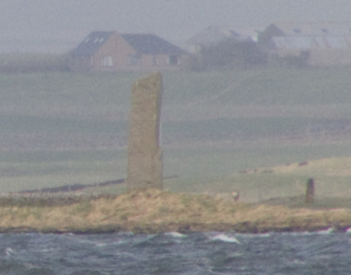
Picture of the “Stone of Ludd”.
Down in Caithness a story was told of the St Magnus turning a dragon into the Sten Hone. Another tradition gives this as the grave of Earl Liot(us), like Magnus an Earl of Caithness and Orkney [Ljot Thorfinnsson killed by Macbeth].
Stone Hone, ND25NW 13 at ND24265736, by tradition is the grave of an Earl Liot(us) of Caithness and Orkney [Ljot Thorfinnsson].

entrance passage – there appears to be a slight kink or bend in the right-hand wall. Thanks to Hamish for letting me publish these and I hope I haven’t mistaken W for E !
Image credit: wideford


looking along central passage from W chamber to E chamber
Image credit: wideford


view across entrance to cell (? S2) – the bottom centre stone looks to have grooves
Image credit: wideford


unexplored, the latest found cell was under the lintel of the entrance passage
Image credit: wideford
When the Knoll of Burian was partly excavated in 1866 they found a large “brough”, but though the rest was being laid bare the outworks were left alone. Farrer found “underground cupboards, partly beneath the floor of the main circular chamber” and three steps he thought to have been part of an (?intra-mural) staircase. A sketch and plan by George Petrie show what are interpreted as a hearth and tank in the central chamber with a built wall dividing this from a long
curving room on the north side and 3 small cells ? sleeping-quarters. Now some think it a wheelhouse, which is a round house divided into compartments by radial slabs, though.the few features have been compared to Burroughston on Shapinsay and Bu in Stromness.


Thank you Hamish for another wonderful twa hours. A fortnight ago Orcadians went for free, but that weekend the weather was pish poor so I came now. Still a bargain – not much comes from a fiver in life nowadays and he has made vast improvements for folk, like new signage and a fresh tarmac-ed road for starters. In the near future Hamish is looking to have his farmland geofizzed for a day, but needs must he pays for it his sen. Apart from the passage in the tomb is now fully roofed (with contrasting slabs to show the differ). In the rotunda by the fishpond the feed from the tomb is now shown on a peedie widescreen monitor, the output being guidable to boot.
At the inner end of the passage you now have to kneel down and step down backwards – better for most than a trolley but you canna stand up straight once inside.Of course this tomb hasn’t been excavated there completelyto the natural, so one day this stae of affairs might change. Since my previous, chance, visit the other chamber has been opened to the public and the one facin the passage too. There isn’t much to see as yet of the new chamber he found (contrary to some archaeologists opinions) under the passage itself though it does go back aways, as revealed by penlight. I had had visions of sticking my digital under the lintel and revealing wonders, but at the moment entry is blocked by the original closure material with just mebbe an inch open directly under the lintel ! Of course some would object to poking in a fingerhole (oops, pardon my French, void) even with a camera. However the way one should look at it is photographic record is essential in case something changes before it is professionally looked at, mistakes are made in excavation and (in the present archaeological climate) promised weeks can turn into decades or even never. Unfortunately the completed roof does make the in situ markings less easy to have a proper gander out.
Luckily there are several fine examples of marked slabs in the rotunda exhibition. Here we were then shown some of the organic material recovered to date. Hamish was very pleased withe the deep interest shown in the skeletal remains shown by not only those with a general interest in physiology but also those of a professional bent such as surgeons and dentists. We were allowed to handle very healthy looking teeth and also less healthy bones that showied clear evidence of arthritis [?osteoporosis]. One tooth the size of a small pearl came from a toddler. As well as limbs we saw ribs and the kneebone of a ten or eleven year old. Intersting though these were best were the fragments of skulls, every one of them rather thin apart from a very thick piece that had protected the brain stem. Even so it looked overthick, like four heavy-duty homemade ashtrays welded together. Finally Hamish passed round pieces of shaped pot decorated in various ways. If I heard him correctly there are thought to be two different traditions present. Certainly there are also several kinds of decoration, both by stroke and impression. We agreed with him that the stand-out potsherd was one very dark piece, almost black, that appeared as if someone had made downward slashes with a knife point all the way around the rim – apparently this one is very much a mystery at present, perhaps ?? a one-off.
The mound is now on the edge of the new housing development
The burnt mound is on the LH side of the road onto the new Hatston pier amongst the new industrial development. Unfortunately it is now fully enclosed by a fence with not even a gate for access. An opportunity for excavation missed.
orkneyjar.com/archaeology/2012/04/20/sixth-chamber-in-banks-chambered-tomb/
unfortunately this is not “The Orcadian” article by Craig Taylor, which has a photo

looking down on south side from Mount Pleasant track
Image credit: wideford

looking down on southern side from main road
Image credit: wideford

looking down on east side from main road
Image credit: wideford

situation from opposite bank of present burn course looking at east side
Image credit: wideford

situation from opposite bank of present burn course
Image credit: wideford

looking over onto central excavation from the north
Image credit: wideford


view from approx E of area from downhill, access by track from Old Hall in top half of pic
Image credit: wideford


The Nettletar/Netlater Broch was revealed in about 1860 when the Rev.Dr.Trail excavated a large mound some 200 yards south of the manse, and hard by the present course of the Burn of Nettleton, whilst making improvements to his land. Roughly five years later local antiquarian George Petrie came to investigate. He published his observations and plans (from sketches) in an 1873 article. Later there are joint manuscripts with Sir Henry Dryden including annotated elevations. In his article Petrie mostly described what he personally saw and, strangely, nowhere gives the like of wall heights – perhaps these only came with Dryden’s 1866 measurements. Modern commentators give Petrie ‘stick’ for things he only took from others observations or indeed never mentioned as seen by him. tIt is much to be regretted that we are missing Trail’s actual notes for instance, as Petrie tells us that several important features of the broch and its adjuncts had been destroyed prior to his visit. Unfortunately Dryden had the draughtsman’s eye to draw things as they should have been rather than as they presented themselves.
During the 1860s improvements the Burn of Nettleton had its course straightened. From a point on the ‘upper’ side of the broch a small conduit was thought to connect to a well inside the tower. This conduit passed through an oval enclosure east of the broch, though at the time Petrie only saw two walls some distance apart cut through where space had been cleared [by the broch builders or Trail isn’t obvious in the text, presumably the latter] in front of the broch entrance. In the space and probably within said enclosure was a deep well, entered by several steps, covered by the time of the article. Between this vanished enclosure and the 12’ thick broch wall, and a yard from the latter, Petrie saw a rough stone wall (probably concentric, gone now anyway) some 3’ thick and ? 5’ high. Petrie was informed that this was faced only on the inner side, and by analogy with other brochs it has been since suggested that this is upper wall debris. The conduit might stop at this point. At a point outside the south-western part of the main tower hard by this wall calcine bone fragments were found in two large fire-baked clay urns. Petrie describes their appearance as “rude” but they had carefully cut triangular flagstone covers, said covers being roughly at the same level as the broch floor. Cut into the rough wall to the north side of a line from the passage, and abutting the broch tower, he saw a three foot deep cell/compartment, which at the time of his visit was the only remaining one of several found by Trail, chiefly on this same side. The cell’s entrance was only 22” wide and 2’6” high. None of these ??outbuildings were properly explored. There is dispute as to whether the broch walls survived to 6’6” or 8’6” high, but during the improvements about half of the stonework was robbed for the Glebe dykes [the field walls of the land belonging to the Manse] and by 1966 we are left with only a western arc upstanding. The broch entrance (now obliterated) is aligned approximately twenty degrees south of due east. For the first six feet its width was 2’9”, at which point it reached stone door jambs and broadened out to 4’ wide for the last six feet. The broch’s interior has a diameter of 33’4” and Laing tells us that there was a second pavement some 18” above the first. Inside on a line with, and close to the left-hand side of, the doorway there stood a radial stone about 4’9” high and 4’6” wide, with a hole about 2 inches in diameter through it within 14” of the inner edge at roughly mid-height – close to the wall at the back of this stone a human skull was found. The plan show several arrangements of wall fragments and edgeset stones (now gone [or perhaps ‘buried’] ) which Petrie thought post-dated the broch, though Hedges thinks that they could actually be contemporary with it. Within the broch tower wall three oval mural cells were roughly equidistant if you include the passage. Two chambers are describes as ruinous and the third to the south was deduced from remains. From the last nineteen steps of an intra-mural staircase ran clockwise from it, suggesting that the broch once had an upper floor. A subterranean passage near the centre of the interior led to five steps that gave access to a three foot square flag-lined rock-cut well near the interior wall – the bottom of the well lay 9’ below floor level. It is now choked with debris but in Petrie’s time it always held water.
On plan in looking at the outer cell remaining at the time of Petrie’s notes it rather obviously cuts into the fragmentary concentric wall. So either it post-dates the broch collapse or that wall is at the very least contemporary with the cell. Could it be that the compartment is really one of the guard cells one would expect to find just inside the entrance. It survives too well to simply have been left outside the broch tower after some later re-modelling reduced the broch’s diameter. So I think that the two walls are the inner and outer faces of a single wall, with the earth used as banking to shore it up. Which would give epic walls a minimum of 15’ thick, similar to the East Broch of Burray which is (partly) surrounded by an earth rampart. A modern dig would be needed to give an answer to this as the two levels of interior floor surely means that the Trail/Petrie/Dryden material relates to two, perhaps more, building phases.
NMRS record no. HY31NW 38 at HY32321741 in an area also known as Noltland. From Noltland ‘cattle land’ Hedges suggests that the original name comes from Nolt+Clettr ‘cattle rock’.but is unable to come up with anything in the vicinity that would have given rise to this name. I would suggest that perhaps the Vikings saw the broch mound as having been ‘calved’ by the burn. At the end of a long walk I wasn’t up to making my way to the broch but made observations from various places. To see the interior good views can be had from the Howe road that runs beside the Harray Manse. Going back onto the main road I first saw the broch by looking straight across from the site of the Knowe of Brinnanea where the burn meets the road. I find it difficult to realise that I must have been looking directly at it several times previously. Eye unaided I would have seen it as simply a fieldwall of white stones like shiny pearl teeth. Admittedly there is such a wall beside it, but with camera and binoculars the stone is truly monumental, much bigger in size and more regular in shape.
Open from now until Halloween
viewed from edge of Standing Stones Hotel grounds
Image credit: wideford

view from edge of Standing Stones Hotel grounds
Image credit: wideford

