
Views of stonehenge, from west and south. Engraving late 17th Century.
Image credit: David Loggan
Views of stonehenge, from west and south. Engraving late 17th Century.

Stylistic landscape interpretation of the White Horse of Uffington with star constellations above, and some of the villages of the vale below. Good music too...
Pagans have pledged to perform “rain magic” to wash away a cartoon character painted next to their famous fertility symbol – the Cerne Abbas giant.
BBC News
news.bbc.co.uk/2/hi/uk_news/england/dorset/6901543.stm
I can hear those rants beginning...

The only complete skeleton found in the earthen long barrow. Mr Smith himself? :-)
Archaeologists have revived the debate over whether a spectacular Bronze Age disc from Germany is one of the earliest known calendars.
The Nebra disc is emblazoned with symbols of the Sun, Moon and stars and said by some to be 3,600 years old.
BBC
see
Watton town sight: the babes and the wood, the easter hare jumping over some beer?
Babes in the Wood tale
plan view of the circle in 1722. click on ‘this album’ link for more of Avebury.
Superb Image and text explaining the Weyland myth and the connections with other myths and legends.
Two slides of the smithy from the archive of the Oxford Institute of Archaeology.
Cashtal yn Ard in Manx-Gaelic means ‘Castle of the Height’.
Source: The Folklore of the Isle of Man, by Margaret Killip.
from ‘the Harwell News’ number 143 April 2007
‘...we come to the few stones lying about in Harwell, such as the Bargain Stone, and my ignorance regarding their origin. They are all about 60cm thick, and are all at or near Middle Farm barn, (the barn on Grove Road) apart from a smaller one by Church Farm. If these stones are Sarsens it would seem likely they were brought here from the Downs by man. Did the people who built the barrow bring them? I have not heard any facts or even theories relating to their origin.‘
text by Martin Ricketts.

Kerry Hill geometric interpretation
Tumuli
Gaunt trees, scant shelter
For the grass covered barrow
On wind caressed downland
Overlooking the vale
The ancient chalk highway
A stone’s throw away
Lies vacant, brooding;
Acknowledges whispers, inaudible echoes
Vibrations from invisible feet
Weathered sarsen monoliths
Stand to attention
Lichen encrusted overseers
Of a strange uneasy place
The pulse quickens, reactive sensation
An incorporeal feeling;
The heart of past centuries
Although hidden, still beats.
David Pike
Iron age settlement site. Pottery and a skeleton found in the 19th Century. (ref: Smith 1894, Victoria County History, Beds.)
Includes the info:
‘Adwell Cop is an ancient entrenchment supposed to have been constructed by the Danes when they burnt Oxford in 1010.‘
(included here as links to change and expire)
Iron age settlement site. Finds of pottery. (ref: Bradford 1942).
---
‘A small detached hillock, about midway between Tetsworth and Lewknor, some 1½ miles from the foot of the Chiltern escarpment’ – (quote found somewhere on that there ‘Tinternet’)
SP981221 Nearby settlement site at Totternhoe.
Storage pits and hearth. Finds included: high round shouldered jars and a bronze vase-headed pin. Iron age. (ref: Hawkes 1940)
Pits cut into chalk, pottery finds with unique horseshoe decoration. Also, finds of bone, bronze and iron objects. (ref: Richardson & Young 1951)
Settlement site with intercutting pits. Finds of pottery, bone and bronze ring-headed pin. (Head & Piggot 1946)
Univallate enclosure of about 4 acres and Heavily ploughed.

Amber gold-bound disc. Enalrged detail. Actual size 1inch (2.5cms) approx.
As a link from this site says. Did they have a magnifying glass? The level of detail (the holes are 1mm) and the perfection of the circular indents (inlaid with gold leaf), must have taken a craftsman (or woman, should that be Craftsperson in the PC world?).

Greatly enlarged detail of wood fragment decorated with inlay of minute gold pins, seen in section. Part of remains of haft of dagger. Actual pin length = .0425 inch

Wilsford G5 copper dagger showing wood traces representing haft and sheath. The scale is 2:1 approx

from Ancient History of Wiltshire.
in the middle to far distance are def barrows. Three near the track and four to the left of the track in the field. Given the artistic licence given to drawings of the time (like distance and what you could actually see on the horizon), does anyone have any clues as to which ones they are?


An old illustration from an old book, showing the ‘cromlech’ of Wayland’s Smithy with Uffington castle on the horizon in the background and the white streak of chalk road that is the Ridgeway.
‘One great occasion in the Vale was the pastime accompanying the scouring of Uffington’s White Horse. It usually took place in Uffington Castle but occasionally moved to Kingston Lisle or Seven Barrows Farm...‘
From ‘Rural Life in the Vale of the White Horse’ by Nigel Hammond.
---
Interesting that the festival didn’t always take place at Uffington Castle:
The Kingston Lisle site must be because Mr Atkins owned the Estate there (and it’s reasonably close by, and must have had an inn or tavern).
Seven Barrows Farm (near the Lambourn Seven Barrows site) may have been in the area of the barrows, but after you’ve finished scouring, that’s a fair trek across the downs (you’d probably go past Rams Hill and head towards it that way). Did they get the payment in beer on the hill (and therefore wandered drunk over to Seven Barrows Farm) or when they arrived?

Portion of front cover of Murray’s Berkshire Architectural Guide. Pretty accurate representation.
A newly renovated bunkhouse set in a converted skittle alley and attached
to a real ale pub has been leaving guests ‘bowled over’ in Wiltshire.
Recently opened YHA Clyffe Pypard is conveniently located right next to the Goddard Arms and has already welcomed a steady stream of visitors from all over the world.
Clip from an episode of Robin of Sherwood (the eighties one, not the one on telly at the mo), entitled ‘Swords of Wayland’. – they don’t make them like they used too!
Notes on Puck of Pooks Hill and the Sword of Weyland. Nice piccy of Mr Smith aswell.
Teutonic/Scandinavian Roots of Mr Smith. Not sure I want to go into the ‘Spae-Realms’ though, down the pub sounds like more fun. ;-)
Interesting look at how Blacksmiths are viewed as devilish in folklore and culture. Much text about the Vulcan!
some nice photos

White Horse, Dragon Hill and Uffington Camp.
Who says you can’t see it from the ground? You’re obviously not the opposing iron age tribe across the river. Tribal Emblem? Yes! Iron Age? No – older than that (there goes another theory!)

The White Horse Pub Sign at Woolstone. A cracking pub – lovely painting of the White Horse above the fireplace too.

The track between the intial defense and the main ditch and bank
The digging into the hillfort culprits (all three of them).
Oh for a lurcher.....
WF x


Little Coxwell Hillfort from the Shrivenham Road. The site occupies the wooded crest on the top left of the piccy.

The view towards WHH and Uffington from Little Coxwell, full magnification on my cheap digi, so not the best quality.

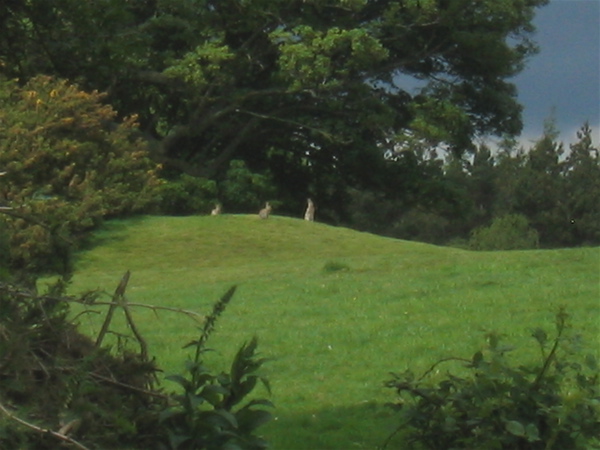
Difficult to make out, but there’s def a earth circle in the centre of the photo. Hut circle or barrow – I know not! Located in the field approaching the site and huff and puffingly uphill.

That’s the first bank, on the other side of the fence.

Yep, it’s steep (they haven’t put that on the warning sign)

The earthworks begin on the other side of the road in the trees
The rain broke in the afternoon, and having some free time, I decided to scout the hillfort.
Herein lies the problem with some sites, some of them are private property (cue Marxist rants) and being of the opinion that it is better to err on the side of caution, I donned the trusty combats and DPM jacket and proceeded with caution in the horseless carriage up the road to the site.
Following the OS map, I meandered through the wonderful villages of the vale, made a few wrong turns (ok, nobody’s perfect), doubled back and eventually made landfall near the site. Parking in the access road for St. Mary (blesséd be her name) Lodge, I clambered out of the motor and grabbed the faithful digi (including spare battery) and eyed the landscape.
A hedge and a barbed wire fence pose little issue with a country lad, so I tramped in a straight line across from the motor and launched myself through the hedgerow and over the wire.
The field had many established trees in it (and a herd of cattle who thankfully were far away to my right – bulls and bullocks can be troublesome), and I could see the rise of the topography clearly ahead. A cracking view of Uffington and the White Horse is clearly visible from here. Was this place in opposition to the Atrebates? With the river Thames and its tributaries being the possible tribal boundary, it may be and it’s obvious from this hillfort location, that you could keep an eye on Uffington.
Across another fence (with the music from mission impossible rattling around me skull) I came across a road and could see the tell tale embankments of a hill fort in front of me. Being conspiciously camoflaged, I looked left and right and with confirmation of the coast being clear, dashed across into cover.
The whole site is very overgrown with mature trees and established ‘jungle’. This makes it very difficult to work out what it what and where is where. A little tree strewn valley led me up to the earthwork. It seemed small to me, until I realised that I was on the edge of the fort and not in it (init!). The bunnys had moved in and there was plenty of burrows to see.
I explored more and found a fence with open fields beyond. Was that it? Cos it seemed a tiny hillfort to me. I realised that the piece I’d been in was just part of the complex. Beyond the fence I could see the buildings of a large private house and more earthworks. Keen to explore without being exposed, I followed the fence line (crossing more barbed wire) and could then see the bigger picture. This hillfort runs the length of the contour and I’d just been at the beginning!
The ditches and banks are less defined than, say, Uffington, but if the field beyond is the interior of the fort, then it’s a biggy. Being in full view of the house didn’t seem like a good idea, so I grabbed some snaps (the bunny’s didn’t mind at all) and headed back whence I’d came to explore the other side.
A lovely tree lined avenue headed towards the house and looked tempting, but I avoided the temptation and went back to where I started. Whoops – a car came up the drive and I mingled nicely into the background. The site is adjacent to the road and every engine noise put me on edge.
I footed back over my original path and looked at the field below the site. Like all hillforts, you can see the problem with charging uphill and attacking – you’d be exhausted before you reached the fight!
I did spot a lovely earthwork circle in the field below. Didn’t look like a barrow, but def a circular earthwork of some description. Maybe it was a hut circle? Feeling vulnerable in the middle of a field with no cover, I twitched as another car came up the drive – better safe than sorry I thought, and I guess my luck had run out, so I headed back to the car and over the hedge and barbed wire. Sat in the car, I couldn’t help thinking that I might be a looney-tune, and that it was OK to go a stomping and that we have a right to see our heritage. But, I know how precious landowners are ‘bout their little bit of land, and I know gamekeepers that carry shotguns (OK, so I’m a big rabbit) and was thankful that it’s better to be ‘invisible’ if you can.
I guess it’s a different mentality than wandering moors and fells, were nobody gives a toss what stones or lumps and bumps you’re looking at, in the South it’s more a case of ‘Get orf MY land’... or else!
And was it on a Mary or Michael Ley Line?
Dunno
WF