moss

moss

All posts expand_more 551-600 of 707 posts

Miscellaneous

Hill of Tara

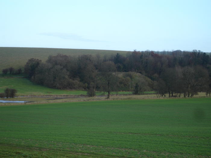
A Poem addressed to the destructive process of the new road being built through Tara’s historic landscape. Sacred to prehistory and to the history of Ireland, for this a few protestors will go to prison, people will write letters in vain to newspapers, and politicians will procrastinate and write their lies...... it is wise to remember that progress has a heavy boot to wield and often hasty and ill-concieved laws to underwrite the handiwork of the bully and developer...... the poem is taken from the Save Tara site.

Song to Progress

no swan , no snail must stop this dash
to tear around with wads of cash
and get at speed from A to B
and not to Dawdle pointlessly
So – move Along ! – wont it be Grand !
when Ireland’s just like Legoland

my work will only be Complete
when Boyne to Liffey’s all Concrete
and Shoefayre stands where Fianna fell
and Leisureworld – and Next as well
IKEA – if we’re really lucky
and drive-in Chicken from Kentucky
THIS is what we want to see
not grass and trees and history
but modern stuff – and this and that
and things on which we can put VAT
and if you want to get more slim
why walk ? – just buy a Multigym
When we’re encased in cans of steel
both hands attached to steering wheel
and eyes fixed on the road ahead -
we may as well be effing Dead
this stretch of road – built over bones
is one of many thousand clones
did we just pass the Lia Fail ...?
it could be anywhere at all
just sit like this an hour or two
as if you’ve nothing else to do
and work and work all day and then
stay sober and drive back again
a quarter million cars a day
is JUst what Dublin needs I say !
aMAZing what they get to pay
to park the things – we’re making hay !
cos there’ll be car parks to be built
and lots of pockets to be filled
there’ll be no end to means and ends
cos its so nice to have good friends

there is a railway – but you see
it closed in nineteen sixty three
it could be opened up again
but that somehow doesnt seem to happen

Mad Suibhne sitting in his tree
is keeping feathered company
he watches as the human race
is drifting loose from sense of place
and capsulated in a car
of who and where and what we are
so every weekday without fail
we slave to buy a better jail
or hang on to the one we have
by hook and crook and tooth and nail

and so far is now the space

and so far have we come apart

we even think to cut the Heart

“Progress”

?
though feathered Suibhne looks absurd
he doubts if it’s the proper word

marcellavee 1/08/07

Ebbor Gorge

Take the road to Priddy from the Wells Road, and as you drive through this stonewalled landscape remember that you are entering a truly prehistoric landscape that goes way back into the past. Barrows, swallet holes, Priddy Circles and of course caves and rock shelters.
If you drive into the village of Priddy, stop for a moment and admire the large village green with an old fashioned farm on the other side. Drive up the hill to the church, and there is a barrow sitting in the field next to it. But to find the lane to Ebbor Gorge, you must take the first lane sharply left just as you enter the village, drive past the picnic place on the highest point of the hill, and descend down for a few hundred yards till on the left there is a car park for the Gorge.
The “scramble” walk is well indicated, you descend into the wooded depths of the gorge, high trees, dark green luscious growth and ferns on old fallen trees, patches of open ground gleaming pale in the sunlight, the white perfumed meadowsweet that loves boggy ground is on show. Then the scramble, you enter the narrow defile of the gorge where the shelters are situated, and begin to climb sharply over great natural stone steps with the sheer rock faces on either side, where there is sun the blue flowers of the nettle leaved bellflower cluster at the path’s edge and a small stream trickles down the steps, at one point the path becomes so narrow between the rocks that it looks impassable.
The shelters are dark and gloomy places, Victorian grottoes comes to mind, Neolithic and Bronze age finds have been found, perhaps they were more burial place that living quarters. Upwards to the viewpoint over the gorge itself, steep, steep cliff like faces of rock covered with vegetation and tall trees in the gorge below, gives it a rainforest look and of course there is also a  misty view to Glastonbury Tor with Wearyall Hills’ long length blending into the landscape.
If you drive back to Priddy you should see some of the Nine Barrows on the horizon, turning left from the carpark takes you to Wookey Hole, and not too far away is Westbury Sub Mendip, where I believe half million year old bones were found…..
Its a middling demanding walk, steep paths and a bit of rock climbing.

Miscellaneous

Lugbury
Long Barrow

The following taken from George Witt’s Archaeological Handbook of the County of Gloucester 1882; he places it under the name of Littleton Drew Barrow.

“This was first noticed by John Aubrey in his MS., “Monumenta Britannica,” in the seventeenth century; it was called “Lugbury.” It lies in the parish of Nettleton, but close to Littleton Drew, in Wiltshire, just outside the boundary of our county. •It measures 180 feet in length, and 90 feet in breadth, its greatest elevation being six feet. Its direction is nearly due east and west. There are three stones at the east end, on the slope of the barrow, thirty feet from its base; the two uprights are •six feet six inches apart, two feet thick, and four feet wide; one is •six feet six inches high, the other •five feet six inches. Resting on the mound and leaning againstº the uprights is a large stone, •twelve feet long, six feet wide, and two feet thick. A cistern was discovered •about sixty feet from the east end, containing one skeleton. Another cistern was found on the south side. Three other cisterns were also found, •about ten feet long, four feet wide, and two feet deep, formed of rough stone. The total number of skeletons found numbered twenty-six. Several flint flakes were also discovered. ”

Stonehenge Update from Rescue News – Summer 2007

English Heritage’s Appeal against refusal of planning permission for its new Stonehenge visitor centre has been allowed and planning permission granted by the Secretary of State, subject to 58 conditions and a Section 106 Agreement between Salisbury District Council and the applicant. This is absolutely no surprise to objectors to a scheme that is part of what has become a very expensive Stonehenge Project led by the Government acting as both promoter and decision-maker....

savestonehenge.org.uk/rescue102.html

Miscellaneous

Uffington White Horse
Hill Figure

“There seem to be few genuine traditions attached to the Horse, for its ‘traditional’ attribution to King Alfred is almost certainly due to Francis Wise in 1738 and is not mentioned by Baskerville or Defoe”

Can’t let that pass, the person who wrote it had obviously not read Jacquetta Hawkes on the subject or H.J.Massingham – two favourite books, if you want to read about the emotional love affair people have with their English countryside ;) look no further than early 20th century literature.
The scouring ceremony is first mentioned by Aubrey and the best early record dates from 1677 when Baskerville wrote;-
“Some that dwell hereabouts have an obligation upon their hands to repair and cleanse this Lande marke, or else in time it may turn green like the rest of the hill and be forgotten”
The Uffington White Horse sired nearly every other 18th century chalk horse in the district!

He holds within his image, the beautiful celtic curvilinear design to be found on the horse furnishings around this area, he can be called a Saxon horse because of association with King Alfred and white horses, and of course he belongs to St.George and his dragon. His various mythical and magical guises link him to gods and harvest ceremonies....

Carreg Samson

Carreg Samson is a favourite, wander round the cliff path from the village, the farmhouse route looks pretty boring. Chunky is the best way to describe the dolmen, standing at the head of a small pretty valley that runs down to the
sea, the great capstone perched on three of the seven large uprights forms an oval/polygonal chamber. It dips towards the bay and Strumble Head, dominated by the peaks of Garn Fawr, Garn Gilfach and Garn Wnda, again the siting of the tomb is not on high ground, its reference point seems to be easy accessability to the sea and stream that runs down a few yards away. The chamber being constructed over an irregularly cut pit, stones that may have been found in the chamber could be put down to the fact that it was recently recorded that it was used as sheep shelter and had drystone walling inserted between the stones. There is no direct evidence for a covering mound but Nash suggests that the elongated shape of the stones points to a covering mound, not unlike Pentre Ifan
Three of its stones are of similar material and stand in a small row together, whether these stones are part of an earlier monument I don’t know but Figgis says
that there was some mesolithic flintwork found within the tomb, so perhaps it points to a ‘returning place’ which had special significance.

ref; Neolithic Sites – Geo.Nash and Geo.Children
Prehistoric Preseli – Figgis

Pentre Ifan

This is a chambered long cairn and the remains of its mound can still be seen. Set high on a hill, with, at the moment,(which must have been in March 2007) hundreds of sheep and lambs cavorting around, this is one of those spectacularly rocky places, with stones protruding from the ground everywhere. Soft turf and chunky stone walls add to the charm of the surrounding rather deserted countryside. The capstone looks rather like a flying saucer, elegant with two shaped orthostats framing the stone portal door, this is seen as a sophisticated design, but perhaps we are looking with modern eyes, given the chunkiness of Coetan Arthur and Carreg Samson’s capstones, the ideal of beauty is in the beholders eye. Who is to say; maybe the neolithic builders felt that the erection of great heavy capstones was a work of great physical strength and prowess and deemed far worthier than puffs of the wind sailing capstones that Pentre Ifan represents.
Its capstone is tilted towards the Afon Nyer Valley to the north, the chamber being about 3 metres long by 2 metres wide. It was originally cut into the ground about 40 cms and lined with drystone walling, but has recently been infilled.
There is a blocking stone(doorway) in the forecourt area. Apparently there is supposed to be a cupmark on its outer face, but have stared long and hard could’nt find it- so I shall put it down to wishful thinking on someones part.
According to Nash it is a terminally chambered long cairn with a semicircular forecourt set in the southern end of the barrow – a Closed Portal Tomb. Glyn Daniels compared it to the so-called “horned cairns” of Carlingford in Ireland. Not surprising really its just a short hop over on the ferry to Ireland. Interestingly he also suggests that our more easterly Severn-Cotswold tomb group is derived from the Pentre Ifan type, perhaps that is why I am always drawn to this part of Wales – the sense of the familiar.
Grimes, another archaeologists who trod the ground round Somerset as well, excavated in 1936 and 1958, and he described the forecourt where ritual feasts may have been held, it consisting of two orthostats placed either side of an entrance, itself blocked by the massive ‘closing’ door. This door is of course speculated upon wildly by archaeologists, maybe it was open on occasions to bring in bodies that had been stored elsewhere. Maybe, it was a great chieftans tomb, with his retainers being sacrificed with him (bit dubious). Or in fact was a false door, the bones of the dead being inserted from the side of the mound, similar of course to the Rodmarton ‘porthole entrance’ or the Lanhill longbarrow.
The mound does not survive, but could have measured about 40 metres long by 17 metres wide. There are traces of kerbing stones, but they do not always align with the mound, and it could be linked with possible ritual pits.
Nash points to the dip in the capstone and the slope of Carningli, both point to the sea and the Afon Nyer Valley. This I could’nt see, being misty and very cold but I did find one of the fallen stones rather beautifully white with lichen and, a bit like a ‘jewel ‘stone, a rather rounded female stone

p.s.N.P.Figgis in Prehistoric Preseli gives another theory; there is a fallen stone, that remained in situ as the stones of the burial chamber were put up. This may have been a first phase, a single standing stone with a fire pit near to it, making this a dual mortuary site, or at least, a site that was in use over a long period but again all conjecture, with the stone being part of the first chamber building and single unembellished facade, with short mound. “The latest elongated tapering mound, and the elaborate facade covered the whole of the earlier structure”.

ref; Prehistoric Preseli N.P.Figgis
Neolithic Sites – Geo.Children and Geo.Nash

Carreg Coetan Arthur

When people write about this small dolmen they talk of mushrooms and fairies, and it does indeed sit tranquilly in its own little garden surrounded by a surburban small settlement of bungalows. Coetan Arthur was excavated in 1981, there had been a build up of plough soil over the centuries and in fact, the stones would have had another metre added to their height originally, making them much taller than they are today. There are four stones theoretically supporting the capstones, but only two are in contact.
One of the marvellous things about neolithic builders, is their ability to balance a huge capstone on a fine point. Think of a stiletto heel, its fine point bringing all that excruciating pain on to someone’s foot, the weight of a person concentrated on a small round five pence bit. So it is with the capstone pressing its enormous weight down, thrusting it through the upright to secure thousands of years permanency – it gives one pause for thought.
Carreg Coetan Arthur is low-lying, just eight metres above sea level, close to the Afon Nyer estuary and about half a mile from the coast. To the south is Carningli, and the usual legend has been attributed to the stones, that they were thrown from the summit of the mountain. According to George Nash, the capstone when aligned with Carningli peak seems to match it.
Turning to N.P.Figgis on the subject, he cites a recent excavation which gives Carreg Coetan Arthur a somewhat different history. It had been presumed up till recently that the tomb had a closing ‘portal door’ and that its corresponding upright stone had disappeared, it was in fact an ‘H’ shaped portal dolmen similar to Pentre Ifan. It seems though that there never was a third stone, so no portal door. An arc of small stones had been laid like a kerb to the south round the remains of the mound, and between it and the now supposed ‘front’ of the chamber a space had been cleared. In front of the chamber had been a platform with some pottery and ‘clumps’ of cremated bone.
Radio-carbon dating gives the early date of 3500 years old for the construction – middle neolithic. But also inside the chamber there had been found much later Grooved Ware and Beaker Ware, showing that it had been in use over a long period of time.
Figgis goes on to speculate that perhaps we should not fall into the easy trap of labelling these sites as chambered tombs, but that they may have had a mulitiplicity of functions, which is little understood today.
refs; Neolithic Sites of Cards.Carms.Pembs.by Geo.Children and Geo.Nash; 1997 Logaston Press.
Prehistoric Presili (a Field Guide) N.P.Figgis 2001 Atelier Production

Miscellaneous

Wayland’s Smithy
Long Barrow

Wayland Smithy is a place that has a haunting atmosphere, and as I am reading a Peter Please book at the moment, he is a ‘wayfaring soul’ of Bath much given to walking the Wiltshire countryside,I thought it would be nice to recommend his book; “The Chronicles of the White Horse”, written for children and adults it is a good book and the story culminates at Wayland’s Smithy...
In the following quote he invokes the bloodied hooves of the horse pounding between the standing stones, calling the dead and all things that have ended back into the barrow....

“I was at the door of the manger, the horseshoe chamber of Waylands. Not a grave, but a door,
a passage between two worlds; a spirit cavern for the dead and all that is dying....

and on a happier note;
“I heard the bells ringing in Wayland’s Smithy. I heard the larks above White Horse Hill.I saw the flowers opening. I saw the barley growing. I saw the lambs in the meadows. I heard the earth singing. And even when the last of the light had faded to a pinprick in the sky, and the last of the stars had disappeared.....
Myself when I wrote about it found it an utterly peaceful place but I expect it was because there were no people around – dead or alive ;)

Stonehenge; Heritage Action Alert

Plans for vast irreversible changes to the surroundings of our national icon “in time for the Olympics” are fully in place. Most heritage and archaeological bodies, with the extraordinary exception of English Heritage, are totally opposed to them. Yet final government confirmation may be imminent......

the rest of the article can be read here;

heritageaction.org/?page=heritagealerts_stonehenge

Miscellaneous

Martinsell
Hillfort

“Neolithic Dew-ponds and Cattleways.” The brothers, Arthur and John Hubbard, wrote this lovely book, though its facts are slightly on the wild side, at the beginning of the last century, they diligently recorded the cattleways and dewponds around such places as Cissbury, Chanctonbury and Maiden castle hill forts. Wolf platforms; Maybe they got it wrong, but wolves, can you not see them, like great lions guarding the gates of Martinsell hillfort, really does send the imagination racing.

“The month which we now call January our Saxon ancestors called wolf-monat, to wit, wolf-moneth, because people are wont always in that month to be in more danger to be devoured of wolves, than in any other season of the year; for that, through the extremity of cold and snow, those ravenous creatures could not find of other beasts sufficient to feast upon”
Richard Verstegan
“Restitution of Decayed Intelligence in Antiquities 1673”

Image of Martinsell (Hillfort) by moss

Martinsell

Hillfort

Imaginative reconstruction of a Neolithic settlement on Martinsell Hill, note ‘wolf platforms‘

Image credit: Arthur John Hubbard 1907

Discovery of a Henge under proposed route of M3

Press Release;

The Campaign to Save Tara is very pleased at today’s announcement that
construction is to be stopped on the proposed route of the M3 through
the Tara/Skreen Valley. Under the National Monuments Act the
archaeologists contracted by the NRA were forced to declare a likely
National Monument has been discovered. It had been the Save Tara
Campaign that first alerted the National Museum to the potential
significance of the Liamullen site, a wood henge which is within 100mts
of the Rath Lugh monument, and directly within the path of the proposed
motorway. It is known that the Museum immediately contacted the NRA
seeking information on the find. Henges are generally used for
ceremonial activity and this directly links the Valley with the top of
the Hill of Tara where a similar henge was found by the Discovery
Programme archaeologists Conor Newman and Joe Fenwick.
This Government does not exactly have a stellar record in dealing with
heritage or archaeology and the amended National Monument Act of 2004
gives the Minister permission to destroy this precious area. The
Campaign would ask again that any construction by held off until the
election is over and a new Government may be put in place.
The Lismullen site had not been accurately identified during the initial
archaeological survey of the route and the discovery of a henge almost
80mts in diameter and comprising of two concentric circles caused
surprise to the archaeological contractors and near-apoplexy at the
National Roads Authority. It would appear that there are underground
passages associated with the henge.
Michael Canney from the campaign said: ‘Everybody knew that this route
was destined to destroy the landscape of Tara if it went ahead. The
advice of national and international experts was ignored. This route was
chosen because it was favored by local politicians and businessmen. That
this monument has been discovered is more by accident than by design and
many other sites that were of significance have been hastily and
inadequately surveyed. We now can on the Government and the NRA to
abandon this route – admit they have made a serious mistake and act
properly and positively to protect our heritage.‘
Mr. Canney continued: ‘Minister Cullen and the NRA must now admit that
this road is wholly inappropriate for the landscape of Tara and initiate
a review of the whole project. The people of Meath deserve to have a
decent rail transport system and the line to Navan should be re-opened
immediately. This road would have done nothing to create local jobs, and
in fact would have exacerbated the multitude of problems faced by the
people of Meath regarding planning and transport.‘
Muireann Ní Bhrolcháin
Campaign to Save Tara

Miscellaneous

Ffyst Samson
Chambered Tomb

As you can be see, I didn’t find the cromlech, it is apparently but a few metres east of the rocky tor/outcrop on above photo which obviously gives the cromlech its significance according to Neolithic Sites of Pembs., Children & Nash). To get nearer the outcrop would have involved pushing through three lots of barbed wire plus climbing stone banks – something the Welsh farmers really get cross about!

Given its narrative within the landscape, (some cromlechs are hidden from view) this one, according to Children, its importance is linked with the rocky outcrop. It was not a visual concept, such as Carreg Samson maybe, but one constructed through ritual and symbolic knowledge of the landscape.

My interpretation of what he means by this, is that the shape of the outcrop is similar to the shape of a burial mound. Similar tor like shapes are found on the Preseli mountains – natural places being seen as the burial stones of long dead ancestors.

Miscellaneous

Cissbury Ring
Hillfort

Neolithic mine shafts; to add to Rhiannon’s post, my book says there is a line of 39 shafts to be seen outside the south entrance of the fort. Some of the shafts go down 40 feet through the chalk, cutting through 6 or 7 seams of flints, with galleries radiating horizontally from the main shaft. Apparently there were two burials down there (one maybe accidental fall), no serpents though.
Iron age;60 acres roughly egg shaped, with two banks, and ditches, 250 bc. In its first form the chalk rampart stood 15 feet high and faced with vertical timbers, also had tie beams as well. The ditch, separated by a berm, was 10 ft deep into the chalk and about 25 feet across.
Fell into decay after 200 years, and was ploughed in the roman period, with the iron age ‘celtic’ fields in and around the fort. Then refortified for a short time at the end of the roman period against the Saxons this time, they won the day of course because there are saxon burial mounds on the Chanctonbury Ring Fort.
A guide to Prehistoric England Nicholas Thomas;

Miscellaneous

Buzbury Rings
Hillfort

According to Nicholas Thomas – A Guide to Prehistoric England, this is a hill-slope fort and boundary ditch. He goes on to say that it is interesting because it is the only example in Wessex of this type. He also says its less defensive more to do with the herding of cattle, similar to ones found in Cornwall, Devon and South Wales. Date approximately 2nd-1st Century bc.
Two main earthworks – outer one, kidney shaped enclosing 12 acres, and an inner one roughly circular, but not concentric with the outer one, 2.1/2 acres.
A series of ditches radiate out from the Rings, could be late B/A but more likely iron age, being a ‘celtic’ field system, apparently the west ditch is probably the track down to the river for watering the cattle presumably...

Miscellaneous

Poundbury Hillfort
Hillfort

The earthworks enclose about 15 acres. Two lines of ramparts on all sides except the north, which is protected by the river Frome and only has one (though two ditches). Original entrance through the east inner rampart, close to the mouth of the railway tunnel (quoting here from 1960’s book). Its one of those interesting hillforts that has timber revetments on the inner rampart, which is built of chalk and has a berm between it and the ditch. Probably 13 foot high, with a corresponding depth for the ditch. This work carried out 3rd century BC (maybe contemporary with Maiden Castle).
Then just before the roman conquest an outer ditch and bank was added, and the inner bank widened and heightened, AND a limestone parapet was built on the crest.
There is a story waiting to be written here.... apparently, according to the book, those responsible for this reconstruction were the Durotriges tribe who had seized Maiden Castle. Poundbury was important because it overlooked a ford across the river.

ref;A Guide to Prehistoric England – Nicholas Thomas- Batsford 1960.

Miscellaneous

Abbotsbury Castle
Hillfort

A hillfort and a Roman signal tower?. Triangular in plan, its defences encloses 4 and half acres. On the N.S. and E. the earthworks comprise 2 banks with a ditch between them. At the S.E. level ground has caused the building of four ramparts with ditches outside them.
Maybe Roman bit; At the S.W. earthworks have been altered at some later stage so that an almost square earthwork has been constructed in the angle of the inner bank.
Within the hill-fort to S.E. are a group of about 9 circular depressions could represent site of huts B/A? south west of them is the mound of a bronze age bowl barrow.. Presumed Date; 250-50 bc.
Taken from A Guide to Prehistoric England – Nicholas Thomas 1960.

Image of Carn Meini (Rocky Outcrop) by moss

Carn Meini

Rocky Outcrop

The modern bluestone lifted by helicopter in 1986. A fragment of bluestone picked up on the path, is a beautiful grey blue colour, it is smooth and very tactile in its fresh state, almost slate-like.

Devizes Museum; Uncertainty At Wiltshire Heritage

Just before Christmas the Wiltshire Archaelogical and Natural History Society, which maintains the Wiltshire Heritage Museum, library and gallery in Devizes, heard from the county council that their grant for 2006/7 (£24,500) would not be renewed in 2007/8. One of the oldest of its type in the country, the society was founded in 1853 and has been at its current premises since 1873. Its Stourhead Collection, finds from excavations around Stonehenge by William Cunnington and Richard Colt Hoare, is recognised as one of the most outstanding groups of prehistoric artefacts in Britain. The society said the grant withdrawal threatened the future of the museum.

From British Archaeology March/April 2007

Miscellaneous

The Great Circle, North East Circle & Avenues
Stone Circle

The following information is taken from Jodie Lewis – Monuments... The Neolithic of Northern Somerset..
3 circles, 2 avenues, a cove and a henge, with of course the geo-phys’d timber circles. Great stone circle has a dia; of 112.2.m and has 26 stones, the great avenue is 49 m long and 10.4.m wide. It could well be that the timber, stone and earth phases are contemporary, with the inner sacred centre of timbers (either in situ/or rotted) being the focus round which the stone circle and the henge (for viewing) were viewed. The open/closed nature of the central timber structure could be augmented with hurdles/planks for hiding rituals. But of course timber and stone periods might be different, the stone circle just acknowledging the sanctity of the older timber circles
North-east circle is 44 m to the n/e and has 8 very large stones, the largest in the complex, diameter of the circle is 29.6.m. One of the things to be noticed about these stones, no female/male typology, just large square blocks of stone. Leading from this circle is the n/e avenue with 7 stones. Apparently in the centre of this circle were 4 anomalies (maybe pits) sharing an alignment as the four pairs of stones that are the circle, but these circles had orchards around them so therefore tree remains cannot be ruled out.
The South west circle is recorded in 1881 as having some of its stones removed for the fencing round an orchard, so presumably stones have been moved around. It lies 137,2 m s/w of the great circle, has a dia. of 44.2m and is comprised of 12 stones, and Jodie Lewis goes on to say stones have almost certainly been moved around. Again geophysics noted 3 concentric rings of pits within this circle, so again presumably another timber circle within the bounds of a stone circle.
Note; this is written down, not just for anyone reading it but for those two young men sheltering from the cold wind behind a stone (one playing some pan pipes) when I was there last autumn and when they asked for an explanation – did my best at the time but did’nt have the book...

web.arch.ox.ac.uk/archives/underhill/viewarchiveslide.php?imageID=26&albumID=1 map plan in the Underhill Archives showing the Avenue

As a note; Stanton Drew circles do not seem to relate to any outstanding landscape feature, such as Maes Knoll, but are focussed towards the river Chew, Jodie Lewis makes the point that at certain times of the year, due to flooding, the river turns red from the clay and soil leaching into the river., this would give it a significance as a meeting place (there is lithic scatter found near the site). This river also joins the River Avon further down at Keynsham were ammonites are found, such as the one at Stoney Littleton.

Part of the henge can still be seen in the foreground of Morfe’s photo;

themodernantiquarian.com/post/44696

Cherhill Down and Oldbury

Cherhill Down is a place close to my heart -might even get my ashes scattered up here one day – as a landscape its totally weird, those folds of the hills that seem to draw you down into a vortex. The hillfort when visited last November was full of sheep and the day was misty, its part of the Avebury landscape that is thankfully untouchable because of the terrain.
I can see the monument from the downs round Bath, a good 30 kms away, and it is always a reminder of the nearness of the prehistoric settlements round here, Avebury, the Mendips, Cotswolds, Stonehenge and Salisbury Plain. The movement of people through the high lands with the marshy ground below, visiting each other at certain times through the year,, generations of people living in a landscape that provided for them. They melded the land into a place of permanent homestead, from the early beginnings of the causewayed enclosures of Windmill Hill and Nash Hill down to these large defensive iron age hillforts.
Practical facts; 25 acres defended by two banks and ditches, with an inturned entrance on the East. Area enclosed is divided across by a small bank and ditch running N/S (probably not contemporary) Pottery of 2nd/3rd century bc has been found in rubbish pits inside.

The Stonehenge Riverside Project

Saturday 9th December 2006

A lecture re-assessing the local and regional associations of Stonehenge, by Prof. Mike Parker Pearson, Professor of Archaeology at Sheffield University.

This is a fundraising lecture in aid of the Wiltshire Heritage Museum.

The Stonehenge Riverside Project is exploring and re-interpreting the archaeological evidence of the landscape around Stonehenge, Woodhenge and Durrington Walls. As a result of these investigations new theories regarding the purpose of Stonehenge have been put forward. One of these suggests that Stonehenge was linked via avenues and the River Avon to Durrington Walls, a Neolithic monument with timber circles, as part of a funerary and processional route. Stonehenge may, therefore, have been built not for the living but to commemorate the ancestors, their permanence being materialised in stone.

Prof Parker-Pearson is Professor of Archaeology at Sheffield University and as one of the team-leaders of the project is closely involved with the excavations that have taken place at Durrington Walls over the past few summers. He is an internationally renowned expert in the archaeology of death and also specialises in the later prehistory of Britain and northern Europe. He has published more than 10 books and over 100 academic papers on a variety of topics.

This lecture will be held at Devizes Town Hall.

Visit www.wiltshireheritage.org.uk/events to find out more.