Image credit: Cissbury Ring-Tim Knight-Secret Landscape Photography

Taken on a rare visit outside of Cornwall.
secretlandscape.co.uk/sussex.php

Panorama of the entrance earthworks on the South Eastern side. This is the entrance/exit they would have used when popping down to Sainsburys.

Panorama from the ramparts on the Eastern side of the fort looking North.

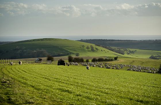
Panorama looking North West with the track to Chanctonbury Ring across the Downs visible to the right.

A rough-out found among rabbit diggings. Mrs. Windsor for scale.

Neolithic Dewponds & Cattleways 1905..
Title not to be taken too seriously.....

A 360’ panorama within the interior of the fort showing some of the numerous pits left by back-filled Neolithic flint mines.

Looking South towards Worthing and the sea.

You only get an idea of just how large these pits are after a bit of scrub clearance.

One of the larger hollows looking West towards Church Hill across Findon Valley.

The rather fabulous model of a flint mine in the Worthing Museum & Art Gallery!

4x4 owners – dontcha just lovem!

Panorama from the top bank looking south towards Worthing and the sea.


Plundered barrow in the North East part of the ring

The South East entrance

Looking south towards the South East entrance

View looking across the South Downs to the south east

View from the ramparts looking south east towards Church Hill and the back-filled flint mine-shafts to the right


The view westwards from Cissbury ring at sunset on 19th June 2007, during the start of a thunderstorm.

One filled-in entrance of over 250 Neolithic flint mines within Cissbury Ring

17 May 2003 The outer Ditch and Embankment in the descending mist.


Cissbury Ring from Chanctonbuy Ring
An ancient hill fort dubbed “one of the jewels in the crown” of the South Downs National Park has been damaged, police have said.
Illegal metal detecting is believed to be behind the disturbance to the ground at the 5,000-year-old Cissbury Ring site near Worthing in West Sussex.
More: telegraph.co.uk/news/2016/11/25/illegal-treasure-hunters-damage-ancient-hill-fort-south-downs/
Hundreds of people have staged a protest on land near an Iron Age hill fort in a bid to stop it being sold and keep it in public ownership.
Worthing Council has already said it has suspended the sale and will also review the decision to sell farmland near Cissbury Ring, in West Sussex.
The council said the review was because of public concern about the site.
The South Downs Society said it was a famous archaeological site that needed to remain in public ownership.
The group, Stop the Cissbury Sell-Off (SCSO), said about 400 people gathered for the rally and walked across the land in question, letting off flares.
SCSO spokesman Trevor Hodgson said there was strong feeling and a “massive turnout” by people who had vowed to fight on until the land was fully protected for generations to come.
Worthing Council said the decision to sell two parcels of agricultural land, 57 and 132 acres in size, was taken following the death of the former tenant farmer.
The council said the review would consider fresh options and talks would be held with the South Downs Joint Committee and the National Trust.
Mr Waight said: “Because the decision was made a year ago and because of public concern, we feel it right to review the decision made over a year ago in order to make sure we take everything into account before a final decision is made.”
Spokesman for the South Downs Society, Steve Ankers, welcomed the move but called for a permanent halt to the sale.
He said: “It is essential that this important site remains in public ownership. Cissbury Ring cannot survive properly on its own.”
He added: “If it was sold, it could end up being fenced off into unsightly paddocks with no access for the public.”
Cissbury Ring is one of my favourite walking places in West Sussex. Standing on the South Downs and within walking distance of my home town of Worthing it’s an excellent place to wander and refresh yourself. Even in the depths of winter you’ll find some hardy folk along with their canine companions walking the ring or brivetting about in the undergrowth. It’s quiet seclusion also offers spectacular views in all directions covering the Downs, the sprawl of the south coast conurbation from Brighton to Bognor Regis and on a clear day you can even see the Seven Sisters to the east and the Isle of Wight to the west.
Hard to believe then that this was once one of the powerhouses of Neolithic industry in the UK. Though entered on TMA as an Iron Age hillfort it actually began it’s fantastically varied life as a source of raw flint in the Neolithic era and the south western area of the hill bears testimony to this with it’s hundreds of shallow, and sometimes enormous, pits. This ‘moon-cratered’ surface represents the backfilled shafts of flint mines dating back some 5000 years and although not visible today some of them were between 40-45 feet deep and gave onto galleries and chambers that sometimes connected to other shafts. Cissbury and the nearby Church Hill and, slightly further afield Harrow Hill and Blackpatch, were some of the primary sources of flint throughout the Neolithic period. Only the slightly later mines at Norfolk’s Grimes Graves were any significant rival. The quality of the flint mined here was obviously very high as mining continued well into the Bronze Age and tools created from the flint have been found across Britain and mainland Europe. Between the four Sussex locations there were probably in excess of 400 shafts. Some of these were the subject of a number of archaeological digs between Victorian times and as recently as the 1970s. The earliest interest for the Cissbury site comes from 1849 when the Reverend Edward Turner, addressing the Sussex Archaeological Society, stated confidently that the hollows were formed for ‘Druidical celebrations’ but didn’t specify what these might be! The first excavations were carried out in 1857 by George Irving, but he failed to get to the bottom of the pits both physically and metaphorically and interpreted them as ‘animal pens’ due to the finds he came across. In 1867 Colonel Augustus Lane Fox was the first person to suggest that the pits were associated with flint mining while investigating hillfort construction on the South Downs, but he too failed to fully excavate the mines to their actual bottoms. However, the discovery of shafts beneath the fort’s ramparts made them realise that the shafts pre-dated the Iron Age and discovery of a polished axe within the ring and to the east of the pits firmly planted the shafts in the Neolithic era. Ernest Willet, who in 1868 had been looking at similar features to Lane Fox on nearby Church Hill, began working at Cissbury in 1873 and was the first person to get to the bottom of a shaft after digging down 4.2m through the back-fill in one of the earlier excavated pits where he discovered a series of chambers and galleries. Sadly his site notes from the dig were lost. More diggers came and went for the next 60 years but one of the more interesting figures to explore Cissbury was a local working class self-taught archaeologist named John Pull. He’d already achieved notoriety in the area following his discoveries at Blackpatch in the early 1920s and suffered at the disparaging hands of the Worthing Archaeology Society for his methods and site recording procedures. Most of this was down to pure snobbery on the Society’s part and given the towns Conservative nature hardly surprising. He did however rejoin the Society in 1947, taking over as president in 1952 and started new works at Cissbury the same year which gave rise to the most comprehensive studies of the Cissbury mines ever undertaken. Sadly he was shot dead in a bank raid in 1960 while working as a security guard at the Durrington branch of Lloyds Bank. For further intriguing reading on the subject take a look at Miles Russell’s fascinating book ‘Flint mines in Neolithic Britain’ (Tempus Books, 2000).
Camden points out [..] a confusion in the case of [..] a place in Sussex, ‘a military fort compass’d about with a bank rudely cast-up, where the inhabitants believe that Caesar intrench’d and fortify’d his Camp. But Cisbury, the name of the place, plainly shews it was the work of Cissa; who was the second King of this Kingdom, of the Saxon race, succeeding Aella his father.
Camden’s eighteenth century editor interpolates an account of another* Caesar tradition in Sussex: within a mile of Findon ‘is an ancient Camp, about two miles distant from the sea. It is call’d Caesar’s-hill, because the people imagine it was Caesar’s Camp; and they pretend to shew the place where Caesar’s tent was. Notwithstanding which, the form of it shows that opinion to be ill grounded; for, being roundish, it seems rather to have been a British work.‘
p224 in
Local Caesar Traditions in Britain
Homer Nearing, Jr.
Speculum, Vol. 24, No. 2. (Apr., 1949), pp. 218-227.
*surely the same – because Cissbury ring is very close to Findon.
At Offington, near Worthing, an old seat of the Delawarrs, a blocked-up passage, which can only be approached from the cellars, is still believed to communicate with the encampment on Cisbury Hill, and to be full of buried treasures. Some years ago there was a story current of the then occupier of the house having offered half the money to be found there to anybody who would clear out the subterranean passage, and that several persons had begun digging, but had all been driven back by large snakes springing at them with open mouths and angry hisses.
From ‘Some West Sussex Superstitions Lingering in 1868’ by Charlotte Latham, in ‘The Folk-Lore Record’ Vol. 1. (1878), p16.
I’ve read similar things, re an underground passages and snakes. It was also believed that fairies could be seen dancing on Cissbury at midnight on Midsummer Eve.
An underground passage was said to run from Offington Hall (now gone) and the ring guarded by large snakes insode the tunnel.
A highwayman before he was hanged vowed not to sleep in his grave. Somewhere near the middle of a road near Cissbury ring the corpse was buried, but next morning was found lying on top of the grave. The dead Highwayman would not rest and his career continued. On the command of an occupant of his carriage a driver drove straight towards the highwayman that tried to rob them, only to pass straight through him! Even worse those passing by the grave would see at the last minute a body in the road and unable to stop would runover it with a terrible clump. When they went back noone was there!
At Cissbury Ring there is a treasure concealed in an underground tunnel guarded by serpents. Perhaps this is linked to the extensive Neolithic flint mines on the western side of the hill? 250 blocked shafts have been found – up to 12m deep with side galleries.
The Ring itself is actually a lump of earth thrown off the Devil’s spade as he was digging his Devil’s Dyke.
from Janet and Colin Bord (in ‘Prehistoric Britain from the air)
Neolithic mine shafts; to add to Rhiannon’s post, my book says there is a line of 39 shafts to be seen outside the south entrance of the fort. Some of the shafts go down 40 feet through the chalk, cutting through 6 or 7 seams of flints, with galleries radiating horizontally from the main shaft. Apparently there were two burials down there (one maybe accidental fall), no serpents though.
Iron age;60 acres roughly egg shaped, with two banks, and ditches, 250 bc. In its first form the chalk rampart stood 15 feet high and faced with vertical timbers, also had tie beams as well. The ditch, separated by a berm, was 10 ft deep into the chalk and about 25 feet across.
Fell into decay after 200 years, and was ploughed in the roman period, with the iron age ‘celtic’ fields in and around the fort. Then refortified for a short time at the end of the roman period against the Saxons this time, they won the day of course because there are saxon burial mounds on the Chanctonbury Ring Fort.
A guide to Prehistoric England Nicholas Thomas;
As at Harrow Hill excavations produced some fascinating underground galleries and tunnels which may have given rise to the tradition of an underground passage. Antler picks found in the tunnels have been dated to around 3500 BC. The mines predated the Iron Age hillfort by over 300 years.
Cissbury Ring is one of the greatest of Britain’s prehistoric hill forts.
The banks and ditches which you see are are the remains of a vast defensive wall enclosing an area of 65 acres. The inner band is over a mile around!
“The first British Neolithic representational art? The chalk engravings at Cissbury flint mine”
Article by Anne M. Teather