Incredibly ‘Silbury’ like, these three remaining barrows are also made of chalk
Incredibly ‘Silbury’ like, these three remaining barrows are also made of chalk
At one time, chisels would be handed to people visiting Stonehenge, so they could chip away at the ancient monument to get their own souvenirs.
But the practice has been outlawed since 1900, when landowner Sir Edmund Antrobus decided the site needed protecting and introduced charges.
Before then, anyone who visited the site could walk freely among the ancient stones.
Now, the stones are fenced off, with private access allowed only by special arrangement.
English Heritage said an attack on the revered stones on Thursday, during which a piece of the Heel Stone was chipped off with a hammer and screwdriver, was believed to be the first of its kind in many years.
Nearly 1m visitors a year flock to the 5,000-year-old World Heritage Site.
Thousands of visitors also flock there for traditional pagan festivals, the summer and winter solstice and spring and autumn equinox.
For 15 years, until the summer solstice in 2000, the Wiltshire site was protected by a four-mile exclusion order, following a series of public order problems.
Lifting the ban, English Heritage appealed to solstice visitors to remain peaceful and respectful during their visit, and the event – and subsequent events – passed largely trouble free.
In December 2006, winter solstice visitors were left red faced after turning up for the celebrations on the wrong day.
The 60-strong crowd were allowed into the site by English Heritage despite arriving a day early, but were advised to always check the date in future.
One reveller said: “There were an awful lot of red faces.”
Though a spokeswoman for English Heritage said the organisation could not remember a recent incident of vandalism at the site, it did become the focus of a protest in 2007.
Three men from the group Fathers 4 Justice, dressed as cartoon characters from the Flintstones, scaled the monument and unveiled a banner.
English Heritage said it was disappointed with the protestors and felt the demonstration not only disrespected the stones, but could damage them.
The men were arrested by Wiltshire Police on their descent, and two of them later fined.
Stonehenge was bought by its last private owner, Sir Cecil Chubb, for £6,600 in 1915.
He presented it as a gift to the nation in 1918.
The site was substantially restored in the early 20th Century, when stones which had started to fall over were straightened and set in concrete.
More recently, the site, which was originally built in three stages of construction requiring more than 30 million hours of labour, has been the focus of attention from archaeologists, rather than engineers. A 2008 excavation – the first in four decades – aimed to try to establish some precise dating for the creation of the monument.
In April, archaeologists said they had broken through to a layer which could finally explain why the site was built.
Their findings are expected to be made public in the autumn.
Excavations at Condicote Henge by A.Saville 1977


Large inner (22 acres) area of the enclosure; Moss has given up and gone to sleep in the heat.
Up date....
ESSENTIAL improvement works on Castle Hill will start within days.
Contractors will be on the hill – a protected Ancient Monument – to begin improvements to footpaths and to create a wheelchair-accessible pathway.
But there are no plans yet to replace the former pub, the centre of a controversial planning saga for the past five years.
To minimise disruption to visitors the work will be done in two successive phases, each lasting about six weeks.
Kirklees Council officials have promised to work closely with conservationists and archaeologists to protect the history of the landmark site.
The new footpaths will generally be constructed in the same position as the old ones, with some modifications to reflect existing desired footpath lines and passing places.
A new level pathway route around the perimeter of the site will improve access for disabled visitors, as well as for families with pushchairs and people who experience mobility problems.
It will be reached from the existing car park on top of the hill and will have passing points at regular intervals.
The footpaths and pathway will be constructed using low-maintenance and environmentally friendly materials that have been tested in a trial section of footpath laid on the hill last summer.
Special techniques will be used to minimise disturbance to the underground archaeology.
The work, which will also include repairs to eroded areas, will be done in two sections.
While one section is under construction the second will be accessible to the public. Section 2 will start as soon as section 1 is finished.
Seats and viewing platforms will be installed to enhance visitors’ enjoyment of the spectacular views.
The work is part of a programme of improvements outlined in the Castle Hill Conservation Management Plan.
This was approved by Kirklees Council in 2006 following discussions with English Heritage and a range of local interest groups and people living nearby who continue to meet regularly as part of the Castle Hill Management Advisory Group.
Clr Elizabeth Smaje, the Kirklees Cabinet member for Leisure and Neighbourhood Services, said: “’Renewal of the footpaths and repairs to eroded areas are starting points for improving Castle Hill.
“This work will help to preserve this important site and enhance the experience for visitors to the site.”
Later plans also include the installation of a bridge – subject to planning permission – leading up to the Victoria Tower. That work is expected to start in the winter.
The changes at Castle Hill, the site of an Iron Age hill fort, have been given Scheduled Monuments Consent authorisation by the Department of Culture Media and Sport.
Archaeologists will have a watching brief for the work and any finds will be immediately recorded and then taken to the Tolson Museum at Moldgreen for investigation.
Further to Rhiannon’s notes, (reference later) Garn Turne is one of three megaliths clustered around the hamlet of Colston, and apparently seem to be the end of the monuments that delineate the Myndd Preseli group....
It is an enormous capstone Nash says, one of the largest in Britain(weighing more than 60 tons,) now collapsed.
It had a ‘v’ shaped forecourt similar to Pentre Ifan and Irish court tombs, facing north-east toward the large rocky outcrop. Apparently it has a large, pointed sandstone conglomerate block within the centre of the forecourt (think Pentre Ifan started with one singular stone).
It’s ‘hidden’ or at least merges into the stony outcrop that surrounds it, a feature of a lot of the cromlechs round here, and of course the siting near to a distinctive outcrop; the ‘gorsedd’ maybe of Julian Cope fame...
ref; Neolithic Sites of Cards, Carms, and Pembs. by Geo.Children and Geo. Nash
By – Adam Harvey.
CONSTRUCTION WORK on the M3 motorway will continue at the foot of the ancient Rath Lugh promontory fort near Tara, despite claims from an NUI Galway archaeologist that the work is putting the site at risk.
The National Roads Authority says that a 2,000-year-old circular fortification – declared a national monument – will not be damaged by work to remove part of the hillside on which the fort sits.
“The construction work will not be impacting whatsoever on the declared national monument”, said Seán O’Neill, a spokesman for the NRA. “The area of the national monument is being avoided at all costs – the contractors have put up fencing, which the protesters have removed. There wouldn’t even be partial impacting on the site”, said Mr. O’Neill.
However, Conor Newman, an archaeology lecturer at NUI Galway, says that the motorway will cut open the hillside on which Rath Lugh sits, and a steep cliff will eventually be formed just 20m from the outer wall of the fort.
The entire hill is unstable, he said, as it is built on an esker – a ridge made of small rocks left behind by the glacier that formed the local hills and valleys.
“It’s the bed of a river that ran under a glacier”, said Mr. Newman, “small round stones held together by sand and silt”.
Mr. Newman, and the small group of protesters camped on the side of the esker in the path of the M3, argue that cutting into the esker will inevitably damage Rath Lugh. “The monument is at the top of the esker – you can’t divorce one from another”, he said.
The protesters have built an elaborate camp on the side of the esker, and they say that they have also dug tunnels into the ground which they will occupy in an attempt to stop or delay construction.
The esker is one of the last obstacles to construction in the Lismullin area. The motorway’s path is clear from the side of the esker, as bulldozers have cleared the land on both approaches to the site. A confrontation with protesters is looming as the contractors will need to clear their camp to shore up the esker before work at the site can continue.
Mr. Newman says the fort was one of the original defensive positions protecting the Hill of Tara, and would be one of the first purely military settlements built in Ireland.
“It probably dates from shortly after the birth of Christ”, he said.
© The Irish Times, 11th. March 2008.
A modern telling of folklore by Neil Acherson in a Granta article....
Neal Ascherson on the people and stones of Scotland that form its cultural landscape:
The inward gates of a bird are always open.
It does not know how to shut them.
That is the secret of its song,
But whether any man’s are ajar is doubtful.
I look at these stones and know little about them,
But I know their gates are open too,
Always open, far longer open, than any bird’s can be…
Hugh MacDiarmid, ‘On a Raised Beach‘
Every day, I would drive to the hospital in Oban, taking just under an hour each way. That year there was the unexpected gift of a summer, with the big rains staying away from May until September. Enough fell in the mornings or at night to wet the land, from the season of rhododendrons glaring into the ruins of the big house through to the September swags outside the small house to which its owner would never return. In the afternoons, it was fine, sometimes very hot, and the grass in the fields was cut early and easily for silage.
On the way, I passed a great many stones, some of them raised up as monuments or gathered together into funeral cairns which had once stood taller than houses. I had known these stones all my life, and for most of chat life I had assumed that they were unchanging. As a small child, in fact, the difference between natural Stone formations—’living rock’—and old masonry had not been at all obvious to me. Masses of stone like the foundation blocks of the Dean Bridge in Edinburgh might equally well, as far as I was concerned, have been put there by men or abandoned there by glaciers or extruded from the magma by a volcano. They seemed to me no more or less intentional than the equally black and angular basalt crags rising out of Princes Street Gardens to support the Castle. I liked the style and the feel of these dramatic stones; that was the point, and explanations about what was artefact and what was ‘nature’ seemed beside that point. In the dark, Cyclopean cities of sandstone and granite left by the Victorians, a good many Scottish children grew up with the same impression.
In his poem ‘On a Raised Beach’ MacDiarmid wrote:
We are so easily baffled by appearances
And do not realise that these stones are one with the stars.
It makes no difference to them whether they are high or low,
Mountain peak or ocean floor; palace or pigsty.
There are plenty of ruined buildings in the world but no ruined stones.
It is not the stone which can be ruined, but the stone artefact created by human sculpting or building or even by the transforming power of human imagination alone. Five thousand years ago, slabs of Dalriadic schist weighing many tons were prised off the face of a cliff, slithered downhill to the level ground, levered and lugged upright in foundation pits and then commanded to change their substance—to become ritual spires of condensed fear and memory. The slabs which cracked apart on their journey or as they were raised upright merely turned into two slabs. But a standing stone which falls becomes a ruin. One standing stone which broke in recorded times is close to the Oban road. A long gorge runs from Loch Awe down towards Kilmartin, dug by a vanished glacial river, and where the gorge widens out, near the farm called Creagenterivebeg or Creagantairbh Beag, at a place called Tigh-a-Char, the wreck of the thing sits up against the wall of the road to Ford.
This was the tallest stone in the district. The stump still protrudes six feet our of the earth, and the broken slab lying beside it shows that the stone originally stood some fifteen feet high. The Royal Commission on the Ancient and Historic Monuments of Scotland states that ‘it was blown down in 1879’. The local historian Alan Begg agrees, but is cautious about which of that year’s storms did the damage. He writes with awe of the ‘huge Druid-like stone which broke and fell… My grandfather who worked in Ederline and Craigenterive Mor used to say the great stone fell ‘the night of the Tay Bridge Disaster’. Thinking back it seems to me now, according to the old of the time, that ‘all sorts of things that took place happened on the night of the Tay Bridge Disaster’.
Further along the main road to Oban, there is the stone at Kintraw. Today you would never know it had ever fallen down, and yet everyone in the district remembers that it collapsed in the winter of l978 for reasons not clear: a bull stropping his itchy flank, or a Dutch camper backing his Dormobile without looking in the rear mirror, or perhaps Keats’s unimaginable touch of time.
But in contrast to the monoliths of Ballylneanoch or Creagantairbh, this fall was unacceptable. Kintraw, or the terrace bearing the stone and the cairn beside it, is one of the most spectacular and celebrated outlooks in the West Highlands. The A816, after crossing a high plateau of frowning crags’ and ‘horrid desolation’, suddenly plunges down a defile and bursts out onto a vast view: the head of Loch Craignish three hundred feet below, the sea stretching away towards the mountains of Jura and the horizon which is the rim of Ireland, the yacht masts in the anchorage at Ardfern glimmering across the water.
Artfully positioned in the middle of this view, on a grassy platform beside the road, are the stone and the cairn. The image of a tomb with its mourning pillar-stone, silhouetted against the prospect of nature like a romantic contemplative in a Caspar David Friedrich painting, is irresistible. In fact, there are two cairns here, and archaeological investigation has not clearly associated the stone with either of them. But nobody is bothered about that. The place is a resource; it has Outstanding Natural Beauty; it is Heritage, which requires heritage management. So this stone, unlike the others, was put back. First there was an archaeological rummage around the socket, which turned up nothing much. A photograph taken in 1979 shows the stone lying prone on the grass beside the square excavation pit. It resembles a pulled tooth, its lower shaft an unpleasant greenish-white where it had been grasped in the earth’s gum. Then the stone was reinserted, this time with its base in a concrete plinth. In the process, the workers set it at a different angle, no longer aligned to its original axis, which enraged all those who fancied that it had been carefully positioned to mark astral and seasonal events.
The repair squad also took the opportunity to correct a slight tilt which had apparently developed over the millennia. The big bird which used to perch on the Kintraw Stone to digest its kills (’the Buzzard Stone’) has resumed its place. All expectations have been generously satisfied. As the Swedish archaeologist said when his Crown Prince reopened the famous Bronze Age cairn at Kivik in south Sweden, restored with a new entrance passage and specially wrought bronze doors: ‘It looks older than ever before.‘
But the first stones which came into view on my way to Oban were the huge uprights at Ballymeanoch. There are the remains of a henge monument here, and a later circular cairn, and six standing stones arranged along what may have been the two flanks of a broad ceremonial avenue. It brings to mind the ‘cursus’ monuments of the same age which are found all over Britain, the two parallel banks which can run for many miles uphill and downhill across the landscape. Unearthly beings, invisible or impersonated by robed shamans, may have been invited to pass along these avenues, between earth banks or files of standing stones, and perhaps the living people lining the route hid their eyes as they passed.
In my lifetime, one of the stones fell. It was an outlier, not in the main alignments, famous because there was a hole through it. Deep cup-marks have been ground into the faces of almost all the stones; it could have been Neolithic patriarchs or Victorian cattle-boys who persisted with the grinding until one pit penetrated to the other side. It became a peephole. Engaged couples met one another’s eyes through it; papers scrawled with wishes were threaded from one side to the other. Then, at some moment in the last century, it fell or rather broke off halfway down. Nobody knew what to do with it. The stump was eventually uprooted, and archaeologists found cremated bone in the foundation pit. The top section, with the hole, lay around in the grass and got in the way of farming. A few years ago, it was dumped into a field-drain some yards away. Today it lies on the edge of the drain among other dislocated pieces of schist.
The new hospital where my mother was, the Lorn and Islands, is built on the southern fringe of Oban. Beyond its roof you can see the big Hebridean ferries entering and leaving the bay. The ambulances arriving from Lochgilphead, Tarbert or Campbeltown come over the southern hill and then swing off the main road directly into the hospital reception bay. One day they brought an old friend of ours, Marion Campbell of Kilberry. She lay in the same ward under an oxygen mask, eyes closed, silver hair scattered on the pillow. Marion was an historian, novelist and poet; she was a patriot antiquary, a sailor in war and a farmer in peace; she was the mother of scientific archaeology and of community museums in Mid-Argyll. Only two days before, I had telephoned her, and found her cursing and joking at the onset of what she said was a nasty cold. I told her how much I was enjoying her biography of Alexander III, published at last after many years. This cheered her. ‘Purr, purr!’ she responded.
It wasn’t a cold that had brought the ambulance so suddenly out to Kilberry, on its windy headland over the Sound of Jura. Going out into the corridor, I waylayed a doctor and asked her what was wrong with Marion. She answered, after a slight pause, that she was not a well lady at all, and watched me to see what I made of that.
Later in the ward, I was talking to my mother about the Ballymeanoch stones, and the one that fell, and saying that nobody seemed sure when it had fallen. A muffled voice came from behind me. ‘Well, I know!’ said Marion, suddenly awake. It was in 1943, and a Shetland pony was sheltering up against it from the storm when it broke off. Must have terrified the poor beast.’ She paused, and then said: ‘Nobody would believe now that I remember the stone when it was up, and how I used to look through the hole.’ She slept again, and later that afternoon they came to put screens around her bed. They tried to drain her lung, but it was too late. She must have known how ill she was.
Marion died on the third evening after they brought her into hospital, unconscious in a little side room across the corridor. At the moment of her death, I had left the ward and was downstairs in the hospital cafeteria, drinking coffee to bring myself awake for the drive home. The news came to me at Kilmartin next morning.
After Marion’s death, my mother talked about their first meeting. There had been a dance some years before the war at Stonefield on Loch Fyne—another big Campbell house, now a hotel. She thought now that Marion’s family, probably matchmaking, must have pushed her to come. Anyway, there in the Stonefield drawing room was this small, pretty girl in a blue dress, standing by herself and looking quite bewildered. Her goldy-brown hair had a natural curl. Although my mother was more than sixteen years older, they made friends immediately.
At her funeral, after the service, we all drove behind the hearse to Kilberry where the family burial ground is next to the castle. It was pouring as we formed up to walk down the track through the dim green wood. First went the piper, then the coffin on men’s shoulders, then a small girl walking by herself, her long fair hair dripping and lank. We followed, best shoes slipping in the mud, a procession under umbrellas. But as we passed the front of the castle, the sun broke out; the sky turned blue, and the rain glittered as it rushed into the unkempt trees.
On the night of Marion’s funeral, as I was making my way to Glasgow to take a train south, my mother suddenly weakened; one after another, the systems of her body gently slowed down and stopped, and she died early the next morning, long before dawn. I had reached London, and was making myself coffee when the telephone rang.
She was ninety-six years old. Marion was eighty. When my mother was a little girl, most people in the district spoke Argyll Gaelic, made their own clothes, grew oats and went fishing after cuddy (saithe and lythe) in oval roving boats they had often built with their own hands. They lit their houses and byres with paraffin, and they walked miles daily to work or to school. Christmas, a pagan or Papist institution, was observed scarcely or not at all, and they kept the Sabbath—after going to the kirk—in heavy silence at home. In spite of this Christian Piety, a boat pushing out into the sea would always be turned sun-wise towards its course; a body taken from the kirk to a grave would be carried sun-wise around the building.
When Marion was small, there were still man); travelling families in the landscape, encamped in woods or at the end of little side lanes, or moving along the roads with their horses and caravans in search of tinker work. Duncan Williamson, who was born on the shore and who through his mother belongs to the famous traveller-clan of the Townsleys, says that they would camp near the standing stones at Ballymeanoch or Nether Largie when they came by Kilmartin. Near, but not too near. His father told him that the stones protected the travelling people who lit fires and bedded down by them, but they did not like to be touched. As a child, Duncan once climbed one of them, but his father was shocked and pulled him off angrily. Afterwards, Duncan fell very ill.
guardian.co.uk/uk/2008/mar/02/northernireland.tara
Seamus Heaney claimed this weekend that the ancient Hill of Tara was safer under British rule than the present Irish government, describing the construction of a motorway near the site as a betrayal of ‘Ireland’s dead generations’.
The Nobel laureate’s attack on the construction of the €800m road linking Dublin with Counties Meath and Cavan is compounded by sharp criticism from the World Monuments Fund. The New York-based organisation has compared the building of the motorway through the Tara Skreen valley to the Taliban’s deliberate destruction of the giant Bamiyan Buddhas in Afghanistan in 2001.
The assaults on the Tara motorway project are broadcast in a documentary this weekend on BBC Radio Ulster.
The Irish government has insisted the road is a vital piece of infrastructure to ease severe traffic congestion suffered by commuters in the satellite towns on the north and west of Dublin. Conservationists and historians from all over the world furiously oppose the project, which they say will desecrate the ancient seat of the High Kings of Ireland – and a place of Celtic mythological legend.
Speaking on Tar and Tara, to be broadcast on BBC Radio Ulster at 2.30pm today, Heaney said the Irish government had ignored the sacred and spiritual significance of Tara.
‘The proclamation of the Irish Republic in 1916 summoned people in the name of the dead generations. If ever there was a place that deserved to be preserved in the name of the dead generations from prehistoric times up to historic times, up to completely recently – it was Tara.‘
On the attitude of the Irish government, Heaney said: ‘Tara had been protection under British rule. I was reading around recently and I discovered that WB Yeats and George Moore and Arthur Griffith wrote a letter to the Irish Times, some time at the beginning of the last century, because a society called the British Israelites had thought the Arc of the Covenant was buried in Tara, and they had started to dig on Tara Hill. And they [Yeats et al] had written this letter and they talked about the desecration of a consecrated landscape. So I thought to myself if a few holes in the ground made by amateur archaeologists was a desecration, what’s happening to that whole countryside being ripped up is certainly a much more ruthless piece of work.‘
The Nobel literature prize winner said Tara was ‘a source and a guarantee of something old in the country and something that gives the country its distinctive spirit’.
Dr Jonathan Foyle, the World Monuments Fund’s UK chief executive, said: ‘This actually reminds me of the Bamiyan Buddhas that were destroyed by the Taliban in 2001. It was a government that decided that these monuments would be erased, and cultural erasure is part of the game of war and buildings very often suffer from that.
‘This entire site [at Tara] is the equivalent of Stonehenge and Westminster Abbey all rolled into one. And that is to be made way for, well, maybe not a radical Islamist view of God, but it is a radical view of Western consumerism as a be-all and end-all that must be serviced by the state. I really think that to destroy culture to shave 20 minutes off a journey time and turn County Meath into a vast car park is a really quite radical thing to do.‘
The European Commission has begun legal proceedings against the Irish government over its decision last year to build through an archaeological find classed as a ‘national monument’ at Lismullen, close to Tara on the M3.
Noel Dempsey, the Irish Minister for Transport, refused to participate in the programme.
The Save Tara campaign has learned that the a slip road will pass
within
7metres of a souterrain at Lismullin in the Gabhra Valley, Co Meath
instead of the supposed 100metres. Protesters stopped construction work
and tree felling at the site of the souterrain this morning 22nd
February. The structure has not been excavated as it was not one of the
sites initially listed as being impacted by the motorway route.
This souterrain is just the latest in a line of new sites that are
coming to light in this area after the initial surveys had been carried
out. They include the ancient temple, a wood henge, that was declared a
National Monument in May 2007. The geophysical survey had failed to
identify the huge site. Soon afterwards a souterrain was discovered
close to the henge and during excavation a huge decorated stone was
uncovered bearing megalithic art that is very similar to that found at
Newgrange and Knowth (c.3000 B.C). This again showed the connection
between Tara and the Gabhra Valley as the nearest example of megalithic
art is to be found in the passage tomb of the Mound of the Hostages on
the summit of the Hill of Tara AND In terms of style this example also
bears a remarkable similarity to that found in this monument. The stone
had been split in ancient times to fit into the souterrain and the
remaining section may lie somewhere else in this archaeological
complex.
The ancient promontory fort of Rath Lugh watches over this entire area
and the M3 is planned to pass within 20metres of this site despite NRA
assurances that it would be 110metres away from it. Minister John
Gormley placed a Temporary Preservation Order on the Rath Lugh but this
will not prevent the road from passing dangerously close to the
foundations of the Rath that include an esker – an unstable geological
feature made up of sand and gravel.
Dr. Muireann Ní Bhrolcháin said: “This proves again, if proof were
needed, the rich archaeological heritage of the Gabhra Valley and that
this route should never have been chosen for the road. We call on
Minister Gormley to act now before another archaeological site is
destroyed. All these sites are part of the greater Tara landscape.
Another major mistake has been made in the location of this souterrain.
How many more mistakes have been made or will be made? ‘
Muireann Ní Bhrolcháin
savetara.com
Photographs of the souterrain, taken yesterday, here:
s168.photobucket.com/albums/u167/muireanntemair/Lismullin%2021%20Feb%202008/
High Court action seeks to protect site near Tara
Irish Examiner – 06 February 2008
By Dan Buckley
A HIGH COURT action was launched yesterday aimed at protecting the Lismullin national monument near Tara. The action is being taken by Gordon Lucas, who is seeking to enforce EU directives on national monuments.
He is seeking an injunction and a declaration that the National Monuments Act 2004 is in breach of EU law. Lismullin was declared one of the top 10 most important archaeological discoveries in 2007 by Archaeology magazine, published by the Archaeological Institute of America. The Hill of Tara has also been placed on the 2008 list of 100 most endangered sites by the World Monuments Fund.
Last year, archaeologists working on the route of the motorway stumbled on a vast Iron Age ceremonial enclosure, or henge, surrounded by two walls. The 2,000-year-old site is about 2km from the Hill of Tara. The discovery of the henge, measuring about 260ft in diameter, confirmed the long-held belief that the area contains a rich complex of monuments. The extent of archaeological remains on the Hill of Tara — burial mounds, religious enclosures, stone structures, and rock art dating from the third millennium BC to the 12th century AD — makes it Ireland’s most spiritually and archaeologically significant site.
Lismullin and other sites that stand in the way of the new motorway are now approved for destruction. Although archaeologists are rallying support worldwide for the protection of the Hill of Tara, the iconic site remains in great peril, according to the lobbying group Tara Watch. The European Commission has initiated legal action against the Government over the M3, charging Ireland with failing to protect its own heritage.
A Red C opinion poll has found that almost two-thirds (62%) of Irish adults agree that the current format set down for the M3 is wrong, and that alternatives should be found to protect the heritage sites. More than half (58%) support a proposed heritage park solution, while 31% agree they would prefer to keep the M3 running through the valley as already agreed.
Vincent Salafia of protest group TaraWatch said: “This is a parallel case to the case being taken against Ireland by the European Commission, which states the Irish government is in breach of EU law. Work should cease immediately within the Tara archaeological complex, until this matter is resolved. “It is ironic that the Irish government is pushing its citizens to adopt the Lisbon Treaty, while they flatly refuse to obey current EU law with regards to protection of the environment and the national monument at Lismullin,” said Mr Salafia.


A brief resume of all that has happened regarding the destruction of this rather precious site. The ‘trial’ of the eleven protestors will take place on the 28th January 2008.

One of the many thousands of bags, seemingly made of woven polypropylene, used for the dividing walls within the Atkinson/BBC tunnel.
The label “national disgrace” has for too long been attached to our national icon. But now the failure to deal with it after so many years is creating the appearance of a national humiliation.
The most recent scheme (the Stonehenge Project) was cancelled by the government in December 2007. Quite properly in our view since it aimed to improve the immediate setting of the stones but at the cost of vast collateral damage to the wider surrounding landscape and was consequently strongly opposed by most archaeological and heritage bodies. (For more, see our previous Summary and our Journal article, Stonehenge Saved). The government has also made clear that no other large scale schemes are to be considered.
However, this means the way is now clear for the programme of smaller-scale but urgently needed improvements long called for by the Stonehenge Alliance, Save Stonehenge and others. We have termed it Achievable Stonehenge......


feldspar; enlarged photo of one of the stones found on an outcrop near to Carn Meini.
news.bbc.co.uk/1/hi/england/wiltshire/7130666.stm
“No-one with any sense wanted a tunnel, a flyover, a dual carriageway, and two whacking great interchanges here”
Chris Woodford, Save Stonehenge spokesman
English Heritage said it is very disappointed plans for a 2.1km bored tunnel taking traffic away from Stonehenge have been shelved.
The announcement, made in a parliamentary statement, concluded the £540m for the proposed tunnel scheme could not be justified.
English Heritage said it was encouraged the setting of the stones and a visitor centre were still a priority.
The cost of the 2.1km-long (1.3 mile) scheme had soared from £223m.
After careful consideration, we have now concluded that, due to significant environmental constraints across the whole of the World Heritage Site, there are no acceptable alternatives to the 2.1km bored tunnel scheme.
“The government recognises the importance of the A303 Stonehenge improvement scheme and that the announcement would come as a considerable disappointment for the project’s supporters.”
He said the Highways Agency would investigate possible small-scale improvements to the A303 as part of its overall stewardship of the route.
The tunnel scheme was deemed the best alternative scheme for an area which suffers major traffic hold-ups.
The decision was welcomed by the Save Stonehenge organisation.
Spokesman Chris Woodford said that only a 1.3-mile section of the proposed 7.7-mile route would have been underground and that the decision “was the only sensible outcome”.
“Christmas has come early for Stonehenge. No-one with any sense wanted a tunnel, a flyover, a dual carriageway, and two whacking great interchanges here.
“It’s just not acceptable to build 1950s-style motorways in places like this anymore,” he said.
Denise Carlo, of the Campaign for Better Transport (formerly Transport 2000), said: “We’ve been saying for years that the plan to build a tunnel and road through the Stonehenge World Heritage Site would be an environmental and financial disaster.”
But shadow transport secretary Theresa Villiers said: “Stonehenge’s World Heritage status will be in jeopardy if this problem remains unsolved.”
Ms Villiers said the United Nations’ cultural arm Unesco had called on the government in July to explain its lack of progress on the scheme, which was announced in 1998.
“Why has this government taken 10 years only to come back to square one? This is one of the most notorious traffic bottlenecks in the country, it impacts on great swathes of the south west who will feel betrayed by this announcement.
“One of our greatest cultural icons has been left in limbo for a decade as a result of this government’s total inability to make a decision or deliver on their very clear promises.”


Part of William Long’s ‘Abury’ article on Silbury Hill
High tides and winds that have battered our shores have unearthed a burial mystery for archaeologists.
Erosion by the sea and weather has revealed what seems to be the remains of a Bronze Age child.
But what puzzled archaeologists was a layer of hard white material which appears to have been moulded around the body, like a casing.
More at the following link....
dailymail.co.uk/pages/live/articles/news/news.html?in_article_id=493609&in_page_id=1770&ito=newsnow
The “Kyber Pass”.. Close to Clifton Suspension Bridge, 3 promontories have been fortified by earthworks, these three camps are within 800 yards of each other. Apparently all were identical in design, which could point to them being contemporary. Dated to 300bc to 100 ad, some use in medieval period.
Stokeleigh Camp faces Borough Walls across a short valley. Two bank and ditches, with additional banks on the N.W, and also at the S.E. overlooking Nightingal Valley. Entrance close to S.W. corner, area enclosed about 6 acres. Taken from....
Guide To Prehistoric England – Nicholas Thomas
Reverend Skinner had a theory that the Wansdyke might have been extended in this direction.


The Government could face fines imposed by the European Union over its handling of the M3 motorway project in the Tara-Skryne valley following legal action which gets underway today.
The European Commission is expected to begin legal action against the Government today over the manner in which it has proceeded to build the M3 motorway near the Hill of Tara.
The decision will provide a boost to campaigners who are trying to force Minister for the Environment John Gormley to consider re-routing the motorway.
The legal move is not expected to halt the construction of the road, but it will force the Government to defend its position at Europe’s highest court, a process that could eventually lead to the imposition of fines if it loses the case.
Environment commissioner Stavros Dimas will tell his commissioner colleagues at a meeting in Brussels today that the National Monuments Act in the Republic does not offer enough protection for important archaeological sites.
He will also highlight alleged weaknesses in Irish law that split decision-making between Irish planning authorities and the Environmental Protection Agency (EPA) for industrial projects.
Meanwhile, pressure group TaraWatch has described as “significant” the discovery of a new archaeological site in the path of the M3 motorway, at the Hill of Tara in Co. Meath.
The group called on Minister for Environment, Heritage and Local Government, John Gormley, to place a preservation order on the site which it says may be a fortified complex.
The site is located between the defensive fort of Rathmiles and the burial ground at Soldier Hill, the newly discovered site is further proof that the Hill of Tara constitutes a vast archaeological complex.
Certain rules and restrictions that apply to public access to Stonehenge
THE European Union Petitions Committee, which visited the Tara-Skryne Valley and the route of the M3 motorway in June, has called for a substantial review of the environmental impact of the M3 and for less intrusive alternative routes to be designated which should safeguard the area for the Irish nation.
The delegation from the European Parliament said it was perplexed by the choice of route and by the damage done to the integrity of the many sites in the Tara area and the Gabhra Valley which had been drawn to its attention by petitioners, mentioning sites in particular at Baronstown, Collierstown, Roestown and Dowdstown.
It says it is also concerned as to why it has been deemed necessary to build one of the largest M3 intersections precisely at the most vulnerable location in terms of Ireland`s national heritage.....
more here; meathchronicle.ie/story.asp?stID=910&cid=126&cid2=134
Not much to add in the way of fieldnotes, except to say that Merrick’s bluestone is probably the spotted dolerite type. Above the tomb is ankle-breaking rock and heather, the view is of course magnificent. I walked up from the lane, along the path past a small derelict schoolhouse. Glyn Daniel who gave the name ‘earthfast’ to this localised crop of tombs, goes on to say that they come from the sub-megalithic group which existed in western France, Wales and Ireland; he plays around with terms such as primary, demi-dolmen, or half-dolmen. They do seem original ‘cave’ tombs, giving them a somewhat primitive feel. But like Carn Llidi tombs they hide themselves from view in a jumble of rocks and are often difficult to find.
Not far from here are are the Garn Wen tombs, there are three in a row (SM 948 390) sadly you won’t be able to find them for they are covered safely in a thick vegetation of nettles and brambles.
Safely, because they back on to council housing, and the area in front of the cromlechs is used for a motorcycle track and tipping.
At Garn Wynda I had jammed the car key in the door lock but deciding not to panic had managed to work out how to unjam and vowed there and then NEVER to lock the car. Arriving at the council estate I asked the road sweeper, how to get onto the coast path, giving me instructions he warned me not to leave anything in the car and to lock securely (did not). But coming back to the car three children who had been watching me intently, yelled back to their mother, ‘Mum she’s back in her car‘
So if you really want to find these three take a sickle. ;)


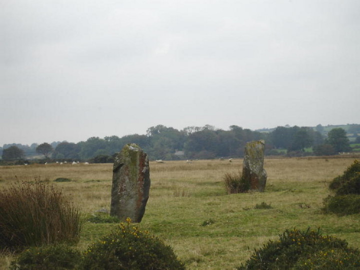
Strange rock formations make Foel Drygarn an impressive place for bronze age burials

Jagged rocks on this outcrop facing Carn Meini in the misty distance, the three cairns are behind the camera.
Campaigners fighting to preserve the Rotherwas Ribbon say they will be taking the “issue further” after they claimed a council scrutiny committee decision to endorse a plan to build a road over the Bronze Age find was invalid.......... more at the following link
24hourmuseum.org.uk/nwh_gfx_en/ART50991.html
The Rotherwas Ribbon site has a more detailed account of the council meeting....
MORE THAN 10,000 of the most important ancient and historical sites around Scotland’s coastline are at risk of being destroyed by the storms and rising sea levels that will come with global warming.
Sites in jeopardy include the neolithic settlement of Skara Brae on Orkney and the prehistoric ruins at Jarlshof on Shetland. Others under threat range from Viking burial boats to Iron Age brochs and Mesolithic middens.
New surveys for Historic Scotland reveal that the remains of communities up to 9000 years old could be lost for ever due to accelerating coastal erosion.
The potential loss is incalculable and has alarmed experts. “This is a uniquely valuable and totally irreplaceable part of the nation’s cultural heritage, with much still to teach us about our past,” said Tom Dawson, an archaeologist at the University of St Andrews....
the article continues at the link below
An Emergency Situation is developing at the Lismullin Site where Construction Works to Divert the Gabhra River have Seriously Breached the 250m Exclusion Zone of the National Monument.
Heavy machinery and gravel lorries moved in to the Lismullin site this afternoon to begin works to divert the historic Gabhra River as part of the M3 Construction.
Observers were immediately concerned as machines began excavating well within the 250m exclusion zone around the Lismullin National Monument. There was no Archaeologist present as NRA Contractors made deep excavations & backfilled with truckloads of hardcore only 120m from the Lismullin Henge.
Activists entered the site and were able to stop work for most of the afternoon by occupying the diggers. Gardai were called to the site and activists were given a Caution not to interfere with works. However, two people re-entered the site and have stopped two of the machines by standing on them.
These incursions show a blatant disregard for the EU concerns currently being voiced about the legality of destroying a National Monument without a further Environmental Impact Assessment being made. The EU petitions Commitee is due to meet tomorrow (13th September), hopefully Lismullin will be high on the agenda.
Irish Independent
EU threatens huge fines if Tara M3 work is not halted
Thursday August 30 2007
WORK on the controversial section of the M3 near the Hill of Tara must
now stop.
And the Government now faces the prospect of being hit with millions of
euro in fines if it allows construction to proceed.
The Irish Independent has learned that the EU Commission has told the
Goverment that no work can be carried out near the national monument
discovered at Lismullin, Co Meath.
And it has ordered that a comprehensive assessment of what impact the
road will have on the Tara Skryne Valley be carried out before the road
is built.
The warning came as a legal challenge was launched yesterday aimed at
stopping the proposed motorway.
Michael Canney from the Campaign to Save Tara group issued legal
proceedings against the Minister for the Environment, the Minister for
Transport, the National Roads Authority and Eurolink Ltd, the consortium
awarded the construction and tolling contract.
The case centres on how the route of the motorway was chosen and Mr
Canney alleges that a comprehensive assessment of each route was not
carried out in line with EU law before the ‘preferred’ route was chosen.
And the Irish Independent can reveal that the EU Commission has warned
the Government that Ireland is in breach of EU law by not carrying out a
second investigation after the discovery of a national monument along
the route.
Former Environment Minister Dick Roche, in one of his last acts in
office, issued a direction that the Lismullin monument be excavated
before the road is built over it.
But a spokesperson for EU Environment Commissioner Stavros Dimas said
yesterday that Ireland was in breach of EU law by not carrying out a
second Environmental Impact Assessment after the monument was discovered.
“At the moment we are still talking to the Irish authorities,” the
spokesperson said. “We want a second assessment. The road cannot be
built until the second assessment is done.
“We have a legal disagreement with Ireland. We are saying you have now
uncovered this national monument, and you cannot proceed until there is
a second assessment.”
In a separate development Michael Canney is seeking a court ruling that
construction works on the motorway should be halted pending the outcome
of the case currently being taken by the EU Commission.
The case is the first of three threatened legal challenges to the €800m
motorway planned to help ease congestion on the Dublin to Meath route.
Yesterday Mr Canney said it was being taken as a ‘last resort’ and
because the ‘political and commercial backers’ of the project had
ignored public concerns about the road.
“It has never been my ambition to put my name forward in a legal
challenge, especially a challenge against such a seemingly impregnable
array of powerful political and economic forces,” he said.
“I have only done so as a last resort, and only because it is absolutely
essential that the silent majority who oppose this road have their
concerns heard.”
.............................................

Tunley Cromlech destroyed. Identified by Skinner as a capstone with two supporting stones, but was already being broken up by 1812 for road material. Skinner says;
“there was a cromlech on the highest point to the east of Tunley Camp”
Jodie Lewis (Monuments Ritual and Regionality) Neolithic of north Somerset says, that it could either have been the remains of a Cotwold Severn barrow or a simple portal dolmen.
‘International Expert Report Calls for Preservation of “Unique” Lismullin Amphitheatre’;
Dr.Ronald Hicks has written a full and explanatory report on the need to save Lismullen..........
The article can be found at the following link below...
“The monument discovered earlier this year at Lismullin is, quite simply, unique. For that reason, if for no other, it should be preserved.”