Previous 5 Previous 5 | Showing 11-14 of 14 posts. Most recent first
what's windproof?!
After spending most of Christmas eating and drinking, I decided it was time for some exercise, and set out after lunch today to try out one of my new presents - a pair of Goretex Windstopper cycling gloves from Grandma & Grandpa.
I loaded the bike into the back of the car, and headed up to Dunkeld, through Strathbraan, and up Glen Cochill to the car park opposite Griffin Forest, high above Aberfeldy. As usual, I had a list to ignore for the day, comprising of Boltachan Burn, Lundin Farm and Carn Tulach. I'd attempted to get to Carn Tulach once before, a few weeks ago, but there was a shooting party nearby, and I decided that rustling in the undergrowth while wearing camouflage gear was not a good idea, especially if there were any Italians in the party.
Having re-assembled my bike, I set off down the long descent to Aberfeldy. Immediately I realised what a stupid idea it was to park there - great views, and a fantastically-fast run down to Aberfeldy, but I would be faced with a 1000-foot climb at the end of the day. My mind was soon on another subject however, as I discovered that Goretex Windstopper gloves don't stop the wind when you're doing 40mph downhill in a Perthshire winter! My fingers soon defrosted once I got to a more sensible altitude, and once the blood was pumping around my body again the gloves did their job.
Passing through Aberfeldy, I headed for Castle Menzies, where the path up Weem Rock begins. Weem Rock rises almost vertically behind the village, and the path criss-crosses steeply from side to side on it's way up. I was soon out of the saddle and pushing my trusty steed, which was easier said than done. It was fairly moist underfoot (understatement of the day) and once again I was suffering from the curse of the inappropriate footwear. Two steps forward and a slide back was getting quite annoying, so I turned around and slithered my way down, vowing to return at a later date with stouter attire.
So I returned to Aberfeldy, turning left at the cross-roads to head out east towards Lundin Farm and Carn Tulach. By this time I was losing my race against time as the low winter sun began it's descent behind a snow-covered Schiehallion, so I decided to give Lundin Farm a miss, as I know roughly where it is, and look for Carn Tulach instead.
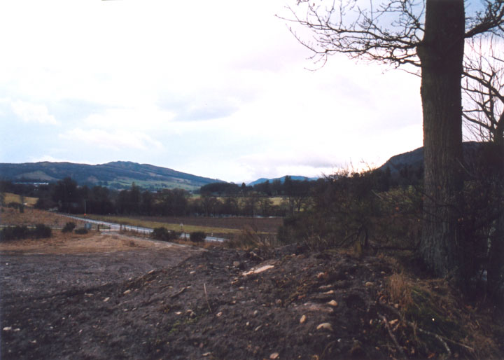
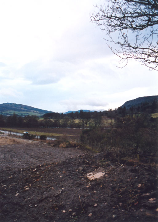
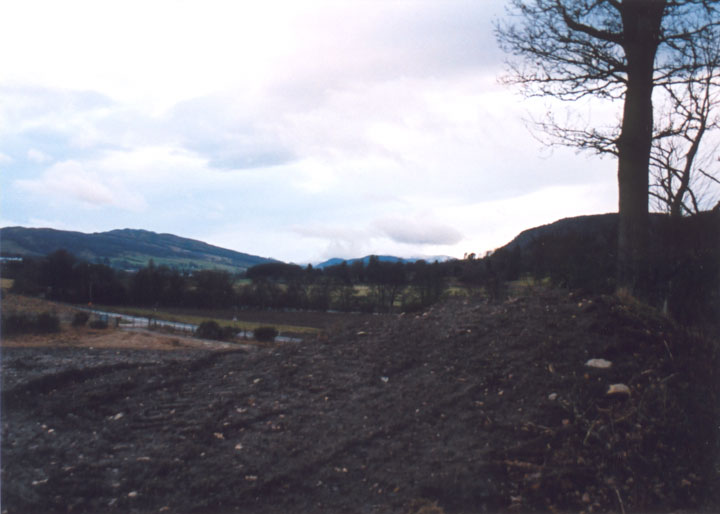
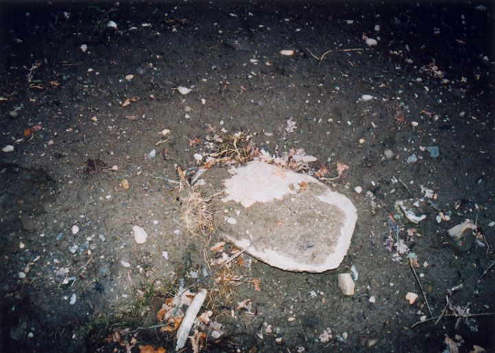
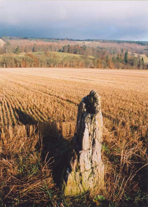
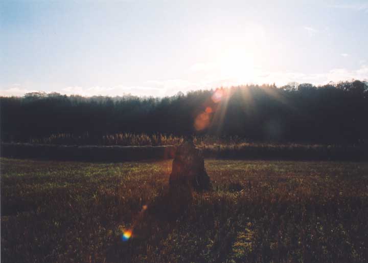
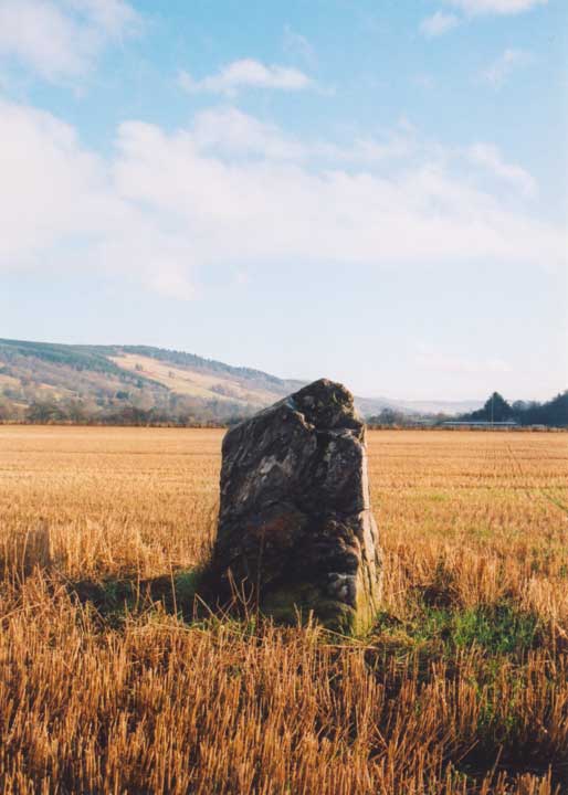
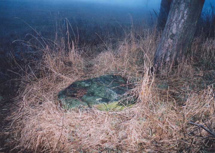
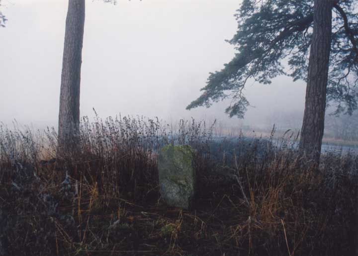
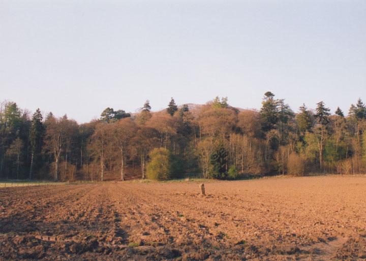
Stopping at the track up to Cultullich farm, I didn't fancy scaling the 6-foot-plus chain link padlocked gates at the entrance to Cultullich Tip, so instead I carried on on the main road for a couple of hundred metres more, left my bike on the verge, and climbed over a much more lowly barbed wire fence. Scrambling up the steep bank, my worst fears were confirmed. The stone has fallen, and now lies half-buried in sand and mud, presumably meaning little to those who have quarried away the mound on which it stood to within centimetres of it.
Feeling a little sad having seen this stone so neglected, I set off back for Aberfeldy in the fading light, with a 1000-foot ascent to look forward to, softened only slightly by the thought of a cup of tea when I got to the top.
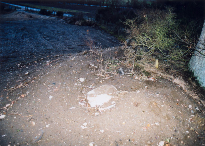
This is a very, very sad site. As if a stone circle being reduced to a single remaining standing stone wasn't bad enough, a tip and quarry have sprung up beside it.
The site originally consisted of a large natural mound o sand and gravel, on top of which, at the western edge (ie closest to the road), was a circle of stones. When the mound was excavated for gravel, several cists containing human remains were found, and also a stone hammer which is now in the National Museum. This quarrying has left little of the mound, the remains of which stand at the top of the bank which rises beside the main road.
CANMORE describes the standing stone as surmounting the summit of the ridge, which should make it just visible from the road, or at the very least from halfway up the bank. CANMORE also mentions that the ridge had been quarried away to within 2m of the stone - that was in 1975. The stone has now fallen, and is half-buried by sand and mud. The remains of the mound seem to be even smaller than described by CANMORE, and it's surely only a matter of time before the mound is destroyed altogether, and the stone thrown to one side. I will be contacting the RCAHMS about this site, in a bid to stop any further damage to the site. Directions - head east from Aberfeldy on the A827, passing the distillery on your right. Approximately a mile and a half further on is the track up to Cultullich farm, and the large chain-link gates into Cultullich Tip. There's space to park carefully here. Walk along the grass verge beside the main road in the direction you were heading in, until you are level with the highest point of the ridge. Climb over the barbed wire fence here, and climb up the bank. The stone lies on the highest point of the ridge.
|
What time do you call this?!
Don't ask me why, but I decided I was going to get up before dawn today, to try and take some "atmospheric" photos taking advantage of the early morning light.
Rudely awakened from a deep slumber at an ungodly hour by the radio, I was up and out by 7:30 and on my way with the trusty bike in the boot, after scraping the ice off the windscreen. I'd been hoping for a little low-lying mist to give the photos an "otherworldly" quality, but this was ridiculous! Visibility was down to about 100m as I drove up the A9, and as if I needed reminding that it was baltic outside, the windscreen began to freeze over again.
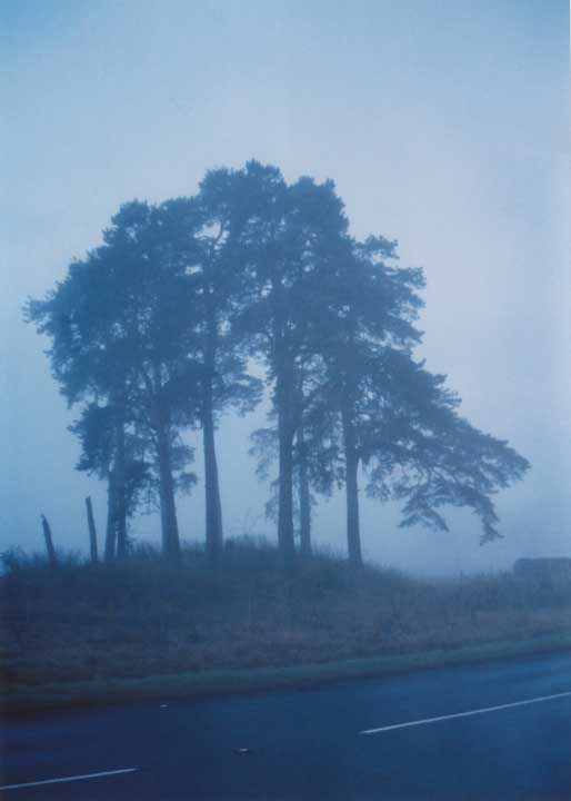
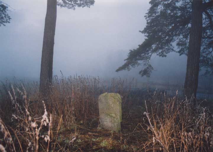
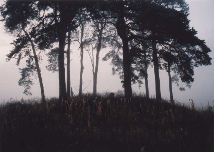
First stop was Pitnacree, which I've passed I don't know how many times without stopping, usually because of the problems associated with head-high nettles and wearing shorts. The mist had lifted a little after leaving the A9 at Ballinluig and heading west, so I was able to get some photos from across the road showing the small standing stone sitting atop the large round barrow, before going up for a closer look.
Back to the relative warmth of the car (and the sonic delights of Heartland FM) I trudged, the frosty grass crunching underfoot. And so it was on through Grandtully, following the Tay down past Lundin Farm, keeping watch for a space to park near Carn Tulach which I was going to visit on my way back. Through Aberfeldy, which was eerily quiet at 8:30 on a Saturday morning, and on past Croft Moraig and Newhall Bridge to Kenmore, where I stopped to take some photos at the head of Loch Tay. The waters were still, reflecting the autumn plumage of the surrounding wooded slopes and the hanging mists that encircled them.
Crossing the Tay, I turned up by Main of Taymouth to park at the forest car park on the edge of Drummond Hill, and assembled my bike with numb hands. I was now in search of the missing Comrie Bridge stone circle I'd been looking for last weekend. I thought I had a better idea this time of where it might be, and turned off the road onto the North Terrace track that follows the Tay. Spotting a lady walking her dog, I stopped to ask if she knew of any stones in the vicinity. She didn't, but mentioned that someone had previously been looking for an old well in the area, if that was any help. Fending off a hyperactive sheepdog with one hand, I showed her Coles' drawing of the circle with the other, but it didn't ring any bells, so I continued on my way, peering into rhodedendron bushes as I cycled back round to the road.
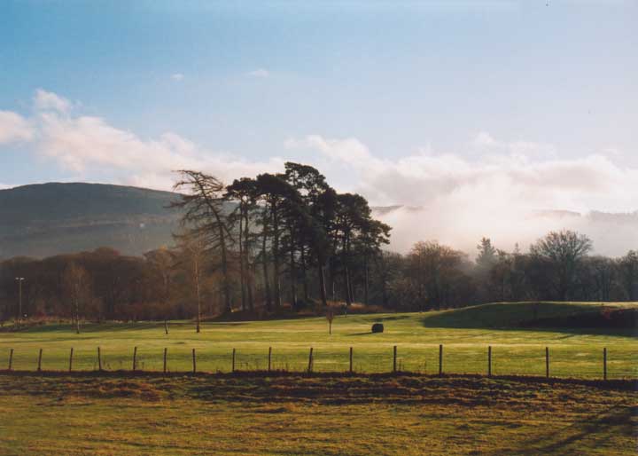
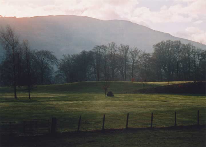
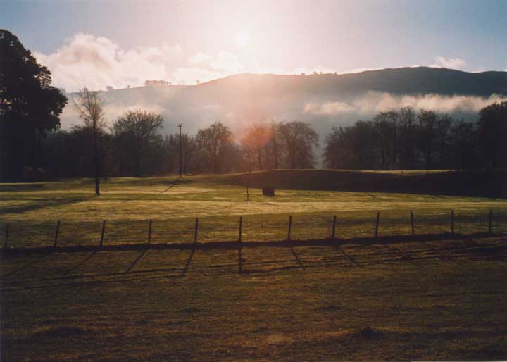
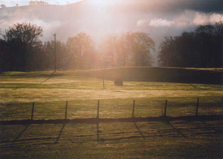
Feeling remarkably energetic for a time when I'm usually tucked up in bed, I climbed the muddy track up into the Peeler Gate section of the Drummond Hill forest for an hour's thrash on the mountain bike tracks, before descending once again to the road to head back to the car. On my way back, I noticed a suspicious-looking stone sitting in the centre of Kenmore golf course. I'd noticed it several times before, but hadn't thought about it on this trip. So I cycled round to the clubhouse, but it was closed for the winter. There was nothing for it, I'd have to speak to some golfers! The Scottish Megaraks had previously discovered on our mammoth June journey that golfers and megaraks are equally bemused by the others' hobby!
Pulling up to the first tee, the golfers looked at me as if I was something that had just climbed out of the loch. Of course it didn't cross my mind until I got back to the car and saw my reflection in the window that I DID look like something that had just climbed out of the loch, being as I was caked from head to toe in mud from the forest tracks! Anyway, the golfers didn't know of any stone circles near the golf course, and when I mentioned the stone on its own, it was described as "just a standy-uppy stone, not a standing stone". I wasn't convinced, and decided I'd come back once I've done a bit more research.
After defrosting my fingers around a cup of tea from my flask, I took my bike apart, put it back in the car, and re-traced my steps to and through Aberfeldy. As I came round the corner just before Carn Tulach, the space I'd earmarked earlier for parking was taken - with a couple of pick-ups full to the brim with tweeded gentlemen, shotguns over the shoulder. I decided that this was not the time to be rustling in the undergrowth nearby! And so I had to save his one for another day too.
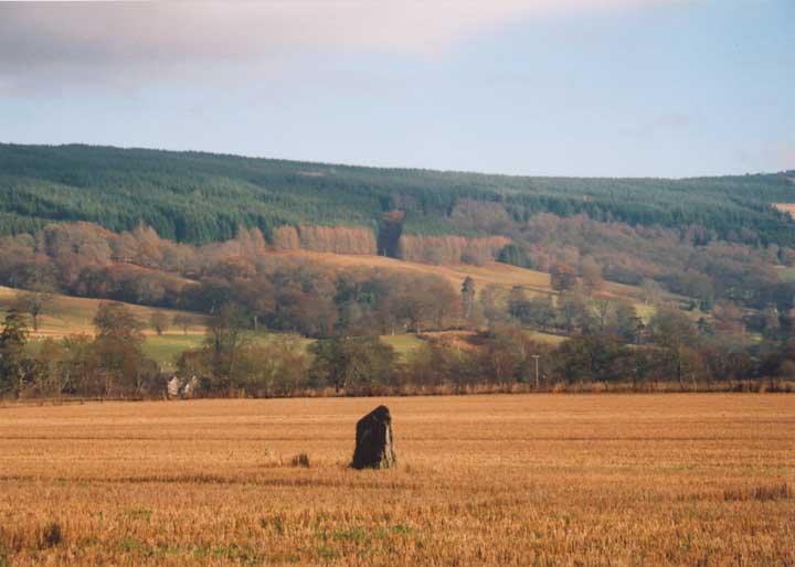
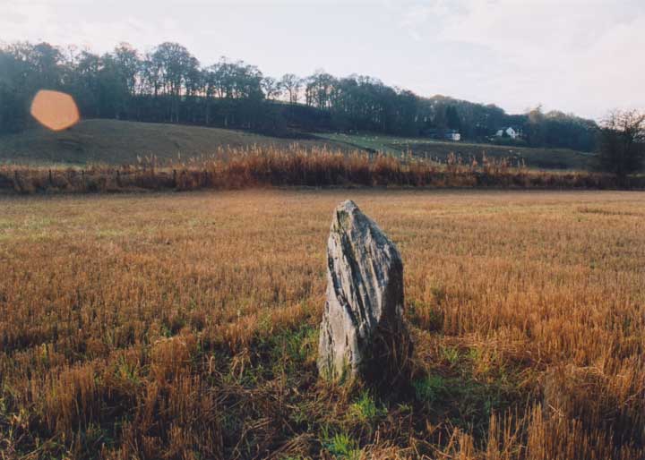
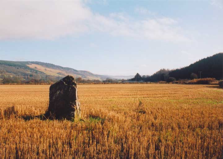
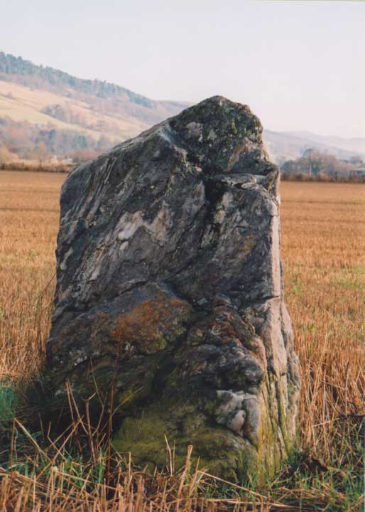
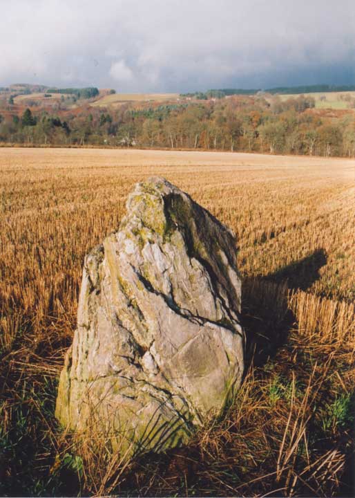
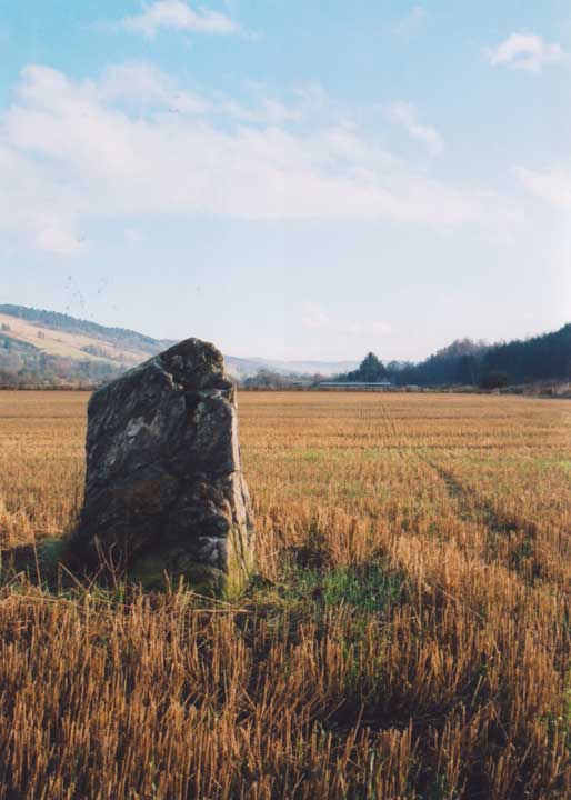
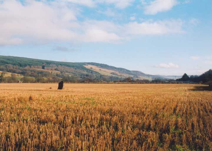
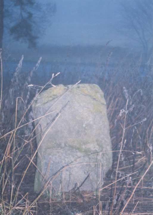
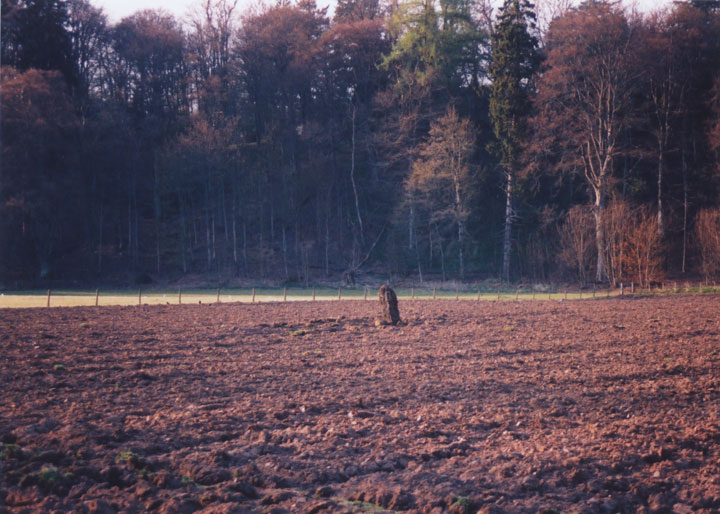
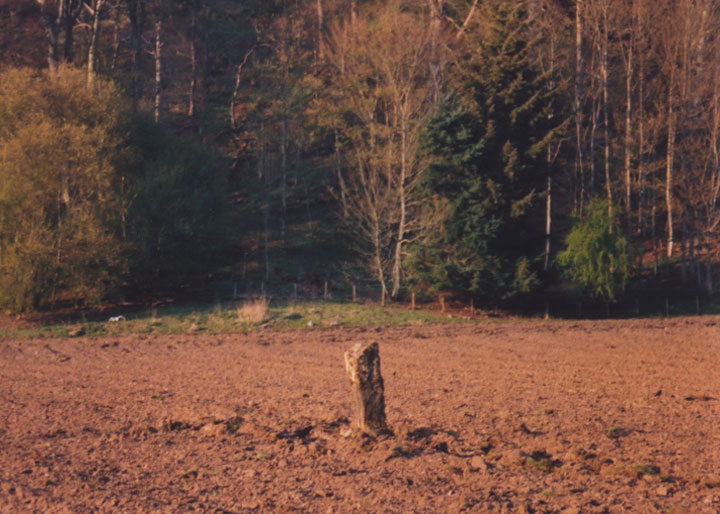
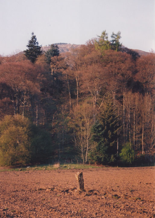
On I went to Grandtully, parking beside the Tay just after I left the village. I crossed over the road, climbed the wall and fence with the aid of a telegraph pole, and headed into the fallow field in search of the Haugh of Grandtully stone. I'd scanned the fields from the road when I'd passed before, but had never seen the stone, so I was working from the map on this one. As I got closer to the old railway line, I spotted the stone in the neighbouring field, and went through the gate at the bottom. This stone's a wee beauty, with thick veins of quartz running through it. By this time the sun was burning brightly in the sky, silhouetting the peaks high above the Tay's flood plain to frame my photos of the stone.
After that, it was back to the car for the drive to sunny Stanley, home in time for lunch!
Directions - head N from Perth on the A9, and take the A827 (sign-posted Aberfeldy) at the Ballinluig junction. After about 5km you'll come to a junction having just crossed a bridge - turn right here (still sign-posted A827 Aberfeldy). Approximately 400m along this road you'll see a small muddy layby under the trees on the right-hand side of the road - park here. Walk on maybe 50m further towards Grandtully, and you'll see a wall seperating two fields across the road. If you look even further beyond this field, over the old railway line to the slope in the distance, you should see a house on the right, with another wall to the left of it. If you walk along the road until you're in line with the wall in the distance on the hill, then you'll see a telegraph pole close to the wall next to the road, and to the right of the closest field wall - this is the easiest place to cross into the field, as the wall has "footholds", the wire of the fence on top of it can be pushed down easily, and you have the telegraph pole to lean against. Once in the field, walk to the edge of the field (left) with the field wall on your left, and continue up towards the old railway line. After about 150m you'll be able to see the stone over the wall in the field to your left. There's a gate at the bottom of the field that gives you access into the stone's field. This is a cracking wee stone which sits close to the old railway embankment, at the bottom of a field on the haugh of Grandtully. The stone is 1.4m tall, and approximately 1.0m wide and 0.5m thick at the base, rising to a point. It has thick veins of sparkly white quartz running through it. Fred Coles was told in 1908 by "two aged residents in the immediate vicinity" that there used to be a second stone close by this stone. I tried again to locate this circle today, and once again failed - perhaps! There's a stone standing in the centre of Kenmore golf course which looks suspiciously like one of the stones drawn by Fred Coles in 1910, and it's in the right general area to fit his description. The golfers I spoke to didn't know anything about the stone, and the clubhouse was shut, so I'm planning to write to the owners and ask if the stone has always been there, and if anyone knows anything about it. This barrow, topped with tall thin conifers, is very visible from the road. The barrow was excavated in 1964, and found to be the final stage in a series of monuments. At its heart were four cremations (dated to c.2860 BCE) in a rectangular stone enclosure, and two ramped stone or wooden post holes. The cremations and holes were inside a penannular ring-cairn, over which the turf and stone barrow were built. On top of the barrow is a standing stone, under which a fifth cremation was found (dated to c.2270 BCE).
The perimeter of the barrow was originally bounded by a dry-stone kerb, but this has now been confused by ploughing and field clearance. On the south side of the barrow is a large square recumbent stone which isn't mentioned in the CANMORE report, and so may also be field clearance. Directions - head N on the A9 from Perth, turning off onto the A827 for Aberfeldy at the Ballinluig junction. After approximately 5km you should see the barrow on your left at the edge of a field - it's quite hard to miss. There's a gate next to it giving access to the field, and there's space to park in here on a muddy area before the field proper. If it looks too muddy to get out again, continue on another 10m or so around the corner, and there is another gate with space for one car on the tarmac in front of it (just before you go onto the bridge).
|
Where's the stones?!
I set off at noon today with the bike in the back of the car, sandwiches and tea in the rucsac, and a long list of lost sites I was going to re-find. The sun was shining, the sky blue, and just a light crisp breeze in the air - perfect conditions for cycling. But this was always going to be an uphill struggle!
Parking at the Drummond Hill forest car park near Kenmore, I assembled my trusty steed, and set off in search of stones. Coles mentions a circle of stones close to Comrie Bridge, which the RCAHMS dismissed as just four boulders. Here hindsight came into play - if I had been clever I would have checked Coles' original article before I left, but I didn't. If I had, I'd have seen that the stones he mentions actually make a circle of 5, and are "a mile and a furlong" due south of Comrie Castle, so I was looking in the wrong spot - I shall return!
Having admitted defeat, I carried on across the bridge up to the main road, along to Keltneyburn and down through Fortingall, waving at the three circles (Fortingall), the ancient yew and cup-marked rock in Fortingall Churchyard and Clach a' Phlaigh atop the Carn na Marbh. All of these sites had been "done" several times before, and I was on a quest of re-discovery!
Turning north on to the Glen Lyon road, I cycled through the Pass of Lyon, looking down over the impressive Macgregor's Leap, resplendent in its autumn plumage. It wasn't long before I was passing through the wood known in Gaelic as Coille Dhubh - the Black Wood. Legend has it there are two standing stones in here, close to the road - the Stone of the Devil Cat and the Stone of the Demon. Neither was immediately obvious, as there are many likely-looking candidates around here, so I made an executive decision and decided to do a bit more research before I return for an exhaustive search. Another failure!
Next on the list was a stone opposite Invervar at Dericambus, which isn't listed anywhere but certainly seems to fit the bill as a potential standing stone. I've seen a photo of it, but have yet to see it for myself as it nestles high above the glen's floor. By the time I reached Invervar, the sun was already low in the sky, so yet another stone had to be saved for another day. With my itinerary torn to shreds, and the prospect of seeing any stones heading downhill fast (unlike my cycle back along Glen Lyon which was uphill slow!), I turned around and headed for home.
Leaving for Fearnan and Loch Tay, I passed the field at Bridge of Lyon jam-packed with features - Uaigh an t-Seanalair (also known as Pontius Pilate's grave!), Bridge of Lyon Long Cairn and the Bridge of Lyon Standing Stones, again, all much visited by myself and the Scottish Megaraks in the past (most recently a week previously). And the wild goose chase (perhaps) that is Cromrar. As Moth, pebblesfromheaven, nickbrand and others will testify, looking for cup-marked rocks at Cromrar is like looking for a rock in a field full of rocks!
Turning east along the edge of Loch Tay, the sun falling fast behind me, I made my way back to the car, vowing to do it all again next weekend, but with hopefully more success!
I tried (and failed!) to find these stones today. My mistake was to only read the CANMORE entry, and not download the PSAS report by Fred Coles. CANMORE only quotes a footnote by Coles in which he describes information given to him about four "'great stones' close to Comrie Bridge" - he dismisses these as just boulders. But it wasn't these that he was describing as a circle of 5 stones - the circle is apparently a mile and a furlong south of Comrie Castle (which is next to Comrie Bridge). So I was looking in the wrong area today (as presumably were the RCAHMS, given the bit they quote), but I shall return with the PSAS description soon and see what I can find. As anyone who's familiar with the Glen Lyon road through Coille Dhubh will know, there are a lot of lumps of rock beside the road. One of them may well be the "tall upright Clach Taghairm nan Cat" described by Archie McKerracher, but I couldn't be sure. I will try to find out his source for the story, and see if the present road was always the route into Glen Lyon, and then return for another look.
|
A round trip on 2 wheels from Garry Bridge
Sunday, 27th July 2003
I drove up to the car park at Garry Bridge, got my bike out the back of the car, assembled it, then set off over the hill by Tenandry. After a long climb, I was rewarded with an equally-long descent, unfortunately slowed down by an escaped spaniel in the road! Once at the bottom, I stopped at the bridge over the Garry to take some photos of the Soldier's Leap, before turning left onto the main road.
I was intending to get a good look at Claverhouse's Stone (Killiecrankie), but once again I was denied. Last weekend it was torrential rain, this week it was cows in the field (again!). One of these days I'll get in there!
Next on the list was Clach Na H-Iobairt (Clach Na H-Ioabairt) - I've looked for the other Clach na h' Iobairt before, down by the caravan park at Blair Atholl, but without much luck. I think I'll wait until the holiday season is over for this one. Anyway, onwards towards House of Bruar. Passing Blair Castle, I remembered just how wet I had been last weekend, and was grateful for the blazing sun which was overhead today.
After a bit of fighting against a strong wind, I laid my bike down by the side of the road and climbed up the small bank that Clach Na H-Iobairt (Clach Na H-Ioabairt) sits on. It's an impressive size of stone, and is aligned N-S. After spending quite a while taking photos here, it was time to move on again if I was to make it home by dark.
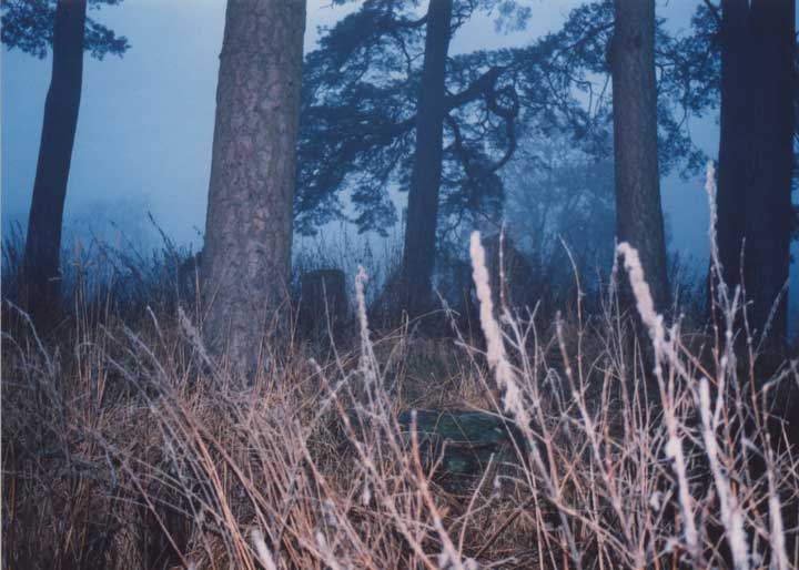
Continuing on by way of Struan, I followed Errochty Water through Glen Errochty as far as Trinafour, before curving back on myself to go round the south side of the Tummel Forest. There was a nice long, straight, downhill section, so I sped down that, but soon had to screech to a halt as I sped past the turn-off for Over Bohespic - thank god for disc brakes! It was off the road and onto a forestry track now, as I passed the cottage on my left. A padlocked gate across the track did little to stop my progress, as I lifted my bike over and continued up the hill, before taking the right fork. And there it was - the huge cup-marked stone at Upper Gaskan. The RCAHMS are being typically cautious on CANMORE, listing this as a cup-marked rock with a possible stone circle around it:
http://www.rcahms.gov.uk/canmore/details_gis?inumlink=25168
Well there's no possible about it - this is a stone circle! I counted 10 stones in a wide ring around the central stone, which is decorated with at least 28 cup-marks. The stones, none of which is bigger than about 0.5m x 0.5m x 1.3m long, stand on a ring of diameter 18m approximately, and appear (measured with my feet!) to be equidistant from their next neighbours, and also the central stone. This is a great site which I'll definitely come back to.
Heading back down and out of the forest, I turned left back onto the tarmac, and continued my downhill journey until Tummel Bridge. I followed the road along the edge of Loch Tummel as it undulates up and down, my legs by now feeling a little weary, and my poor nose a little sunburnt! There was no time to stop at the Queen's View, but it probably hasn't changed much since my last visit a couple of months ago anyhow, so I pressed on back to the car. I had intended to stop at Faskally Cottages on the way home, but fading light and a rumbling stomach made up my mind to save it for another day.
I saw this one on CANMORE when I was compiling my definitive list of Perthshire stones, and they had it down as a cup-marked rock with a possible stone circle:
http://www.rcahms.gov.uk/canmore/details_gis?inumlink=25168
Well there's no possible about it, this is definitely a circle! The stone at the centre measures 1.7m x 2.0m across it's top, and is between 0.7m and 0.9m high, depending which end you measure at. The upper surface is profusely decorated with many weathered cup-marks. CANMORE says at least 28, but I could only count 15 or 16 clearly.
Around this stone is a ring of 10 stones, with a circle diameter of about 18m (I was measuring with my feet, so it's not exact!). These stones appear to be equally-spaced from each other at a distance of about 4m. There are a few other stones lying about which may or may not have formed part of the circle, but it's difficult to tell exactly what's what as there are trees growing all over the place (which is what you'd expect in a forestry plantation I suppose), and the stones have a considerable amount of moss and grass on them. Nevertheless, this site is still well worth a visit, as it has a good feel to it. Directions - Head N on the A9 from Perth, and take the Pitlochry turn-off (this is the easiest way to ensure you don't miss the smaller turn-off further up). Drive straight on through Pitlochry, past the circle at Faskally Cottages to where the A924 becomes the B8019. Turn left at Garry Bridge (for Loch Tummmel & Kinloch Rannoch) and follow the B8019 west to Tummel Bridge. Instead of crossing the river at Tummel Bridge, stay heading W on the N bank of the Tummel, and take the next turn to your right, following the edge of the Tummel Forest. After approximately 2.0km is a track to the left which passes by the white cottage of Over Bohespic. Park down by the road here, making sure to leave enough room for people to get in and out. Walk up the forestry track past the cottage, and climb over the locked gate. Keep following the track up until it forks, and take the right hand track. About 200m along here you'll notice that the tall, thick pines of the plantation give way to smaller, thinner pines. It's just after this change that you can see the huge cup-marked stone down to your right. A path of sorts has been cleared down to it, so it's easy enough to spot. I was on my bike, so I'm not sure how long the walk would be, but I'd guess 20 mins to half an hour from Over Bohespic.  |
|
Previous 5 | Showing 11-14 of 14 posts. Most recent first |
Hi!
I'm a freelance eyewear designer in Edinburgh, exiled from my beloved Perthshire. I also run a website which includes a section on Scotland's many standing stones, stone circles and other old things:
Stravaiging around Scotland
Some things I like:
cake
ale
music
Perthshire
Moscow
You can read more of my ramblings here: http://www.stravaiging.com
|