I rang up Wayside Stores this afternoon, to see whether access was still possible. They told me that, as of this year, they no longer hold a key. Apparently Cadw are running occasional open days though.
K x
I rang up Wayside Stores this afternoon, to see whether access was still possible. They told me that, as of this year, they no longer hold a key. Apparently Cadw are running occasional open days though.
K x
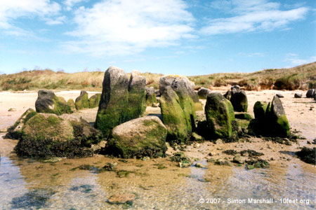
Looks like the nearby trees are mostly gone now and the site has been cleaned up to the point where it looks like a garden rockery.
Video published on the BBC News web site on 23rd January 2014:
Winter storms which battered the coast of Wales have exposed previously hidden traces of the area’s Stone Age landscape.
A four mile stretch of coastline near Tywyn on the west coast of Wales was so altered by the sea that it was pushed back 50 feet (15 metres).
The new coastline has revealed the existence of ancients forests, with the remains of trees dating back 6000 years.
From an article published on the BBC News web site on 29th June 2012:
A reindeer engraved on the wall of a cave in south Wales has been confirmed as the oldest known rock art in Britain.
The image in Cathole Cave on Gower, south Wales was created at least 14,000 years ago, said Bristol University.
Archaeologist Dr George Nash found the engraving while exploring a rear section of the cave in September 2010.
He said uranium dating showed it was the oldest rock art in the British Isles, if not north-western Europe.
Full article, with photo, at bbc.co.uk/news/uk-wales-south-west-wales-18648683
This is a YouTube video of Kerri Brown explaining about recent DNA sampling of the Cladh Hallan burial.
From a collection of paintings recording the standing stones of Pembrokeshire by artist J.C. Young over a three year period from 1981 to 1984.
From a collection of paintings recording the standing stones of Pembrokeshire by artist J.C. Young over a three year period from 1981 to 1984.
From an article published on the News Wales web site on 24th January 2011:
Army Preparation Course students have helped to repair a Scheduled Ancient Monument in the Pembrokeshire Coast National Park. The group of 14 from Pembrokeshire College joined the National Park Authority’s Archaeologist and Rangers to help reinstate damaged Bronze Age burial cairns on the Preseli Hills
On the summit there are three cairns, probably for Bronze Age burials.The site is nationally important and is designated a Scheduled Ancient Monument. As such, it is a criminal offence to alter it without permission. However, visitors have been moving stones to make shelters within the cairns.
The students have been helping to restore them to their original formations.
Visited 22/01/11: Walked to Disgwylfa Fawr from a parking spot next to Llyn Syfydrin to the west. This is the shortest & simplest route up (my friend’s 7 year old daughter had no trouble with it).
I’m embarrassed to say this was my first time up Disgwylfa Fawr and it’s hard to imagine why it’s taken me so long to make the journey. The cairn is large and earth-covered with an indentation in the top, presumably from excavation. It’s a nice lump the stand on and the views of the surrounding peaks are splendid (especially Pumlumon and Dinas). Well worth a visit.
From an article published on the BBC News web site on 13th May 2009:
A £25m plan to revitalise the world-renowned Stonehenge in Wiltshire, including diverting a nearby road, has been announced by the government.
Also included in the plan from the Stonehenge Programme Board are proposals for a new visitor centre at nearby Airman’s Corner.
From an article published on the BBC News web site on 1st December 2008:
A rare amber necklace believed to be about 4,000 years old has been uncovered in Greater Manchester.
Archaeologists made the find while excavating a cist – a type of stone-lined grave – in Mellor, Stockport.
It is the first time a necklace of this kind from the early Bronze Age has been found in north-west England.
Experts from the University of Manchester Archaeological Unit said a amber necklace was one of the ultimate status symbols of the period.
The necklace consists of dozens of pierced amber beads of various sizes, linked together on a length of fibre.
It was discovered in the cist by experts from the university and local Mellor Archaeological Trust, who said the mystery was now how the material got to the north west.
Includes a detailed description of the fort, photographs, a plan and a RCAHMW report on the site.
The full extent of a hillfort likened to an Iron Age “Millennium Stadium” has been uncovered by investigators.
Gaer Fawr hillfort at Guilsfield, near Welshpool, Powys, is effectively hidden by woodland, making it impossible to appreciate the scale of it.
Detailed survey by the Royal Commission on the Ancient and Historical Monuments of Wales produced a computer model of the site which dates from around 800BC.
A good little article about the Wrekin including directions and folklore.
From an article published on the BBC News web site on 28th January 2008:
The remains of an Iron Age man found in a peat bog are leaving the British Museum for the first time in 17 years.
Lindow Man was found in a Cheshire marsh in 1984, nearly 2,000 years after his horrific death.
Chemicals in the bog preserved the body and researchers found his throat was slit and he was garrotted, possibly as a sacrificial victim.
Lindow Man is being moved from London to the Manchester Museum, on long-term loan, and will be displayed from April.
From an article published on the BBC News web site on 7th December 2007:
A 29,000-year-old skeleton is being displayed in Wales for the first time since it was discovered in a Gower cave in the 1820s.
The Red Lady of Paviland, actually the remains of a young male, is the earliest formal human burial to have been found in western Europe.
It is going on show on Saturday at the National Museum in Cardiff.
Artefacts also include a 13th Century figure of Christ, Bronze Age jewellery, a Viking sword guard and a Roman cup.
All were found at various locations throughout Wales and are brought together for the first time for the exhibition Origins: In Search of Early Wales.

Taken Summer 1996: Louise standing next to one of the Kergadiou Menhirs. We didn’t find the fallen stone because it was hidden by maize.
Future husbands would go there by night it is said and beat themselves against the protuberances unclothed in order to have beautiful children!
Source: The Megaliths of Brittany, Jacques Briard (ISBN: 2-87747-063-6).

Taken Summer 1996: Menez Lié Dolmen, sitting pretty in its corn field.

Taken Summer 1996: Pen an Run Dolmen festooned with ivy. Half hedge, half dolmen.

Taken Summer 1996: The Kermario stones viewed from the (now demolished) Visitors’ Centre.

Taken Summer 1996: A gaggle of Kermario stones, with the Le Dolmen de Kermario just visible in the distance.


Taken Summer 1996: Shaded stones at Kerzerho.
At 9.5 metres, Kerloas Menhir is the tallest standing stone to remain erect. In the English Edition of The Megaliths of Brittany (ISBN: 2-87747-063-6) Jacques Briard states that the stone was originally over 10 metres high, but the tip was struck off during a thunder storm “some centuries ago”, bits landing in a nearby farm. At it’s base the menhir has two very feminine looking lumps. The stone is granite, and is thought to have been transported 3km from L’Aber Ildut.

Taken Summer 1996: The site is truncated by the road between Erdeven and Quiberon. This cottage stands incongruously next to the stones.

Taken Summer 1996: The tallest stones at Kerzerho including the large fallen stone known as the ‘table of sacrifice’ (is that a bad translation of ‘altar’).

Taken Summer 1996: Kerloas Menhir, the tallest menhir to remain standing at 9.5 metres.
The inset shows Louise standing next to the stone for scale (she’s 5ft 6 inches tall).

Taken Summer 1996: When we visited it was foggy,and the stones felt very familiar compared to the sun drenched megaliths of southern Brittany.
Taken Summer 1996: A photo of Kernic, viewed from the wet side.

Taken Summer 1996: A photo of Kernic from the east (very approximately speaking).

Taken Summer 1996: A photo of Le Grand Menhir Brisé, taken with a super wide angle lense to try and fit it all in.

Taken Summer 1996: A beautifully shaped megalith at Lagatjar.

Taken Summer 1996: Looking down the Allee-Couverte.

Taken Summer 1996: La Roche-aux-Fées in the shade of oak trees on a very sunny day.

Taken Summer 1996: Looking up the side of the chamber. Note the variance in the heights of the orthostats supporting the capstones.

Taken Summer 1996: A copy of one of the carved megalith found inside Barnenez, subtly flood-lit and sited by the ticket office.

Taken Summer 1996: One of the reconstructed entrances into the cairn.

Taken Summer 1996: The northern part of the cairn, seriously damaged by quarrying in the 1950s.

Taken Summer 1996: The entrance to the cairn.

Taken Summer 1996: Carved stones inside the camber at Gavrinis.
No doubt the three alcoves were designed to accommodate Neolithic T-Lights.

Taken Summer 1996: Carvings inside the chamber at Gavranis.

Taken Summer 1996: Looking down the 11 metre corridor into the Gavrinis cairn.

Taken Summer 1996: Gavrinis Cairn viewed from the Gulf of Morbihan.

Taken Summer 1996: The dolmen at Crucuno.

Taken Summer 1996: Dolmen de Kermario

Taken Summer 1996: Le Petit Mont with it’s strange concrete staircase.

Taken Summer 1996: Le Petit Mont near Arzon.

Taken Summer 1996: The ‘roof’ of Le Petit Mont.
