
Another N view...note the smallness of the stones used in the entrance, surely a factor in collapse. Stairhaven car park in distance, complete with WC. (hello t/rusty Fiesta xxx)
Image credit: Mike Purslow
Another N view...note the smallness of the stones used in the entrance, surely a factor in collapse. Stairhaven car park in distance, complete with WC. (hello t/rusty Fiesta xxx)

Looking N up coast to Stairhaven, and, in L distance, the sand dunes at the head of Luce Bay, which contain many Neolithic axe factories with, iirc, Langdale connections..the weather constantly reveals.

Looking W – uppermost extant top step of intramural stairwell R lower


Looking south.... Mull of Galloway on horizon R, with walling of intermural stairway in foreground

The start of a clockwise circular walk round...entrance at R

What greets you on completion of your ascent: the entrance on the NW side

Closeup of approach route: easy scramble up round L side of large blackened boulder in centre, then up ex-broch debris to site


The approach along the beach from Stairhaven..the stone chute from clifftop path to L ends in a mass of brambles etc. Sorry, beach at low tide IS only way. Step on the creamy brown boulders – barnacles give excellent grip. Incidentally the stone chute is whats left from a village clearance, heaved over the edge. Google the Master of Stair for other historical landowner activity....
Full title: Report on a survey of crannogs in the south west of Scotland (and excavations at Buiston) ..contains a complete list of known crannogs in D&G, submerged and above water. As of October 2016 many therein to be added to the TMA database...some shewn on OS Explorers not Pathfinders. An example is Whitefield Loch near Glenluce, where one is shown on OS Pathfinder 82 (NB correct name is Dorman’s Island, Whitefield Loch) whilst Explorer 310 reveals more (two, albeit one submerged unless extreme drought)


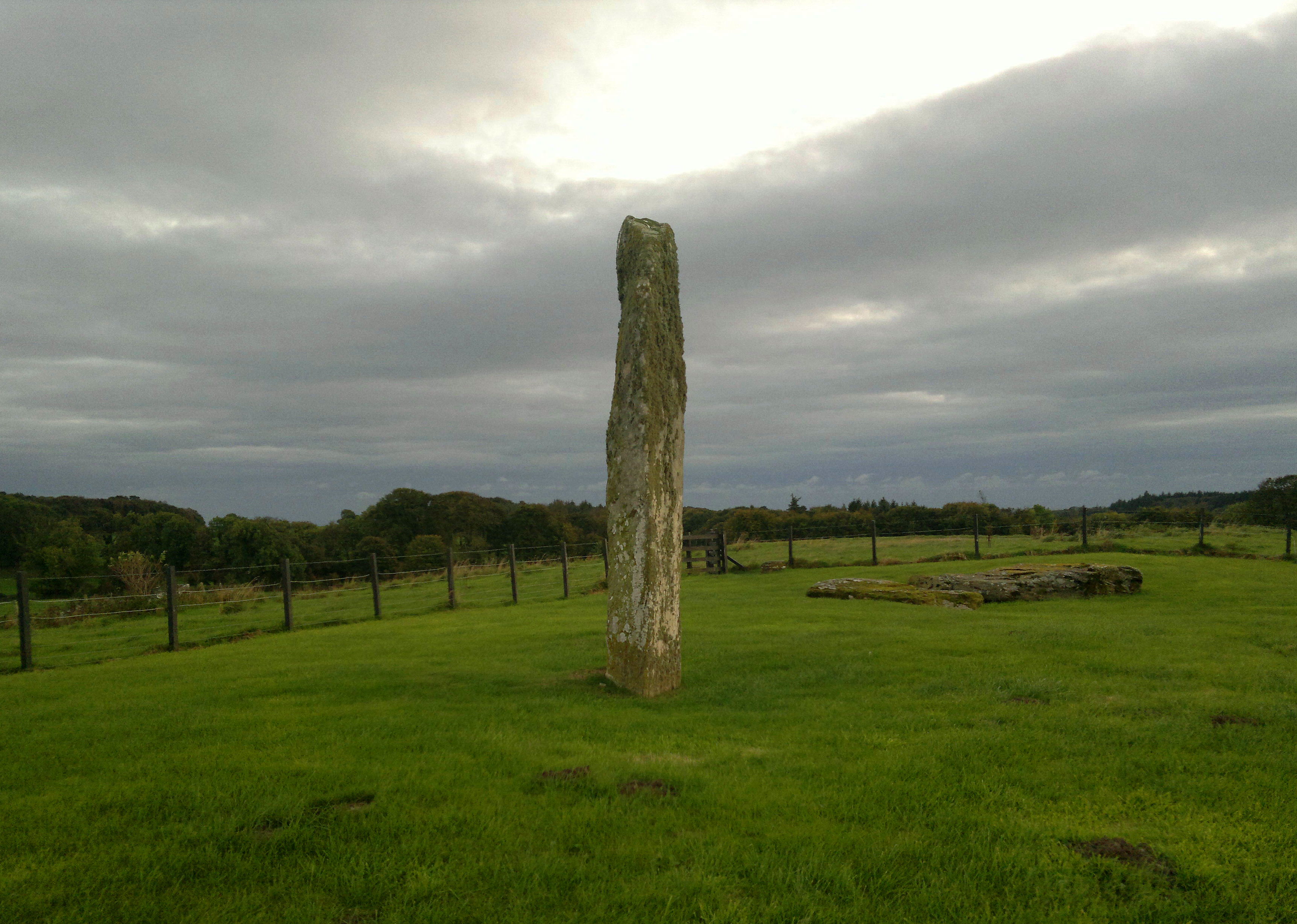
Note how the stone is significantly broader on the ‘field’ side of the wall

2016... someone planted rambler roses either side of the stone, must look very pretty when in full bloom June/July, but need tending to avoid obscuring what they’re supposed to frame (Paul’s Scarlet Rambler, dontcha know..regards, TMA/HH gardening correspondent : ) )

The cairn, such as remains of it, is in the brambles to the left of the rocky outcrop at L of beach. A good place to chill, especially at low tide. Fine view of Ailsa Craig.


Well, after all these years s o m e o n e had to bother to photograph the poor thing, neglected in favour of the neighbouring glamourpusses... I hope the person whose resting place it is would approve and will sleep better.


Seen from the northwest, atop the railway embankment.
There are some places that I hold dear due to memories of antiquarian stomps with my late dad in days of yore, places that I have not returned to since his passing twenty years ago. Minninglow is one such. We first visited not long after the rails of the Cromford and High Peak line had been lifted at the turn of the ‘70’s, our feet crunching along the limestone ballast as we trekked in from Newhaven crossing. The atmosphere of the place on that blue sky day captivated me the way that the arid calculation of azimuths never will. I had last been there about ten years later. After marriagr,lthough moving much nearer than when on holiday jaunts, life had precluded a return. I had, though, seen Minninglow from afar countless times, as it hove into view on the A621 south of Owler Bar near Barbrook. Some people always greet magpies... I always silently greeted the sight of that beech tree topknot that never failed to raised the spirits. “Hello Minninglow!” The tree profile changed with seasons and time, but always had the same effect. So near but so far.
The hankering for return had been increasing steadily, a must. I had read after the passing of TMA’s Stubob that his ashes had been scattered there at his wish, and this had made me smile. I understood. It also acted as a nudge. I had wanted to go earlier in the season at budbreak, but the demands of fieldwalking in the soon to awaken bracken had precluded this..a race to at least cursorily survey a list of sites I’d been given where the Peak Park did not hold much archaeological data took precedent, and at weekends my nose had been to the gritstone. This had been brought to an abrupt halt the previous weekend, when seven hours of tooing and froing in the sprouting green menace wearing new boots, although productive, had resulted in a huge heel blister and a bad viral ‘do’. Time to have an enforced break. My allotment this Sunday had been my intended limit. I’d then remembered that a steam engine would be visiting my former preserved railway haunt at Matlock, and I couldn’t resist a look and a picture of its departure back to London. Just in case I put the OS Explorer in the car. I needed some limestone. News of further damage to Stanton’s Nine Ladies, another haunt with dad, had upset me too. A further defilement of memory. I needed the antidote of a place where such acts would be unlikely, away from the maddening, gormless crowd. Only one place would do, if I felt up to it. Soil was turned for a while on allotment, then, yup, I reckoned the drive south was doable.
I drove to Matlock, thence Cromford, limped to a vantage point, got my shot, rued not paying in an almost deserted out of the way car park at six on a Sunday evening, then dammit, I had to do what I hadn’t for nigh on thirty years. Up the Via Gellia, past Grangemill, then the Parwich turn off the A5012 to the car park at SK195582. As I neared there were swallows wheeling in the sunshine round nest sites in the huge limestone railway embankment that shielded my goal from view. Only two cars in the car park. I wondered if they’d gone to where I was heading...and also wondered if my goal was accessible. There had been no TMA fieldnotes since 2012, and Stu had posted that concessionary access was to end. One way to find out. I struck out, wincing from my blister, from the car park. Once out of a cutting and atop the finely engineered embankment there, to my right, was Minninglow, drawing me on. There too was the farm. Were eyes watching me? Had Stu’s nearest and dearest had to ask for access? Would I be confronted with an unsurmountable field wall near my goal?
I pressed on, Minninglow ever larger, as larks sang above and lambs bleated around in the early evening sun. A runner passed, then a cyclist. That was it. Such a contrast to Matlock Bath’s bustle. Through a cutting which opened out into a lineside quarry, then, yes!!! There was a metal gate to my left, and, adjoining, a small wooden one...and a recent sign confirming a concessionary path uphill to my destination. The limping w a s worth it. There were no bootmarks in the mud. Perhaps people are offput by there being no path marked on the OS, perhaps this place just seems too far out the way. Perhaps this is a blessing. No voice would shout ‘get off my land!!’ from the farm..just the sound of happy children playing drifted uphill. Lift the catch, through that gate, past the woolly mums and kids, past the limestone scarp, and there was that encircling wall with the open gate. It had been too long. I confess emotion. I had known here when the encircling tree belt was but the tiniest saplings, and prefer it with just the central beech sentinels.. surely the builders had meant here to be seen. If others prefer the present day seclusion so be it. One day the trees may be gone but those capstones and mounds will remain. I kicked and scraped a few molehills, ‘just in case’, and then, taking a breath, through the gateway. Back. The bronze age cairn, with young nettles starting to conceal Bateman’s stone exposures for the summer, was to my right. I stopped, thought of my dad and then, mindful that Stu’s ashes might be underfoot, walked slowly and lightly as I could to the main mound and those great capstones again. So good to return after all this time. No carved names, no paint..just everything as it had been and should be. After another pause and contemplation of my own mortality I took stock. There were one or two small stones protruding through the grass. Had Bateman excavated everything here, I wondered. I photo’d, then went through the gate on the low’s furthest side.
The footpath veers to the right. I walked a little way straight ahead to get a view of another nearby cairn marked on the Explorer. A small green mound, no discernible stonework at that distance. I decided my blister should take precedent over curiosity and instead opened out the map to try and ID the other see for miles highpoints...if sheep have a sense of humour they would have enjoyed the battle. Paper won, but was mishapen. Back to the capstones, a quiet pause, taking in the lowering sun streaming through the beech trunks and branches..then time to go. I wiped my boots. Stu remains where he wished. Downhill, out into the evening blue. Turning right on the uphill side of a wall that cuts along below the scarp I wanted a look at another cairn marked on the OS. Close inspection was not possible due to a wire topped wall barrier, but I found a stone that seemed of interest embedded in that wall below the scarp. It was of wall height, and seemed to serve no demarcational or structural function. If anything, it was a structural weakness, as the wall was toppling either side. With some possible packing visible, was this contemporary with the hilltop sites? Had it been noted? One to read up on in due course.
I retraced my steps to the Midshires Way..somehow my steps felt lighter. No kids voices from the farm now. As I walked back along the black ash I scanned left and right, looking for signs in the close nibbled fields around of those who had built Minninglow for their loved and revered. On the north side of the farm and uphill? Who knows. So much remains hidden still. We do not know it all, never will. What I do know though is that, yes, Minninglow still is a special place, four square to time, part of the fabric of the landscape and my life, and I felt recharged and fulfilled by my visit. I hope others will too. Don’t believe the map. Go. Once will not be enough. I walked slowly back to my Landy, past the cowslips and curlews, lambs and larks. An hour later I was back at my allotment, picking rhubarb in the gloaming. Better. Date of visit 22nd May 2016.
Before meeting the first group of trees to your left you will see Mag Low...one of those ‘easy to reach with vibe’ sites. The shafts of sunlight picked it out, bright green. On, till you cross the brook. I climbed a stock track that passed under an old hawthorn, then, cresting the rise, the ‘whateveritis’. There looked to be three pretty evenly spaced degraded remains of small cists tucked into the inner face of the ring. The light wasn’t right, so thought I’d wander before returning to photo. Uphill, through the open gate, the grass undulated and there looked to be traces of trackway and other earthwork. These, and the presence of sorrel, also an almost ubiquitous bellweather of settlements on the west coast of Scotland, made me feel ‘as sure as’ that those who built Green Low lived here. I climbed the rise behind, looking for more earthworks. Yup, but I reckon not t h a t old. A potter in the top of the wood prior to the intended extended pic session looking down on the site..I was looking the wrong way. The wind had got up, then, suddenly, snow. With surreal speed it fell and was blasted into the branches and grass. I couldn’t see more than 100’ for a time. Curtains crossed the valley, muffling the sound of trains climbing to Cowburn Tunnel below. It was bloody cold too. Back down to the site. Not a cist to be seen. Bother. The sun was back though. A few pix, decision made that this place was well worth a return, then back along the track. A happy woman with her even more happy offspring passed, heading to where I’d been. A fine, easy site to blood the young archaeo with. Good luck to ‘em.


