I parked the car in the Aber falls carpark. Pass the first parking area then left over the stone bridge then turn right. It is £2.00 to park for the day. There are picnic tables and loos here too.
Follow the signs for Aber falls crossing over the wooden footbridge. After climbing some steps you are given the choice to either go to the falls or go left up the hill to the laven view walk. This is the path you take.
Not being the best map reader I hadn't fully appreciated that what I thought would be a gentle up hill stroll was actually quite hard going. It's one of those never ending hills.
The path is easy to follow. You will see another path joining it on your right, don't take this path. Keep on going up the hill until you come to the next right hand path.
Before you take this path looking to your left you have wonderful uninterrupted views of Foel Dduarth.
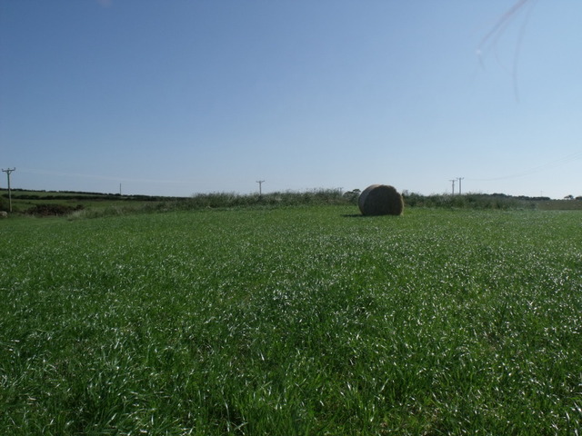
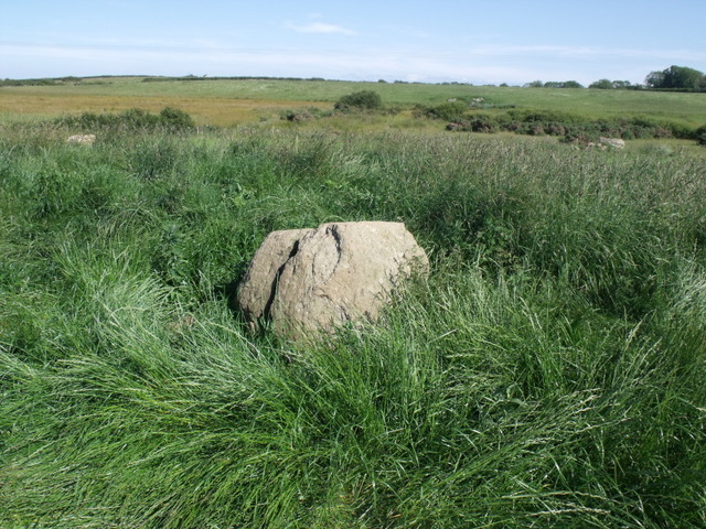
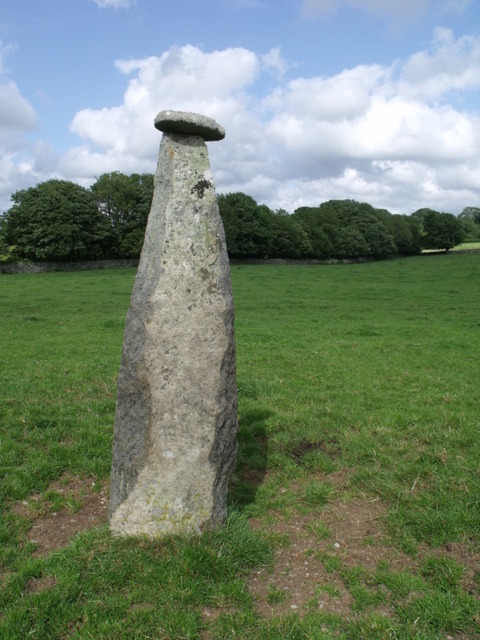
The path continues to wind up the hill. If you are feeling ok you can take a left hand track marked by two boulders. This will give you more of a climb up to the round cairn. Or you can continue along the track. Round 2 left hand bends and you are on the flat. Behind you is the sea and ahead of you on the right is the round barrow.
The views down across to the sea are lovely. It was so peaceful. I didn't see another soul and considering how many cars I'd seen parked up I was lucky. I guess most people are heading for the falls.
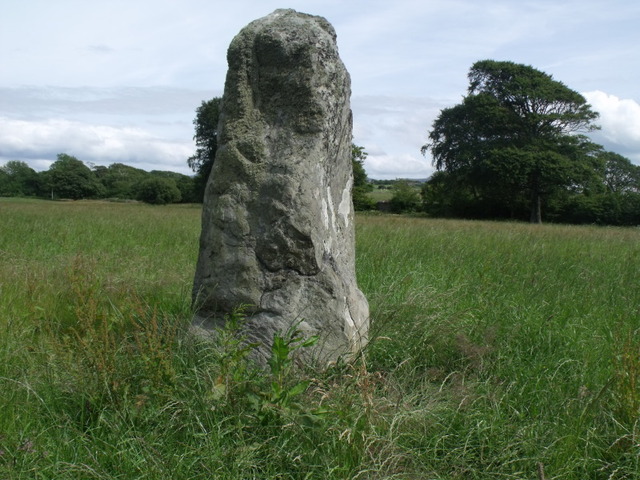
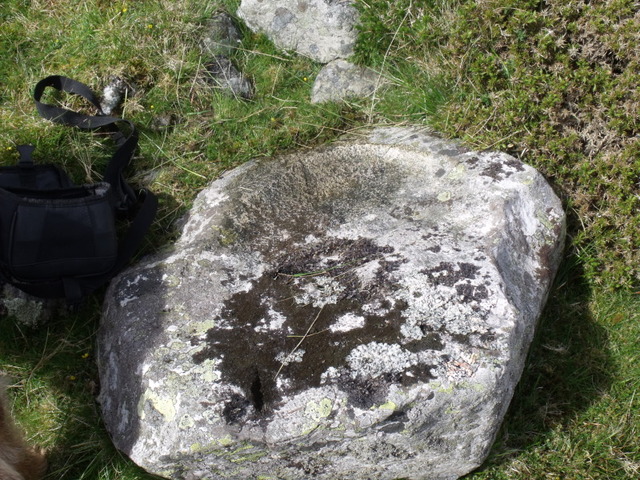
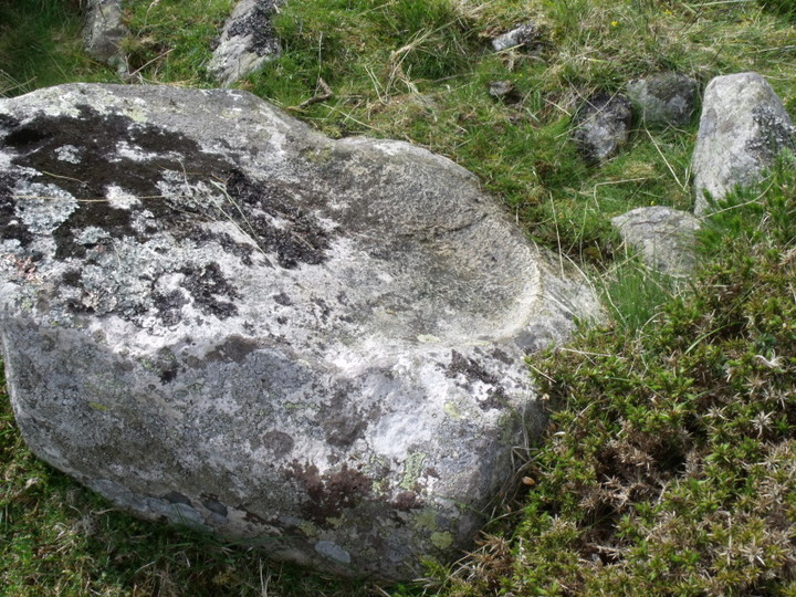
The cairn is great. The shape was clearly defined. Unfortunately the heather made taking a good pic almost impossible. But I could clearly see kerb stones and also the large stone in the centre thought to be the remains of the cist.
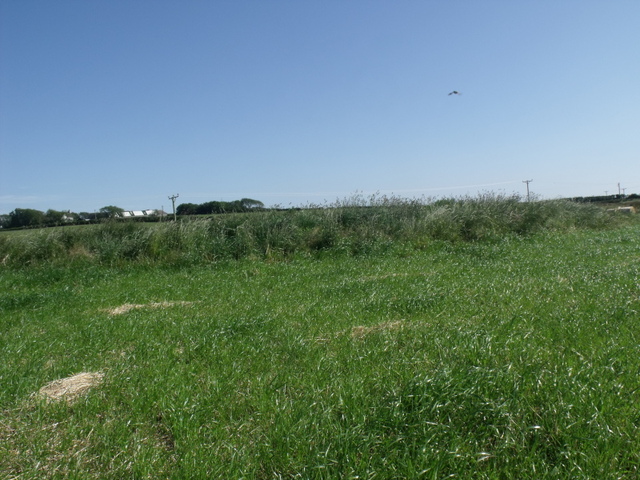
I could see why they chose this spot. Veiws of the sea and also across Foel Dduarth and Foel Ganol and beyond.
I'd planned on visiting more Cairns today but the hill did me in and I decided to leave the others for another day.
|
I liked it here.
Someone was playing an electric guitar somewhere and the music filled the air. I couldn't tell where it was coming from and wondered as I looked for the burial chamber if I would find some crazy old rock star sitting on it being all rock star-y.
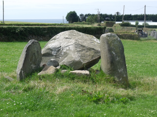
There is an easier route and with places to park. If you follow the Brnsiencyn road signposted for the sea zoo. Take the first proper right hand lane. It's quite windy and you will see a public footpath on the right. This leads to the chamber but there is no where to park here.
Follow the road along and take the next right hand turn. There is a sharp right hand bend with a driveway opposite. Not far passed this is a big white house on the right. Then a small residential area.
Park up here, there is plenty of room. Next to the big white house, on the right hand side of it, is the other end of the public footpath, although it is unmarked at this end. Walk down passed the white house then through a kissing gate.
Continue a really short distance through this field to a gate on the left.
Then diagonally over this really small field to another kissing gate next to a white farm house.
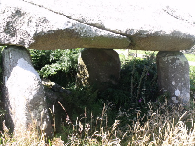
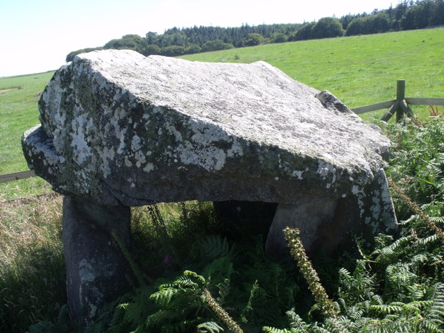
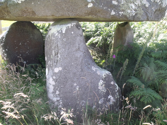
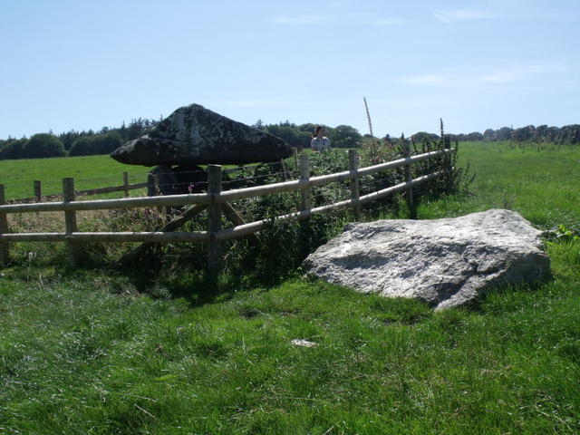
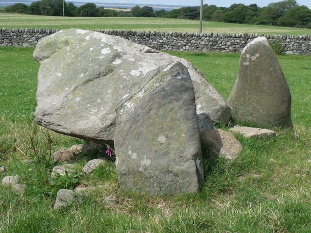
The chamber is in the field next to the side of the house.
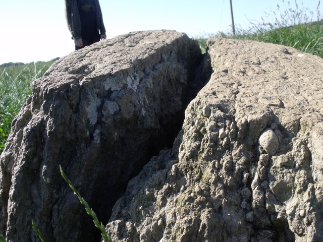
It is really hard to imagine what this would have been like. Maybe it was always very low to the ground?
But it is still charming.
|
   
|
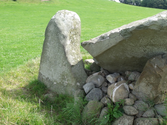
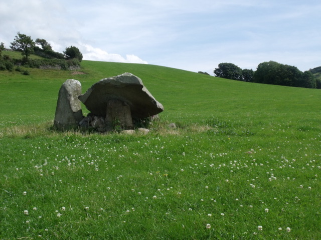
Follow the B4417 Nefyn to Pengroeslon Road. Just before Penllech there is a sharp left hand bend in the road. Just on the bend is a left hand turn. Take this road. The lane passes through a wooded area. As soon as the woods end there is a a yard on the right hand side with a metal shed/garage. The chamber is in the field just beyond this yard. There is a kissing gate leading into the field.
I parked here as there was no one around but as we were leaving the owners of the garage turned up. They were fine with us being there once we explained why we were parked up there.
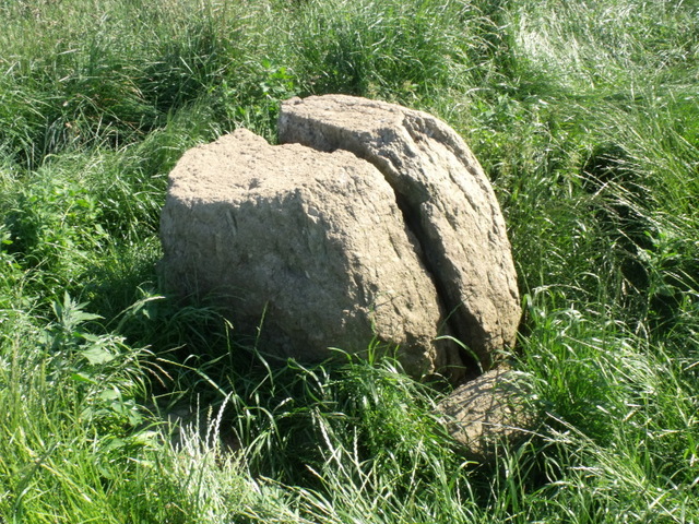
It looks like the fencing has recently been replaced so I didn't manage to get in. The capstone is huge. The setting is lovely.
|

|
Taking the A497 Pwllheli to Nefyn road take the left hand turn onto the B4415 road (signed towards Botwnnog)
At Bodgadle the road forks off to the right. Take this windy little lane. Take the first right hand turn which will lead you through some woodland.
The road winds to the left passed some farm houses on the right.
The stone is in a field on the right. There is a gate on both sides of the road so easy to pull in.
When I visited the farmer had not long planted crop and new shoots had just come through, so I decided not to go into the field. But took pics from the gate.
What disappointed me more was that the farmer was using the stone for a scarecrow. He has tied the scarecrow to the stone.
I wasn't impressed!
Following along this track will bring you out onto the same road you turned off.
|
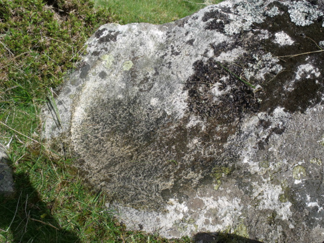
Brilliant site with lots of information and great photographs showing all the cup marks
|
I'd seen the pottery and grave goods from this site at Bangor Museum and read all about it. The jet necklace was absolutely beautiful.
And so despite it having disappointed stubob I decided I wanted to visit because it was clearly a site of some importance.
Frances Lynch says that
"the arrangement of burials and personal belongings chosen to accompany the dead have some interesting social implications. Unlike contemporary burial monuments in some other parts of Britain, no one individual is afforded a position of primacy with in the cemetary. The burials were placed in apparent equality around the stone ring, even though their personal belongings suggest variation in wealth.
she goes on to say
the separate burial of infant earbones, an unexplained ritual practice found several times in North Wales, is especially evident here.
The walk down the track is easy. It is concrete and flat. And some what un-inspiring. We followed our map and Frances Lynch's directions.
The farmer passed us in his tractor giving us a wave. We went into the field and climbed the mound. I began reading from Frances Lynch's book to my kids, blahing on about everthing that had been found and talking about the central stone etc... While my son, Rowan, frowned and looked confused.
Next thing there is a shout from the previously friendly farmer who had stopped his tractor and is waving his arms about shouting something at us.
We thought we should go over to him and he had come to the side of the field still waving and shouting.....
"it's not there, it's over there...in the next field."
Hmmmmmmm!
We thanked him and trudged off to the next field where Rowan told me that nothing I had been saying whilst in the other field was making any sense, and now we know why.
|
    
|
 
|
Travelling from caernarfon towards the LLeyn on the A499 you take the left turn at Aberdesach. Opposite the left hand turn is a stone built bus stop and a phone box.
The chamber is clearly seen from the road, it is opposite the entrance to Penarth farm caravan park.
I agree it would be great to see this restored. It is a lovely chamber and the setting is great.
I spoke to a chap who was sat on the top of his caravan and he said that the farmer is happy for folk to visit at anytime.
|
    
|
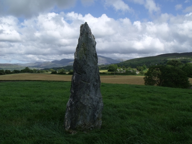
Do you think that the nearest place to this is Capel Curig rather than Llanrwst?
The main A5 road from Bethesda to Capel Curig cuts through this valley.
The Gwynedd Archeological Trust call this the Afon Bedol Standing stone but recognise that it was probably part of a stone circle surrounding the Cairn.
http://www.cofiadurcahcymru.org.uk/arch/gat/english/gat_interface.html
(type afon bedol in the search for box, one click on the results box, below the map, will indicate it's position. 2 clicks will bring up notes)
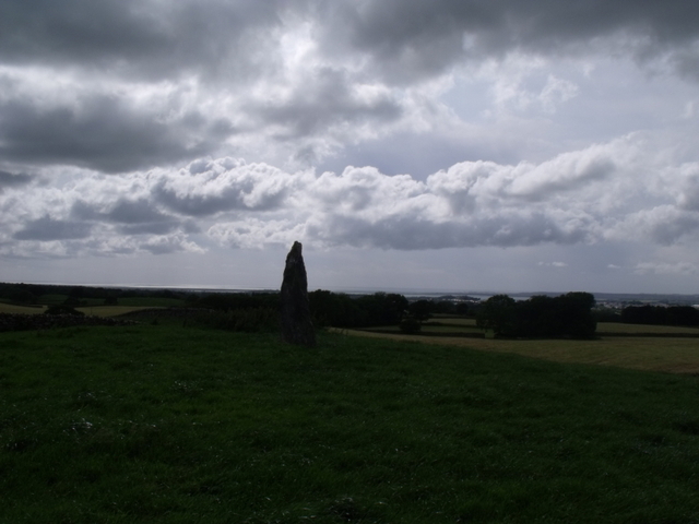
I have found a much less soggy and strenuous walk and still with the outstanding views Postman speaks of.
If you are driving along the main A5 from Bethesda you will see a farm campsite on the opposite side of the road about 5 1/2 miles from Bethesda,
Just before you come to the Public FP marked on both sides of the road there is track with a gate and stile on the left hand side of the road. at approx SH 68806030.
This belongs to Welsh Water. If you park carefully close to the wall you will not be blocking the entrance.
Climb over the Stile and follow the tarmaced track up to the leat. At the leat there is a farm gate. Don't go through this but instead climb the stile on the right and follow the track around the edge of the leat.
You will have to cross over several very small stiles but the leat will lead you right round to the valley in which the stone sits.
Once you go around an obvious bend follow the leat to the weir/dam with the little hut beside it.
There is an obvious track leading down from here to the bottom of the dry stone wall. Here you'll find the stone and Cairn.
In Postmans 3rd picture he points out the dry stone wall but you can also see the line of the leat leading round the side of the hill.
|
This from the GAT HER page:
Cairn, S of Bwthyn Graeanog
Primary Reference Number (PRN) : 225
Trust : Gwynedd
Site Type : CAIRN
Period : Bronze Age
Community : Clynnog
NGR : SH45504913
Legal Protection :
Description :
A damaged cairn of earth and stones 1.3m high and about 18m in diameter. Condition: mutilated by ploughing.
Cairn 1.0m high. Surveyed at 1:2500.
Telegraph pole on mound, now oval, used as a stone dump.
Threat of quarrying avented.
Description of clearance a reinstatement work (this is the south cairn).
A large topsoil dump and modern field clearance were removed from two cairns at Cefn Graeanog, Clynnog, Gwynedd in September 1989, as part of land restoration, following gravel extraction by Penrhyn Quarries Ltd. (a division of Alfred McAlpine Quarry Products Ltd.) As well as being scheduled ancient monuments the standing stone and cairns had been protected from quarrying by a section 52 agreement under the Town and Country Planning Act between the Quarry and the GCC Planning Department. Unfortunately, during preliminary land reinstatement work at the end of 1988, part of the north cairn was accidently occluded with a large topsoil dump, whilst the south cairn, already showing evidence of machine damage and obscured by boulders, had its west edges graded down to below subsoil level. Ensuing clearance and reinstatement work agreed between CADW and the Quarry was undertaken by GAT, mainly by machine but with the addition of a hand dug 3x 1m trench on the west edge of the south cairn to establish the precise extent of the disturbance caused by the grading and to locate the edge of the cairn and see whether or not there was a kerb. G2130-504 and G2130-503 digitized form on U:G2130.
A rather vague, irregular low mound, much damaged in the past and then partly restored by R. S. Kelly in 1989. Some of original cairn was shown to survive so buried features may exist.
Monument de-scheduled, and will be omitted from the statutory list of ancient monuments.
Sources :
Prehistoric Funerary and Ritual Monument Survey: West Gwynedd & Anglesey , SMITH, G. , 2003 ,
|
     
|
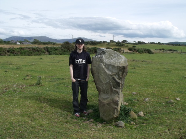
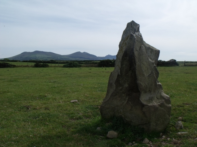
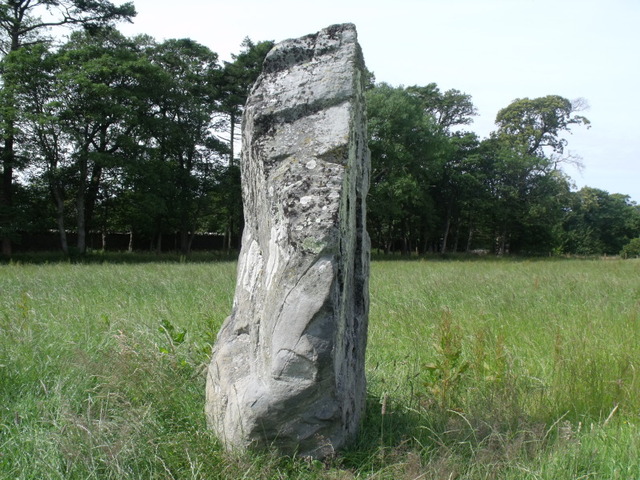
I would suggest that if you are coming down the A499 from the Caernarfon direction you will see the huge gates for the Glynllifon park on your left. Just after this is are the metal gates of the Park Newydd house. The next left is the road to Pen y Groes.
Take this turning. Immediately on your left are the metal gates of a gatehouse. Park by the roadside here.
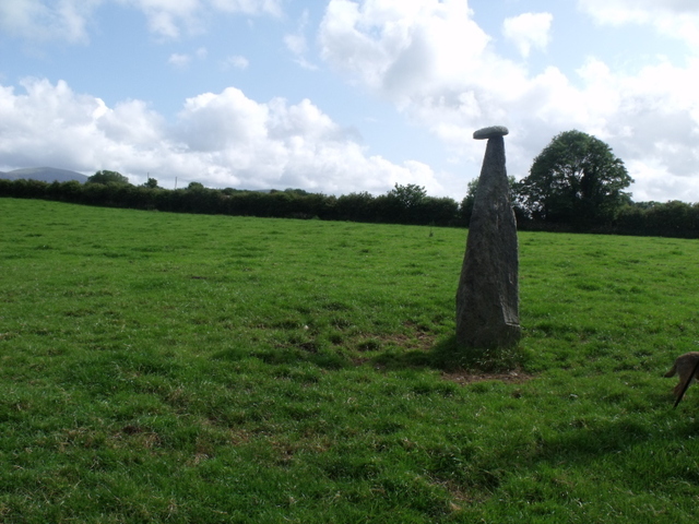
You can see the stone in the field from these gates. I asked the owner of this house and she was happy to let me go into the field to look at the stone.
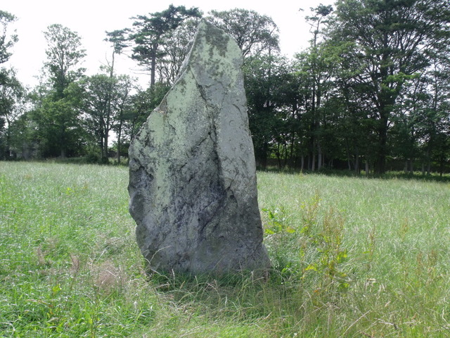
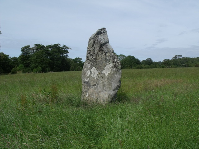
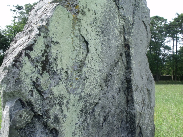
I loved this Stone. Lovely textures and colours. A huge Stone with real presence. It felt majestic.
A layer of calcined bone mixed with charred wood and fragments of a burial urn (early Bronze Age) was found 1m east of the stone.
|
From Welsh Rock Art Organisation website.
Llanfechell (East) Standing Stone (NGR SH 370 916)
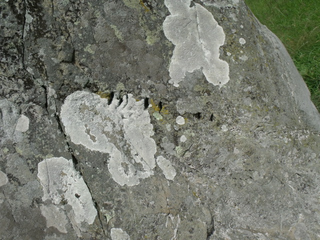
Following the recent collapse of a standing stone (or menhir) at Llanfechell, near Cemaes, north Anglesey in late 2009, researchers have been given a rare insight into the symbolic nature of standings stones, one of Western Britain's most enigmatic monument types. The fallen stone was probably the result of a combination of long-term inclement Welsh weather and cattle-rubbing.
This Scheduled Monument (SAM An 80, PRN 3048) site is set within a busy prehistoric landscape that also includes the Cromlech Dolmen (ANG 15), a series of standing stones (including the triangular setting of three stones at Llanfechell [NGR SH364917]) and recently discovered cupmarks on rock-outcropping (Nash et al. 2005). The standing stone, according to Cadw would have stood around 2m in height, with a further 0.50m buried and incorporated into a set of packing stones.
Following its collapse in 2009, Cadw requested Gwynedd Archaeological Trust (GAT), the regional monitoring authority to re-erect the stone, all 4.6 tons of it (Smith & Hopewell 2011)! In January 2010, the stone was moved from its prostrate position in order that the socket hole and the immediate area could be archaeologically investigated; initially by geophysical survey (by David Hopewell), then followed by targeted excavation (by George Smith). The excavation revealed at least 20 packing stones within the socket pit. On one of the faces of a large packing stone measuring approximately 0.80 x 0.95 x 0.50 m was a pecked cup-and-ring and a single cupmark. The cup-and-ring, measuring c. 10cm in diameter is probably the first recorded in North Wales and can therefore be considered an important discovery. Previously, the nearest cup-and-ring carvings were to be found at the Calderstones monument in Calderstone Park, Liverpool and on the base of the Robin Hood's Stone, a standing stone located several kilometers to the south-west of the Calderstones. Located on the same face is a single cupmark which is oval shaped, measuring c. 0.80m by 0.3.5cm.
As part of the research agenda, Ben Stern (University of Bradford) undertook organic residue analysis from within the engraved areas in order to test the possibility of the engraved areas being once painted, however the results were negative (no lipids found within the two samples taken).
The reason why a stone with a cup-and-ring (and cupmark) should be buried within a packing features for a standing stone is unclear, however there are a number of plausible reasons why such a potent symbol might be buried. It could be the case that the stone [fragment] (with the cup-and-ring) originates from another monument and this may have stood on the site; becoming redundant, later destroyed and pieces of it incorporated into construction of a new monument (i.e. the standing stone). It could be the case that the new stone may have represented a new ritualised ideology (e.g. similar to the fate of a 10m menhir with rock art which appears to have been deliberately broken-up and incorporated into three Brittany passage graves). Alternatively, it may be that in order to legitimise the standing stone, a decorated stone fragment was buried during a ceremony associated with either the initial use of the monument or it may have an association with a pit that lay beneath the packing stones. The pit at Llanfechell contained a dark humic soil with charcoal which may relate to an offering or some form of feasting event, prior to the erection of the standing stone. The date of this sub-surface activity is however difficult to ascertain, possibly associated with Late Neolithic/Early Bronze Age ritual activity. Despite this speculation, the GAT team have retrieved one radiocarbon date of around 400-700 BCE from carbonised material which is much later than the expected date for the use of the monument. However, similar to other monuments of this type in Wales, there is more than one history attached.
The standing stone (minus the cup-and-ring packing stone) was re-erected in September 2010, whilst the engraved packing stone was placed in the care of Oriel Ynys Môn (museum). The cup-and-ring and single cupmark is carved on a laminated Protozoic mica schist.
|
In Llanfechell look for the tall white 12 century church. It can be seen from all around. It has a distinctive old beehive shaped tower which has been white washed and has a metal cross on the top.
In front of the church is a war memorial with a small clock tower. The church yard is a walled and seems almost circular. The road that the church is on is called Brynddu Road.
Making sure the church and wall of the church yard are on your right follow this road up the hill take the second road on the left.
There is a rather large modern house on the left. In front of this house is a small layby type parking area.
The footpath is on the opposite side of the road just past the 3rd house. It is clearly marked from here. The 3 stones can be seen from here, and are about 10 mins walk.
|
Sadly nothing can be seen here.
I did a short course on the archeology of Gwynedd when I first moved here in 1995. The tutor who worked for G.A.T told us that during the excavations in the 1960's all the finds were lost. In his words they are probably sitting in a carrier bag in the cupboard under someones sink!
Recent excavations in a nearby field turned up lots of interest and can be found here: http://www.heneb.co.uk/llandegaiweblog/llandygaiintro.html
|
|