Steep slopes fall from the broch to the Carnachy Burn.
Image credit: Les Hamilton
Steep slopes fall from the broch to the Carnachy Burn.


This is the only recognisable stretch of the inner wall exhibiting facing stonework.

This open section of mural gallery is the only major feature remaining at Dun Chealamy.

Looking down on Strathnaver from the vantage point of Dun Chealamy
Visited: June 19, 2019
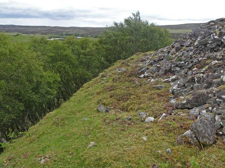
The remains of Dun Chealamy stand on the top of a grassy mound which falls steeply around most of its perimeter. The broch is in near total ruin, Canmore stating that it “was badly damaged in a search of stones for building a bridge and a dwelling house” in the early 1900s. To add insult to injury, the stones of the broch have again been plundered to erect a cairn in front of it (an event not elsewhere reported as far as I can determine).
It’s so sad that even in this relatively remote spot there are people who show our national monuments no respect!
As for Dun Chealamy itself, there still remain short segments of both internal and external walling several courses deep, and there is an exposed section of a mural gallery which also reveals several courses of architecture. But that’s about it and the structure has been so badly ravaged that there is not the slightest trace of an entrance passage.
But the views from the broch down to Strathnaver are extensive, and in its day this broch would have been a formidable fastness.

This gate is the starting point for a visit to the broch. Thing’s Va can just be discerned as a tiny hump on the horizon, about a kilometre away.

Almost there! This is the view of Thing’s Va’s grassy mound from the approach path.

This image is a composite of six phtographs across the summit of Thing’s Va broch.

The entrance passage at Thing’s Va, heavily overgrown but still discernable.

This, presumably, is the ‘probable guard cell’ reported by Canmore.

This is a probable section of heavily overgrown inner wall-face at Thing’s Va
Visited: June 18, 2019
Though highly impressive when viewed from the air, Thing’s Va broch has few redeeming features when visited on the ground.
Aerial view of Thing’s Va (Image: Caithness Broch Project)
Thing’s Va sits atop a low hill just west of Thurso, as illustrated above.
The best starting point for a visit is a lay-by on the A836 at OS: ND 0867 6923.
Walk down the road (towards Thurso) for about 400 metres, and a few metres farther than the gated loop of old road, you will find a gate to a field. Inside the field, a good path heads southwest up the field through mainly grassy terrain with a sprinkling of gorse. You can just make out the broch on the horizon ahead.
If you count the drystane field dykes to your left as you pass them, Thing’s Va is on the right just after the 4th dyke. The walking distance is a shade over a kilometre.
Sadly, there is absolutely nothing particularly impressive on the ground at this site these days. The broch rises as a grassy mound within a recently emplaced surrounding fence. Annoyingly, although there is a gate for visitors, whoever installed it drilled the posthole for the securing bolt somewhat on the small side: I couldn’t budge the bolt and had to clamber over the gate.
The entrance passage to the broch, heavily overgrown, is still discernable, and there are a few sections where fragmentary masonry protrudes. Also visible is what could be a guard cell as a deep pit in the turf, and here and there can be seen short sections of walling.
Canmore provides considerable information concerning features that have been observed in the past, but with this recent (2007) caveat: “A recent survey showed that most of the features described by the Commission are not now visible”.
Historical Note
Thing’s Va broch is a drystone, hollow-walled structure built by the Middle Iron Age inhabitants of Caithness. Much later, some time after the mid 9th century CE, the remains of the broch were used as a meeting place by Norse incomers.
The name “Thing” comes from an Old Norse word meaning a “meeting place”, and variants are found in place names elsewhere, such as Tingwell in Shetland and Dingwall in Ross & Cromarty (source: The Public Information Board at the site of Thing’s Va).
An ancient well at the top of one of Scotland’s most iconic mountain peaks has been unearthed for the first time in hundreds of years.
Archaeologists from Aberdeen University’s Northern Picts projects made the incredible discovery this week at the Mither Tap, one of the summits of Bennachie in Aberdeenshire. The deep granite well would have served as a water source for the occupants of the impressive fort at the top of the hill, the remains of which can still be seen today.

Grave Mound No 1, viewed from the northeast.

Viewed from the southwest, Grave Mound No 1 lies just off a path junction. Around two metres tall, it is the most expansive of the group.

Grave Mound No 2.
The path to the right heads north, and Hunebed D11 can just be seen, on the path, in the distance.

Grave Mound No 2 in its forest clearing.


Grave Mound 3, one of the largest in this group, stands almost 2 metres tall. It is also the farthest east of the six.

Grave Mound No 4 lies on the opposite side of the path to No 5.
Grafheuvel No 5 is a grassy mound located at the junction of two forest paths.
Visited: April 18, 2019
National Monument 45018 in the Evertsbos
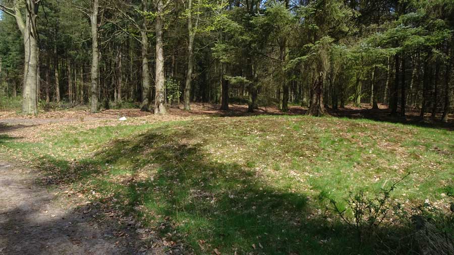
This area of the Evertsbos woodland contains a group of grave mounds, described in the official monument list for the Anloo district as “seven or eight mounds”. There seems some doubt as to the actual number, but as I walked the paths, I encountered the six grave mounds indicated on the map below. They all sit close to paths between 100 and 300 metres south and east of Hunebed D11: you don’t have to go searching for them as they are easily spotted from the paths.
All six grave mounds can be visited, along with Hunebed D11 in a circular walk from either Anloo in the north or Eext in the south. A leisurelly hour and a half should suffice. Mounds 1, 2 and 3 are the most impressive, all rising to around two metres. The other three barely reach a metre in height.
The non-intuitive numbering of the mounds is the assignment given by Museum ‘Oer‘, located in Ulft, Netherlands. This link displays two further maps showing the locations of the mounds, plus a photograph each of mounds 1-7.

Grafheuvel No 6 stands on the opposite side of the path to mound 3 and a few metres farther west.
Visited: April 18, 2019
Galgwanderveen, also known as Braamsplas, is a small kettle-hole lake dating from the last Ice Age. Renowned locally as a fishing lake for carp, it is located 2.5 kilometres south of Anloo and 1.5 kilometres north of Eext.
In the woodland surrounding this lake are five Late Stone Age grave mounds, of which this splendid example (marker ‘G’), located just a few metres from the water’s edge is by far the most impressive, rising to almost four metres in height.
The best approach by car is from the village of Eext (at bottom right of the map above), as there is a convenient car park just 200 metres southwest of the mound.
Note
There are grave mounds in several different locations in this area of woodland (the Evertsbos), each identifiable by virtue of its National Monument number.

The Galgwanderveen Grave Mound as viewed from the approach path through the woodland.
The Galgwanderveen Grave Mound.

The Galgwanderveen Mound in its beautiful lakeside setting.

Close-up view of the grave mound from across the lake.
Visited: April 18, 2019
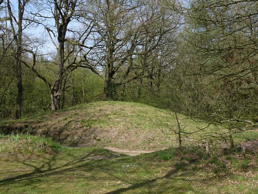
In a clearing in the Evertsbos woods stand two impressive grave mounds, situated 90 metres apart. The smaller western mound rises to almost two metres in height, but is dwarfed by its near neighbour, which probably exceeds three metres tall.
Both are symmetrical, grass-covered mounds, free of rampant weeds and young trees, so must in all probability be well looked after by the Boswachterij Anloo (Anloo woodland management).
To reach the grave mounds, it is a pleasant walk of 1¾ kilometres from Anloo, through woodland, until the trees thin significantly on the left. To track your progress, count the forest tracks you pass on the way.
Note
There are grave mounds in several different locations in this area of woodland (the Evertsbos), each identifiable by virtue of its National Monument number.

This is a close up image of the larger of the two grave mounds here, which must be at least three metres tall.

This is the larger of the two grave mounds, and is situated at the east of the site.

This is the western, and smaller, of the two grave mounds on this site.
Visited: April 18, 2019
National Monument 45012
Located just within the boundary of woodland east of the village of Anloo, Liesakkers is a rather unremarkable grave mound, at most reaching a metre in height (red marker on map).
It has clearly been neglected for a long time as it is overgrown with saplings.
Access is straightforward. Just follow Molenberg, the obvious road with a right-angle bend in it to the edge of the woodland, where a rough path follows the tree line. Then it’s just a matter of following the edge of the cultivated area until you reach the corner of the woodland. The mound is just a few metres into the trees.
Note
There are grave mounds in several different locations in this area of woodland (the Evertsbos), each identifiable by virtue of its National Monument number.

The grave mound at Liesakkers, viewed from the south.

The grave mound at Liesakkers, viewed from the east.

The northern grave mound, which is visible for Kerkweg.


The southernmost of the three grave mounds.
Visited: April 18, 2019
National Monument 45013
A set of three grave mounds (grafheuvels) stand just inside the margin of woodland on Kerkweg, about 900 metres south of the village of Anloo, in the Dutch province of Drenthe. From the junction just south of the church in Anloo, briefly follow the road to Anderen, then follow the left turn on to Kerkweg, as shown in the map below.
On reaching the woodland, continue until you arrive at the second track heading east (left). You should now be in sight of the first of the grave mounds (marker G on the map). The other mounds follow on a north/south line, almost shoulder to shoulder with each other.
The mounds are all about 1½ metres in height and of considerable breadth. Unlike others in the vicinity, they appear well looked after: i.e. no saplings and scrub growing over them.
Note
There are grave mounds in several different locations in this area of woodland (the Evertsbos), each identifiable by virtue of its National Monument number.
Visit to MuzeeAquarium Delfzijl, and Hunebed G5
Visited: April 16, 2019
I had been intending to visit the MuzeeAquarium in Delfzijl for some time to view Hunebed G5 at first hand, but was forced to wait several years due to the relocation of the museum some 100 metres inland from its former location close to the coast. This was necessary because the Dutch had embarked on a project to raise and strengthen the sea dykes of the region, and in its original location, the MuzeeAquarium was ‘in the way’.
Hunebed G5 takes pride of place in a hall devoted to minerals and archaeology. It stands almost two metres tall, and was considerably larger than I had imagined. It is set against back-lit murals that depict the community of the hunebed builders at the time of its construction, around 3400 BCE.

Hunebed G5 viewed against a diorama showing a neolithic settlement

Hunebed G5 Heveskesklooster, in the new MuzeeAquarium building in Delfzijl.

Hunebed G5 Heveskesklooster, in the new MuzeeAquarium building in Delfzijl.

Hunebed G5 Heveskesklooster, in the new MuzeeAquarium building in Delfzijl.

Looking into the passage of Hunebed G5 Heveskesklooster.
Apparently, the Holmhead RSC was actually built by a previous tenant of the land during the 1990s.
Read about it in this Daily Telegraph report....
... and on the BBC website.

... and here’s the bhoy, up with the lark, documenting Holmhead RSC shortly after dawn!