LesHamilton

LesHamilton

All posts expand_more 401-450 of 1,910 posts

Recumbent stone circle discovered at north-east farm

A stone circle has been discovered on a farm in the north-east.

The stone circle was found near Leochel-Cushnie and had been unknown to archaeologists until now.

Read the Evening Express report.

Adam Welfare from Historic Environment Scotland said: “In numbering 10 stones it fits the average, but its diameter is about three metres smaller than any known hitherto and it is unusual in that all the stones are proportionately small.”

More information on the Aberdeenshire Council website

See also Aberdeenshire Archaeology Service Sites and Monuments Record (SMR) for more details.

Dun Borve

Visited: September 23, 2018

Dun Borve, situated at an altitude of 180 metres on the hillside just east of the village of Borve, was probably the final outstanding broch I had yet to visit on the Isle of Skye. All too often it had been bypassed en route to other sites to the north and west of the island. But it proved somewhat trickier than I had anticipated.

staticmap?center=57.449,-6.241&markers=size:mid|color:blue|label:P|57.448492,-6.242116&markers=size:mid|color:white|label:G|57.449286,-6.244824&markers=size:mid|color:white|label:G|57.450353,-6.243986&markers=size:mid|color:white|label:G|57.450773,-6.242766&markers=size:mid|color:red|label:B|57.448454,-6.236760&path=color:0xffff00ff|weight:2|57.448492,-6.242116|57.448794,-6.243475|57.448809,-6.244112|57.449286,-6.244824|57.450353,-6.243986|57.450773,-6.242766|57.448454,-6.236760&zoom=16&maptype=hybrid&size=600x400&sensor=false&key=AIzaSyCp6JckL_ykPLQNTeiT2zJYsaR9v2NDwpk

There was no problem parking at the farm as advocated by Gladman (blue marker), but where was that stile? The hillside now seems to be isolated by high fences and padlocked gates, with ‘Danger do not enter’ signs attached. So I walked down the road west into the community of Borve, a few metres past the first two houses, to find the moorland just two grassy fields distant: and there were convenient gates for access (white markers on the map above).

Entering the first field from the road, head diagonally left almost to its far corner, where an open gate leads to the second field. Then head diagonally right to its far corner where another gate leads out to the hillside. Thereafter it is just a 400 metre walk to the broch. Time taken, about 15 minutes.

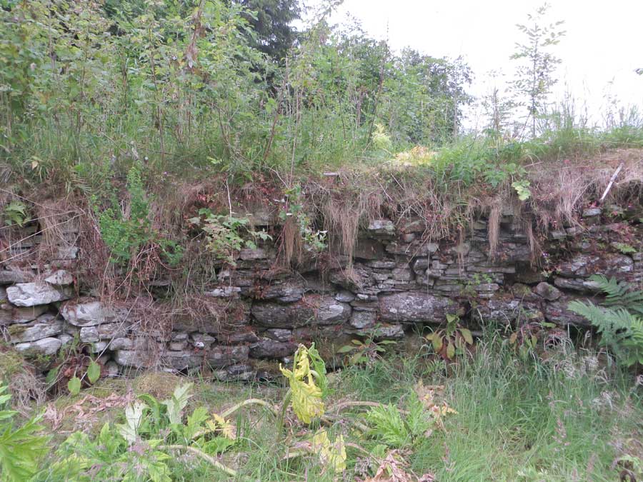
Although Dun Borve is an almost featureless pile of long displaced stones at close quarters, it is well worth venturing up the hillside from where it offers its most striking profile. Down at the broch, the only major structure is a row of a few large outer foundation blocks on the southwest. As stated below, the exercise is well worth the effort for the views the broch offers.

By the way, if you are using an up-to-date map of Skye, the A856 is no more. Both the former A856, and the section of the A850 from Portree to Borve, were reclassified as the A87 when the Skye Bridge opened in 1995.

Ancient Pictish relic is unearthed from River Don after angler spots it due to low water levels

A fisherman found an “incredibly rare” Pictish stone after a long spell of warm weather lowered water levels in the River Don.

Teams from Historic Environment Scotland (HES), the council and Aberdeen University visited the site to remove the relic after the angler spotted it partially uncovered in the river.

The stone, which is believed to date from around 600AD, was removed and taken to the Crown Office’s Treasure Trove in Edinburgh to be examined.

Read the full report in the Aberdeen Press and Journal.

Clerkhill

Visited: June 26, 2018

About a kilometre north of Bettyhill on the north coast of Sutherland stand the ruined remains of Clerkhill Broch. The prominent mound where the broch once stood is now fenced in and is private property. Part of the mound on the east has been excavated, and a house built, while on the very summit now stands a rotary washing dryer.

Even Canmore has little to say about Clerkhill other than that it is:
a possible broch in Farr, Sutherland, consisting of a turf-covered, quarried mound on the end of a ridge, the east half of which has been removed to make way for the outbuildings of a croft. On the west side is a part of the basal course of the outer wall of a broch-like structure forming an arc about 9.0 metres long.

Achvarasdal

Visited: June 29, 2018

Just a few hundred metres from the village of Reay on Scotland’s far north lies one of the largest brochs in Scotland: Achvarasdal. After heading east on the A836 out of Reay, the road dog-legs sharply northward. Almost immediately, turn right following the road for about 600 metres and park outside the woodland surrounding Achvarasdal Care Home. It’s just a short walk along woodland paths, following ‘broch’ signs, to the broch.

Achvarasdal Broch is, in area, one of the largest in Scotland with a court diameter of 9.8 metres. The interior of the broch was excavated during the latter part of the 19th century, but the external wall face was not cleared, and remains concealed beneath a sizable vegetated mound. The walling, which rises to 1.6 metres above the central court, is composed in the main of quite small slabs of light-coloured sandstone, giving an appearance rather like brickwork. Achvaradsal has a most impressive, quite narrow entrance passage, a little short of 4 metres long on its east-south-east.

At the time of my visit, the broch was besieged by a major infestation of Giant Hogweed. Even with a walking pole fully extended above me, I could not quite reach the hogweed’s flowering heads, which must therefore have been at least 4 metres tall. Achvarasdal is one of the brochs promoted by the Caithness Boch Project, whom I contacted about the problem. They replied that they were aware of the situation and would be taking measures to tackle it. I’m pleased to report that, just three weeks later, I was sent a photograph showing that clearance work had begun. Hogweed, however, is not easy to erradicate, particularly if it has been seeding the area for years, so it may take several seasons to render the site hogweed-free.

You can read much more about Achvarasdal Broch on the Canmore website, including details of finds from the site.

The Borg

June 5, 2017

Driving north through Strath Halladale, it is difficult to miss the huge bulk of The Borg looming above on your right, standing atop a mound 38 metres tall and about 200 metres distant. It is an impressive edifice built of large rounded boulders, many of which now form a mantle of tumble all around it.

Although much of the broch wall has degenerated into a field of tumbled blocks, there are still some sections where the structure endures, particularly so in the west where neat courses can be seen rising to a height of three metres. At the other extreme, to the north, the walling has all but disappeared, creating an opening into the central court.

The entrance passage, now largely blocked by debris, lies a little east of south, and can be traced through the entire thickness of the broch wall, and most of its lintels remain in place.

The Borg is most certainly a worthwhile stop on the route north, not least because its elevated position affords splendid views along Strath Halladale.

Image of The Borg (Broch) by LesHamilton

The Borg

Broch

Though partially blocked, it is possible to look straight through the entranceway from the outside, towards a chink of daylight at its inner end.

Image credit: Les Hamilton

Trantlemore

Visited: June 25, 2018

Just 1½ kilometres north of The Borg, off the A897 as it passes through Strath Halladale, a minor road branches left across the Halladale River towards a walled cemetery. Trantlemore broch lies a kilometre farther on on the right-hand side of the road.

There is very little remaining to be seen, just a vegetated rise about a metre and a half tall in a field a few metres east of the road. On the southwest of the structure a section of vegetated wall can be recognised, but little else. There is no sign of an entrance passage.

Langdale

Visited: June 26, 2018

Langdale broch lies about a kilometre from Syre, just north of of the Langdale Burn and 400 metres walk from the road. It stands on the top of a prominent, steep sided grass covered knoll about 40 metres tall, commanding a superb view of the surrounding countryside.

The broch, built from large boulders, is very dilapidated now and little structure of the outer wall facing remains. But the interior walling is still fairly well defined round most of the structure, standing a metre or more high and almost 5 metres wide, though detail of the facing is largely hidden under rubble.

Access is straightforward from immediately north of the farm, where a 4-bar stile gives access through the fence to a steep grassy slope that follows the stone wall round the farm area to a gate, beyond which a path heads past the broch.

Carn Nam Buth

Visited: June 25, 2018

This remnant broch, also known as Upper Suisgill, seems only to have been discovered by the OS as recently as May 1961: it is not shown on any previous historical OS map.

Carn Nam Buth is extremely dilapidated, and while it has been categorised as a ‘possible’ broch on account of size, shape and position, it may simply have been a ditched homestead or dun. It occupies the summit of an impressive knoll that has been artificially steepened, and which would have provided an easily defended position overlooking cultivable land, immediately north of the A897 Kildonan road and 180 metres east of the bridge over the Suisgill Burn.

A visit entails an easy uphill walk over grass to a largely heathery dome showing little remaining structure apart from a hint of foundation course on the southeast flank.

Vandalism at Louden Wood Stone Circle

Discovered on July 23, 2018

Today, making my first visit to Loudon Wood Stone Circle for five years, I was appalled to find the site desecrated by the remains of a campfire: in the centre of the monument’s court were the blackened remains of the fire, complete with a huge pile of litter.

Whoever the thoughtless uneducated louts that perpetrated this atrocity were, there must have been quite a contingent of them judging by the quantiy of residue they left behind. This consisted of two disposable barbecues, numerous plastic bottles and wrappers (some still containing the remains of cold meat) and, worst of all, glass beer bottles, many of which had been smashed to pieces (presumably deliberately).

It is heartbreaking to see such an iconic, Historic Environment Scotland Scheduled Monument defaced in this way.

As I had visited on a very warm day, in shirtsleeves and without a rucksack or any other container with which to remove the detritus, I satisfied myself by carrying out the two largest items (the foil barbecues).

Can I appeal to anyone planning to visit Loudon Wood Stone Circle in the weeks ahead to equip themselves with a suitable container (such as a reusable supermarket shopping bag) to help clear the site. There is a bin at the White Cow Wood car-park where the contents may be deposited.

Baile Mhargaite

Visited: June 28, 2018

Immediately below the hill of Baile Mhargaite, with its summit broch, lie the remains of a Bronze Age village and burial ground on a sandy plateau some 15 metres above sea level. The plateau undulates a little and includes a number of hut circles and three cists.

The main cist, by far the best preserved of the three, lies at NC 69863 61030, sunk into the summit of a mound (cairn ?) about 2.5 metres tall. The cist, measuring 107x56x51 cm, is perfectly preserved, and open (its capstone lies just to one side of it), and is lined on all sides with flagstones.

Just a few metres away at NC 69856 61027 is a second open cist with one end flagstone and its cover both absent.

The third cist lies in level ground some 22 metres north of the first two at NC 69847 61051. It has no capstone, both end flagstones are missing, and the crypt has infilled with sand.