
A panoramic view over Dun Totaig, with Loch Dunvegan on the horizon.
Image credit: Les Hamilton
A panoramic view over Dun Totaig, with Loch Dunvegan on the horizon.

Foundation course walling remains at Dun Totaig.


The well defined entrance passage at Dun Totaig.

This notice stands a few metres away from Burial Mound No 3.


Hunebed D24 Bronneger. It is the hunebed nearest the main track from Bronneger, and the one closest to the Information Board.

This overhead view clearly illustrates the dilapidated condition of Hunebed D24.

The classic dolmen profile of Hunebed D23 Bronneger.


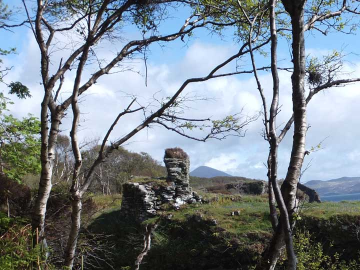
This photograph, taken from the cliffs to the southeast, clearly shows the “missing link” where the present-day Dunnicaer Sea Stack was once joined to the mainland.


The smaller of the two burial mounds near Bronneger.


Constructed from fragments discovered at D19, this is the archetypical funnel-shaped beaker manufactured by the people of the Funnel Beaker Culture.

A vessel from the Funnel Beaker Culture, reconstructed from fragments found at D19, and on display at the Borger Hunebed Centrum.

One of the TRB (Trechterbekercultuur) vessels discovered at D19, and now on display at the Borger Hunebed Centrum.

Hunebed D25 Bronneger, with its sidestones still deeply embedded in the remains of its barrow.


Heveskesklooster Steenkist, now relocated in the Hunebedcentrum in Borger.
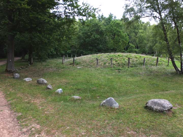
Galgenberg, viewed from the south, showing its circle of surrounding stones.

Galgenberg, as seen from the northeast.

Galgenberg, viewed from the east, surrounded with its ring of poles.

This is the description at the site of Galgenberg.

This is the view of Dun Skudiburgh you see as you pass Scuddaborg [sic] Farm while taking the path to the coast. The small dùn atop the remains of the fort is clearly visible.

Evidence of a ground-level gallery at Dùn Skudiburgh.

This composite of three photographs gives a good impression of the appearance of this dùn – very much like a small broch, in fact.


Remnants of wall courses at the northeast of Dùn Neill.

A possible access route to Dùn Neill, indicating just how secure this fortress must have been.

A panoramic composite image of the grassy summit of Dun Neill, looking towards McLeod’s Tables.

This is a telephoto shot of Dùn Arkaig taken from about a kilometre to the southwest.

Approaching Dùn Liath from the north.

Several courses of walling are still evident at this ruinous dùn.


Evidence of double walls at this galleried dùn.

Unusually, Dun Liath has this extra-mural cell outside the structure.
First sight of Dùn Grugaig while following the clifftop path.

Dùn Grugaig, seen from above, from the neighbouring cliffs.

Dùn Grugaig from above. This photograph emphasises just how secure this site must have been, guarded as it is by sheer cliffs.


