Information about the Bronneger burial mounds.
Image credit: Les Hamilton
Information about the Bronneger burial mounds.

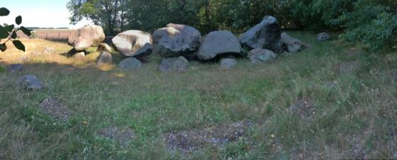
The smaller of the two burial mounds near Bronneger.

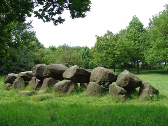
The large burial mount at Bronneger.
Visited: June 18, 2015
Right beside the roadside, just a kilometre to the west of the village of Bronneger, stand two conspicuous Bronze-Age Burial Mounds. The larger (eastern) of the grass-covered mounds is 15 metres wide and rises to a height of just over two metres; its companion, 60 metres to the west, is ten metres wide and two metres tall.
In the Google Map above, the burial mounds are indicated by red markers. For reference, the blue marker shows the location of Hunebed D25.
The information sign beside the larger mound states:
This burial mound, like the one located slightly west, was investigated in 1948.
In contrast to the other mound, the research here yielded tangible results. The excavators established that the mound had been raised in three phases during the Bronze Age, between 2000 and 1200 BCE. Around the foot of the first and third phases a wreath of stones had been placed. This appeared to have been partially demolished by stone robbers.
In the center, a shallow stone-covered grave was uncovered, belonging to first phase. Other graves did not come to light.