In the 1930's the grave field south of Ströböhög was examined,
The barrow is about 35 metres in diametre, and was originally higher.
Today the height is about 10 metres.
The scientist Rickard Dybeck acted together with an earlier owner
of the Strö farm for saving the barrow from total obliteration,
when there was a gravel mining pit on the barrow's east and south side.
How to get there:
Drive on highway E18 to the city of Köping.
The site is immediately north of the crossing with road 250.
The site can be seen in GE
Info board on site in Swedish.
|
  
|
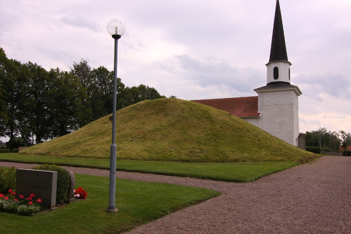
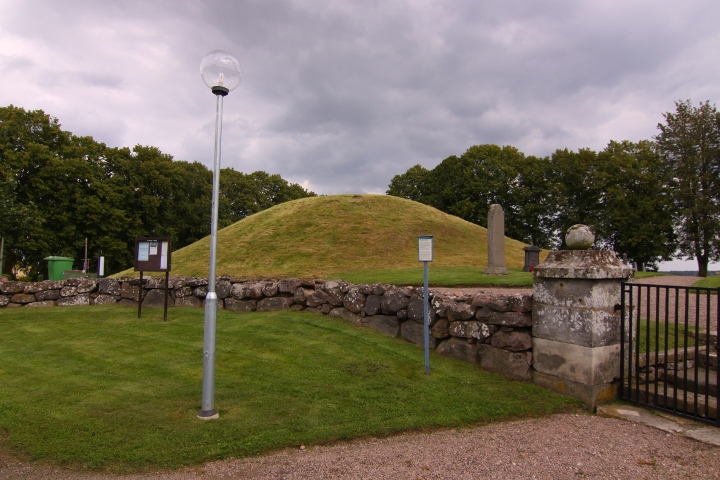
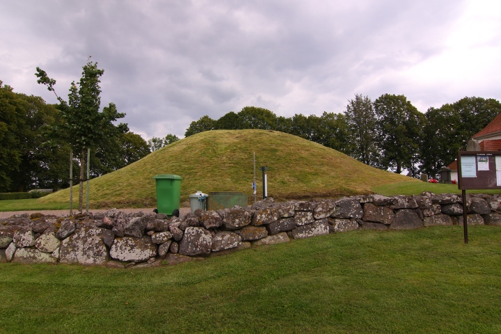
Kung Ranes hög (King Rane's barrow)
On the cemetery of Flistad church lies Kung Ranes hög.
The barrow has a diametre of 25 metres, and i 5 metres high.
The top is flattened and has a diametre of about 5 metres.
No King Rane is known in the Swedish history,
but Rane is a noa word for the norse god Woden.
The barrow can be seen in GE
Info board on site in Swedish, English and German.
How to get there:
Follow the directions for Askeberga, but after the right-turn in the town Tidan, drive 1,8 kilometres instead of 350 metres, and turn right
at the white sign "Ranes hög 2". Continue to Flistad village and
turn left at a second sign that says "Ranes hög". Parking spot at the church.
|
     
|
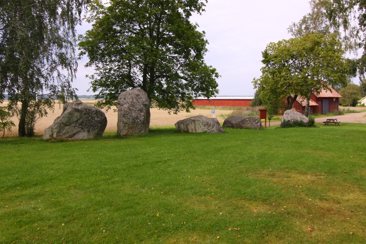
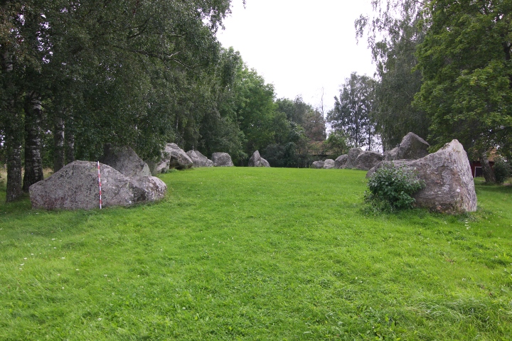
Askeberga is the site of Sweden's second largest skibssaetning,
after Ales stenar in Skåne.
The 24 stones are between 1.5 and 3 metres high, the weight of the
biggest one is estimated to weigh about 30 tonnes.
The size of the ship is 55 x 18 metres, and the fore and aft stones are missing in this ship (like Nässja domarring), as opposed to most other skibssaetnings.
this makes the shape of the stones look more like a longhouse,
a common building during the iron age.
Info board on site in Swedish, English and German.
How to get there:
At highway E20 at the city of Mariestad,
turn southeastwards onto road 201.
Turn right in the roundabout that you arrive to after
13.5 kilometres.
Drive 4 kilometres to Tidan town and look out for
a right-pointing white sign "Skeppssättning".
turn right, and after 350 metres turn right again
and after 1.2 kilometres the site and parking spot is to your right.
The site can be seen in GE
The site has been a gathering place since it was built in the younger iron age, in the south part of the ship there is a foundation for a flag pole, made 19 june 1942.
The ship is pointing in north-south direction, and is almost directly north of Ales stenar.
|
This is the official home page for Anundshög
and the remains in the vincinity.
|
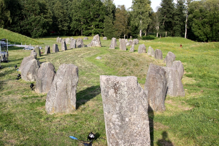
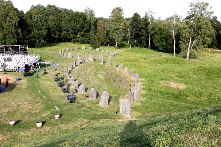
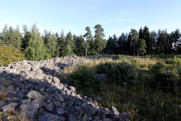
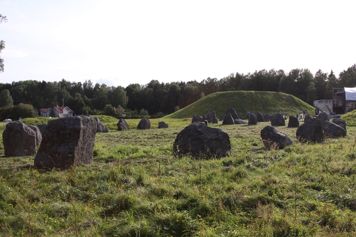
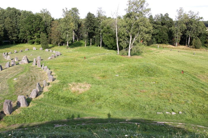
At Anundshög there are 5 skibssaetnings. No other site in Sweden has such a number of big skibssaetnings in a small area.
According to written sources, the stones were lying down in the 17th
century. Probably the stones were understanded as pagan objects,
and were destroyed when christianity grew.
The stones remained lying until 1932, when the restoration of 4 of the
skibssaetnings began. The ground around the area were examined.
Close to the nearest stone to Anundshög some burned bones and a pottery shard was found, maybe a grave.
In the middle of the ships there is a round stone, perhaps symbolizing the mast of the ship.
The skibssaetning closest to Anundshög measures 53 metres lon and 16 wide. The other one is 51 metres long and 25 wide.
The 3 smaller ones are 35, 28 and 23 metres long respectively.
The fifth skibssaetning is still waiting to be restored.
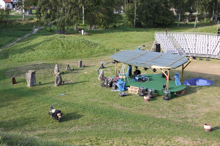
Sorry for the pictures, some moron thought this was a good place to
erect a stage..... I'll try to supply better pictures the next time i visit the area.
Info board on site in Swedish, English, German and French.
|
    
|
     
|
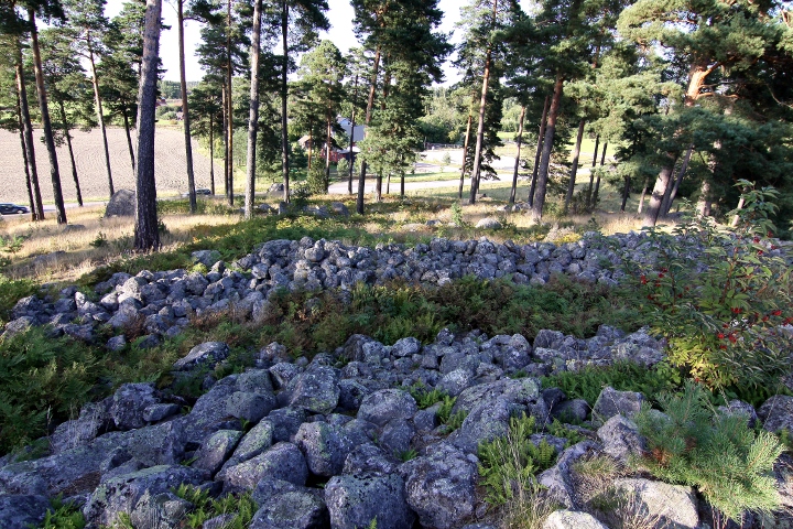
The big ship, made of 24 stones, whereof 10 is standing, is one of the largest in Sweden.
One peculiar thing with this skibsaetning is that the
usually larger bow- and aft stones are missing,
just like in the Askeberga skibssaetning.
The size of the skibsaetning is 44 x 18 metres,
the lying stones is 1.5-2.8 metres long, 1.1-2.4 metres wide and
0.6-1.6 metres thick.
The standing stones are 1.5-2.4 metres high, 1.25-2.25 metres wide and
0.9-1.6 metres thick.
The stones are connected by a wall, 2-3 metres wide and 0.1-0.2 metres high.
The skibssaetning was examined in 1953.
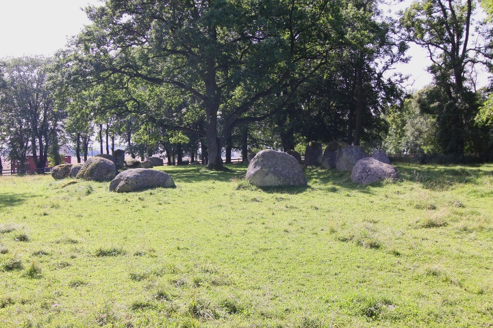
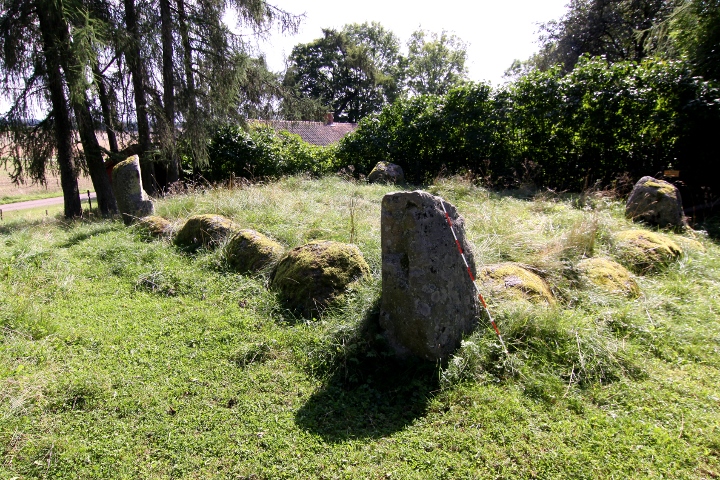
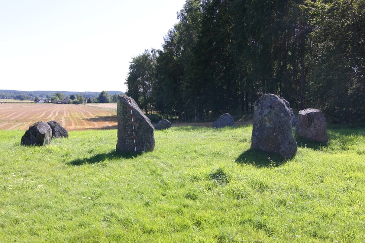
The other 23 graves are round, flat barrows, except for one
quadratic one, with standing stones in the corners.
The biggest one of the flat barrows has been reworked in later times,
to be used as a fundament for a windmill.
GE has too bad resolution in the area
Info board on site in Swedish and English.
How to get there:
On Highway E4, about 58 kilometres north of Jönköping,
take the exit to road 50 towards Motala and drive for 27.6 kilometres (take care - a lot of speed cameras on this road)
then turn left and continue for 4.6 kilometres.
There is no parking directly at the site, so
park at the church 200 metres south of the site.
|
   
|
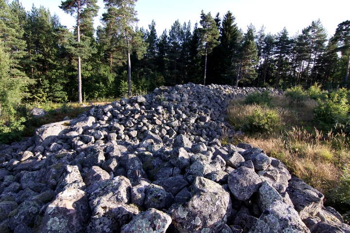
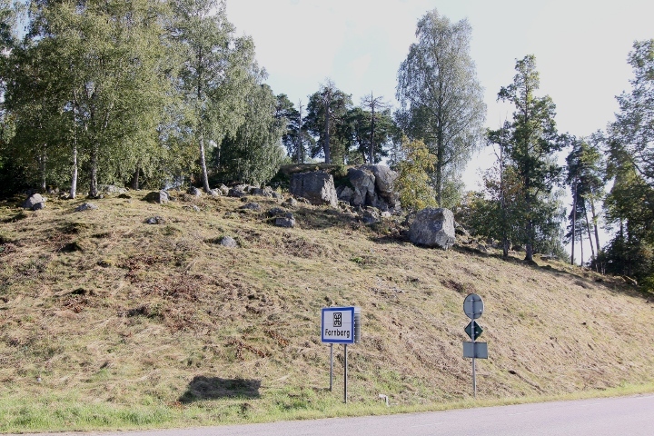
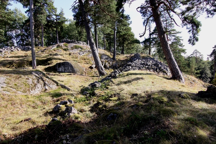
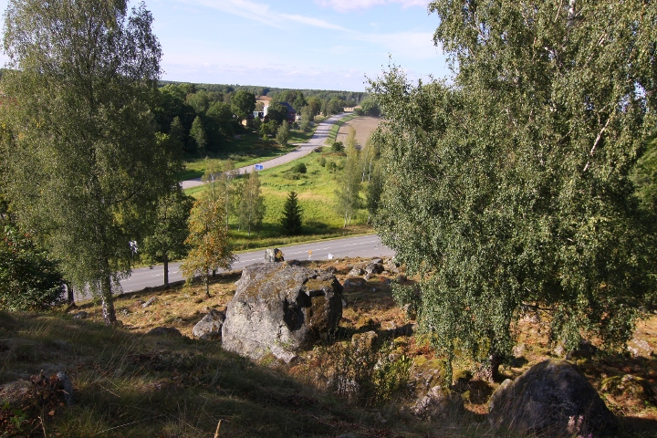
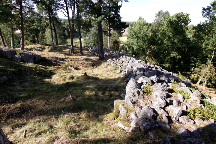
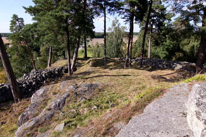
Hill fort, placed on a steep moraine hill with double walls, both walls has
several entrances, whereof the south one is probably the original one.
The inner wall is about 150 metres long and 2-3 metres high. The width is about 10 metres. On the inside you can see traces of dry masonry on several places.
The outer wall is about 250 metres long, 3 metres wide and 0.5 - 1.5 metres high.
The major part of the fort was built between 200 to 600CE
Info board on site in Swedish.
How to get there:
From highway E18, take the exit to road 53 about 12 kilometres
west of Västerås. Drive 2,7 kilometres, then turn right onto road
558 towards Kolbäck and drive for 4.2 kilometres where
there is a crossing.
Continue through the crossing, and after 150 metres there is a parking
slot on your left, and the fort is on the hill to the left of the road.
|
       
|
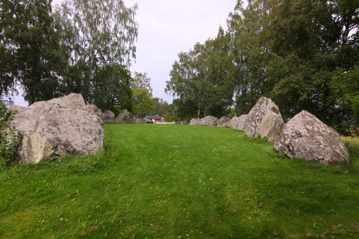
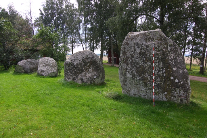
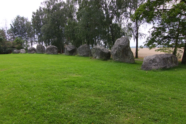
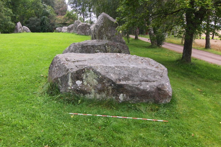
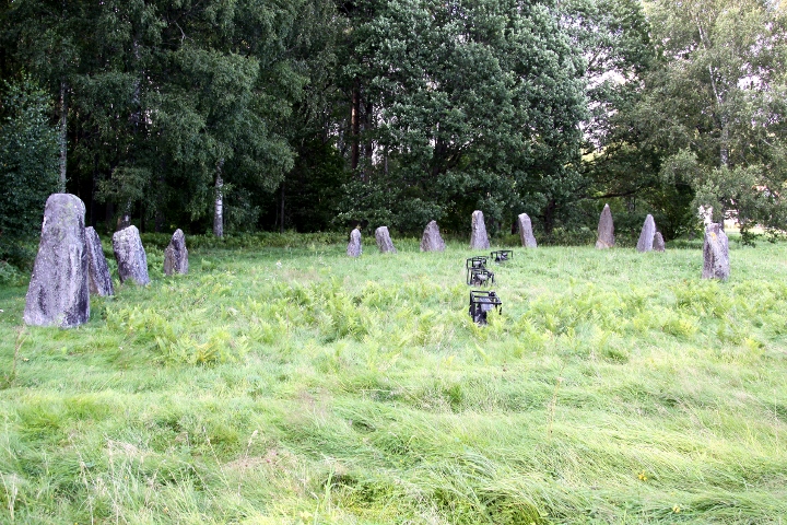
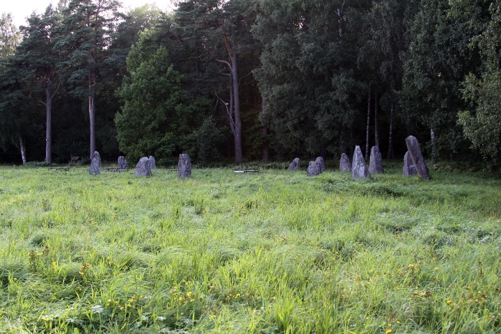
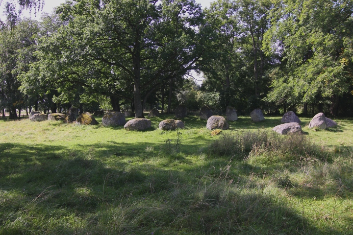
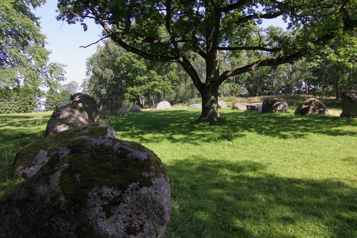
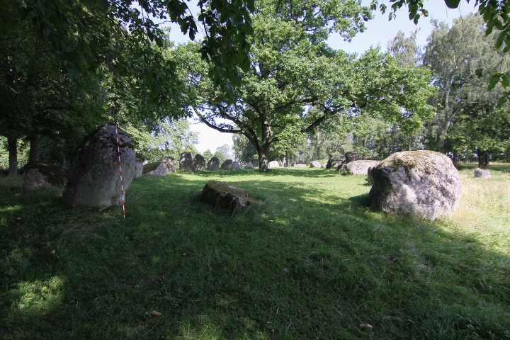
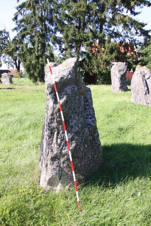
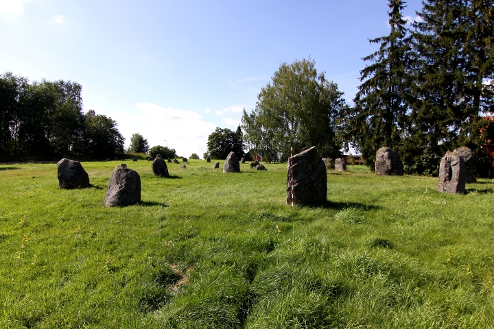
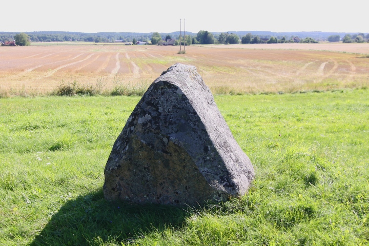
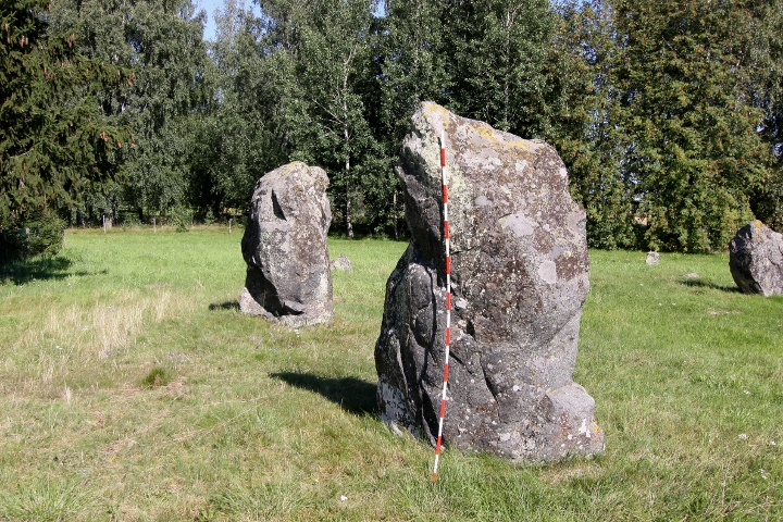
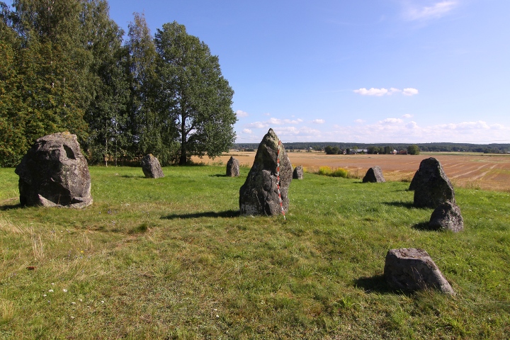
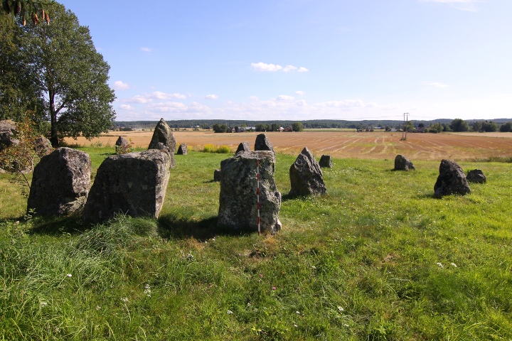
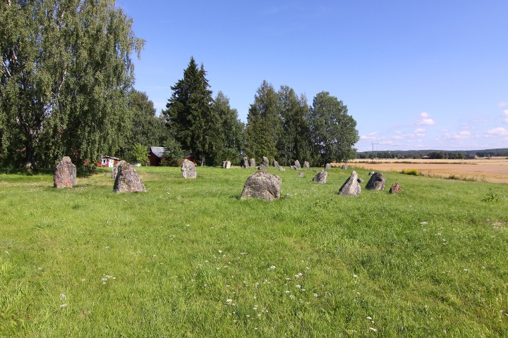
This site comprises of almost 50 standing stones, some of which are positioned to form stone circles.
There are 4 stone circles here, two of which are missing one stone each.
This burial ground dates back to 400-1050CE
Info board on site in Swedish, English and German
The site can be seen in GE
How to get there:
From highway E20, take the exit to road 50 towards Askersund,
after 2.6 kilometres turn left towards Hallsberg and drive
through the town.
When you have exit Hallsberg, continue for about 1.5 kilometres,
and you see the site to your right.
Look out for a yellow sign with crossed black lines that says "Water protection area" on the left side of the road. 10 metres after this sign there is a small parking spot on the left.
|
  
|
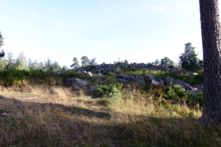
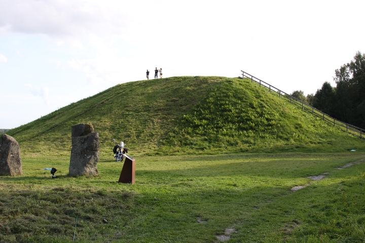
The Anundshög barrow is Sweden's biggest, with a diametre of 64-68
metres and 9 metres high.
It's dated to younger iron age (500-900CE)
In 1788 thw barrow was digged by grave robbers. No info exists about
if they found anything, and they never managed to dig down to the
tomb.
The first arcaeological examination was made in 1998.
Test drillings were made and shafts were dug in the barrow's north
and south part.
It was discovered that the barrow was placed on an older settlement.
The bottom layer of the barrow consists of mud. On this layer the funeral pyre was set.
This has been covered with a cairn, 37 metres in diametre and 4.5 metres high.
The cairn has then been covered by earth.
Info board on site in Swedish, English, German and French.
How to get there:
Driving westwards towards Västerås, take the second exit
when you enter the city (the first exit leads to the airport)
and drive northwards. Drive for 1.5 kilometres and turn right.
The site is on the left side of the road after 2.5 kilometres.
Note:
Look out for white signs with the text "Anundshög",
and they will guide you.
|
|