|
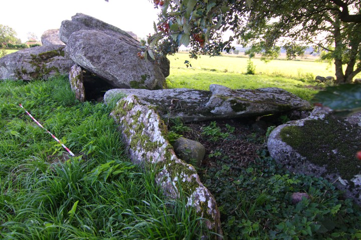
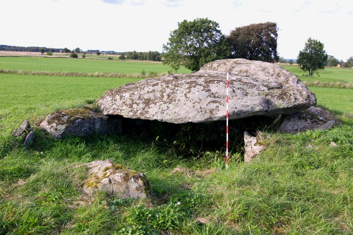
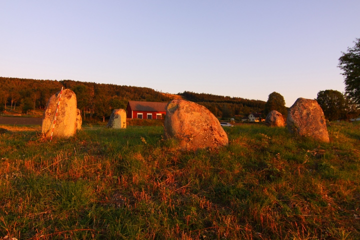
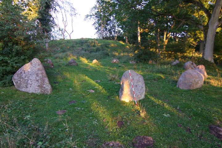
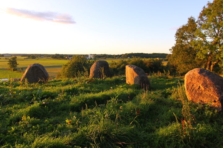
This passage grave is the biggest in scandinavia, and
the chamber is 16 x 2.5 metres, and the passage is about 11 metres long. One of the wall stones in the chamber is over 6 metres long.
this passage grave, together with Klövagårdens gånggrift, Logårds kulle and Haragårdens gånggrift is north of the road, while the farms is on the south. It has been accepted that this configuration has been the same since the stone age, which makes the road Sweden's oldest that is still in use.
Info board on site in Swedish and English, antoher one at the parking spot in Swedish, and some English and German.
How to get there:
From the city of Falköping, take road 47 southeast for 4.3 kilometres, then turn left at the blue sign "Karleby".
Drive for 1.5 kilometres and there is a parking spot on your left.
|
    
|
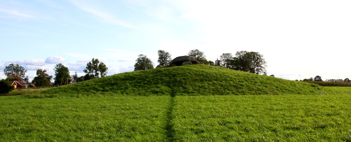
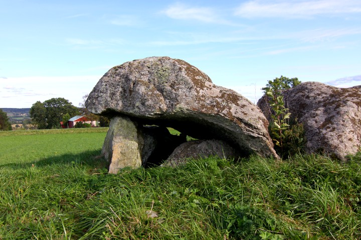
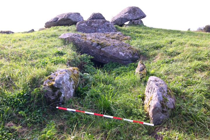
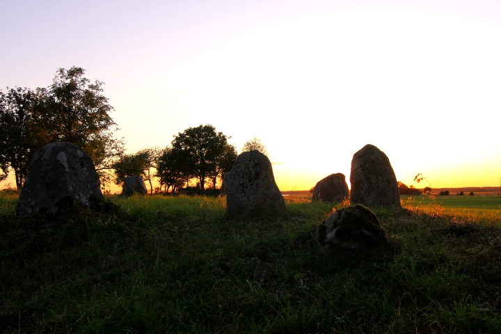
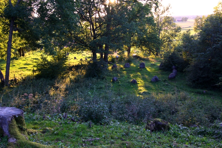
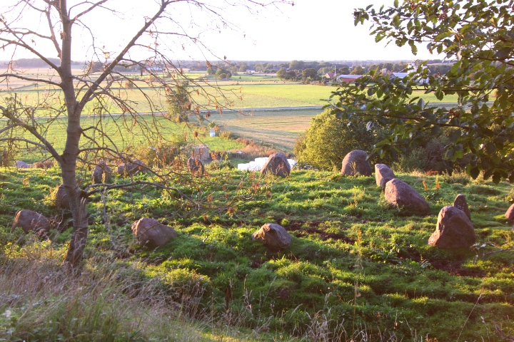
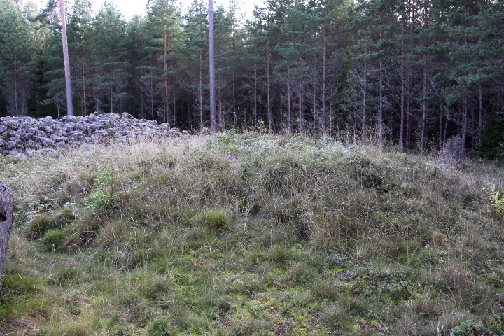
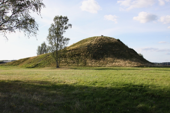
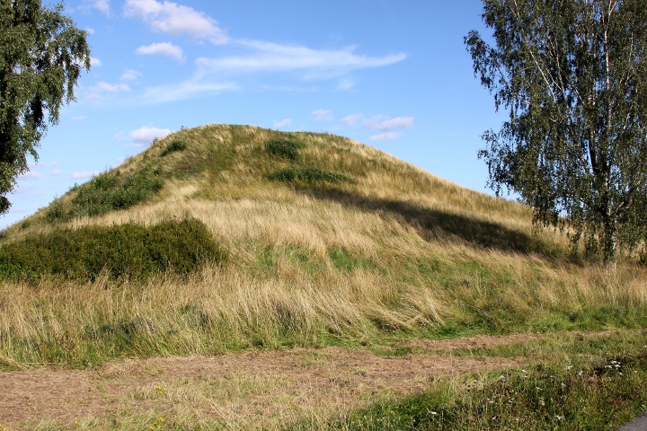
This passage grave lies on a mound, which is about 23 x 22 metres and 2.7 metres high.
The chamber is a rectangle, 6 x 2.5 metres, and the passage is 7 metres long.
The grave was examined in 1872 by Montelius and Retxius and a arrowhead and scrapes of flintstone, amber pearls, fragments of pottery and the skeletons from about 80 people and bones from pig, cow, fox and marten.
this passage grave, together with Ragnvalds grav, Logårds kulle and Haragårdens gånggrift is north of the road, while the farms is on the south. It has been accepted that this configuration has been the sami since the stone age, which makes the road Sweden's oldest that is still in use.
How to get there:
From the city of Falköping, take road 47 southeast for 4.3 kilometres, then turn left at the blue sign "Karleby".
Drive for 1.5 kilometres and there is a parking spot on your left.
Walk westwards towards Ragnvalds Grav, then follow the track south in the field to the site.
|
   
|
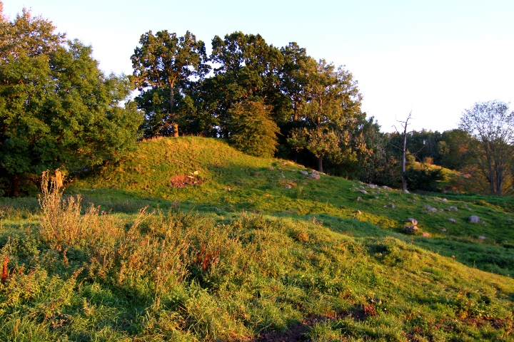
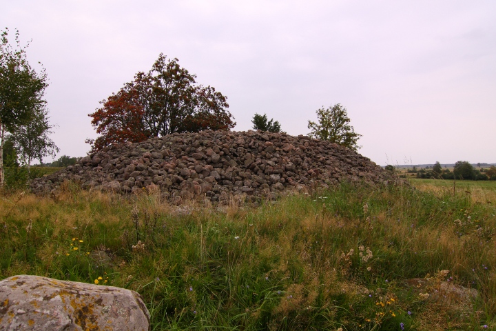
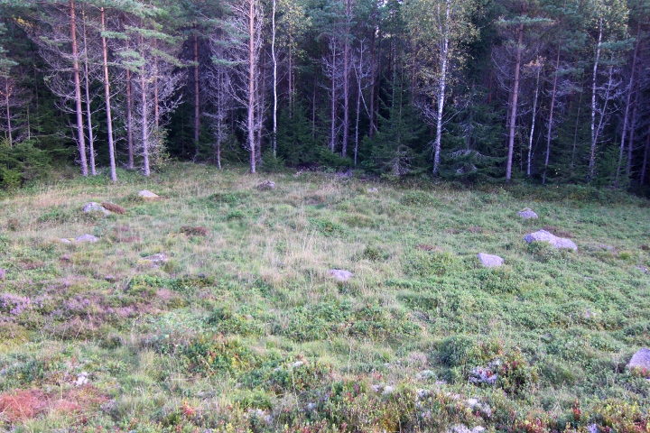
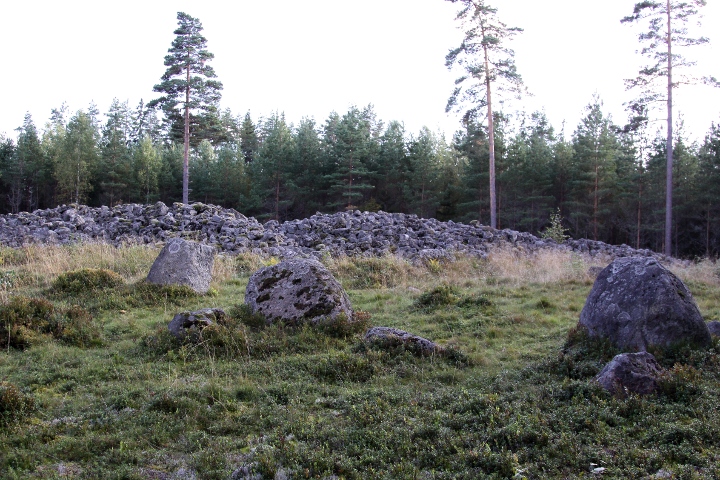
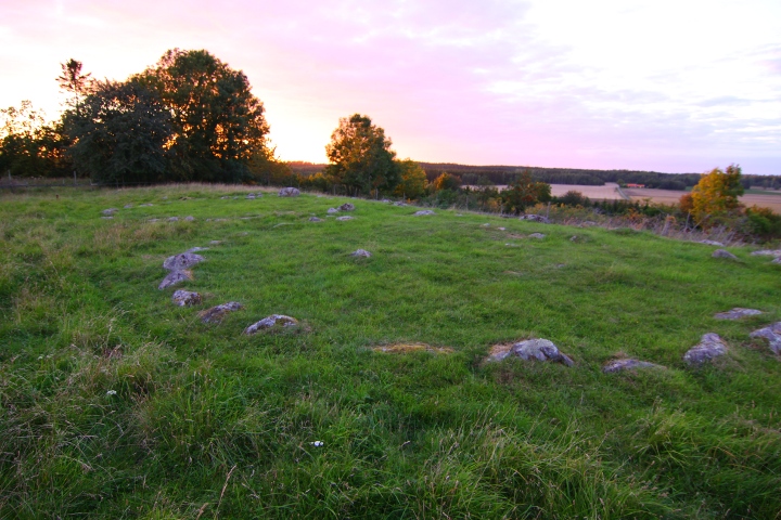
The cairn at Lilla Lycke is probably from the bronze age, 3500-2500 years old. Its 25 metres in diametre and 2.8 metres high.
Around the cairn lies stones that farmers has cleared from the fields, varying from 3 to 11 metres wide (widest on north). The size of the stones from the clearing is much more irregular, and generally smaller than the ones in the cairn.
On the east side there is a hole in the cairn, with sides of dry masonry.
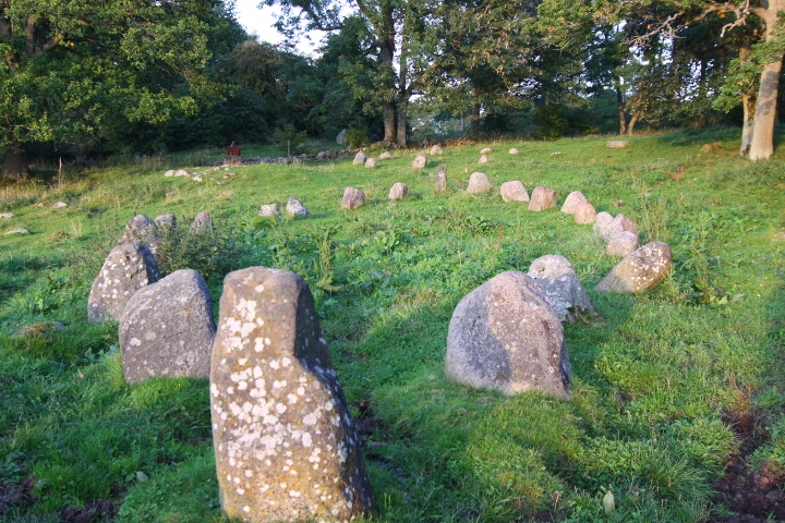
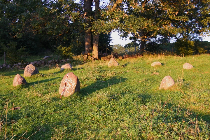
The stone ring once consisted of 9 stones, but now only 6 remains.
This ring also has a low center stone. Was restored in 1936 by mr Sahlström
Info board on site in Swedish, English and German.
The cairn and the stone ring can be seen in GE.
How to get there:
it's 1 kilometre south of Amundtorp, on the west side of the road.
|
       
|
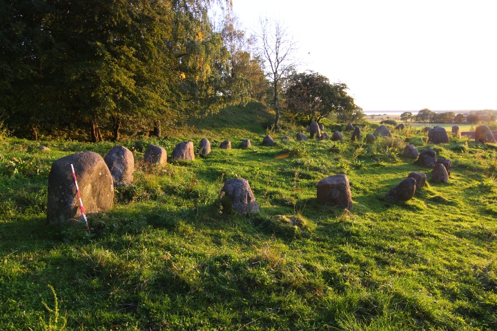
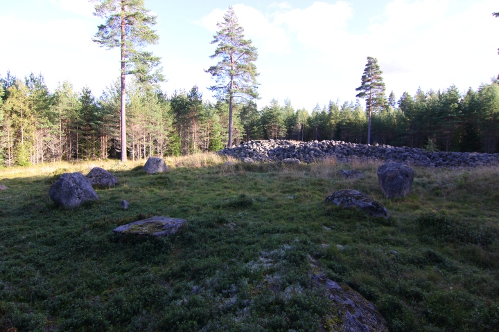
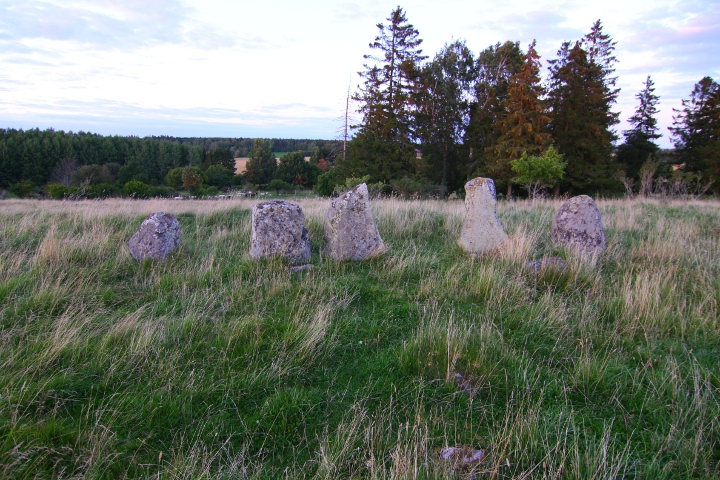
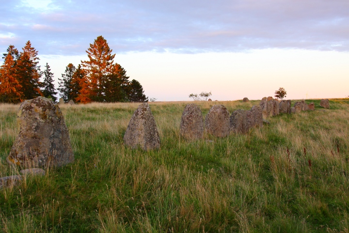
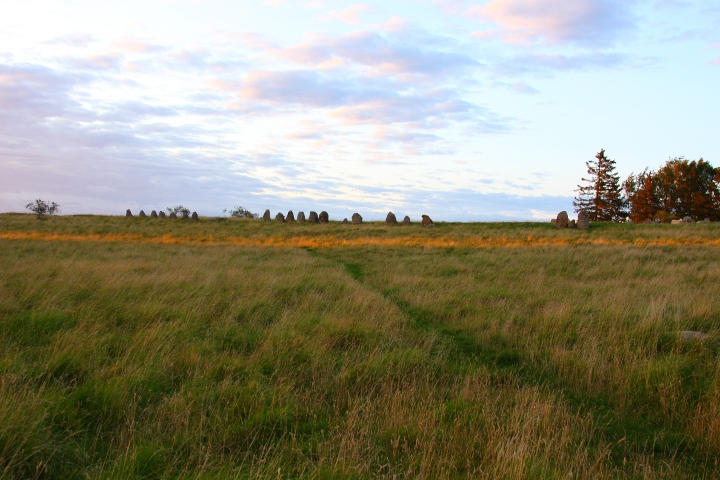
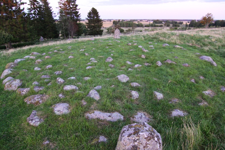
The skibssaetning on Amundtorp grave field is 25 metres long and 9 metres wide, and consists of 24 stones, which gradually gets higher towards the ends. 22 stones were re-erected during a restoration in 1938.
On the WSW end of the ship there is a square, consisting of 12 standing stones, of which 5 was re-erected during the
above mentioned restoration.the sides are 15 metres long.
ENE of the ship is a stone ring, 9 metres in diametre,
and on the other side of the fence is another stone ring, 14 metres in diametre, in front of a barrow.
Note the hill behind the stone ship and the square, it's straight
and doesn't look natural. It could be remains from the lime quarry
nearby, but it looks like the ground where the stones are standing has been cut into the hill, leaving part of the hill behind.
South of the site there is also 2 hills, that looks like 2 barrows.
The stone square can be seen in GE.
How to get there:
On road 49 between Skara and Skövde, turn south in Varnhem towards
Broddetorp, and drive for 2.9 kilometres, then you'll see the spot
to your left. Parking spot and info board in Swedish, English and German immediately beside the road.
Park there and walk to the farm. Pass it and walk up the wooden
stairs to the left behind the farm. After another 50 metres
you are at the square of stones.
|
 
|
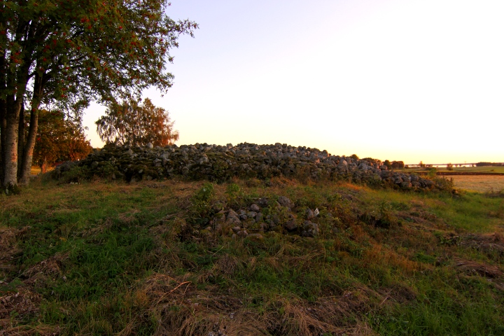
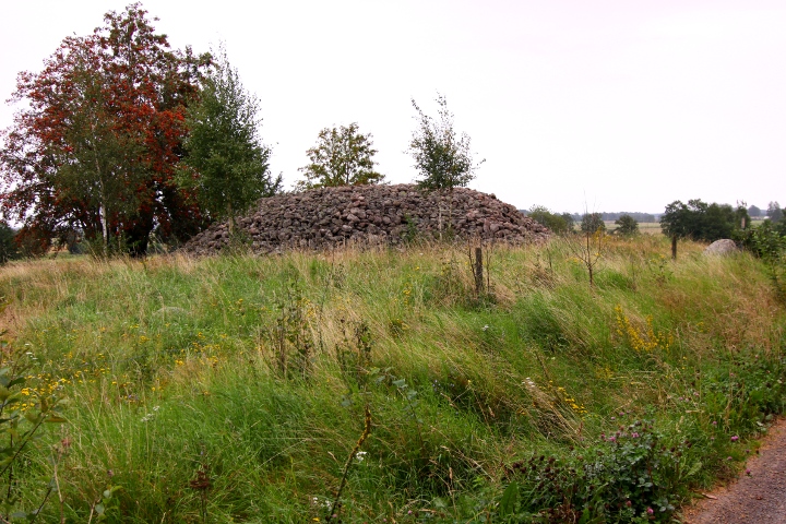
This cairn is one of the largest bronze age (1800 - 500BCE) monuments
in Västergötland.
It has a low stone brim around the cairns edge. Large cairns of this type that have been investigated have often contained a cist built of stone slabs, for one burial. Bronze age cairns occur in the whole of Västergötland.
Grave goods from the same period has been found in a number of rather large, low stone settings. Numerous loose finds also show that there have probably been many more graves, now destroyed.
Info sign on the site in Swedish and English.
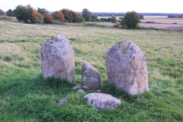
A grave field with 2 standing stones is found 100 metres NNE
of the cairn (you'll see the stones if you are at Stora rör)
The cairn can be seen in GE.
How to get there:
At highway E20 at the city of Mariestad,
turn southeastwards onto road 201.
Turn right in the roundabout that you arrive to after
13.5 kilometres.
Drive 4 kilometres to Tidan town and look out for a blue sign "Horn 10" to the right. Turn and follow the road to the village of Horn (9.2 kilometres), then turn right at the blue sign "Tidavad 8".
After 2.2 kilometres you see the cairn on your right.
|
      
|
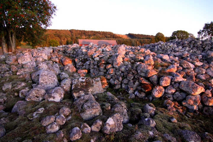
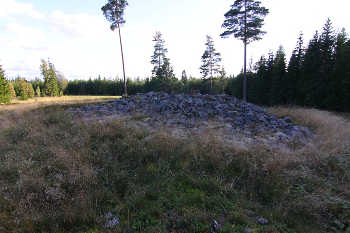
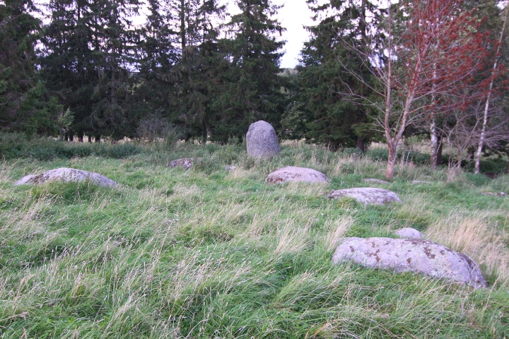
This is one of Sweden's biggest ring-cairn.
To me, it rather looks like a fort, but the Swedish
heritage board classifies it as a ring-cairn, partly
because it's in a middle of a grave site, with another flat cairn
and 2 stone rings immediately beside it, and 4 more stone rings
i the forest. 200 metres north of the ring-cairn lies another cairn,
which you will pass if you visit the site.
The ring-cairn is visible in GE, and the cairn and stone ring
immediately north of it.
How to get there:
From highway E4, take the exit at Torsvik N (about 7 kilometres south of Jönköping)
and drive westwards to the town Taberg.
In Taberg, turn left in the T-shaped roundabout,
and drive for 4 kilometres, and turn left at the sign "Bratteborg".
After 1.9 kilometres, turn left at the yellow sign "Röshult",
drive up to the farm, (where you see a blue sign "Gravfält 2" turn right and follow the gravel road until you see a a 'No entry' sign.
Turn right onto the small track road, after 100 metres you see
the north cairn to your left, but continue another 150 metres for
a parking spot. Walk south on the track road for 100 metres
and the site is on your right.
|
    
|
See the field notes for the main site.
(Lundsbacke, category: round cairn)
|
   
|
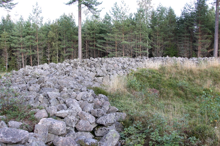
Lundsbacke (grove hill) dates from 500BCE to 400CE and consists of about 200 round flat cairns, varying from 3 to 12 metres in diametre, most of the are overgrown,
and 65 standing stones. Furthermore, in the area there is also a total
of 290 metres of low stone walls, which is remains of walls that kept
the iron age farmer's cattle in place.
The grave field was restored 1928. Then 36 fallen stones were re-erected, and 2 graves were examined, where bronze pieces and a bone comb were found, dated to 1st century CE.
Most of the re-erected stones were erected in the plcae where they were lying, but some of them were placed in the stone row on the hill.
How to get there:
From highway E4 between Jönköping and Stockholm,
take the exit in Mjölby onto road 32. Drive northwards for 7.8 kilometres until you reach aroundabout.
After the roundabout, continue north for 2.6 kilometres, then turn right. Drive on this road for 3.7 kilometres, then turn left at the blue sign "Lundsbacke Gravfält 1.0". After about 800 metres you can
park at the info sign, and walk a small pathe to the right towards
the hill.
|
|