drewbhoy

drewbhoy

All posts expand_more 11,401-11,450 of 13,339 posts

Scurriestone

After arriving very late in Glasgow last night, a wee stop was needed to clear the brain on the way back up the road, the scenic route.

At Balmoral leave the A93 and take the famous South Deeside road, heading east. The Scurriestone stands close to the road, south side, a stones throw from the River Dee. This has a beautiful location and Ballater is faraway. So a very good place.

Visted 30/07/2010.

Loch Kinord

Leave the A93 at Dinnet and head north on the A97. Turn west at the first tarred towards Muir Of Dinnet nature reserve. A notice board and leaflets can be found at the car park. There are several walks around the lochs. The crannog is on the north east part of the loch.

All the walks are fairly flat so if the weather is good a pleasant time taking in other sites can also be had, including the settlement near the car park.

Visited 30/07/2010.

Miscellaneous

Loch Kinord
Crannog

Loch Kinord is in the Muir Of Dinnet nature reserve. This comes from the info sheet.

Kettle, crannog and castle.

Lochs Kinord and Davan also result from the long vanished ice. They formed when two huge chunks of ice pressed down into the land and melted slowly, leaving hollows called ‘kettle holes’ which then filled with water as the ice melted.

Loch Kinord, the larger of the two lochs, has a number of small islands. One of these near the north-east shore is artificial. It’s an old crannog~a loch dwelling where a large hut sat on a platform, once connected to the shore by a narrow causeway. Around 2.000 years ago, Iron Age people using dug-out oak canoes built it by pushing large oak trunks into the loch bed and piling layers of stone, eart and timber on top, to form the base. A large hut was then built on stakes above the water. The crannog stayed in use until medieval times when King Malcolm Canmore (Malcolm III0 may have kept prisoners here in the 11th century. Malcolm used a wooden ‘peel’ tower on Castle Island (largest island in the loch) as a hunting lodge.

Stoneyhill

The remains of this cairn sit on the aptly named Stoneyhill. There are many piles of field clearance which made me wonder if something else stood here. All that is left is a 6 meter wide cairn that stands at 0.4 meters high. One possible kerb remains earthfast on the western side. Bennachie dominates the skyline to the west.

Leave the A947 at Whiterashes and head towards Inverurie on the B993 stopping at Fawells farm. Stoneyhill is the small climb opposite.

Visited 24/07/2010

Langstane o’ Craigearn

This is an easily found standing stone and what a beaut it is as is its near neighbour at Woodend. This is much more accessible. Leave the B993 after Kemnay and turn south towards Craigearn pulling in at the second drive on the east side. Walk a short distance to a gate, the Lang Stane stands impressively in the middle of the field. If there weren’t trees magnificent views of Bennachie would be seen.

No witches to be seen today. If there was a stone circle here, if all the stones had similar stature, what a place this must have been.

Visited 24/07/2010.

Braeneil

After speaking to Patrick Will, the old man of Methlick, I had to find this stone as it formed part of the Castle Fraser RSC, Lauchintilly Standing Stone, the Knock and South Leylodge RSC line of ancient monuments. He was right.

This stone sits in a middle of a field looking down onto Castle Fraser. It stands at almost 11/2 meters and is almost 1 meter wide at it’s base. Coming from the RSC side go past the stone row and keep going until the wood finishes on the east side of the road. Turn east towards Braeneil Farm and keep going until the road ends. From there its over a gate and fence straight north. A lovely setting and loads of history nearby.

Visited 24/07/2010.

Woodend of Cluny

After going thru Kemnay, via the Gushet Neuk, on the B993 head south on the minor road to Craigearn. Keep going past the sign to Castle Fraser until Woodend farm. Here there are two tracks. Take the first, an estate road, which leads to a man made lake. Go round the lake until the north west corner. Climb over the fence and head in a north westerly direction. Thru the more grown trees straight to a clearing. The stone is in the middle of the clearing still standing impressively.

Sadly near the lake there was a Larsen trap, recently discussed on the forum, with two crows flapping madly inside. Fairly soon they somehow were freed.

Now go to Castle Fraser and the RSC.

Visited 24/07/2010.

Knock of Alves

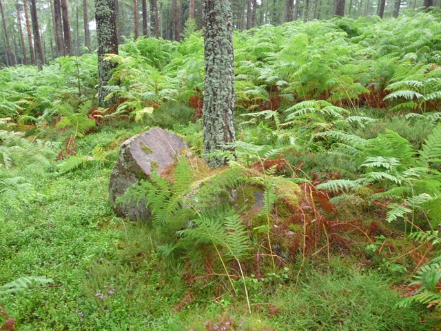
This stone circle can be found at the western side of the Knock Of Alves, home also to a hillfort. It looks like several boulders have been taken advantage of and used to form the site. Today only the sharp topped stone and a fallen neighbour could be seen of the stones that Canmore mention. These other stones are still there as is the boulder they say is an outlier but ferns and other vegetation cover the area. Another visit in Autumn looks likely.

With that it was back to car with one added dimension. Alves is covered in trees and I hadn’t noticed the thunder storms experienced in the Black Isle had moved moved down the coast to Moray. So a severe drenching during the walk north, even a bus shelter proved no help – the roof had been vandalised. Typical!!!

Visited 19/07/2010.

Knock Of Alves

After visiting Inverugie cairn I went south on the B9013 and taking complete leave of my senses left my car at Easterton Farm on the B9013 walking the rest to the Knock Of Alves. Continue to the A96, head a small way east, then cross carefully to the minor road opposite. (Traffic here is fairly horrendous because of the Fochabers and Mosstodloch bypass just east of Elgin) Walk a few meters down the road then turn south along the farm track to Burnside Farm for about 3/4 mile. At this point take the track west, look uphill and York Tower can be seen. Keep going past the quarry, taking the track north climbing a dry stane dyke.

At this point a rarely used path can be seen winding up the hill. This leads to the fort’s interior, any remnants, see links, that might be seen are covered in ferns. But this must have the perfect place for a fort, if the trees hadn’t been there the views would be beautiful, however the trees add to the atmosphere which by now was becoming very warm and humid.

Visited 19/07/2010.

Inverugie

Follow the direction as to the nearby Camus’s Stone. Instead of going west to the stone go straight up the hill in front until the top. Look west and climb over the wall the grass covered cairn is about 20 meters into the small wood.

Lady Dunbar had also been active here removing a stone coffin which is still kept in Durris House. The cairn still stands at 16 meters wide and 2 meters tall, and has several trees growing on it.

Visited 19/07/2010.

Camus’s Stone

I know there this rock art on this stone and another visit will be required but this today was impossible. The north side of the stone had its views covered by show jumping accessories. I could have moved them but with the house nearby I decided against it. Why do people do this? Obviously they don’t have a clue which is a shame because this is a wonderful stone. There are a lot of sites nearby so another visit won’t be a problem.

The easiest way to get here is north on the B9012 from Elgin, then take the minor road west just before the village of Duffus. Take the second minor road north, keep going when road runs out. I parked at Inverugie Farm. Go into the field to the north west and follow the trees west.

I’ll definitely be back as there is another rock art example nearby.

Visited 19/07/2010.

Tappoch

As is usual there is a hard way to climb up to a site and a much easier way back down. This site was to prove to be no exception. Follow the B9013, west of Elgin, north towards Burghead and turn north east at the small village, College Of Roseisle. Take the next minor road direct east. I parked between the farms of West Bank and Mid Bank.

Over the gate, up the side of a field, climb another fence, follow the gap the in the trees to the top of the hill. If you survive the insects the cairn is situated at the top of the hill. But it is worth the trek as the views are fantastic. To north the Moray Firth and the Black Isle, which today was shrouded except for the distant thunder and lightning show. The views south over the Moray plains to the Highlands are equally breathtaking. The cairn itself must have been massive. Even today it is some 36 meters wide and 3 meters tall. On it’s summit is a trig point and a much welcome trunk bench. Two cists were discovered in 1859 during an excavation by the well liked and respected Lady Dunbar of Duffus.

As for the way down follow the track south east. This leads to Mid Bank farm. No fences, no jabby things just the hungry flies. I felt sorry for the horses in the fields, they seemed to having a hard time today. At least I could escape.

Visited 19/07/2010.