


A further 100 meters east a smaller cairn can be found. Time hasn’t been kind as all matter of destruction has applied. Fortunately something still remains. A mound about six meters wide stands at 30 centimetres tall. Surprisingly two kerbs remain in place on the eastern side.
Unfortunately some other cairns, of various sizes, have been smashed to bits.
Visited 1/08/2010.
Just south of Portlethen on the A90 take the minor road west towards Durris, two RSCs are at the start of this road. This is a terrible road, full of twists and hidden points so if driving please take into account slow moving farm traffic. It is also used by many cyclists, like me! Keep going until the second minor road north . Take this and park at the filled in quarry, popular with anglers. Stranog Hill is on the opposite side.
Over the gate and head slightly west past an old quarry. Granite lintils litter the area, what a waste of beautiful stone and workmanship. Over a fence and up the hill.
Canmore don’t say much but I think they must have been here when it was overgrown. There does seem to be a double kerb going around the cairn, tho this has been badly damaged. A small bank exists between these kerbs. At its maximum it stands at 10 meters wide and half a meter tall. Great all round views at this very under rated site. Had a good look for rock art as there are a few rock plates here suitable but my eyes spied none.
Visited 1/08/2010.


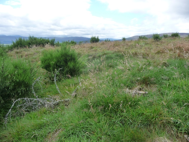
Looking east over the other cairn towards Portlethen and the sea.
Going south from on the B979, leaving the B9077 near Maryculter, take the second minor road west. Go past Altries and the hamlet of Airyhillock pulling in at the first track heading south. A nice and not very steep walk comes next.
The stone stands with a dry stane dyke built each side of it. It stands at 11/2 meters tall being aligned to Bennachie to the north west. The stone known as the wife stands slightly to the west and is shorter.
visited 31/07/2010.
Whilst visiting this stone I was lucky enough to meet a local lady walking her dog. She came from nearby Pepperhillock and told me two local myths.
The Ford.
This stone was used a marker to lead to another standing stone down on the banks of the River Dee. The stone pointed to a place were the Dee could be crossed. Unfortunately the stone was taken down years ago.
Marriage.
The standing stone at Standingstones farm is known locally as the husband. Slightly to the west is smaller stone known as the wife. It is said that as long as they stand together then the local residents will enjoy many happy days especially if they are married.
(It is aligned to Bennachie.)


There is no easy route from Knockargety Hillfort to this cairn. So climb down the northern flank and walk towards the west on the forestry road. To the north a gate appears, over this recrossing the bog to another gate. From there its over the fence and to the top of the hill in front, Knock Hill
The cairn is almost destroyed but is almost 12 meters wide with a circular bank. Perhaps a couple of kerbs remain in place. Nearby are the complete shambles of smaller ruined cairns and hut circles. Smashed to bits by tractors etc. A shame but the scenery is still good.
Visited 31/07/2010,


The ramparts at the west and east ends of this fort were never completed, which can be seen at their best on the eastern side. But what a place to build a fort, glorious all round views in countryside overspilling with loads of things for the prehistoric eyes to see.
From Ferneyhowe cairn it would be easy to say straight up the hill. There is no path from this side so its over the deer fence across a bog and over the next deer fence. Add in a barbed wire fence then quite a steep climb and you’ve made it. The path in the fort is part of the Tarland Walk system and takes the walker back to the village of the same name.
Visited 31/07/2010.
The remnants of ramparts on the forts eastern side.


With Turriff Show weekend upon us, the North East has its normal summer weather sun and downpour, and down in Deeside it’s exactly the same.
Turn east along a newly resurfaced farm track, just south of Blelack farm on the A97. This track leads to a number of cottages the last of which is Ferny Howe. The cairn is to the south east of this house. Water proofs and decent boots are needed as this is the starting point for another three sites in a long circular, or should have been, route.
The long cairn stands at some 16 meters wide and is almost a meter tall. Various rubbish has been added so it looks taller. Canmore says no kerbs can be seen but I disagree. At least 1 earthfast boulder sits on the eastern flank and probably if some the turf and extra materials was moved some more might be found. The mountains to the west are spectacular but at this moment shrouded in mist.
Visited 31/07/2010.


From The Muir Of Dinnet Nature Reserve Leaflet.
The first people probably came to Dinnet around 8,000 years ago but the only evidence that remains is the odd flint chip in the ploughed fields. Some of Scotland’s very first farmers settled in Deeside, in Neolithic times around 5,000 years ago. Tiny pollen grains trapped in the mud of the reserve’s lochs give a picture of agricultural changes from then onwards. A drop in the amount of tree pollen and an increase in the amount of cereal pollen shows that people were cutting down trees and growing crops 5,000 years ago. Iron Age people, roughly 2,700 to 1,900 years ago, left more visible evidence of a settled farming community in the form of field boundaries, trackways and hut circles in the neck of land between the lochs. Now grassed-over and among the woods, these circles show were the bases of large timber huts once stood. Some two millennia later, farming still forms part of the activity on the Dinnet and Kinord estate, part of which now forms the nature reserve.
When the Canmore people visited here they happened to be unlucky as the site was covered in dense woodland. However they must have known about my intentions to visit as most of the trees that covered the fort had been removed. Small lochs protect the fort to the east, north and south. To the west are two small ramparts, clearly visible, about a meter high on the western flank. The forts entrance is also to be found here.
Leave the B9119 just south of Tarland taking the minor road west. (If going into the village take care as the bridge narrows and is a bit of a blind spot.) Keep going until the 2nd tarred road north. Follow this to Hopewell Lodge, walk along the northern side of the wall heading west. A loch will be seen, the fort is behind.
Visited 31/07/2010.


Most of the earthhouse appears to be above ground rather than underneath. It appears the slabs normally placed on top where actually wood therefore only the boulders of the walls remain. The sites structure and shape can be by the depressions in the turf. Fortunately none of these are deep enough to trouble the ankles.
Just south of Logie Coldstone, on the A97, take the first minor road west for about a mile. The disused Milton Of Whitehouse farmhouse is the first farm on the north side, of the road, clear of trees. Thru the gate, cross the field over another fence and the souterrain is in a small clump of trees. Follow the track north.
Visited 30/07/2010.


Travelling east along the A93 from Ballater stop at the car park for the ruined Tulloch church. (Pictish stone in the graveyard) The souterrain is in the middle of the next field, east. Although the field is in crop I walked down the tractor marks to site.
The site is fenced, or has a falling down fence. Next to the east fence the entrance can be seen but the area is inaccessible. Several slabs can be found. I did my best to break my legs as there are deep holes so take care and watch how you place your feet. For a change I survived intact. For details about what is inside the scary dark place see links.
Visited 30/07/2010.
What is inside the souterrain, cause I was to scared to crawl in.


After arriving very late in Glasgow last night, a wee stop was needed to clear the brain on the way back up the road, the scenic route.
At Balmoral leave the A93 and take the famous South Deeside road, heading east. The Scurriestone stands close to the road, south side, a stones throw from the River Dee. This has a beautiful location and Ballater is faraway. So a very good place.
Visted 30/07/2010.


Leave the A93 at Dinnet and head north on the A97. Turn west at the first tarred towards Muir Of Dinnet nature reserve. A notice board and leaflets can be found at the car park. There are several walks around the lochs. The crannog is on the north east part of the loch.
All the walks are fairly flat so if the weather is good a pleasant time taking in other sites can also be had, including the settlement near the car park.
Visited 30/07/2010.