
The boiling sea in Porthmoina Cove to the south-west of the fort. Looking towards Pendeen.
Image credit: A. Brookes (16.6.2021)

The boiling sea in Porthmoina Cove to the south-west of the fort. Looking towards Pendeen.

Looking south towards the prehistoric field systems around Rosemergy, before the moor rise to their highest point on Watch Croft.

The almost sheer plunge down to Halldrine Cove from the fort. Looking north-east towards Gurnard’s Head cliff fort.

Wind- and water-sculpted boulder inside the fort. Watch Croft rises behind.

The ground slopes steeply on the north-eastern side, before plunging down to Halldrine Cove, with prehistoric field systems still being used to divide the clifftop fields. Carn Galva on the right skyline, Zennor Hill on the far left skyline.

The north-eastern end of the rampart.


Big granite kerbs near the entrance grave.


Towards Bartinne and Chapel Carn Brea hills on the skyline.

The very steeply sloping southern flank, rising from Priest’s cove.

Looking landward across the neck of the promontory.

The rocky top of the promontory, which would be a great place for a cairn. Who knows what was once there?

Looking south across Priest’s Cove towards Sennen Cove and Land’s End. Ballowall Barrow is over on the high cliffs near the chimney, far left skyline.

On the edge of everything, looking towards the Brisons and the open Atlantic.

The rocky northern flank of the promontory.

Looking across Porth Ledden towards Kenidjack Castle promontory fort, far left. The cairn circle is next to the ruined buildings on the high point.

The promontory from the neck somewhere near where the rampart would have been, St Helen’s Chapel on the right.
Cape Cornwall is an obvious landmark on the coast, especially from Sennen and Land’s End. Sometimes dubbed the discerning person’s Land’s End, to distinguish it from the tourist trap of the real thing, it has featured in the peninsula’s human history going back to the Iron Age (probably) and the Bronze Age (definitely). Sadly there’s nothing left to see of either, but it’s well worth a visit.
Today we’ve come along the coast from Botallack, after a revisit to Kenidjack Castle. It’s a steep drop and re-ascent from Nancherrow stream, a lush valley filled with vegetation at this time of year. Dropping back down from the “mainland”, the neck of the promontory is occupied by lush green fields, and the early medieval St Helen’s Chapel. Sadly there’s no sign of the ramparts reported by Borlase.
The last and only time we’ve previously made the climb up to the chimney was in June 2001, almost two decades ago to the day. At 64m above the crashing waves below, it’s not a huge hill, but it seems quite a stiff little climb on a warm day and I’m glad to reach the chimney. The top of the promontory is rocky and it’s hard to see that this part of the headland would have supported habitation, but it would be a superb place for a lookout or beacon. It’s quite busy up here today, wildlife photographers and people out to enjoy the stunning scenery. The wind is blowing strongly here, but not enough to stop us having our sandwiches and taking a good break. One nice touch is the plaque on the chimney recording the fact that the headland was bought for, and donated to, the nation by Heinz. Beans means Iron Age promontory forts, right on!
From here it’s a steep drop (another) and then a steep climb (another) up to the Carn Gloose road to revisit another old favourite, Ballowall barrow.

The less well preserved southern ramparts can be made out in the foreground on the left. Looking towards Cape Cornwall, once another cliff fort but with no surviving ramparts.

Looking down on what appears to be a large round house base or building platform.

This may be one of the hut circles inside the fort. There are a couple of courses of stonework over to the right of centre, which don’t appear to be natural clitter.

The rubble construction of the inner rampart on the north side.

The multiple ramparts on the northern side, looking towards Botallack mine.

Hefty orthostat next to the entrance.

Looking towards the chimney crowning Cape Cornwall, with The Brisons beyond.
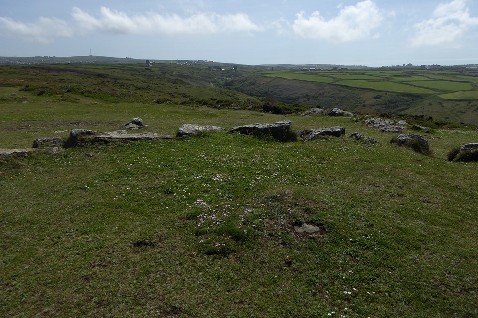
The centre of the circle, showing possible buried remains of a cist. Carn Bean with mast (site of a round barrow) and Carn Kenidjack can be seen on the left skyline. The steep Nancherrow valley runs through the centre of the image, with St Just over on the right.


Detail of the granite kerbs.
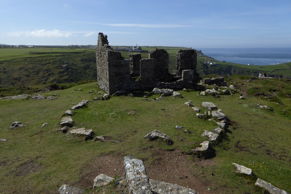
Handy aerial view from the mine workings next to the circle.
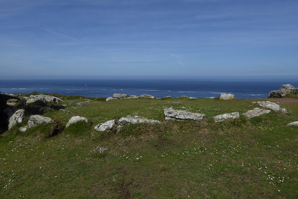
We first walked this stretch of the coast in June 2001, but we didn’t visit Kenidjack Castle for some reason, and we must have walked right past the cairn circle without even realising it was there.
I intended to put this right a decade later in June 2011, when we did manage a visit to the excellent cliff castle, but I failed to find this in tall undergrowth around the ruined mine buildings. With hindsight I was probably looking in the wrong place.
Seeing Costa’s photos a couple of years ago had me kicking myself. So 20 years after first walking past, and 10 years (less one day) to the previous failed attempt, I’m definitely not missing out this time. We walk from the main road at Botallack, round the coast path past the evocative decaying buildings of Botallack mine. It’s an easy walk to come here, and there are a fair few folks about in the glorious Summer sunshine.
I can’t believe I’ve missed this before. The site is completely clear, surrounded by cropped grass. The granite blocks making up the kerb are big, similar to several of the other kerbed cairns of West Penwith. The kerb appears to be mostly complete, although there’s no sign of any central mound that may once have filled the inside.
Although obscured a bit by the mine building, there is a fine view of Cape Cornwall with The Brisons beyond. Looking back inland, the most prominent feature is Carn Bean (with barrow) and Carn Kenidjack rock outcrop next to it. The ground drops very steeply to the south, down to the steep-sided valley of Nancherrow stream, which has wended its way from the edge of the moors and through Tregeseal.
From here we head down to the cliff fort for a revisit, then come back for a second look. An excellent monument, I can’t quite believe it’s taken me 20 years to come and see it.
Onwards to Cape Cornwall and Ballowall barrow.


A summer’s day revisit (11 June 2021). Fancying a trip to the Wye Valley and realising it’s been a decade since my previous visit, this seemed like a good place to combine with a couple of quiet hills on the border between Herefordshire and Gloucestershire.
The bus drops me at Goodrich, and a steep climb takes me up Coppet Hill from where I can survey most of western Herefordshire, across to the Black Moutains in the west and even as far north as Titterstone Clee in Shropshire. Everything is beautifully green and lush. A superb start to the day.
From here I can also see The Queen Stone, which I’ve never visited but which I really should. The excellent aerial view unfortunately also reveals that the farmer is busily spraying the crop in the stone’s field today, which puts paid to that idea. Instead, after a pleasant wander along the ridge to take in the excellent views, I drop down to the valley and cross the river over Huntsham Bridge (not a very nice road for pedestrians).
A footpath runs southeast along the banks of the beautiful Wye, through lush grasses, to the bottom of Huntsham Hill. From the riverside there’s a fine view up to the sheer cliffs of the hillfort and Yat Rock. The towering location of the fort is very imposing, clearly no-one would be attempting any kind of attack from the river.
Leaving the river bank through a short stretch of chest-high nettles (shorts seemed like such a good idea earlier), I climb up through Elliot’s Woods to the top of the hill, before heading to Yat Rock for the stupendously picturesque view of the Wye and back towards Coppet Hill.
A quick cup of tea at the cafe, and it’s into the trees for a revisit to the fort. The last time I came was September, it was really quite overgrown but just starting to die back. Unsurprisingly, June is just as bad in this height of the growing season. The western ends of the ramparts are a choked tangle of briars, hazel and nettles. Luckily, the tall tree cover is thicker to the east, so the shin and ankle shredding undergrowth is less deep and difficult to get through.
I’d forgotten just how impressive the inner banks and ditches are, the earthwork standing well over my head from the ditch. A winter or spring visit would almost certainly be better to reveal more, but it’s very pleasant here in the trees and no-one else seems inclined to leave the paths and roads.
After exploring as much as the vegetation allows, I head off along quiet footpaths, to catch a bus from English Bicknor. It’s been a lovely revisit to this scenic part of the Wye Valley, and definitely worth approaching the fort from below to truly appreciate its daunting location.

Looking out across multiple lines of ramparts.


One of the outer banks, tangled in summer undergrowth.

Looking up towards the hillfort, rising right of centre, from the banks of the Wye at the foot of Huntsham Hill. A reverse perspective of the Yat Rock images.

Elevated landscape context for the stone in the lush Wye valley, seen from Coppet Hill to the WNW.

The prominent hill rises in a commanding position over the Wye Valley – seen from Coppet Hill near Goodrich to the south.

Towards Ysgyryd Fawr (The Skirrid) from the northeastern cairn.

Looking towards Blorenge from the northeastern cairn.

There are some big slabs in the middle of the northeastern cairn, although nothing that indicates a definite cist.
