
Landscape context for the fort (centre skyline) from fields near Youlgreave as we near the end of our walk.
Image credit: A. Brookes (6.8.2022)
Landscape context for the fort (centre skyline) from fields near Youlgreave as we near the end of our walk.


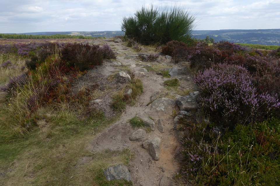

Detail of kerb stones protruding through the heather.


In late summer you get the riot of colour from the heather, but the cairn itself is being swamped by it.

A few little bits of exposed stone on the bank give the site away if you’re not sure where to look.


Minninglow from Moor Lane, Youlgreave.


Cist capstone on top of the barrow, looking towards Lean Low.

Cist capstone on top of the barrow, looking towards Arbor Low.


Two stones protruding from the top of the bank.


5 August 2022. In a few months time it will be 25 years since my first visit to this place; the source, the font, the seed, of the obsession that has filled a quarter of a century, over half my lifetime.
We’re staying in Youlgreave for a few days, ostensibly to check out the awesome Burning Man sculptures on display in the park at Chatsworth. After a rainy start, the afternoon has brightened into a lovely summer’s day, all big banks of cloud and sunshine.
We stroll along Bradford Dale to the always slightly weird village of Middleton, where Green Men and stone faces peer from houses and wells, and where Thomas Bateman lies a’mouldering in his grave. We stop off to pay our respects to him first; his techniques may have been destructive to modern sensibilities, but he furthered our knowledge and understanding of the prehistoric Peak more than anyone else of his day.
Leaving the village we briefly do battle with the quarry road, but it’s quieter than I remember. Up to the farm, pay the fee, is it really 11 years since we last came here? My life is flashing past, but it’s all the blink of a gnat’s eye to the slumbering stones and banks of Arbor Low.
It’s a joy to be back here, especially on such a lovely afternoon. Memories of the place are seared on my brain from that first meeting, but it still feels stupendous and awe-inspiring and fresh each time we come here.
We sit on the bank and take it all in, the long views across Derbyshire given texture by the scudding clouds. Since the last time we came, we finally got to Minninglow (poignant now, recalling Stubob) and it’s nice to nod at the familiar trees in greeting across the landscape. After a long while we pop across to Gib Hill, but before long we’re drawn back to the henge again.
I have no new revelations or profound thoughts to add about the archaeology. This is very much an embrace of an old friend, a pang of regret that it’s taken so long to reconnect and a promise to return again sooner. But then we always think that, and time is a cruel master, running ever faster onwards. For now, it suffices to enjoy the moment and replenish myself once again from the source, the font, the seed.

Cranes Fort, centre, from footpath to the south.

Looking WSW. Bee Low chambered tomb is in the wood on the skyline to the right of centre.


The little fort on its hillltop (centre), seen from the northwest across Bradford Dale, from fields above Youlgreave.

Landscape context from Hadnock, just over the River Wye to the south. The hill rises vertically from the river.
23 July 2011. After the last three Saturdays spent in the foothills of the Carneddau and continuing our slow progress southwards on Offa’s Dyke Path across the flat Hafren plain in Mid-Wales, I decide it’s about time I climbed some big hills again. An optimistic plan is made for a day trip to Machynlleth and a scoot up the twin summits of Y Tarrenau, the range of steep hills between the iconic Cadair Idris to the north and the Dyfi estuary to the south. Effectively the southern extreme of “North Wales”, the range boasts quite a number of round barrows on its lower westerly hills, but only one of its two 2,000 ft summits, Tarrenhendre and Tarren y Gesail, has any monument.
The train drops me at Mach just before 11 o’clock, giving my about 6 and a half hours to climb the two summits and get back again. After crossing the border from Ceredigion into Gwynedd over the Dyfi bridge, there’s a mile or so of open hillside climbing up to Bron-yr-aur before I plunge into the deep dark forest. Tarren y Gesail is already looking like a forbiddingly steep climb before it disappears from view behind the conifer screen.
The weather has been forgivingly dry for the last few weeks and the forestry tracks are kind underfoot for once. I’m not a fan of these dense conifer forests and my aversion is going to be deepened before I’m done today. An hour or so after leaving Mach, I’m on the open, grassy slopes of Tarren y Gesail. It’s a proper slog up to the top in July heat, but the unfolding views south and west make it much less of chore. There’s a great high-level view of the ridge between the two summits that I will take later on.
By the time I stagger up to the trig on the cairnless summit of Tarren y Gesail I’m hot and bothered, puffing and panting; the buzzards circling overhead seemingly waiting for me to collapse into carrion. But the view northwards is sumptuous; my first proper sight of Cadair Idris, a mountain I’ve dreamed of since reading The Grey King as a child, as well as the dramatic peaks of the distant Aranau to the northwest and glimpses of Arenig. Southwards the view stretches across the Dyfi to Pumlumon. Wonderful. It’s a fabulous place to stop for a while and drink it all in.
After leaving the summit and heading back down towards the forest, I make my first bad choice of the day, heading into the trees thinking I can cut off a corner to gain the open ridge on Foel y Geifr directly. It’s only about a quarter of a mile, but the forest closes around and over me like Mirkwood, any semblance of a path disappears and I’m fighting through dense, scratching, catching conifer branches, up a steep slope with no room to stand up straight beneath the trees. Eventually I reach the top and emerge blinking on the open ridge. I’m sweating profusely and covered in flecks and fragments of gritty twig and branch. Yuch.
From Foel y Geifr (the delightfully named “Bare Rounded Hill of the Goats”) everything improves immensely. A really lovely ridge walk with some up and down sections takes me to the base of Tarrenhendre and the second steep climb of the day.
Like Tarren y Gesail, the last 100 metres or so of ascent to the top of Tarrenhendre is punishingly steep. The earlier sunshine has disappeared and the sky is now filled with ominously grey-black cloud that threatens rain.
The round barrow or cairn is reached before the summit. Despite a dilapidated fence crossing right over it, it’s a really decent monument, a turfed-over mound keeping its shape under a small modern marker cairn. The views are truly excellent, especially to the south over the estuary and west across the lower hills of Y Tarrenau. Northwards the ground continues to rise, gently now, to the summit. From there the views of Cadair Idris are exceptional. What a marvellous place for a funerary monument this is, high above everything.
What I completely fail to notice, or take any photos of, is a further barrow on the undulating grass-covered area between the main barrow and the summit. It’s not on the OS map and my radar is obviously not tuned in properly to realise it’s there. No real matter though, there’s plenty to enjoy without it.
I reluctantly tear myself away at last. The rain has held off, but the train timetable isn’t going to flex to allow me to stay longer. My second forestry mistake follows, as I decide to avoid more narrow paths in favour of broad tracks that won’t swallow me whole. Instead they zig zag for what seems like miles, getting me nowhere slowly, dropping down, climbing back up, never apparently getting anywhere. Time vanishes and I’m still zig-zagging through the forest.
By the time I’ve eventually slalomed my way back to the Dyfi I’ve wasted a load of time and the walk has lengthened to almost 15 miles.
But this is churlish moaning about route-finding. Concentrate instead on the lovely ridge, the wonderful summits and the fine barrow, devoid of people but overloaded with views. These quiet, unheralded hills (I haven’t seen anyone on the whole walk) have absolutely rewarded the effort of the climbs today.


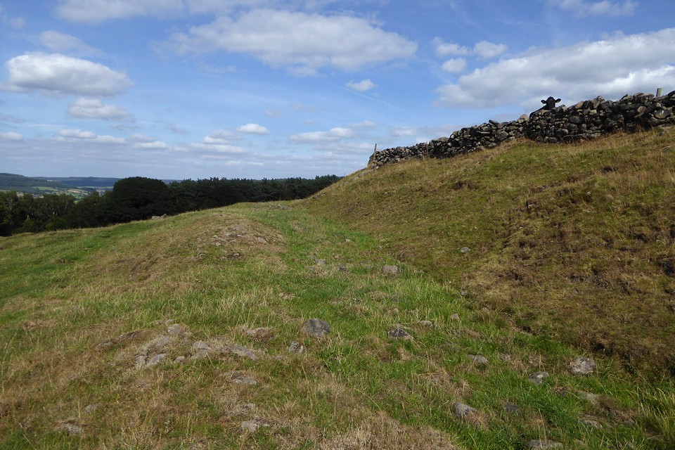
Shattered rock strata on the northern edge of the fort.


The Wye Valley Walk meets the southeastern corner of the fort.


Landscape context from Nyth yr Eryrod (Eagle’s Nest), further up the Wye Valley to the north. The larger Piercefield Camp is on the left, the smaller Piercefield Wood Camp on the higher elevation in the centre. The Hafren/Severn with its bridges is in the background. The beautiful Afon Gwy is brown and turgid with pollution from Herefordshire farms in the foreground.

The huge stone bank of the south-western rampart of Piercefield Camp.

South-eastern rampart, looking south-west.

Well-preserved stone rampart on the south-eastern side of Piercefield Camp.
