
Fellow visitors give some scale to the single bank and ditch. Looking north across the Loughor/Llwchwr estuary to Pembrey and Burry Port in Carmarthenshire.
Image credit: A. Brookes (28.4.2013)
Fellow visitors give some scale to the single bank and ditch. Looking north across the Loughor/Llwchwr estuary to Pembrey and Burry Port in Carmarthenshire.

The single rampart cuts across the promontory, cutting off the higher area on the left.


Across Rhossili Bay from the fort. Burry Holms promontory fort can be seen centre left, joined to the shore at low tide.

Looking NE across the fort to Rhossili Down. The rampart arcs round the right hand side of the picture.


Outer Head and Devil’s Bridge from Inner Head.

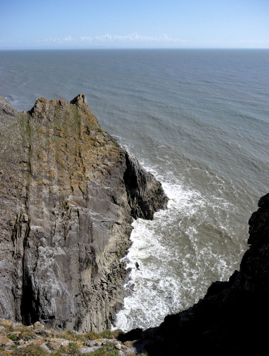
Looking back across the rocky Causeway and cliffs of SW Gower from Inner Head.

Looking across Rhossili Bay from Worm’s Head, to Rhossili Down.

Inner Head, which reminded me a little of Isandlwana.


Worm’s Head from the start of the Causeway, near Kitchen Corner.

Landscape context for three of SW Gower’s cliff forts. Seen across Fall Bay from Tears Point.

Approaching the fort from the east. The two lines of defence, although much-reduced, are visible crossing the picture (the inner rampart is marked by sheep).

Scant remains of the earthwork of Mew Slade fort crossing the field.

Sheep and lamb give scale to the middle rampart.

The outer rampart seen from outside the fort. The end of the middle rampart can be seen far left.

Looking across the interior of the fort (inner rampart visible). Rhossili Down is the hill of the left skyline.

The seaward side of the fort falls near-vertically down to an extraordinary ski-jump of a cliff below. Horse Cliff fort is visible upper left.

Horse Cliff seen across Deborah’s Hole from the neighbouring fort to the NW, The Knave. The cliffs are gradually being undercut by the sea.

Rockrose Cave is somewhere in the cliff face opposite. Seen from the headland close to neighbouring Longhole Cave.


The entrance to Longhole Cave.
The vertiginous drop on the eastern side of the fort.

Looking NW along the single bank. Rhossili Down is the prominent hill.


The view over the cliffs of “Yellow Top”. Goat’s Hole cave is out of sight, but the sloping tongue of rock that allows access to it at low tide is visible at the very bottom of the picture.

Looking back down to Foxhole Slade from the fort after our climb up.
Visited 26 April 2013
A short cliff-top stroll from Paviland fort, Horse Cliff is a simpler construction than its neighbour and has suffered more in the couple of millennia since its construction. A single, curving line of defence cuts off the windswept headland. Several quarry pits have been dug up against the northern section of the rampart.
The views off the cliffs that form the western and southern bounds of the site are impressive and dizzying, especially down to the water-filled channel separating this headland from The Knave, coincidentally the next of the chain of multiple forts that top the cliffs between Port Eynon and Rhossili.
Worm’s Head can also be seen from here, the western tip of the Gower peninsula. Beyond, the Pembrokeshire coast is dimly visible.
In all honesty, it feels less impressive that its neighbours, lacking the romance that the “Paviland” name conjures. Still well worth a visit though, especially on such a lovely day.
Visited 26 April 2013
After reluctantly leaving Goat’s Hole cave, we make our way back up the gulley of Foxhole Slade. Passing the sheer cliffs that mark the southern extent of the promontory fort far above us, G/F points to the only slightly less steep grassy slopes to our left and says “we could climb up there”. Fresh from the revelation of her enthusiasm for the inaccessible upper chamber of the cave, she’s obviously feeling adventurous, so climb it we do.
This brings us out beside the inner rampart of the fort, with a dizzying view back down to Foxhole Slade behind us. We flop down on the grass of the flat interior to get our breath back.
This is actually my second visit to this fine little fort, as I came a little more than a year earlier on a coast walk with some friends. That was a rather flying visit, so today I’m keen to stay a while longer. It is very windy up here, luckily blowing inland over the cliff edge and unlikely to hurl us broken to our deaths far below.
The cave that we recently left is invisible in the cliff face below us, although we can see the “tongue” of rock that allowed us to scramble up to it, the far end now starting to disappear beneath the waves. The seaward aspect of the fort is pretty formidable, even if the tide is out only a lunatic would make any Guns of Navarone style approach to the defences from down there.
There are two certain lines of defences, one of which is further protected by an apparently rock-cut ditch. There may be a possible two further lines, although these appear more to be slight augmentations of the tilted planes of rock that form the headland and, indeed, the Gower’s entire southwestern coast line.
We sit for a while at the exposed and windswept tip of the fort, above the “Yellow Top” that provides the alternative name. Exmoor can be seen hazily across the Bristol Channel, forming the far edge of the pre-Ice Age plain that once stretched sway from these cliffs.
It’s a great spot, worth the longer visit this time round. We head off to meet the neighbours at Horse Cliff.
Our entire back catalogue is available through our bookshop.All out of print titles are now available as eBooks via Google Play with inventories published before 1965 being free of charge.

The sea cave below and to the east of Goat’s Hole. This would have been dry and spacious during the Paleolithic.


The Red “Lady” was found in the area on the right.

The view from the porch, sans mammoths.

Scary-looking “access” to the upper chamber.

Mineral deposits have painted the bowels of the cave with multi-coloured swirls and patches of glitter.


This is the way, step inside.

The extravagantly sculpted rocks of the shoreline below the cave provide a bit of difficult terrain to cross.

The first sight of Goat’s Hole from the shore.

The path through Foxhole Slade from the Coast Path.
Visited 26 April 2013
Back in the autumn last year, as we made our snail-like way around the Glamorgan coastline on the newly opened Wales Coast Path, we promised ourselves a Gower weekend in the Spring. This gave us something to aim for, an elusive Shangri-la to spur our efforts onward, possibly more in hope that expectation.
So I’m mightily excited that we’ve reached the Gower on time and the long-awaited trip has even tied in with some promising weather. We’re staying in Scurlage, but come down the day before our first walk. I’ve managed to remember to bring the tide times with me, ostensibly on the off-chance of a visit to Worm’s Head tomorrow, but I’ve realised that the tide will be at its lowest point about an hour after we arrive at our accommodation, itself less than an hour’s walk from the coast path and the wonders of Paviland.
From Pilton Green, a footpath sign points to “Foxhole Slade”. We scurry and hurry along the path that runs smooth and easy alongside hedges for about a mile, conscious of the limited, precious minutes ticking away. We meet the Coast Path, to the left heading to Longhole Cave and then Port Eynon (3.5 miles), to the right climbing up to the cliff forts on the headland above and onward to Rhossili (4 miles), but our route carries straight on down towards the azure sea, glimpsed tantalisingly between the V of steep cliffs.
There is no footpath, just a sheep track heading down over initially grassy then increasingly rocky slopes, alongside an old drystone wall. The cliff on our right looms intimidatingly steep, a sheer tower of rock, and I start to wonder how accessible the cave is actually going to be.
The path peters out and we find ourselves scrambling over sharply sculpted rock, millennia of wind and water have carved this foreshore into a serious obstacle. Progress is slow but the tide is at least out (thank you, tide timetable). I’ve read that you have to get down to “beach” level before climbing back up to the cave, so that’s what we do. The foreshore is rock, slick and jagged, but not impossible to negotiate. Once down on the relative flat, we turn round and scan the cliff face above. From here, the entrance to the cave faces us rather obliquely, but that’s definitely it! The pear-shaped opening of Goat’s Hole is recognisable from photos I’ve seen, with a smaller cave entrance visible to the left.
G/F hadn’t decided until now whether to stay on the shore and wait for me, or to come up to the cave. Once down, the scramble doesn’t look too difficult, the rocks rise from the shore at a fairly gentle angle until the cave itself, where the cliff then shoots up vertically. She decides to come with me, good choice. I will say that although the scramble isn’t all that difficult, it isn’t all that easy either, the rocks are very pointy! Wear appropriate footwear and don’t try this if the tide is on its way in, that’s my advice.
Luckily we have no such worries, at least an hour or more before we would really have to start hurrying.
Scramble over, we reach the cliff face and the opening. It’s apparent that this is actually a very big, open cave – no ducking and squeezing here. The thrill of stepping over the threshold is almost too much. It’s just a cave, no piles of jewels, no genied lamp, but it’s soooo exciting coming here. If you have even a passing interest in the past of these islands, this has to be one of the most overwhelming places you can come. I’m almost beside myself.
The cave floor has been dug out, so there is a bit of a pit on the left hand side, which I think must be where the Red “Lady” was laid to rest. The cave goes back somewhat further, a spacious place and certainly one that you could imagine being holed up in, as it were, for a while. There does not appear to be any entrance to goblin town from the back of the cave. There is however another “chamber”, high above the main area. It looks possible to access, but I wouldn’t even attempt it without rope and safety equipment (helicopter on standby, for example). G/F is strangely keen to have a go, despite her previously stated absolute aversion to potholing and confined spaces, but I dissuade her from making the attempt. There’s more than enough excitement in the main area.
We stay for an hour or so, sitting and gazing out of the cave mouth across the Bristol Channel. The lapping of the waves, the sun playing on the water, creates such a feeling of calm, I could stay for days. One of the many joys of a visit here is to picture the sea replaced by a plain, stretching away for miles and miles, roamed by antelope and mammoth. Wow.
Eventually we reluctantly decide that tide will wait for no man or woman and we must start our return. Before departing, we scramble some way up the ridge at the side of the cave, just to enjoy the vantage point. We also visit the smaller cave to the west, which is rather less interesting and doesn’t go far back at all.
The return to the shore seems easier than the scramble up. There is also an enormous, echoing sea cave to the east of Goat’s Hole Cave, worth a look as the tide is still out. From there, the waters are obviously starting to creep up the beach and we make our exit. In our excitement at climbing up to the cliff fort above, I completely forget to look out for Foxhole Slade cave, which is in the cliff here somewhere.
Of all the prehistoric sites I have visited, Goat’s Hole may be the most evocative, the most overpoweringly redolent of an impossibly long-vanished age, and people like us and yet not. Come if you possibly can. Truly a cave of wonders.
Essential information for a non-abseil visit. Times are for Mumbles (a little way up the coast), so add 15 minutes approx for Paviland.