
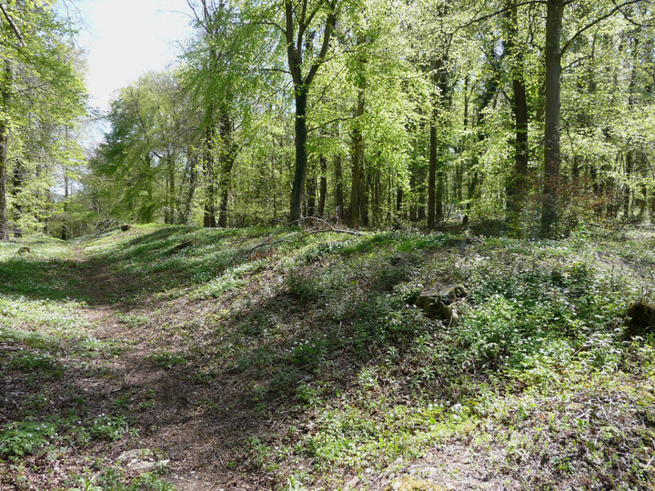
In late spring the earthwork is clothed in bluebells and wild garlic.
Image credit: A. Brookes (6.5.2013)
In late spring the earthwork is clothed in bluebells and wild garlic.


The northern end of the dyke looks over the valley to the neighbouring hillfort of Haresfield Beacon/Ring Hill.
Standish Wood cross dyke, now much-cleared of vegetation.

Steep slopes guard the southern flanks of the hill.


Northern counterscarping seen from within the Ring Hill fort.

Counterscarping along the northern rampart of Ring Hill. The escarpment drops away steeply in the trees on the right.


The huge ramparts of Ring Hill, cutting off the promontory.


The southeastern rampart. The hill in the distance is Haresfield Beacon, another of the Cotswolds’ premier hillforts.


Extensive views northwest from the fort ramparts, from May Hill and Robinswood Hill, across Gloucester to the Malverns. Pen-y-Fan and the Black Mountains can be seen to the southwest on a clear day.

Multiple lines of ramparts on the west.

Looking along the northwestern rampart.

Another section of the southern rampart.


The westernmost part of the rampart. The scent of wild garlic was overpowering here.

The woodland setting of the dyke, running from the left side of the picture before disappearing into the trees right of centre.


It was thought that the northern part of Cooper’s Hill might be a promontory fort, but current views are that the “earthworks” are in fact quarry spoil. They do look quite earthwork-ish, so easy to see why this might have been thought. The whole area is a Scheduled Monument.
Various records at Pastscape here.
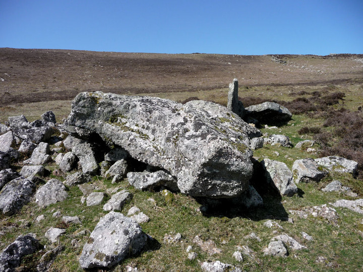
There is however a probable Iron Age cross-dyke, cutting across the neck of the summit ridge:
The cross-ridge dyke on Cooper’s Hill is probably of Iron Age origin, and is the only clearly recognisable defensive or boundary earthwork on the hill. The bank is 18ft wide by 2ft. high, with a ditch on the south side about 2ft. deep and from 12 to 20ft wide. The dyke runs straight for a total length of 655ft, and ends to the east against the natural edge of the ridge.
The northern slope of the hill also plays host to the lunacy of the annual cheese-rolling. I’ve stood at the top of the slope, it’d take more than a bloody cheese to throw myself off there.


Old Castle cliff fort from below.

Old Castle fort tops the cliff in the centre of the picture. Well, it is a cliff fort. Worm’s Head beyond.

The elusive burnt mound on the northern slopes of Rhossili Down, below Bessie’s Meadow.

Bessie’s Meadow cairn, looking SE towards the coast and Oxwich Point.

Showing the oval mound surrounding the chamber.

The configuration in which the slipped capstone was originally supported is not immediately obvious.


Detail of the pebbly conglomerate stones used in the chamber.

The chamber of the northern tomb.

The northern tomb, looking NE towards Llanmadoc Hill (cairns, hillfort) and Hardings Down (three forts).
Presumably the capstone, but unusually shaped.

Looking south out towards the coast.

The wreck of the southern chambered tomb.

Sweyne’s Howes south, with the northern tomb directly behind. Llanmadoc Hill rises on the right.
Two cairns in forestry, one very damaged, the other on the highest point of the hill (528m OD).
Coflein descriptions:
Bachgen Carreg (SS90819810)
A ruined circular cairn, 8.0m in diameter and 0.5m high, set on a parish boundary and bearing the name of a stone rather than that of a cairn.
Mynydd Blaengwynfi summit (SS90659737)
A circular, stony mound, 7.6m in diameter and 0.6m high, capped by an OS triangulation pillar.
Fine overview (with pictures) of the cairns on the main uplands either side of the Rhondda valleys.
There are two cairns on Mynydd Tynewydd, currently in forestry. One of them, Garn Fach, has not conclusively been shown to be man-made.
Like the cairns on nearby Craig-y-Llyn, they are soon to be surrounded by the construction of the Pen y Cymoedd wind farm.
Coflein details:
Y Garn Bica (SN94250051)
A boundary cairn, 10.4m high and 0.6m high, robbed and capped by an OS triangulation pillar.
Garn Fach (SN94490009)
A possible cairn, 5.5m in diameter and 0.6m high.
There are four cairns in a rough quadrilateral near the summit of Craig y Llyn, which at 600m OD is the highest point in South Wales outside of the Brecon Beacons National Park.
The cairns are all currently in or on the edge of forestry, which has caused much structural damage. However, over the next few years the forestry to the south is to be extensively reduced to make way for a wind farm.
Coflein details for the four cairns (north-south):
Y Foel Chwern (SN89840388)
A cairn, c.8.0m in diameter and 0.4m high, that when excavated following forestry related damage, produced no finds. The monument is damaged but has an orange painted, sawn-off telegraph pole protruding from it.
Craig-y-Pant (SN89560367)
A damaged cairn, 13m by 8.5m and 0.9m high, mutilated by a ploughed fire-break to the SW. Traces of kerbing have been reported.
Garn Fach (SN90740327)
A cairn, 10.1m in diameter and 0.6m high, topped by a modern stone pile, 1,7m high.
NB: current OS 1/25000 mapping is misleading, as the cairn is immediately adjacent to the south side of the track, rather than to the north.
Carn Foesen (SN90780288)
A mutilated cairn, 9.1m in diameter and 0.6m high, on the W a cast iron boundary post marks the meeting of three parishes.
Immediately adjacent to this cairn is a modern memorial:
“This plaque marks the spot where the body of Willy Llewellyn, aged 5, was found. He was lost at Aberaman on the afternoon of April 11th 1902. Work ceased at local pits and after a search by the whole community his remains were discovered on April 26th. He is buried at Cefn Cemetery.”

Fine ring cairn, Rhossili Down. Hardings Down, with its three forts, can be seen beyond to the left.


Looking east from Cairn II across the Gower, towards Cefn Bryn.


The Beacon, showing huge footprint and boulder kerbstones.

The Beacon, Rhossili Down, looking NW towards Pembrokeshire.

Burry Holms from the east. The cairn is visible at the highest point of the promontory/island.