


Looking across the mostly-ruined southern circle towards the other two, Stowe’s Pound on the left skyline.


Northern circle, be-cairned Caradon Hill behind.

Approaching The Hurlers from Craddock Moor to the northwest. There are lots of cairns along the ridge of the hill beyond.

From Craddock Moor. The rampart is clearly visible, as is the abrupt quarrying damage next to the Cheesewring.


Southern arc, looking southwest towards Tregarrick Tor. There a several cairns on the ridge ahead.

This could be a wonderful circle if sympathetically re-erected.

Western arc, Brown Willy on the centre skyline.

Southern arc. The Cheesewring and Stowe’s Pound are prominent on the skyline.

Approaching the circle from the WSW.

The central mound of the western cairn of the pair at SX244717.

The western of the pair of prominent cairns to the WSW of the circle. It’s built of stone, but in form resembles a disc barrow, with an outer rim enclosing a berm and central mound.

Eastern of the pair of cairns WSW of the circle, looking north with Kilmar Tor on the right skyline.

One of the pair of large cairns on the summit ridge, WSW of the stone circle.

One of the group of three small cairns centred on SX246719.

Large but disturbed cairn at the eastern edge of the group centred on SX244721. The bare mound over to the left is mining spoil.


Another of the group at SX244721. The Craddock Moor embanked avenue is visible beyond the cairn – although I didn’t realise this when I was there.

Another of the group at SX244721, looking south to the high part of the moor.

One of the group centred on SX244721.
There are several groups of cairns on Craddock Moor.
One group forms a rough arc to the northeast of the Craddock Moor embanked avenue, centred on approx. SX244721. Cornwall & Scilly HER:
A scattered group of approximately six cairns (1291.01 – 1291.10) on the floor of a west facing re-entrant which cuts into the high ground of Craddock Moor, in an area dotted with prospecting pits and surrounded by disturbed ground. These features were first recorded by CCRA and in 1985 were surveyed on the ground by RCHME. According to the latter, they may be cairns rather than clearance heaps, although one large mound (at SX 2445 7210) within the group is formed from upcast dug out of the adjacent mining pit. The identified cairns consist of turf covered stony mounds, 1.5m – 8.5m in diameter and 0.3m – 0.8m high, none of which show evidence of a kerb or a cist and the majority of which have mutilated in one way or another. The cairns are in generally good condition though many have been disturbed. Their sepulchral / ritual character is supported by their proximity to an embanked avenue and a stone row.
A further three small cairns are centred on approx. SX 246719:
A small group of three cairns situated on a gentle north western slope in unenclosed moorland pasture. These cairns were surveyed on the ground in 1984 by RCHME. They are simple mounds, circular and oval in plan and have diameters ranging from 3.5m to 0.4m. Two of the cairns have been dug into, but the group as a whole is in good condition.
The largest cairns are the pair mentioned by Mr Hamhead at SX 2444 7168.
Western cairn
Overall diameter of 18m, comprising a platform or berm 0.2m high and a raised perimerter, 1.5m wide and 0.2m high. Some protruding stone suggests that it has stone kerb. At the centre of the platform there is a mound of stone 7.3m across and a further 0.5m high. This cairn is in good condition.
Eastern cairn
A platform with an overall diameter of 13m and a height of 0.4m, with traces of a kerb on the northern side. There is a central mound 9.2m in diameter and 0.8m high. This cairn is in good condition.
Other isolated cairns are dotted about the moor, with a further group clustered around Tregarrick Tor.

Looking back down the row from its higher northeastern end.
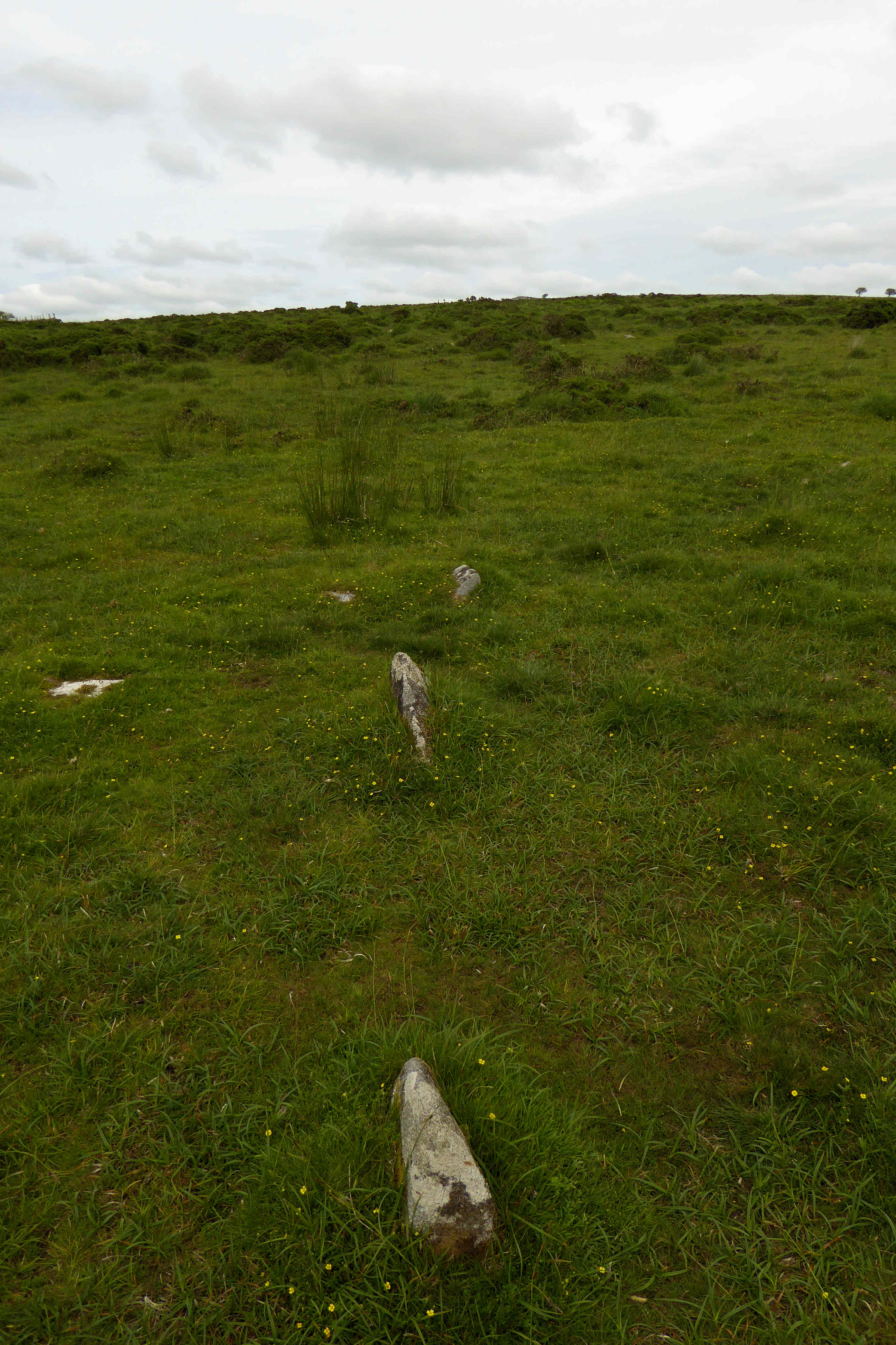
Nearing the northeastern end of the row – at least as far as I could tell it didn’t continue much beyond this.

Midway along the row.

Looking towards the southwestern end of the row.

Stones near the southwestern end of the row, looking towards the northeastern end.

The little near-buried stone in the foreground is the most southwesterly stone I found in the row, which continues through the sheep’s skull and up the hill. If there was ever a massive 8 foot terminal monolith, it’s gone now.

Hut circle at the southwestern extreme of the settlement, near the stone row. Most of the foundations have been robbed leaving six large upright slabs/boulders around the perimeter.

Linear feature in the settlement.

Well-preserved hut circle with door jambs in situ.

Hut circle at the higher northeastern end of the settlement, looking southwest towards Tregarrick Tor and Siblyback reservoir.

Looking NNW down the Withey Brook valley.

The turf and bracken covered cairn, looking across the Withey Brook to Craddock Moor.

This irregular pile of stones, including a large propped slab, is immediately to the east of the cairn. The cairn is the bracken covered mound to the left, in front of the two bushes.

Hut circle at the western end of the settlement. I think the prominent hills in the distance (left of centre) may be the china clay country around Hensbarrow Beacon.

The biggest hut circle in the settlement, with an apparent internal structure. The prominent hill is Stowe’s Pound.

Fine hut circle, looking across the Withey Brook valley to Craddock Moor where there is another extensive settlement, as well as a stone row, stone circle and cairns.

Curving lynchet or reave on the northern edge of the settlement.

The three summit cairns in profile from the southwest.

Looking down on the denuded remains of the southeastern cairn from the central, Sharp Tor rising ahead. Dartmoor fills the horizon.

Looking down on the northwestern cairn from the central. The views stretch away beyond Kilmar Tor to Brown Willy and Leskernick.

The central cairn is the most intact of the three, around 2m in height.