
Eastern profile of the mountain, from the Wales Highland Railway near Beddgelert.
Image credit: A. Brookes (19.4.2016)

Eastern profile of the mountain, from the Wales Highland Railway near Beddgelert.

Ynys Enlli (Bardsey Island) is top left – the prominent hill is the site of a prehistoric settlement and flint tools and workings have been found all over the island. Seen from Mynydd Penarfynydd to the northeast.

Mynydd Rhiw (cairns and Neolithic axe factory) on the left and Mynydd y Graig, crowned with Cregiau Gwineu hillfort on the right. Seen from Mynydd Penarfynydd to the southwest.


Hut circle downhill to the south of the fort.

The fort from the slopes to the south.

Traces of stone walled rampart can be seen below the outcrop on the eastern side of the fort. Looking down on Porth Neigwl.

The middle of the fort incorporates a massive rock outcrop.


Looking north. Mynydd Rhiw (cairns, axe factory) rises on the far left. Immediately to the left of the stone and just peeking above the wall, the very top of Carn Fadrun can be seen.

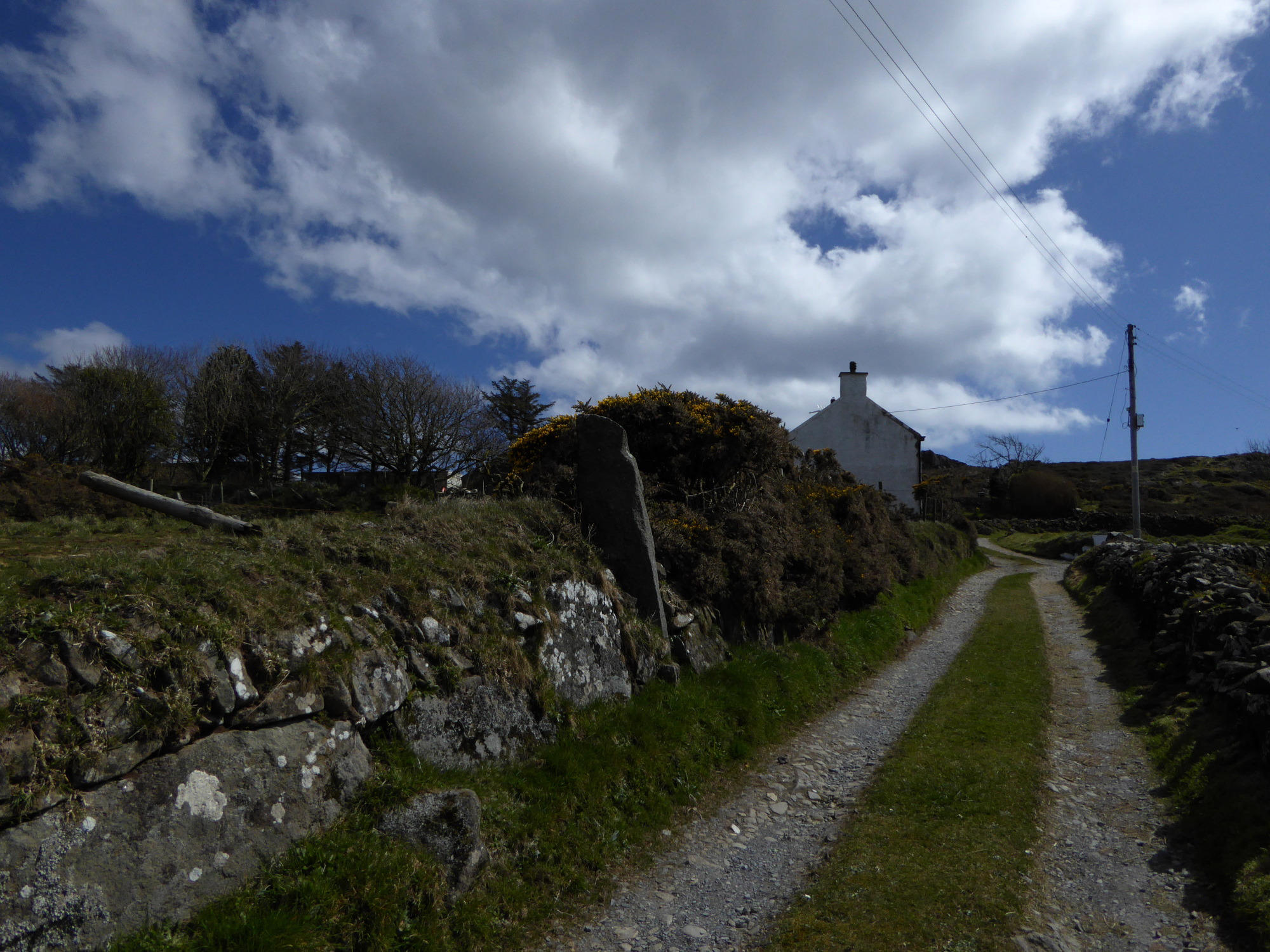
Approaching along the lane from the northwest. Note the large recumbent stone built into the wall, bottom left – it looks like this might be the “other” stone of the pair, although I didn’t even notice it when we were there. Doh.
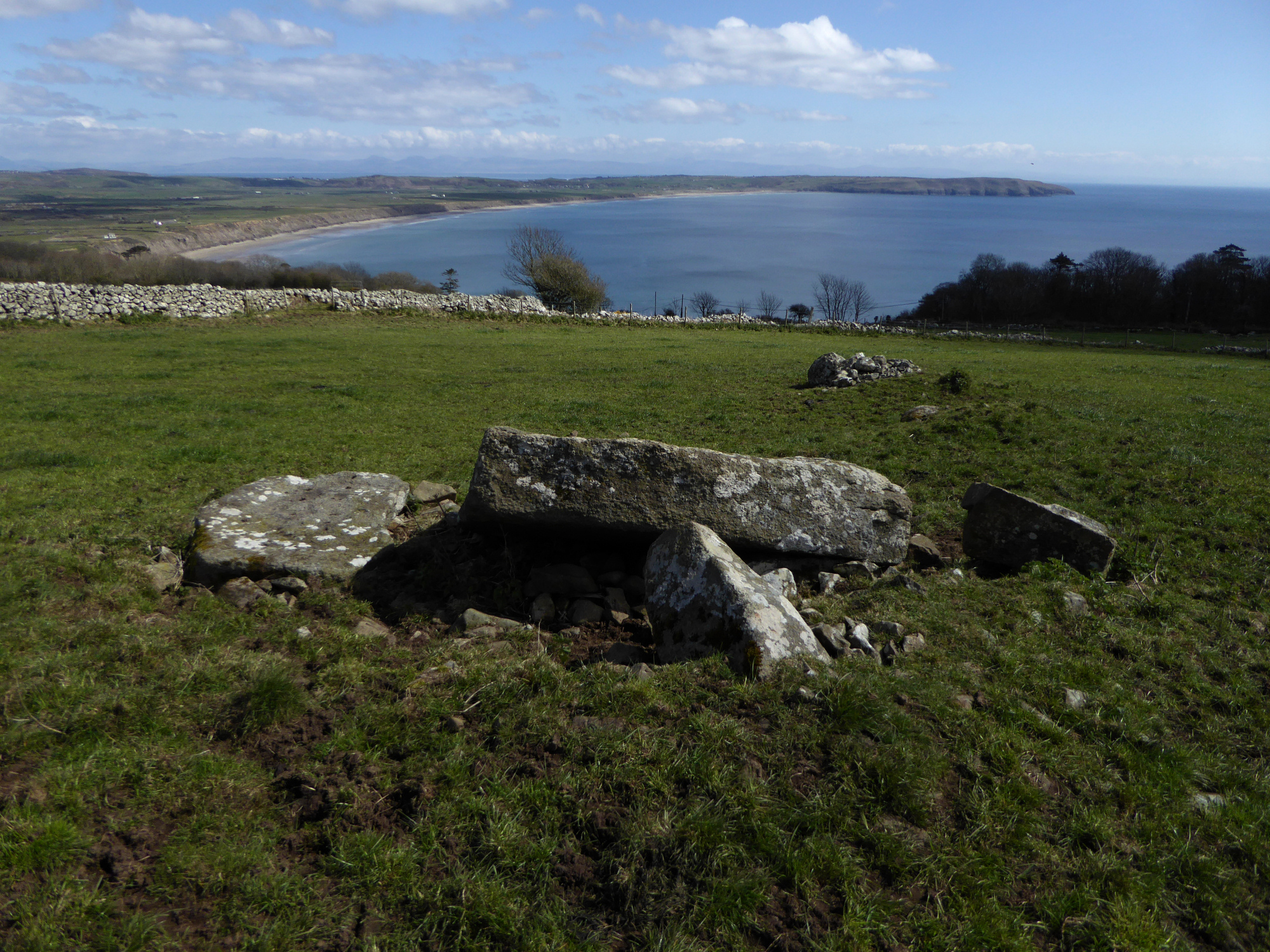
In its damaged and dilapidated state, it’s very much overshadowed by the neighbours at Tan y Muriau and Cefn Amlwch, but you have to give full marks for the setting above Porth Neigwl, with views to the distant Rhinogydd.

Looking north towards the long ridge of Mynydd Rhiw with its Bronze Age cairns and Neolithic axe factory. I was pleased about the electric fence between me and the herd of over-excitable bullocks.

Sadly this is one of those oh-what-a-shame-why-are-people-so-stupid sites.

Looking south, the prominent hill is Mynydd y Graig, with the Creigiau Gwineu hillfort on its rocky summit.

The view eastwards down to the sweeping bay of Porth Neigwl.

The eastern chamber, note moss-covered earthfast stone in the foreground which presumably was once part of a structural feature of the monument.

The smaller but still excellent eastern chamber, with its (presumably) slipped capstone.

The other side of the mighty western chamber.

The western chamber with its massive capstone.

Looking northwest across the line of the long cairn. The distant mountains include the Nantlle ridge, Yr Wyddfa, Moel Hebog and the Moelwyns, while the hillfort of Garn Saethon forms part of the nearer backdrop.

Looking down on Porth Neigwl/Hell’s Mouth and Mynydd Cilan.

Looking – somewhat wonkily – from Cairn V to prominent Cairn IV and the site of Cairn I (where the mast is now).

The very spread out Cairn V, hardly recognisable as a cairn.

Cairn IV profiled against beautiful April skies.

Looking down on the weirdly spread Cairn V from Cairn IV. The prominent hill is Carn Fadrun, which dominates the whole of the immediate area. Beyond that rise the peaks of Yr Eifl.

Looking from Cairn IV towards Cairn III (middle distance) and Cairn II (on the high point).

The impressive Cairn IV. Yr Wyddfa, Moel Hebog and the Moelwyns can be seen faintly on the right skyline.

Low Cairn III, with Cairn II on its prominent knoll to the south. The arc of stones on the right may be the remainder of a kerb.

The low spread of Cairn III in the foreground, with Cairn IV, the best in the group beyond. Carn Fadrun is the prominent hill on the distant right.

The more intact side of Cairn II.
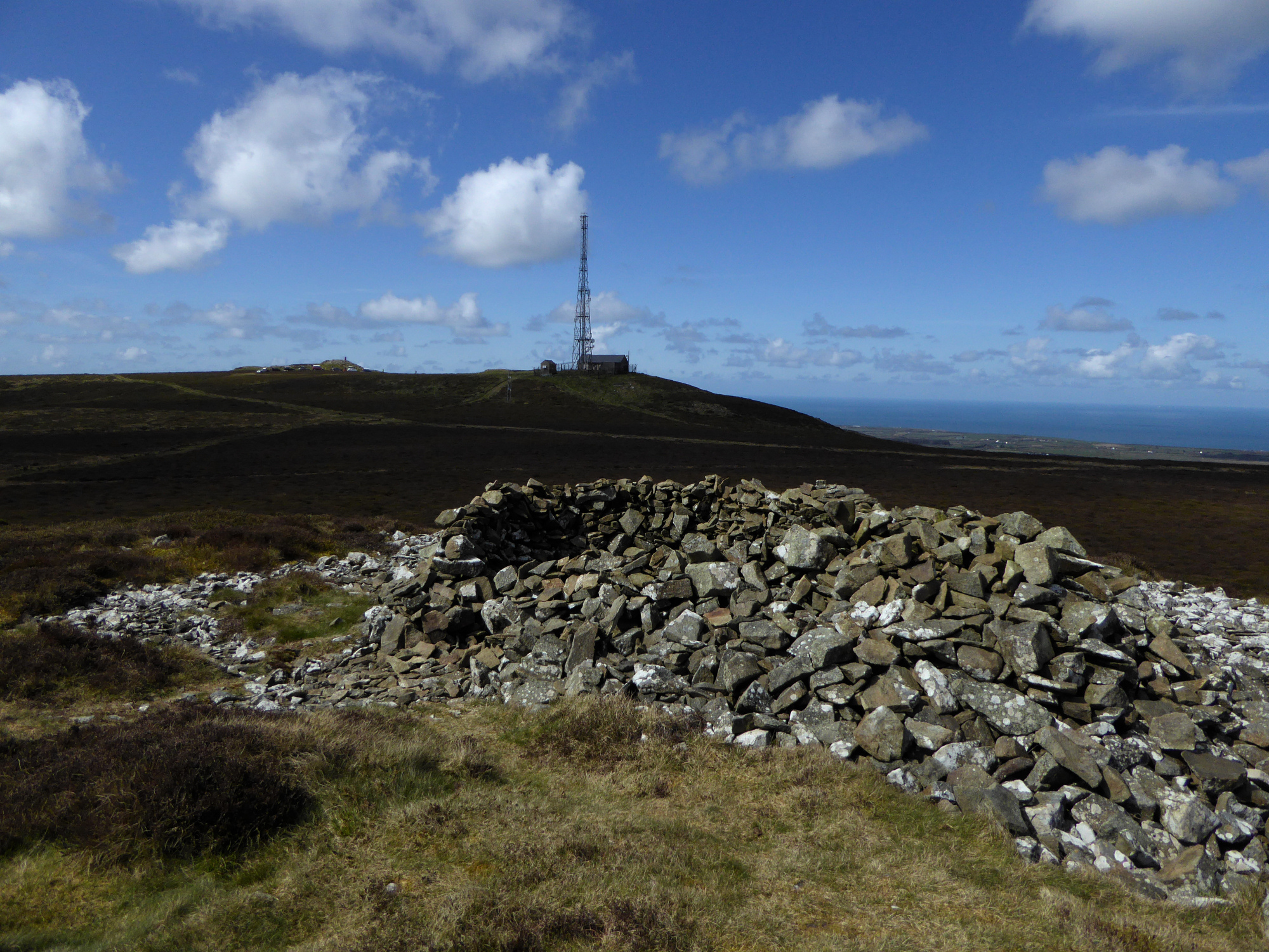
Looking across the trashed top of Cairn II towards the site of Cairn I, destroyed by the building of the radio transmitter.

Cairn II, at the southern end of the linear group.

Landscape context from Mynydd Rhiw to the ENE. Bardsey/Ynys Enlli can be seen in the distant centre. The pointed hill on the far left is Clip y Gylfinhir, where the Tylwyth Teg hang out.

The fairy hillock of Clip y Gylfinhir (see folklore) at the southern end of Mynydd Rhiw.

Creigiau Gwineu hillfort occupies the rocky summit of Mynydd y Graig on the left. The headland of Mynydd Penarfynydd is over to the right. From the southern slopes of Mynydd Rhiw to the northwest.

Just a sprinkling of snow on the summit cairn. Seen through the train window from the south.

Hazy Brent Knoll, from the hillside above Cheddar Gorge.

The road is a long way down there.

The amazing stratified cliffs of the south side of the gorge, with sheep bum.

The wooded upper reaches of the gorge.

Looking along the gorge from the ENE in hazy Spring sunshine.


From the tree-line the ground drops away steeply into a narrow valley.


The west side of the mound of Blagdon 1, on the edge of open moorland. On the other side the fence the mound is lower, as the field is ploughed.

Blagdon 1, at the far eastern extreme of the cemetery, right on the edge of the open access land and formerly crossed by a parish boundary.

Burrington 22, a low and overgrown mound to the southeast of the summit.

Burrington 20 in the foreground, lying a little way to the southeast of the summit group which can be seen beyond.