Skip to content
Julian Cope
presents
The Modern
Antiquarian
Latest
Posts
Sites
Map
Blog
Forum
search
Search
⚠️
Sign in
more_horiz
United Kingdom
Scotland
Highland (Mainland)
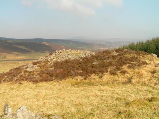
Eldrable
Broch
NC983182
expand_more
Nearest town:
Dornoch (34km SW)
OS reference:
NC983182
OS sheet:
17
Latitude:
58° 8' 28.09 N
Longitude:
3° 43' 39.47 W
Added to TMA by
Lianachan
Images (1)
Add
content
Images
Image credit: Lianachan
L
Lianachan
Apr 2, 2008
Sites within 20km of
Eldrable
Kilphedir
Broch
•
1.3km ENE
photo
13
description
3
Kilphedir
Chambered Cairn
•
1.34km ENE
photo
8
description
1
Torrish Burn
Kerbed Cairn
•
1.6km W
photo
7
description
1
Salscraggie Cairn
Cairn(s)
•
1.8km E
photo
8
description
1
Torrish Burn
Multiple Stone Rows / Avenue
•
1.91km W
photo
4
description
1
Strath of Kildonan
Stone Row / Alignment
•
2.82km W
photo
2
description
2
Caen Burn, Strath of Kildonan
Long Cairn
•
2.95km E
photo
33
forum
1
description
2
Gailiable
Broch
•
3.39km WSW
photo
3
description
1
Balvalaich
Broch
•
3.87km W
photo
6
description
1
Carn Laggie
Long Cairn
•
4.33km E
photo
11
description
1
Clach Mhic Mhios, Glen Loth
Standing Stone / Menhir
•
5.34km SW
photo
20
forum
1
description
4
Kilearnan Hill
Broch
•
5.41km W
photo
1
Ben Uarie
Cairn(s)
•
5.89km WSW
photo
16
description
2
Kilearnan
Broch
•
6.15km W
photo
9
description
1
Craig Halligarry
Cup and Ring Marks / Rock Art
•
6.18km W
photo
5
description
2
link
1
Carn Liath, Strath of Kildonan
Cairn(s)
•
6.89km W
photo
5
description
1
Glen Loth
Standing Stones
•
7.07km SW
photo
8
description
2
Carn Bran
Broch
•
7.19km SW
photo
13
forum
1
description
4
link
1
Green Table
Promontory Fort
•
7.56km E
Clach Na H-Uaighe
Standing Stone / Menhir
•
7.79km W
photo
1
The Craggan
Cairn(s)
•
8.33km WSW
photo
3
Lothbeg Bridge
Chambered Cairn
•
8.53km SSW
photo
12
description
1
Ousdale Burn
Broch
•
8.82km ENE
photo
18
description
4
Suisgill Lodge
Souterrain
•
9.42km W
description
1
Allt Preas Bhealaich
Ancient Village / Settlement / Misc. Earthwork
•
9.66km NNE
photo
2
description
1
Ach An Fhionnfhuraidh
Broch
•
9.93km W
Learable Hill
Stone Row / Alignment
•
10.44km W
photo
15
description
4
Learable Hill
Stone Circle
•
10.54km W
photo
3
description
1
Learable Hill
Cup and Ring Marks / Rock Art
•
10.57km W
photo
5
description
1
Carn Nam Buth
Broch
•
10.77km W
photo
6
description
1
Kintradwell
Broch
•
11.44km SSW
photo
18
description
1
link
1
Langwell
Chambered Cairn
•
11.53km ENE
photo
6
description
1
Suisgill
Broch
•
11.9km W
photo
13
description
1
Borgue Langwell
Broch
•
12.37km ENE
photo
8
description
1
Cos Ceumach
Souterrain
•
12.4km SW
description
1
Kinbrace Burn
Chambered Cairn
•
14.69km WNW
photo
4
description
3
Kinbrace Hill
Chambered Cairn
•
15.57km WNW
photo
21
description
1
Feranach
Broch
•
16.56km W
photo
1
Upper Borgue
Standing Stone / Menhir
•
16.58km ENE
photo
4
description
1
Upper Borgue
Broch
•
16.63km ENE
photo
4
Creag Nan Caorach, Kinbrace
Chambered Cairn
•
17.05km WNW
photo
9
description
1
Carrol
Broch
•
17.97km SW
photo
29
description
3
Leadoch
Broch
•
18.26km SW
photo
7
description
1
Duchary Rock
Hillfort
•
18.82km SW
photo
9
description
1
Altanduin
Broch
•
18.91km W
Caisteal na Coille
Broch
•
19.36km WSW
photo
16
description
1
Harvieston
Ancient Village / Settlement / Misc. Earthwork
•
19.68km WNW
photo
8
description
1
search
I’m looking for…
location_on
photo
ondemand_video
forum
description
link