|
|

|
|
Nash PointCliff Fort
|
||||||||||||||||||||||||
|
|
|
Images (click to view fullsize) |
|
Photographs: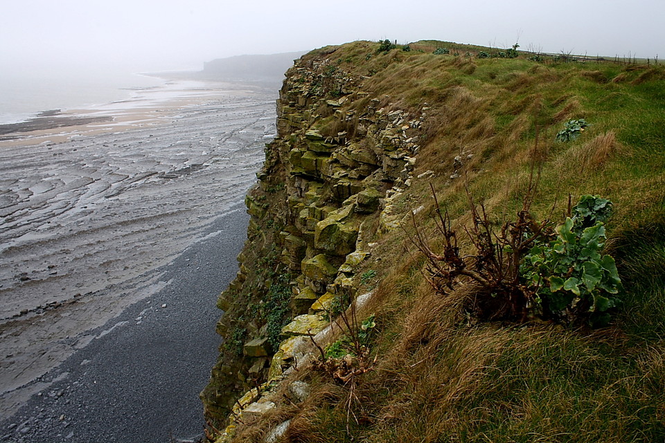

 Artistic / Interpretive:
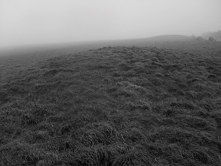
|
Fieldnotes |
|
|
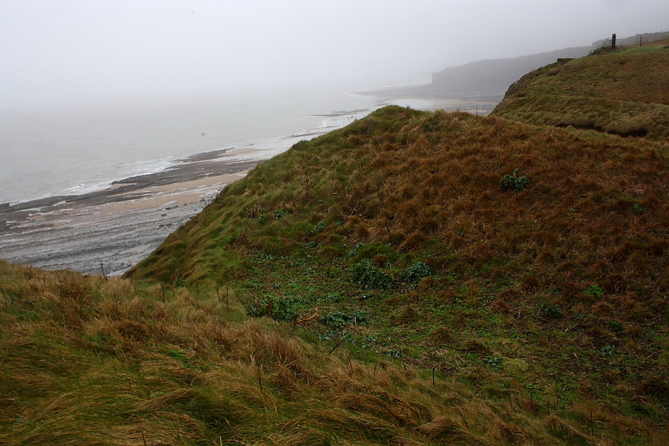
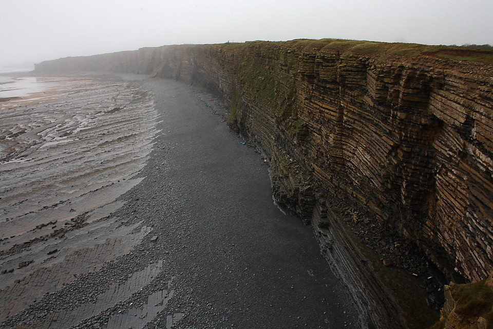
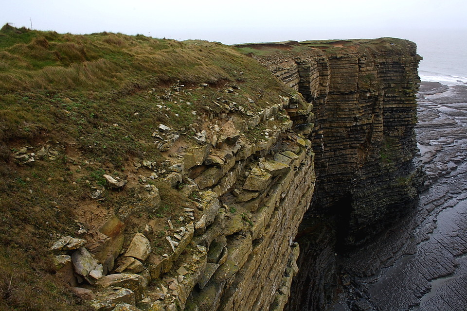
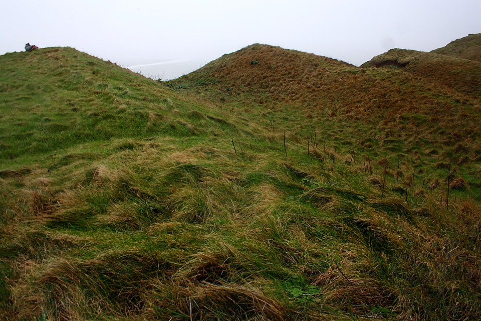
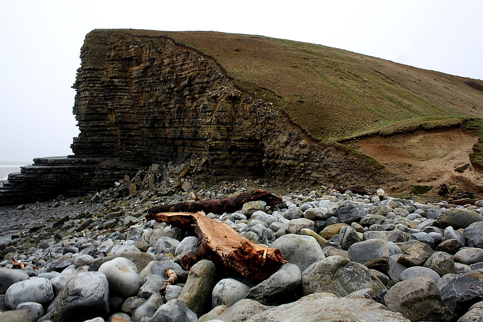
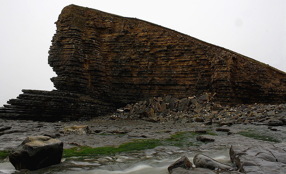
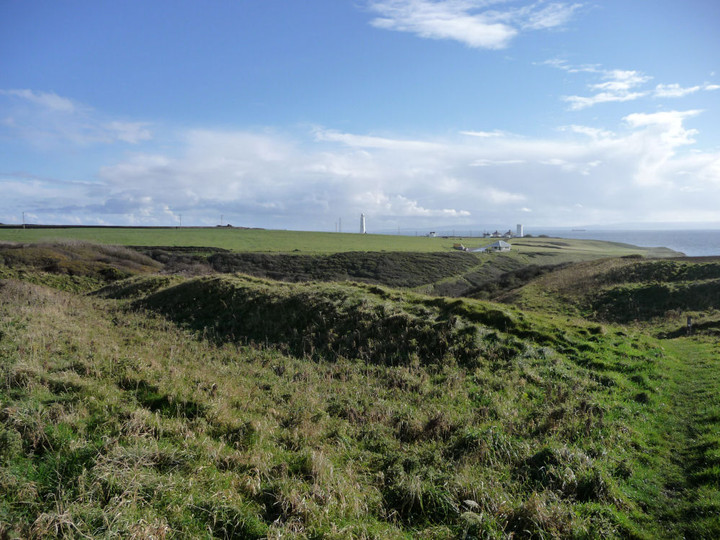
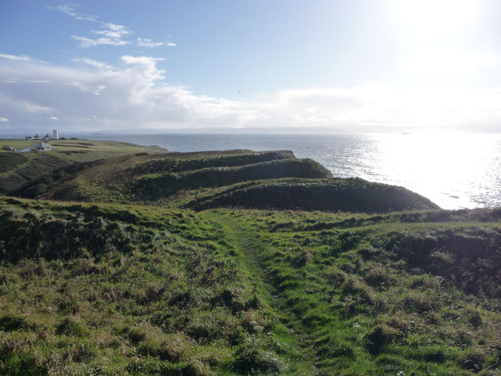
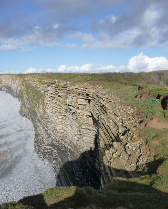
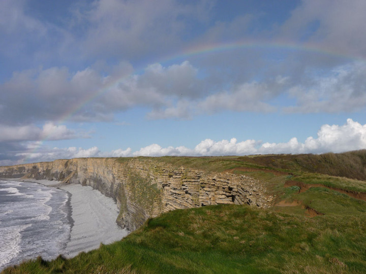
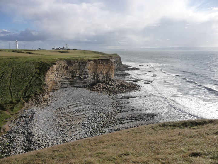
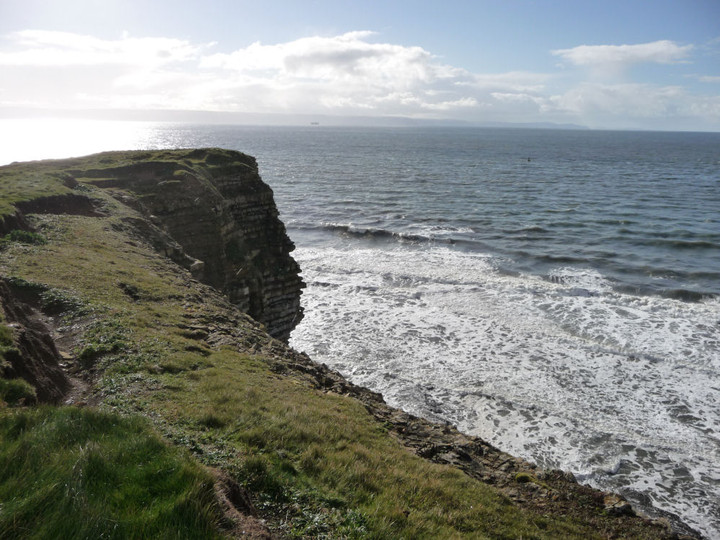
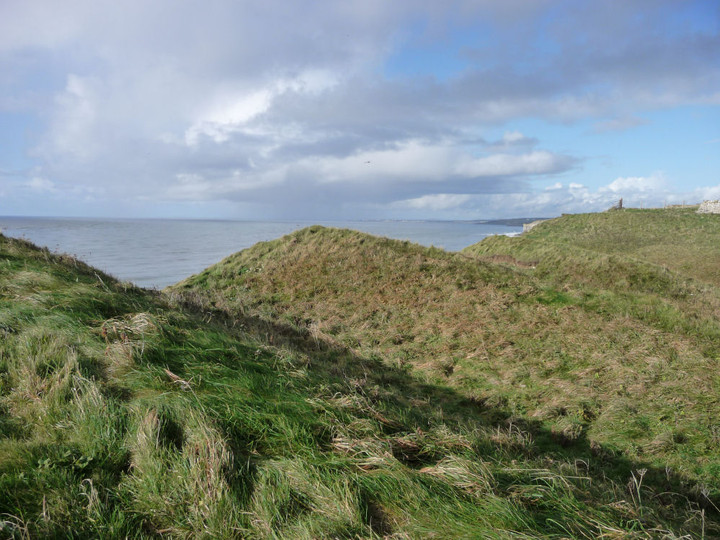
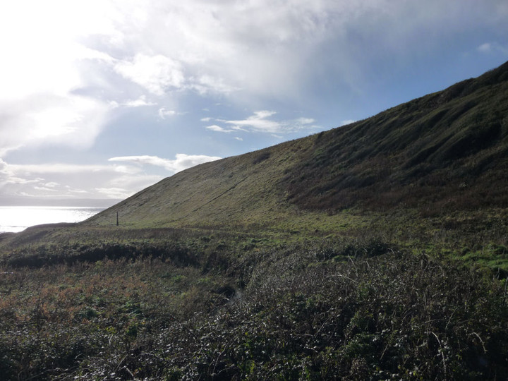
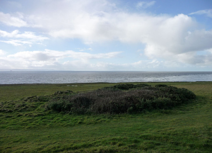
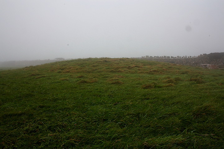
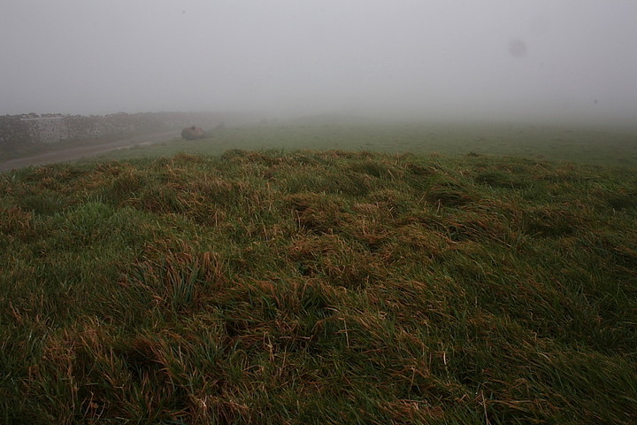
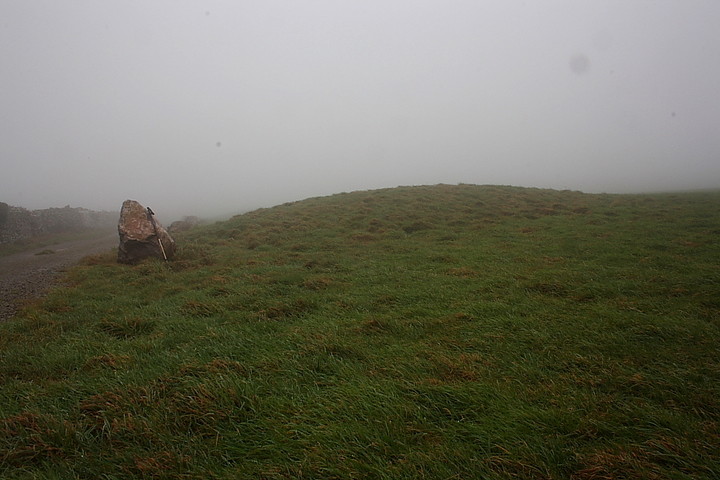
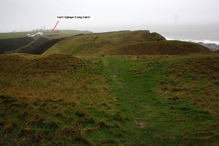
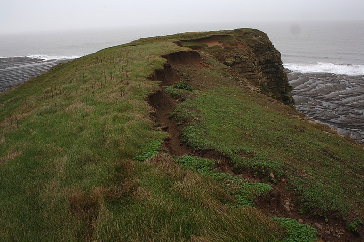
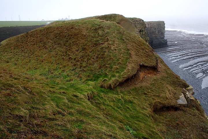
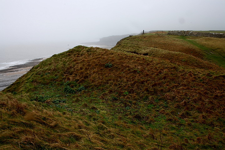
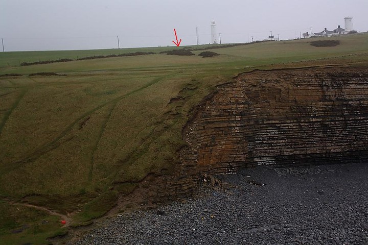
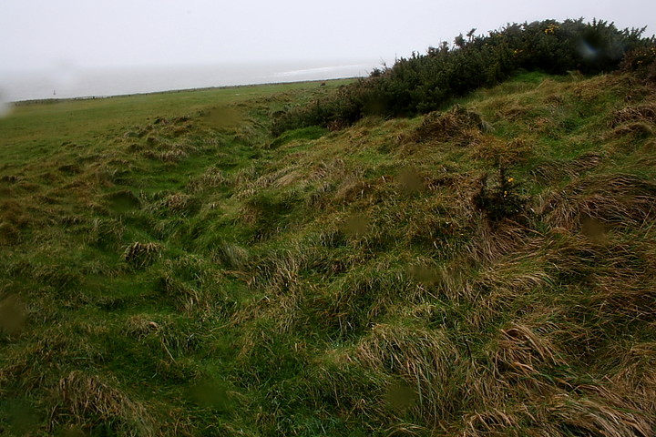
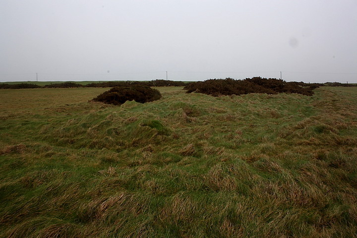
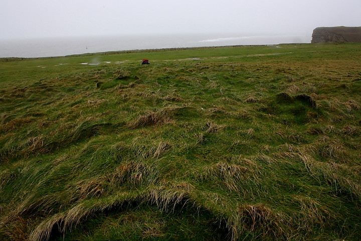
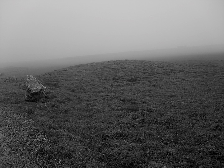
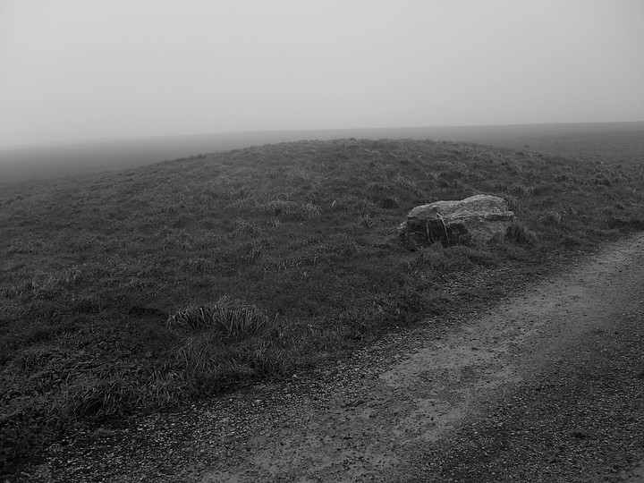
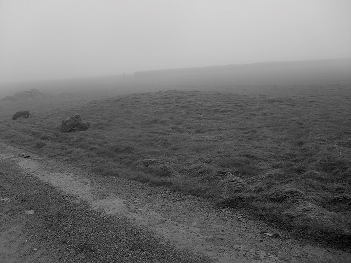
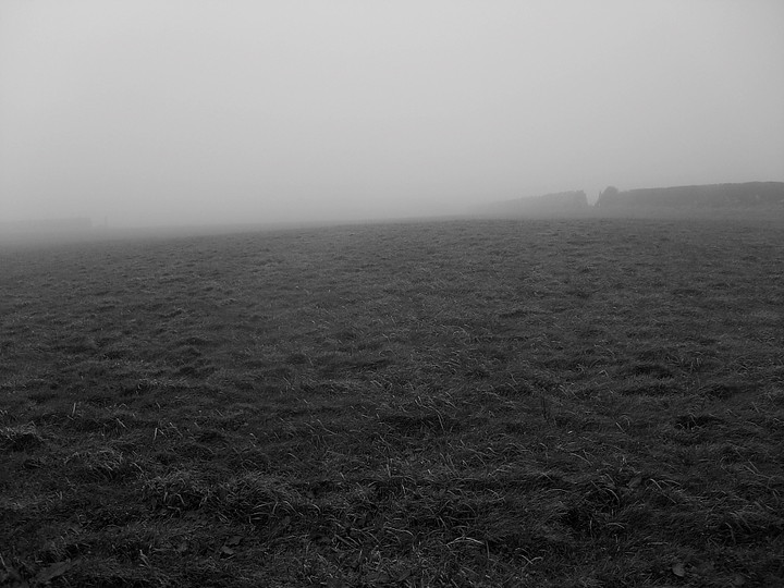
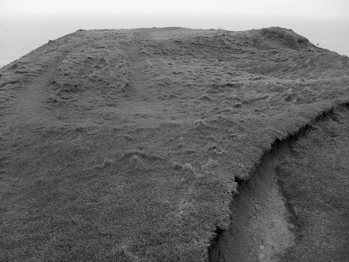
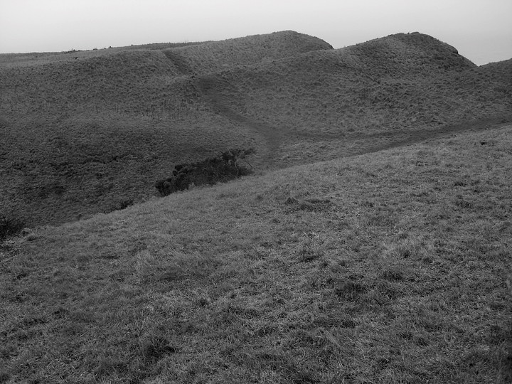
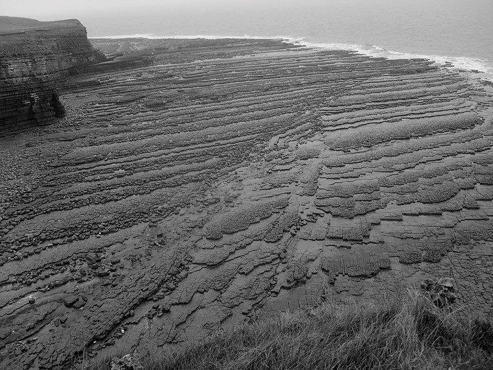
The cluster of monuments in the vicinity of Nash Point do not advertise - or, it would appear, endear themselves to the casual visitor. This is a pity since it would seem, to gauge by the capacity of the car park at least, that there are often quite a few of the latter, particularly so during the summer months. In the absence of an information board - always handy in such popular areas, I find - it is debatable whether more that the proverbial handful have any idea that here, just a few miles from the great urban sprawl of Bridgend, can be found much of what makes the Glamorgan coastline so intoxicating to these eyes. But hey, great place to walk the dog, though.... Some may argue that a day of low cloud, drizzle and high winds may not be the most salubrious of days to go walkabout in South Wales. Maybe. However head for the coast, stick on the waterproofs... and I would suggest there is a strong case for these being precisely the optimum conditions to truly 'experience' this coastline in all its wild abandon. As with Carl, there is no need to pay the £1.50 toll to traverse the private road heading south west from Macross to the car park today. Simple things, as they say. So, suitably 'tooled up', I literally immerse myself in the ineluctable weather and head for the first monument, Cae'r Eglwys, a little way up the road towards the lighthouse at SS91666825, that is to the right. I guess I need to point out that the 'earthwork', as marked on the 1:25k OS map, is not a certain long cairn. However Coflein appear pretty confident, and it does seem pretty difficult to explain otherwise. Unfortunately ignorance of its (assumed) function has not served Cae'r Eglwys well within this community, the grassy long mound being covered in dog excrement, coke cairns and assorted rubbish. In short, it is a disgrace, even for South Wales. A ghostly chiming of bells appears to emanate from the sea and, recalling the association with a 'church' on the site (hence the name, of course), I doubt my senses for a moment. No, it's definitely church bells! Oo-eer... But more of this later. I head north-west towards the defile cut by the Marcross Brook, the serried strata of the crags of Castell y Dryw truly a natural wonder worth the price of admission alone (assuming you have to pay one, that is), despite the litter-despoiled environs of the water course. Hey, you mean people actually lived up there? Nah, surely not. The obvious way up is.... er, straight 'up' the eroded, steep left flank. However Carl's bridge is already long gone and the water difficult to cross, the far bank treacherous in these conditions. In retrospect I'd therefore recommend heading right up the valley and ascending the far (right hand) flank of the site. Whichever way you do it, make sure you do, since this apparently minor, obscure enclosure occupying the summit of the ridge is defended by four - I concur with Carl, count 'em - very powerful cross ramparts to the north. I'm utterly unprepared for this, I have to confess. There's also a single bank - at least partially - defending the eastern flank. Jeez. Where have you been all my life, Nash Point? Oh, here. But mankind's puny defensive efforts pale into insignificance when I'm confronted with the glorious, lethal - bloody awe inspiring - mess Nature's made of the western and southern flanks of this former fortress, crumbling cliff lines falling sheer to rocky pavements pounded by crashing breakers. Ha! The vertigo kicks in and I may as well be upon Crib Coch or The Cuillin... one false step in these conditions will mean death. Suffice to say this is not a place for children, then. As I head toward the southern apex of Castell y Dryw, the linear enclosure not very wide at all, it has to be said (although possibly much reduced through erosion to the east?), I again hear the ethereal peel of bells coming from the Bristol Channel. Contrary to some opinion, though, it seems I'm not mad after all. Yeah, the aforementioned rock pavements hold the key to this mystery, a bell clanging away eerily upon an offshore bhoy (hopefully) warning any nearby ships to take immediate, violent evasive action. What a swizz! Needless to say said bhoy was red, not green and white.... Moving north beyond the impressive defences and crossing a stone stile, I follow the cliff-line approx north-north-west and, upon passing through a second drystone wall, follow the field edge inland. Well, I couldn't exactly head in the other direction, could I? A farm track is encountered running at a tangent with two reasonably preserved round barrows lying beside it to the left. OK, perhaps 'reasonably' is overdoing it a bit generally, but not in this part of the world. To the right of the field wall the OS map shows another, larger 'tumulus'. Unfortunately this is the monument Carl rightly describes as being more or less no more.... an almost imperceptible rise in a soggy field. However at this moment a bank of sea mist sweeps in to engulf all in clammy vapour, thus rendering the landscape as ethereal and thought-provoking as many other more extreme sites I've visited. Nash Point. Litter strewn, uncared for? Yes. But mind blowing in the right conditions? You'd better believe it. Neolithic (probably), Bronze Age and Iron Age. Take your pick.... |
 Posted by GLADMAN
6th March 2012ce Edited 8th March 2012ce |
|
Cae'r Eglwys, Nash Point Agree with Gladman about the condition of this site. I had a look recently when I went to visit the nearby Hillfort and Barrows. Unless you specifically looked for it you wouldn't know it was there. Just a lumpy, rough patch of grass. |
Posted by CARL 2nd February 2012ce Edited 2nd February 2012ce |
|
Visited 14.1.12 COFLEIN states there are four Barrows here. They may be on the O/S map and they may be here is spirit but they are certainly not here in body. The entire field is deeply ploughed and is a sea of sticky earth and mud. I am sorry to report that these Barrows are now completely ploughed out. |
Posted by CARL 17th January 2012ce Edited 2nd February 2012ce |
|
Visited 14.1.12 Although the sign read 'Private Road - £1.50 all day parking' I was confident there wouldn't be any ticket collectors out this time of year. I was right although I was not alone – the car park on the headland was packed and I only just managed to find a place to park. This is clearly a poplar place to come on a cold by dry winter's afternoon. I had been here before to visit the lighthouse (well worth a visit) but this was the first time I could have had a proper close up look at the Promontory Fort. The previous undergrowth has now largely been removed. The information board in the car park gives no mention of the Fort or the nearby Barrows. I took the rough 'path' down from the car park, across a small wooden bridge, and up the steep incline towards the Fort. Luckily there are foot holds worn into the side of the slope so walking up wasn't too difficult. When I reached the top I was pleasantly surprised by how well preserved the defences were. I counted 4 sets of ditches ramparts – the outer rampart being about 1 metre high with the inner 3 about 2 metres high. The site isn't that large although no doubt a large area has since been lost to coastal erosion. A bird of prey hovered silently only about 6 ft of the ground above the ramparts – a lovely sight. Well worth a visit when in the area. One word of warning though – the cliffs are sheer and not fenced off. If coming with little ones you will need to be very careful. The warning signs are there for a reason! |
Posted by CARL 16th January 2012ce |
| A fairly short but steep climb up the steps from the car park up to the headland. I couldn't see any signs of banks/ditches but there was a lot of bushes about so perhaps they are there but hidden? |
Posted by CARL 16th March 2010ce |
Folklore |
|
|
"There is an ancient Cromlech, called The Old Church; and which, according to tradition, was anciently the place of Worship belonging to the Village.." From: A Topographical Dictionary of The Dominion of Wales by Nicholas Carlisle, 1811. The OS map shows 'Cae'r Eglwys', and this webpage on Glamorgan Walks http://www.glamorganwalks.com/localfeatures6.htm says that the remains of this 'cromlech' are actually of a long cairn, and can be seen in the Nash Point car park. Coflein complicates things by saying that the cairn could be associated with an old church that's since dropped into the sea. Ooh it's all very confused. The promontory fort itself is called Nash Point, and the earthworks follow the cwm of Marcross/Marcroes brook back inland. |
 Posted by Rhiannon
26th October 2006ce Edited 2nd February 2012ce |
Miscellaneous |
|
|
Cae'r Eglwys - a possible long cairn, Nash Point Shockingly treated by locals, covered in cans, assorted rubbish and dog waste, this site, marked as an 'earthwork' upon the 1:25K OS map at SS91666825 is nevertheless cited by Coflein as a possible Neolithic long cairn, being an.... 'Oval stony mound about 50m long by 15m wide at east end and 8m wide at west end. (1999.05.21.RCAHMW/SLE). The mound has been mutilated by the digging of a narrow trench about its perimeter, possibly to rob a revetment. Associated with the site of an old church, possibly one lost to the sea. (J.Wiles 19.12.02)' |
Posted by GLADMAN 1st February 2012ce Edited 3rd March 2012ce |