Details of henge on Pastscape
[NT 94053308] Henge [LB] Class II henge monument discovered by Dr. J.K. St. Joseph, consisting of an oval bank with internal ditch and opposing entrances. The diameter of the bank, which is best preserved on the western side, is 310 ft. Inside, the ditch appears as a shallow depression with a difference in height between ditch and bank of about 2ft. Aerial photgraphs show two narrow ditches, forming a droveway which passes through the entrances of the site. The ditches are not visible on the ground, but must be of later date than the henge. (2-3)
Surveyed at 1:2500. Ploughing has considerably reduced the remains which are now barely discernible. (4) As described. Published survey (25”) revised. (5)
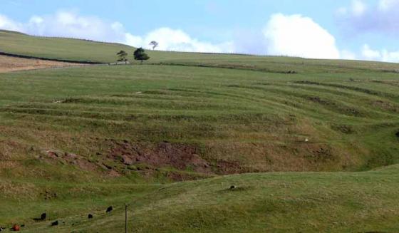
NT 9405 3308. Coupland, Ewart. Sub-oval enclosure known from cropmarks and formerly surviving as a slight earthwork, situated at c.47m above OD on level ground. The external bank has been destroyed on the E by a road and appears to have been damaged by quarry pits (visible as cropmark splodges) in the NE sector. The enclosure, listed as a classic henge, lies some 800m SW of the present course of the River Till. The henge has an asymmetrical ditch of regular width. The N part is rather wider than the S, bowing out particularly in the W sector. There are roughly squared terminals. Outside the ditch are the slight remains of a bank. A pit-like mark is visible roughly in the centre of the S causeway between the ditch terminals. The internal diameter ranges from c.63m to 68m (est. from transcription); the ditch width from c.4m to 5m. The causeways are c.16m wide at the SSE and c.16m at the NNW. The enclosure is associated with a pair of roughly parallel ditches c.7-33m apart and c.1-2.5m wide (see NT 93 SW 42), which run through the enclosure via its entrances. The E ditch of this avenue runs straight through without a break, although curving to avoid the NE terminal of the bank. The W ditch similarly veers to avoid the NW bank terminal, approaching to within c.7m of the E ditch, as it passes through, but in the S sector it breaks, stopping well short of the enclosure ditch on either side of the SSW terminal. (6) NT 940 330. Site of henge 1000yds (910m) SE of Milfield. Scheduled No ND/505. (7)
Excavations across the southern entrance to the enclosure in 1995 have produced evidence which, it is claimed, date the site to the early 4th millennium BC, which would make it the earliest henge by the best part of a millennium. Pits containing charcoal, charred hazelnut shells and Early Neolithic Grimston Ware potsherds were found, and some of the hazelnuts produced radiocarbon dates of around 3800 BC. The presence of similar material in one of the droveway ditches, and similar radiocarbon dates from charcoal in this ditch deposit, have been taken to suggest that the droveway is of Early Neolithic date, and therefore the henge must be slightly earlier. However, an alternative possibility must be that the droveway ditch has cut through an earlier, Grimston ware associated deposit. In any case, further to the south, the droveway also swerves to avoid the late Neolithic henge of East Marleyknowe (NT 93 SW 27), while to the north it also seems to deliberately avoid the late Neolithic henge of Millfield South (NT 93 SW 37). The excavations also identified two post holes in the enclosure entrance, one on either side of the entrance gap and within the area defined by the droveway ditches, while in a more central position was a shallow pit devoid of any artefactual material. (8) The site has been mapped from the air as part of the Milfield Geoarchaeology Project. (See archive object MD000295)