
Anyone any idea what caused these markings on a rock near to the cairn?
Image credit: drew/amj
Anyone any idea what caused these markings on a rock near to the cairn?

Boulders scattered south of the kerbs.

Kerb on western flank.
Two of the southern kerbs.

Inner kerb at north.

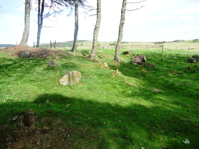
Northern kerbs, outer circle.

Looking south to kerb cairn.
The road to Mid Knauchland farm is to the south of Glenbarry on the B9022, take the second road to the east, the farm is up the second track north. the largely ruined cairn is situated in the wood beside the farm. Lots of large stones are strewn on the ground some which might have stood but it’s hard to tell. Near the top of the woods there is a double kerb cairn with some of the kerbs still earthfast. One thing not in question is the view, all three major hills in the area can be seen quite clearly, namely Bennachie, Knock and Tap O Noth.
As for the church, when asking permission to look around the farmer mentioned that there was the ruins of an old church. What remains do exist are in a rectangular shape with one end open. They certainly do look like the starting point for some type of building. Syd Halkett, who allowed permission, said that in some of the rock piles monk holes had been found. These must have tough men.
Visited 24/8/09.
Canmore says:
‘...the name appears to have arisen from an old belief that the place was haunted by a ghost, and at this cairn St Knauchland conjured or subdued it. It is likewise known by the name of Devils Cairn.‘
Name Book 1867.
This grassy bump sits atop of Bo Hill. Beneath was alleged to be the kirk and holy well of St Knauchland (the most recent record on Canmore is most sceptical of both claims). It’s possible that ‘Knauchland’ is from St Nachlan, a saint renowned for his ability to grow crops when everyone else’s were failing.
You might also want to look out for the remains of ‘Kemp’s Cairn’, also close by. In 1745, a large cist was found at NJ 564514. It was said to be covered by a large stone. The farmer who was quizzed in the 1960s pointed out this reputed capstone, now built into a wall at NJ 5642 5141. “The stone is flat and measures 1.5m x 0.8m x 0.2m, being roughly rectangular.”
(this is not ‘strictly’ in Aberdeenshire, but in a tongue of Moray that sticks into it, so is surrounded by Aberdeenshire sites.)
So the building remains are the bottom of farmstead! No sign of the well or the saint!


