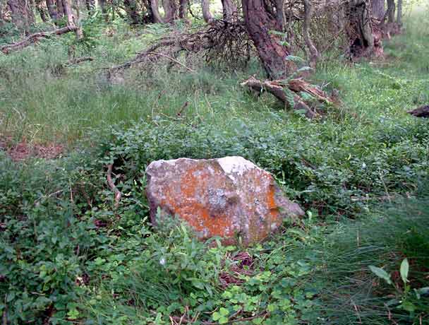
One of the larger of the twenty one (or thereabouts) stones remaining in the Culbone Hill Stone Row...
One of the larger of the twenty one (or thereabouts) stones remaining in the Culbone Hill Stone Row...
...another stone in the Culbone Hill Stone Row...

...and another...

...there are two stones in this photo...

...yet another of the larger stones in the row
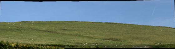
This 1,200 feet long stone row runs east-west within private woodland near to the A39 west of Porlock. There is a permissive path to the nearby Culbone Stone which stands 130 feet south of the western end of the row, but there are signs requesting visitors not to stray from the path. There are thought to be twenty one stones remaining; I managed to find thirteen in the sometimes dense undergrowth of the wood. None of the stones stand more than three feet above the ground.
Details of stones on Pastscape
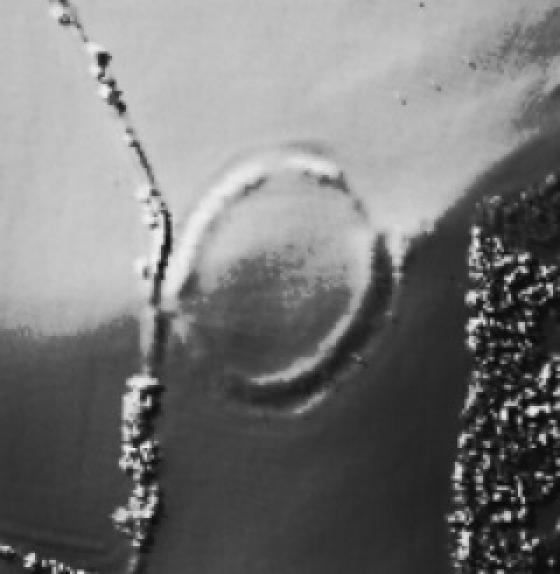
SS 83274739. An incomplete stone row on Culbone Hill was found by N VQuinnell in 1975 and independently by J E Hancock in 1981. It would seem to be of Prehistoric date. It is situated on a spur at about 380m OD with a slight, false crested east slope. Twenty stones are traceable over a distance of 340m from SS 83274739 to SS 83604738 (seeillust). Fifteen stones are in woodland, the remainder in deep bracken and furze where it is possible some have not been detected. Under open conditions the ends of the row would not be intervisible, but these are unlikely to be the original terminations. The stones are local sandstone slabs between 30cm and 70cm long, 5cm to 20cm thick and 25cm to 70cm high. A common interval between the stones cannot be deduced, but some of them are so widely spaced as to suggestheavy robbing.
For 100m at the west end, the row coincides with the parish boundary although this is described as undefined on OS 25” 1957. The boundary must originally have been mered to the row, but it is most unlikely that the stones are boundary markers. It is speculative as to whetherthe inscribed stone at SS 83204736 (SS 84 NW 15) was removed from the row as it is similar in size to the larger stones. A detailed plan of the stone row is lodged with the Somerset SMR. (1)
Additional Bibliography. (2)
This fine stone row commences at SS 83244738 in coniferous woodland at about 405m OD on the NE slopes of Culbone Hill. It crosses a fenced trackway and rough grass/bracken covered ground beloe the crest of the ridge. It terminates in coniferous woodland on the N slope of Stent Hill about 385m OD at SS 8362 4737, atotal length of 371m. It now consists of 21 earthfast sandstone blocks all set longitudinally following the general E-W alignment. The intermittent and irregular spacing suggests robbing; it is now impossible to know if the row extwnded further E or W. Stones 1 to 17 are almost in a straight line (allowing for minimal movement of some stones) the remaining four curving slightly towards the N stones 4,10a & b, 16 and 21 are broken stumps. The others range in height from 0.2m to 0.62m (an average of 0.4m) they are from 0.29m to 0.9m wide and 0.10m to 0.33m thick (3). A further table of information on the stone row is held in the archive. Stone No 3 has an inscribed cross. The cross, on the upper, eastern part of the northern side, is 12cm high and 10cm wide, with the arms of the cross cut 0.05cm deep. The arms of the cross are not sharply incised, and as such are reminiscent of the crude style in which one of the arms of the cross on the Culbone Stone (SS 84 NW 15) has been extended. The cross is not set vertically, but rather is oriented like an `x’, and as such is roughly parallel with the sides of the stone. This may be because the stone has tilted eastwards. The upper ends of both arms have what appear to be `tails’ or short perpendicular extensions. (4)