Articles

Folklore

Dunkery Hill Barrows
Barrow / Cairn Cemetery

This is quite silly but I quite like it. I guess the combination of isolated moorland, darkness and a seemingly intelligent light would get to lots of people.

Jack-a-lantern.. This I believe to be the only name known [for the phenomenon] in the district. [It] only occurs in certain parts of Brendon Hill and the Exmoor district. It is said that a farmer once crossing Dunkery from Porlock to Cutcombe, and having a leg of mutton with him, was benighted. He saw a Jack-a-lantern and was heard to cry out while following the light, “Man a lost! man a lost! Half-a-crown and a leg a mutton to show un the way to Cutcombe!” 1886 ELWORTHY, West Somerset words (EDS), p 375.

Quoted in The Devil and His Imps: An Etymological Inquisition
Charles P. G. Scott
Transactions of the American Philological Association (1869-1896), Vol. 26. (1895), pp. 79-146.

comment 0 Comments

Folklore

Dunkery Hill Barrows
Barrow / Cairn Cemetery

Miss Acland told me.. in 1902 the Horner [village] churchgoers would not go to evensong in the winter at Luccombe because [the Exmoor forest demon] waited for them at Dunkery foot by the ruined chapel, as a stag or ram. The Reverend Acland therefore used to hold the service in the afternoon.

What a dilemma. Shun the locals’ superstitious fears or end up with no congregation. The reverend obviously didn’t want to end up talking to himself. Or perhaps he wasn’t that keen on the dark either.

The ruined chapel referred to is a funny place for the demon to wait, as it used to be a particularly feared spot for such creatures. St Dubricius of Dunkery built the chapel (he lived 150 years in Porlock, don’t you know, and officiated at King Arthur and Guinevere’s wedding). At the sound of the chapel’s bell the hideous forest fiends and dragons went deeper into the moor, and even the devil found things to do somewhere else. Under its altar St D. buried a chest full of gold, which was to be spent on keeping the bell(s) in order and for giving to anyone who had to cross the ‘dreadful waste’ on their own in order to get to market. You can see the site of the chapel “but nobody can find the gold.” This was told to Ruth Tongue in 1950 by Jane Rudd, then 11.

Quote from ‘Forgotten Folktales of the English Counties’ (1970) and info from ‘Somerset Folklore’ (1965), both by Ruth Tongue.

comment 0 Comments

Folklore

Dunkery Hill Barrows
Barrow / Cairn Cemetery

Dunkery Hill was supposedly formed when the Devil was digging out the Punchbowl on Winsford Hill – he dumped the rock and soil to form Dunkery Hill. On the north-east promontory are several large Bronze Age stone Cairns. Two of them are called Joaney How and Robin How, but there is no surviving folklore to explain these names. One suggestion is that they derive from Robin Hood and Little John.

comment 0 Comments

Miscellaneous

Dunkery Hill Barrows
Barrow / Cairn Cemetery

Details of cairn on Pastscape

[SS 9082 4278] Joaney How [NR]
[SS 9082 4278] Joaney How (Beacon) [NR]. (1-2)
Cairn or beacon known as “Joaney How” or (a) “Yonney How” on Luccombe Hill. A structure of piled stones much mutilated and having several depressions with ridges between. The surface stones are very loose as if moved in recent times. On the top is a roughly conical pile of stones, wide at the bottom, and about 3ft. in height, again, possibly rebuilt after destruction. Diameter of exposed stones – about 62ft. Scheduled under Burial Mounds.
This is a disturbed cairn 1.7 metres high. (See G.P.s AO/65/126/1 and 2.) Grinsell lists it as Luccombe No. 4; and although he records a “partly visible” ditch no certain traces can be identified. Resurveyed at 1:2500. (5)
[SS 9082 4279] Luccombe 4. Joaney How, a mutilated cairn 27 paces diameter and 5ft. high, surmounted by a modern stone-heap. Ditch partly visible. Visited by Grinsell Whitsun 1958. Joaney How and Robin How (SS 94 SE 2) were shown as Luckham Barrows on O.S. 1” first edition 1809, and as Luccombe Barrows on the map by
W. C. Cox 1829 and in Savage (c). The earliest appearance of Robin and Joaney How on the maps appears to be on the O.S. 6” 1889. (6)
Joaney How, Robin How (SS 94 SW 2) and adjacent mount (SS 94 SW 4).
Scheduled. (7)
A large cairn, known as Joaney How, lies on the edge of a natural terrace in a false crest position on the N slope of Dunkery Hill at SS 90813 42789. It comprises a circular stony mound, enclosed by a heather covered ring, 22m in diameter and 1.8m high. The stony mound is flat topped. The evidence for this being the site of a beacon comes from the OS 25” first edition map (Somerset 34.14), there is no other evidence that this was the case. The cairn was surveyed using differential GPS as part of the RCHME Exmoor Project (8).
Round cairn known as Joaney How. Part of a round cairn cemetery on Dunkery Hill. Traditionally thought to be named after Little John. Scheduled. (9)
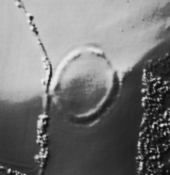
The cairn known as Joaney How has been transcribed as earthworks from aerial photographs as part of the Exmoor National Mapping Programme survey. The cairn appears to be circa 24 metres in diameter and centred on circa SS 90814279. It is one of eight cairns recorded as part of the survey in this area, although more are present but not visible on the aerial photographs available. (10-11)

comment 0 Comments

Miscellaneous

Dunkery Hill Barrows
Barrow / Cairn Cemetery

Details of cairn on Pastscape

[SS 9077 4272] Robin How [NR] [SS 9077 4272] Robin How (Beacon) [NR]
Cairn of beacon known as “Robin How” on the Luccombe-Wootton Courtney parish boundary. On it there are two conical erections one to N., one to S., each about 3ft. high. Between them the mound has a flat top composed of smaller stones than elsewhere. Diameter of exposed stones about 62ft., height above the moor excluding the surmounting stone heaps – 6ft. (3) Scheduled under Burial Mounds (4). (3)(4)
This is a disturbed cairn 1.6 metres high and listed by Grinsell as Luccombe No. 3. As Grinsell suggests, a quarry pit 0.7 metres deep against the east side of the cairn probably provided its material.
(See G.P.s AO/65/126/3 and 4.)Resurveyed at 1:2500. (5)
[SS 9076 4272] Luccombe 3. Robin How, cairn 24 paces diameter, 10ft. high. The material may have come from quarry pits to the east, north-east and south-east. Visited by Grinsell Whitsun 1958. Robin How and Joaney How (SS 94 SW 3) were shown as Luckham Barrows on O.S. 1” first edition, 1809, and as Luccombe Barrows on the map by W. C. Cox 1829 and in Savage (b). The earliest appearance of Robin and Joaney How on the maps appears to be on the O.S. 6” 1889. (6) Joaney How (SS 94 SW 3), Robin How and adjacent mound (SS 94 SW 4).Scheduled. (7)
The large cairn known as Robin How lies on Dunkery Hill at SS 90761 42724. It comprises a large, circular mound of stone, enclosed by a heather and turf covered bank. The cairn measures 21.5m in diameter and stands 2m high. The eastern side is flanked by a large pit, 19m N-S, 8m E-W and 0.8m deep, probably the source of material for the cairn. The stone mound is flat topped, and has probably been re-worked recently, as there is no sign of the two conical erections mentioned by authy 3. The evidence for this being the site of a beacon comes from the OS 25” first edition map (Somerset 34.14), there is no other evidence that this was the case. The cairn was surveyed using differential GPS as part of the RCHME East Exmoor Project (8).
Surveyed at 1:500 scale with EDM, 24 February 2000 (9).
Round cairn known as Robin How. Part of round cairn cemetery on Dunkery Hill. Traditionally thought to be named after Robin Hood. Scheduled. (10)
The cairn known as Robin How has been transcribed as earthworks from aerial photographs as part of the Exmoor National Mapping Programme survey. The cairn appears to be circa 25 metres in diameter and centred on circa SS 90764272. It is one of eight cairns recorded as part of the survey in this area, although more are present but not visible on the aerial photographs available. (11-12)

comment 0 Comments

Miscellaneous

Dunkery Hill Barrows
Barrow / Cairn Cemetery

Details of barrow on Pastscape

SS 90874277. Prehistoric round cairn cemetery on Dunkery Hill. The cemetery comprises at least five round cairns, including three distinctive examples each surrounded by a low bank. These cairns, which include Robin How (SE 94 SW 2) and Joaney How (SE 94 SW 3) appear to have formed the focus of the cemetery. The third, unnamed, cairn (SE 94 SW 4) lies further to the south. Two further cairns lie to the east and north east. Three small mounds, east of Joaney How, have been interpreted as cairns but may be later in date than the others. Scheduled. (1)

comment 0 Comments

Sites within 20km of Dunkery Hill Barrows